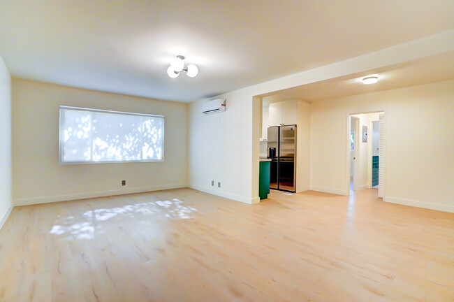
$1,995
Total Monthly Price
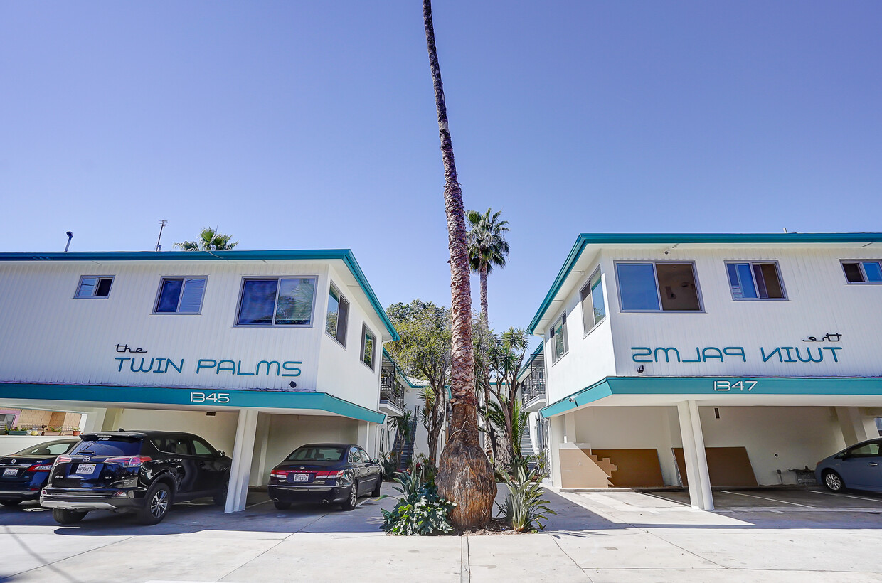
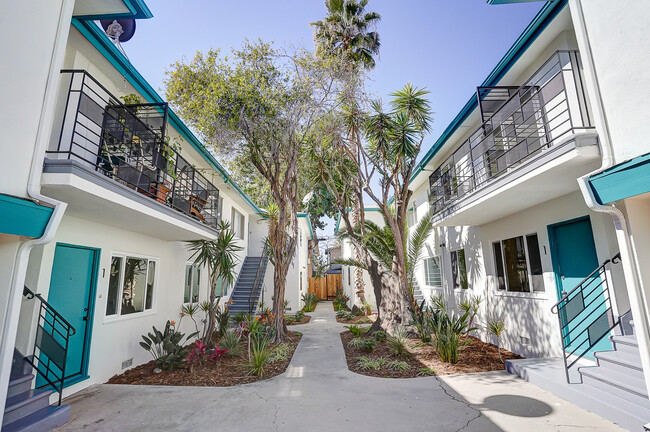
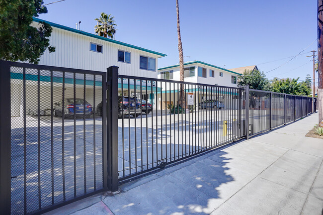
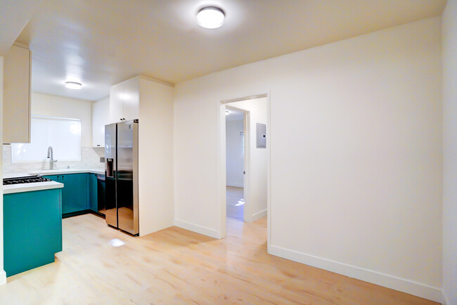
1345 N Las Palmas Ave Unit 2
Los Angeles, CA 90028
Favorites
1345 N Las Palmas Ave Unit 2

Favorites
Check Back Soon for Upcoming Availability
| Beds | Baths | Average SF |
|---|---|---|
| 1 Bedroom 1 Bedroom 1 Br | 1 Bath 1 Bath 1 Ba | 750 SF |
Fees and Policies
Details
Property Information
-
18 units
About This Property
1345 N Las Palmas Ave is an apartment community located in Los Angeles County and the 90028 ZIP Code.
1345 N Las Palmas Ave,
Los Angeles,
CA
90028
Los Angeles sprawls across nearly 500 square miles between the Pacific Ocean and the San Gabriel Mountains, making it one of the few places where you can surf in the morning and hike through chaparral-covered hills by afternoon. Sunshine, open-air farmers markets, and a food scene that pulls from dozens of culinary traditions are a staple of living in the city.
Neighborhoods each have a distinct personality surrounding a particular focus, whether it be culture or nature. Westwood keeps residents close to entertainment at UCLA and the Hammer Museum's rotating art exhibitions. Koreatown is a cultural and food destination, known for authentic restaurants and shops paired with a bustling street energy and nightlife.
The city overflows with iconic landmarks, from natural to man-made. Griffith Park, one of the largest urban parks in the country, offers hiking trails, sweeping skyline views, and the iconic Griffith Observatory.
Learn more about living in Los Angeles
Education
| Colleges & Universities | Distance | ||
|---|---|---|---|
| Colleges & Universities | Distance | ||
| Walk: | 9 min | 0.5 mi | |
| Walk: | 13 min | 0.7 mi | |
| Drive: | 7 min | 3.6 mi | |
| Drive: | 9 min | 4.7 mi |
1345 N Las Palmas Ave Unit 2 is within 9 minutes or 0.5 mile from Musicians Institute. It is also near Los Angeles Film School and City College.
Transportation options available in Los Angeles include Hollywood/Highland Station, located 0.5 mile from 1345 N Las Palmas Ave Unit 2. 1345 N Las Palmas Ave Unit 2 is near Bob Hope, located 9.0 miles or 17 minutes away, and Los Angeles International, located 13.1 miles or 26 minutes away.
| Transit / Subway | Distance | ||
|---|---|---|---|
| Transit / Subway | Distance | ||
|
|
Walk: | 10 min | 0.5 mi |
|
|
Walk: | 19 min | 1.0 mi |
|
|
Drive: | 4 min | 2.0 mi |
|
|
Drive: | 5 min | 2.8 mi |
|
|
Drive: | 6 min | 3.3 mi |
| Commuter Rail | Distance | ||
|---|---|---|---|
| Commuter Rail | Distance | ||
|
|
Drive: | 12 min | 6.3 mi |
|
|
Drive: | 14 min | 6.9 mi |
|
|
Drive: | 12 min | 7.1 mi |
|
|
Drive: | 14 min | 7.2 mi |
|
|
Drive: | 15 min | 7.8 mi |
| Airports | Distance | ||
|---|---|---|---|
| Airports | Distance | ||
|
Bob Hope
|
Drive: | 17 min | 9.0 mi |
|
Los Angeles International
|
Drive: | 26 min | 13.1 mi |
Walkability Near 1345 N Las Palmas Ave Los Angeles, CA 90028
Getting Around
 What do Walkability, Transit, Drivability, and Bikeability mean?
Walkability measures the walking distance to day-to-day needs.
Transit measures access to public transportation.
Drivability measures congestion, parking availability, and access to major roads.
Bikeability measures the suitability for cycling.
How It Works
What do Walkability, Transit, Drivability, and Bikeability mean?
Walkability measures the walking distance to day-to-day needs.
Transit measures access to public transportation.
Drivability measures congestion, parking availability, and access to major roads.
Bikeability measures the suitability for cycling.
How It Works
Very Walkable
Walkability
80
/ 100
Good Public Transit
Transit
70
/ 100
Moderately Drivable
Drivability
70
/ 100
Fairly Bikeable
Bikeability
40
/ 100
Scores provided by
Busy
Soundscore™
67
/ 100
Traffic
BusyAirport
CalmBusinesses
BusyScores provided by
HowLoud What is a Sound Score Rating? A Sound Score Rating aggregates noise caused by vehicle traffic, airplane traffic and local sources. How It WorksTime and distance from 1345 N Las Palmas Ave Unit 2.
| Shopping Centers | Distance | ||
|---|---|---|---|
| Shopping Centers | Distance | ||
| Walk: | 4 min | 0.2 mi | |
| Walk: | 9 min | 0.5 mi | |
| Walk: | 11 min | 0.6 mi |
1345 N Las Palmas Ave Unit 2 has 3 shopping centers within 0.6 mile, which is about a 11-minute walk. The miles and minutes will be for the farthest away property.
| Parks and Recreation | Distance | ||
|---|---|---|---|
| Parks and Recreation | Distance | ||
|
Runyon Canyon
|
Drive: | 4 min | 1.3 mi |
|
La Brea Tar Pits
|
Drive: | 7 min | 3.4 mi |
|
Bird Sanctuary
|
Drive: | 10 min | 4.1 mi |
|
Zimmer Children's Museum
|
Drive: | 8 min | 4.3 mi |
|
Griffith Observatory
|
Drive: | 14 min | 5.3 mi |
1345 N Las Palmas Ave Unit 2 has 5 parks within 5.3 miles, including Runyon Canyon, La Brea Tar Pits, and Griffith Observatory.
| Hospitals | Distance | ||
|---|---|---|---|
| Hospitals | Distance | ||
| Walk: | 12 min | 0.7 mi | |
| Drive: | 5 min | 2.6 mi | |
| Drive: | 5 min | 2.8 mi |
1345 N Las Palmas Ave Unit 2 has 3 hospitals within 2.8 miles, the nearest is Southern California Hospital at Hollywood which is 0.7 mile away and a 12 minute walk.
| Military Bases | Distance | ||
|---|---|---|---|
| Military Bases | Distance | ||
| Drive: | 26 min | 14.8 mi | |
| Drive: | 43 min | 31.5 mi | |
| Drive: | 46 min | 33.7 mi |
1345 N Las Palmas Ave Unit 2 has 3 military bases within 33.7 miles, the nearest is Los Angeles Air Force Base which is 14.8 miles away and a 26 minute drive.
You May Also Like
Similar Rentals Nearby
-
-
-
-
-
-
-
-
1 Bed$3,161+2 Beds$4,611+Total Monthly Price12 Month LeaseTotal Monthly Price NewPrices include base rent and required monthly fees of $15. Variable costs based on usage may apply.Base Rent:1 Bed$3,145+2 Beds$4,595+2 Months Free
Pets Allowed Fitness Center Pool Maintenance on site High-Speed Internet Controlled Access EV Charging
-
-


What Are Walk Score®, Transit Score®, and Bike Score® Ratings?
Walk Score® measures the walkability of any address. Transit Score® measures access to public transit. Bike Score® measures the bikeability of any address.
What is a Sound Score Rating?
A Sound Score Rating aggregates noise caused by vehicle traffic, airplane traffic and local sources.

1345 N Las Palmas Ave
Los Angeles, CA 90028