
$2,100
/ Month
133 Newport St
Brooklyn, NY 11212
2 Weeks Ago
|
Edit
Favorites
133 Newport St

Favorites
Check Back Soon for Upcoming Availability
| Beds | Baths | Average SF |
|---|---|---|
| 3 Bedrooms 3 Bedrooms 3 Br | 1 Bath 1 Bath 1 Ba | — |
Fees and Policies
The fees listed below are community-provided and may exclude utilities or add-ons. All payments are made directly to the property and are non-refundable unless otherwise specified.
Details
Utilities Included
-
Water
About This Property
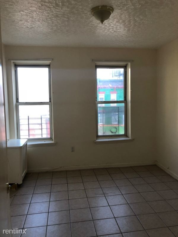
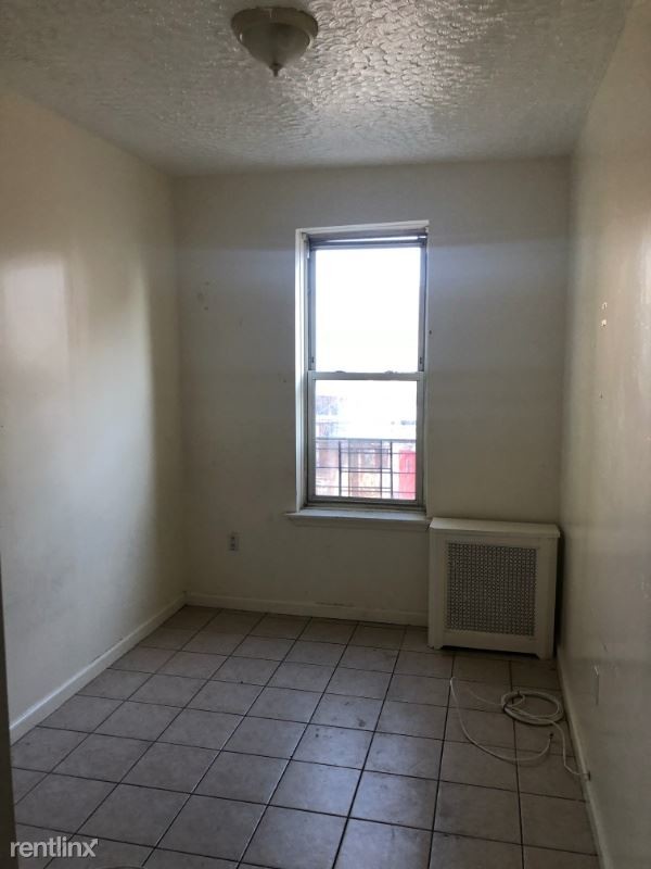
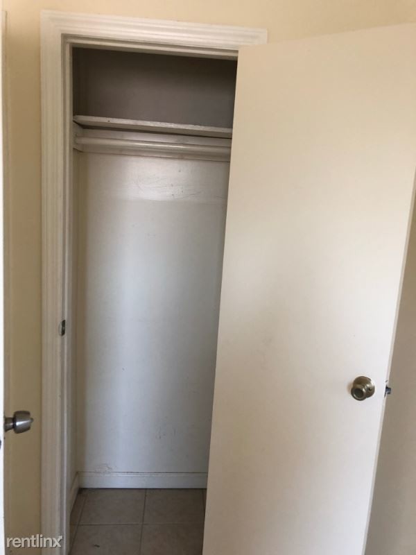
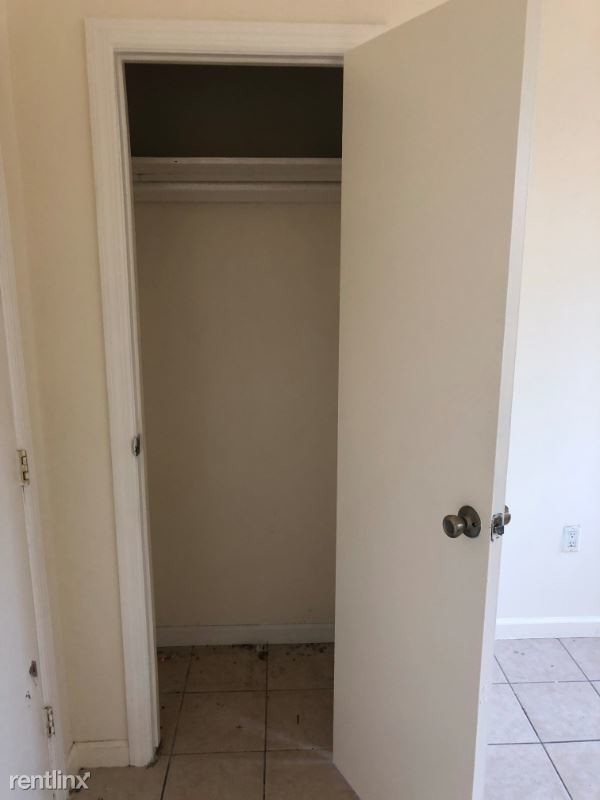
(516) 500-1559 - Beautiful 3 Bedroom Apt In Brownsville - Property Id: 98430 Beautiful 3 bedroom apartment located in Brownsville. This apartment features three spacious bedrooms, ceramic tile flooring throughout, an eat-in kitchen, brand new appliances, freshly painted walls and more! This charming rental is also conveniently located near lots of shopping, Brookdale Hospital, and the 3 & 4 Train. For more information or to schedule a viewing contact Gary - (516) 500-1559 Apply at TurboTenant: http://rental.turbotenant.com/properties/98430 Property Id 98430 No Dogs Allowed (RLNE4680061) Other Amenities: Other (Cable Ready). Appliances: Refrigerator, Range, Oven. Lease lengths: 12 Months. Utilities: Water Included. Pet policies: No Dogs Allowed.
133 Newport St is a condo located in Kings County and the 11212 ZIP Code. This area is served by the New York City Geographic District #23 attendance zone.
Unique Features
- No Dogs Allowed, Oven, Amenities - Cable Ready, Amenities - Cooling System: Wall, Amenities - Floor
133 Newport St,
Brooklyn,
NY
11212
Brownsville is a residential neighborhood located about 19 miles southeast of Manhattan in the borough of Brooklyn. Renters appreciate the neighborhood’s affordable housing and accessibility to the city. Several famous people once called Brownsville home, including the Three Stooges. Brownsville boasts walkable streets and excellent access to public transportation. This close-knit community boasts a family-friendly vibe with access to several community parks like Betsy Head Park. Residents live next to the heart of Brooklyn, making Brownsville a great place for commuters.
Learn more about living in BrownsvilleBelow are rent ranges for similar nearby apartments
Amenities
- No Dogs Allowed, Oven, Amenities - Cable Ready, Amenities - Cooling System: Wall, Amenities - Floor
Expenses
Utilities Included
Water
Included
Education
| Colleges & Universities | Distance | ||
|---|---|---|---|
| Colleges & Universities | Distance | ||
| Drive: | 9 min | 3.1 mi | |
| Drive: | 11 min | 4.1 mi | |
| Drive: | 14 min | 4.5 mi | |
| Drive: | 13 min | 4.7 mi |
133 Newport St is within 9 minutes or 3.1 miles from Medgar Evers College, CUNY. It is also near Brooklyn College and Pratt Institute.
Schools


Public Elementary School
Grades PK-5
213 Students
Attendance Zone
Public Elementary School
Grades K-5
158 Students
Attendance Zone
Public High School
Grades 9-12
166 Students
Nearby
Private Elementary & Middle School
Grades PK-8
Nearby
Private High School
Grades 9-12
448 Students
Nearby
School data provided by
 The GreatSchools Rating helps parents compare schools within a state based on a variety of school quality indicators and provides a helpful picture of how effectively each school serves all of its students. Ratings are on a scale of 1 (below average) to 10 (above average) and can include test scores, college readiness, academic progress, advanced courses, equity, discipline and attendance data. We also advise parents to visit schools, consider other information on school performance and programs, and consider family needs as part of the school selection process.
View GreatSchools Rating Methodology
Data provided by GreatSchools.org © 2026. All rights reserved.
View GreatSchools Rating Methodology
Data provided by GreatSchools.org © 2026. All rights reserved.
Transportation options available in Brooklyn include Rockaway Avenue (3,4 Line), located 0.3 mile from 133 Newport St. 133 Newport St is near John F Kennedy International, located 9.2 miles or 15 minutes away, and LaGuardia, located 9.9 miles or 24 minutes away.
| Transit / Subway | Distance | ||
|---|---|---|---|
| Transit / Subway | Distance | ||
|
|
Walk: | 6 min | 0.3 mi |
|
|
Walk: | 9 min | 0.5 mi |
|
|
Walk: | 13 min | 0.7 mi |
|
|
Drive: | 4 min | 1.2 mi |
|
|
Drive: | 4 min | 1.5 mi |
| Commuter Rail | Distance | ||
|---|---|---|---|
| Commuter Rail | Distance | ||
|
|
Drive: | 4 min | 1.6 mi |
|
|
Drive: | 11 min | 3.6 mi |
|
|
Drive: | 13 min | 4.5 mi |
|
|
Drive: | 16 min | 6.4 mi |
|
|
Drive: | 15 min | 6.6 mi |
| Airports | Distance | ||
|---|---|---|---|
| Airports | Distance | ||
|
John F Kennedy International
|
Drive: | 15 min | 9.2 mi |
|
LaGuardia
|
Drive: | 24 min | 9.9 mi |
Walkability Near 133 Newport St Brooklyn, NY 11212
Getting Around
 What do Walkability, Transit, Drivability, and Bikeability mean?
Walkability measures the walking distance to day-to-day needs.
Transit measures access to public transportation.
Drivability measures congestion, parking availability, and access to major roads.
Bikeability measures the suitability for cycling.
How It Works
What do Walkability, Transit, Drivability, and Bikeability mean?
Walkability measures the walking distance to day-to-day needs.
Transit measures access to public transportation.
Drivability measures congestion, parking availability, and access to major roads.
Bikeability measures the suitability for cycling.
How It Works
Exceptionally Walkable
Walkability
100
/ 100
Exceptional Public Transit
Transit
100
/ 100
Challenging For Drivers
Drivability
10
/ 100
Moderately Bikeable
Bikeability
60
/ 100
Scores provided by
-
Soundscore™
-
/ 100
Traffic
-Airport
-Businesses
-Scores provided by
HowLoud What is a Sound Score Rating? A Sound Score Rating aggregates noise caused by vehicle traffic, airplane traffic and local sources. How It WorksTime and distance from 133 Newport St.
| Shopping Centers | Distance | ||
|---|---|---|---|
| Shopping Centers | Distance | ||
| Drive: | 4 min | 1.4 mi | |
| Drive: | 5 min | 1.6 mi | |
| Drive: | 4 min | 1.7 mi |
133 Newport St has 3 shopping centers within 1.7 miles, which is about a 4-minute drive. The miles and minutes will be for the farthest away property.
| Parks and Recreation | Distance | ||
|---|---|---|---|
| Parks and Recreation | Distance | ||
|
Betsy Head Memorial Playground
|
Walk: | 8 min | 0.4 mi |
|
Linden Playground
|
Drive: | 3 min | 1.5 mi |
|
St. John's Park
|
Drive: | 7 min | 2.4 mi |
|
Fresh Creek Park
|
Drive: | 6 min | 2.5 mi |
|
Wingate Park
|
Drive: | 9 min | 2.7 mi |
133 Newport St has 5 parks within 2.7 miles, including Betsy Head Memorial Playground, Linden Playground, and Fresh Creek Park.
| Hospitals | Distance | ||
|---|---|---|---|
| Hospitals | Distance | ||
| Walk: | 10 min | 0.5 mi | |
| Drive: | 6 min | 2.0 mi | |
| Drive: | 6 min | 2.1 mi |
133 Newport St has 3 hospitals within 2.1 miles, the nearest is Brookdale Hospital Medical Center which is 0.5 mile away and a 10 minute walk.
| Military Bases | Distance | ||
|---|---|---|---|
| Military Bases | Distance | ||
| Drive: | 15 min | 7.2 mi | |
| Drive: | 23 min | 8.7 mi |
133 Newport St is 7.2 miles from US Navy Reserve, and is convenient to other military bases, including US Coast Guard Heliport.
You May Also Like
Similar Rentals Nearby


What Are Walk Score®, Transit Score®, and Bike Score® Ratings?
Walk Score® measures the walkability of any address. Transit Score® measures access to public transit. Bike Score® measures the bikeability of any address.
What is a Sound Score Rating?
A Sound Score Rating aggregates noise caused by vehicle traffic, airplane traffic and local sources.

133 Newport St
Brooklyn, NY 11212