
The Vitagraph
1277 E 14th St,
Brooklyn, NY 11230
1-3 Beds $2,709 - $4,098
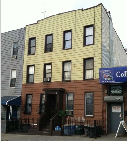
Experience Brooklyn living at 133 20th St. This property is situated in the Greenwood area of Brooklyn. The leasing team is excited to help you find the perfect apartment. Come see 133 20th St today.
133 20th St is an apartment community located in Kings County and the 11232 ZIP Code. This area is served by the New York City Special Schools - District 75 attendance zone.
Greenwood is a quaint neighborhood on the banks of the Hudson River and Upper Bay in Brooklyn, New York. This urban area is situated near Downtown Brooklyn with close proximity to major roads and subway stations that take you around town and to neighboring New York City boroughs.
Though a bustling urban neighborhood, Greenwood boasts walkable streets, good schools, and a safe community that’s favored by its residents. Greenwood is nestled near the Green Wood Cemetery, a sprawling area across nearly 500 acres that’s home to numerous notable figures.
Learn more about living in Greenwood| Colleges & Universities | Distance | ||
|---|---|---|---|
| Colleges & Universities | Distance | ||
| Drive: | 6 min | 2.2 mi | |
| Drive: | 6 min | 2.2 mi | |
| Drive: | 6 min | 2.6 mi | |
| Drive: | 7 min | 2.6 mi |
Transportation options available in Brooklyn include Prospect Avenue (D,M,N,R Line), located 0.3 mile from 133 20th St. 133 20th St is near LaGuardia, located 12.8 miles or 23 minutes away, and Newark Liberty International, located 16.3 miles or 27 minutes away.
| Transit / Subway | Distance | ||
|---|---|---|---|
| Transit / Subway | Distance | ||
|
|
Walk: | 5 min | 0.3 mi |
|
|
Walk: | 6 min | 0.4 mi |
|
|
Walk: | 13 min | 0.7 mi |
|
|
Walk: | 14 min | 0.7 mi |
|
|
Walk: | 16 min | 0.9 mi |
| Commuter Rail | Distance | ||
|---|---|---|---|
| Commuter Rail | Distance | ||
|
|
Drive: | 7 min | 2.2 mi |
|
|
Drive: | 11 min | 3.5 mi |
|
|
Drive: | 18 min | 7.5 mi |
|
|
Drive: | 19 min | 8.1 mi |
|
|
Drive: | 22 min | 10.7 mi |
| Airports | Distance | ||
|---|---|---|---|
| Airports | Distance | ||
|
LaGuardia
|
Drive: | 23 min | 12.8 mi |
|
Newark Liberty International
|
Drive: | 27 min | 16.3 mi |
Time and distance from 133 20th St.
| Shopping Centers | Distance | ||
|---|---|---|---|
| Shopping Centers | Distance | ||
| Drive: | 7 min | 2.3 mi | |
| Drive: | 7 min | 3.2 mi | |
| Drive: | 8 min | 3.4 mi |
| Parks and Recreation | Distance | ||
|---|---|---|---|
| Parks and Recreation | Distance | ||
|
Red Hook Park
|
Drive: | 2 min | 1.2 mi |
|
Gowanus Canal
|
Drive: | 4 min | 1.3 mi |
|
Sunset Park
|
Drive: | 4 min | 1.6 mi |
|
Coffey Park
|
Drive: | 4 min | 1.8 mi |
|
Waterfront Museum & Showboat Barge
|
Drive: | 4 min | 2.0 mi |
| Hospitals | Distance | ||
|---|---|---|---|
| Hospitals | Distance | ||
| Drive: | 4 min | 1.6 mi | |
| Drive: | 8 min | 2.6 mi | |
| Drive: | 6 min | 3.0 mi |
| Military Bases | Distance | ||
|---|---|---|---|
| Military Bases | Distance | ||
| Drive: | 10 min | 4.9 mi | |
| Drive: | 10 min | 5.3 mi |
What Are Walk Score®, Transit Score®, and Bike Score® Ratings?
Walk Score® measures the walkability of any address. Transit Score® measures access to public transit. Bike Score® measures the bikeability of any address.
What is a Sound Score Rating?
A Sound Score Rating aggregates noise caused by vehicle traffic, airplane traffic and local sources

133 20th St
Brooklyn, NY 11232


