
1213 Walnut
1213 Walnut St,
Philadelphia, PA 19107
$2,080 - $5,270
Studio - 2 Beds
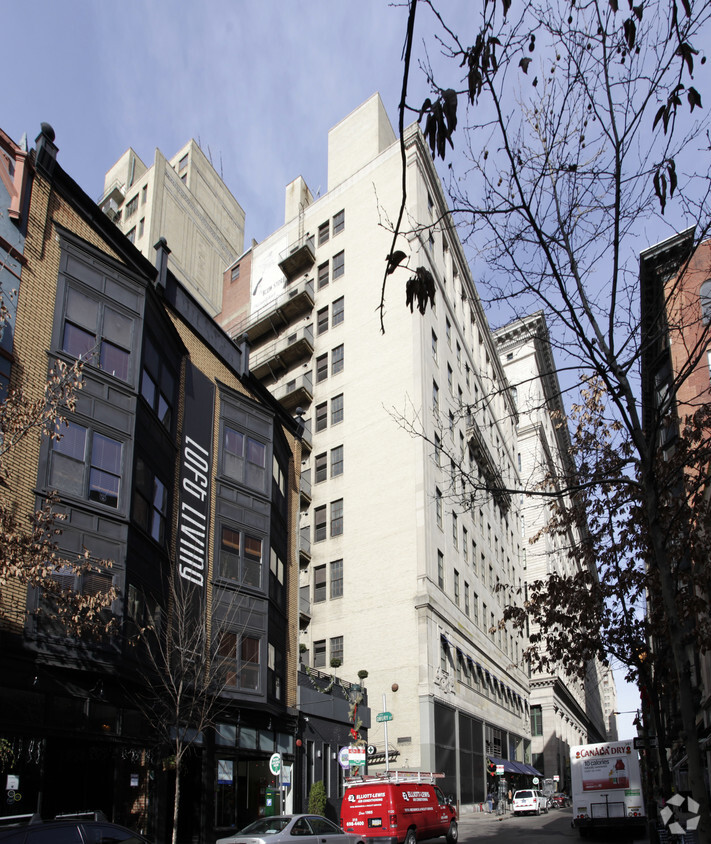
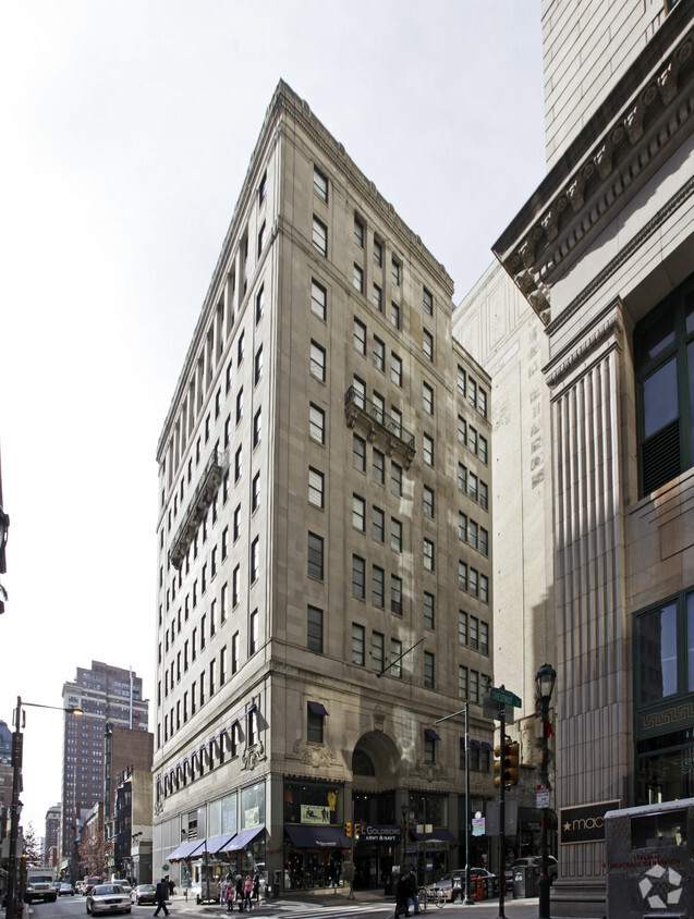
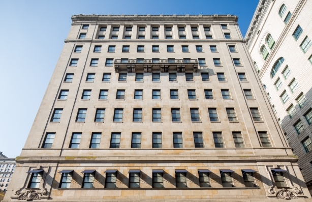
Explore your new home at 1300 Chestnut Street in Philadelphia, PA. Make a visit to view the available floorplans. At this community, you'll have access to a variety of amenities and features. Some of these include: high-speed internet access, smoke free options, and convenient on-site parking options. Here at this community, the leasing team is ready to match you with the perfect floorplan. It's time to love where you live. Stop by for a visit today.
1300 Chestnut Street is an apartment community located in Philadelphia County and the 19107 ZIP Code. This area is served by the The School District of Philadelphia attendance zone.
Air Conditioning
Dishwasher
High Speed Internet Access
Hardwood Floors
Nestled along the banks of the Delaware River near the Pennsylvania-New Jersey state line, the historic city of Philadelphia played a major role in the fight for independence, even serving as the nation’s capital for a brief period. Today, Philly’s rich history blends seamlessly with its modern, progressive spirit, forming a one-of-a-kind urban experience. As one of the nation’s largest cities, you’ll discover a variety of bustling businesses, such as the Philadelphia Stock Exchange, the country’s oldest stock exchange.
The University of Pennsylvania, the Philadelphia International Airport, and a multitude of historical landmarks and tourist attractions reside in this urban oasis. Admire the historic Liberty Bell, explore the Philadelphia Museum of Art, and take a trip to the famous Philadelphia Zoo. Enjoy the waterfront at Franklin D. Roosevelt Park, snap a picture at the Magic Gardens, or soak in the unique identities of the varied neighborhoods of the city.
Learn more about living in Philadelphia| Colleges & Universities | Distance | ||
|---|---|---|---|
| Colleges & Universities | Distance | ||
| Walk: | 6 min | 0.3 mi | |
| Walk: | 6 min | 0.3 mi | |
| Walk: | 13 min | 0.7 mi | |
| Walk: | 17 min | 0.9 mi |


Transportation options available in Philadelphia include 13Th Street, located 0.1 mile from 1300 Chestnut Street. 1300 Chestnut Street is near Philadelphia International, located 12.2 miles or 22 minutes away, and Trenton Mercer, located 33.8 miles or 49 minutes away.
| Transit / Subway | Distance | ||
|---|---|---|---|
| Transit / Subway | Distance | ||
|
|
Walk: | 2 min | 0.1 mi |
|
|
Walk: | 4 min | 0.2 mi |
|
|
Walk: | 5 min | 0.3 mi |
|
|
Walk: | 5 min | 0.3 mi |
|
|
Walk: | 9 min | 0.5 mi |
| Commuter Rail | Distance | ||
|---|---|---|---|
| Commuter Rail | Distance | ||
|
|
Walk: | 7 min | 0.4 mi |
|
|
Walk: | 10 min | 0.5 mi |
|
|
Drive: | 4 min | 1.3 mi |
| Drive: | 5 min | 2.4 mi | |
| Drive: | 7 min | 3.3 mi |
| Airports | Distance | ||
|---|---|---|---|
| Airports | Distance | ||
|
Philadelphia International
|
Drive: | 22 min | 12.2 mi |
|
Trenton Mercer
|
Drive: | 49 min | 33.8 mi |
Time and distance from 1300 Chestnut Street.
| Shopping Centers | Distance | ||
|---|---|---|---|
| Shopping Centers | Distance | ||
| Walk: | 6 min | 0.3 mi | |
| Walk: | 6 min | 0.4 mi | |
| Walk: | 8 min | 0.5 mi |
| Parks and Recreation | Distance | ||
|---|---|---|---|
| Parks and Recreation | Distance | ||
|
The Academy of Natural Sciences
|
Walk: | 15 min | 0.8 mi |
|
Franklin Institute
|
Walk: | 17 min | 0.9 mi |
|
Fels Planetarium
|
Walk: | 18 min | 0.9 mi |
|
Thaddeus Kosciuszko National Memorial
|
Drive: | 4 min | 1.2 mi |
|
Independence National Historical Park
|
Drive: | 3 min | 1.5 mi |
| Hospitals | Distance | ||
|---|---|---|---|
| Hospitals | Distance | ||
| Walk: | 4 min | 0.2 mi | |
| Walk: | 8 min | 0.4 mi | |
| Walk: | 11 min | 0.6 mi |
| Military Bases | Distance | ||
|---|---|---|---|
| Military Bases | Distance | ||
| Drive: | 13 min | 6.6 mi |
What Are Walk Score®, Transit Score®, and Bike Score® Ratings?
Walk Score® measures the walkability of any address. Transit Score® measures access to public transit. Bike Score® measures the bikeability of any address.
What is a Sound Score Rating?
A Sound Score Rating aggregates noise caused by vehicle traffic, airplane traffic and local sources

1300-1306 Chestnut St
Philadelphia, PA 19107


