

$2,350
/ Month
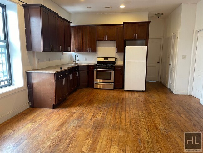
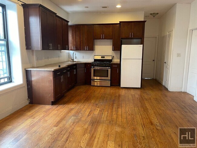
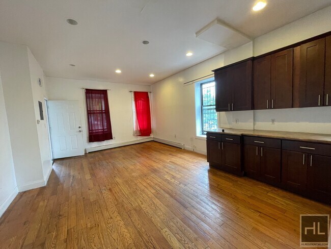
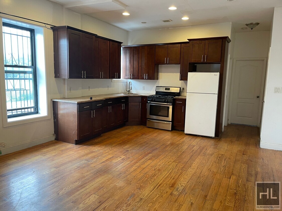
130 Dumont Ave
Brooklyn, NY 11212
Favorites
-
Bedrooms
2
-
Bathrooms
2
-
Square Feet
--
130 Dumont Ave

Favorites
Contact
- Listed by Locayt
Location
Get Directions
Brownsville is a residential neighborhood located about 19 miles southeast of Manhattan in the borough of Brooklyn. Renters appreciate the neighborhood’s affordable housing and accessibility to the city. Several famous people once called Brownsville home, including the Three Stooges. Brownsville boasts walkable streets and excellent access to public transportation. This close-knit community boasts a family-friendly vibe with access to several community parks like Betsy Head Park. Residents live next to the heart of Brooklyn, making Brownsville a great place for commuters.
Learn more about living in Brownsville
Education
| Colleges & Universities | Distance | ||
|---|---|---|---|
| Colleges & Universities | Distance | ||
| Drive: | 9 min | 3.1 mi | |
| Drive: | 10 min | 4.0 mi | |
| Drive: | 13 min | 4.4 mi | |
| Drive: | 13 min | 4.6 mi |
130 Dumont Ave is within 9 minutes or 3.1 miles from Medgar Evers College, CUNY. It is also near Brooklyn College and Saint Joseph's Coll, Brooklyn.
Transportation options available in Brooklyn include Saratoga Avenue, located 0.2 mile from 130 Dumont Ave. 130 Dumont Ave is near John F Kennedy International, located 9.7 miles or 16 minutes away, and LaGuardia, located 10.3 miles or 24 minutes away.
| Transit / Subway | Distance | ||
|---|---|---|---|
| Transit / Subway | Distance | ||
|
|
Walk: | 3 min | 0.2 mi |
|
|
Walk: | 7 min | 0.4 mi |
|
|
Walk: | 10 min | 0.5 mi |
|
|
Walk: | 14 min | 0.7 mi |
|
|
Drive: | 5 min | 1.2 mi |
| Commuter Rail | Distance | ||
|---|---|---|---|
| Commuter Rail | Distance | ||
|
|
Drive: | 4 min | 2.0 mi |
|
|
Drive: | 10 min | 3.4 mi |
|
|
Drive: | 13 min | 4.5 mi |
|
|
Drive: | 16 min | 6.9 mi |
|
|
Drive: | 15 min | 7.1 mi |
| Airports | Distance | ||
|---|---|---|---|
| Airports | Distance | ||
|
John F Kennedy International
|
Drive: | 16 min | 9.7 mi |
|
LaGuardia
|
Drive: | 24 min | 10.3 mi |
Getting Around
 What do Walkability, Transit, Drivability, and Bikeability mean?
Walkability measures the walking distance to day-to-day needs.
Transit measures access to public transportation.
Drivability measures congestion, parking availability, and access to major roads.
Bikeability measures the suitability for cycling.
How It Works
What do Walkability, Transit, Drivability, and Bikeability mean?
Walkability measures the walking distance to day-to-day needs.
Transit measures access to public transportation.
Drivability measures congestion, parking availability, and access to major roads.
Bikeability measures the suitability for cycling.
How It Works
Exceptionally Walkable
Walkability
100
/ 100
Exceptional Public Transit
Transit
100
/ 100
Challenging For Drivers
Drivability
10
/ 100
Moderately Bikeable
Bikeability
60
/ 100
Scores provided by
-
Soundscore™
-
/ 100
Traffic
-Airport
-Businesses
-Scores provided by
HowLoud What is a Sound Score Rating? A Sound Score Rating aggregates noise caused by vehicle traffic, airplane traffic and local sources. How It WorksTime and distance from 130 Dumont Ave.
| Shopping Centers | Distance | ||
|---|---|---|---|
| Shopping Centers | Distance | ||
| Drive: | 4 min | 1.5 mi | |
| Drive: | 4 min | 1.6 mi |
130 Dumont Ave has 2 shopping centers within 1.6 miles, which is about a 4-minute drive. The miles and minutes will be for the farthest away property.
| Parks and Recreation | Distance | ||
|---|---|---|---|
| Parks and Recreation | Distance | ||
|
Betsy Head Memorial Playground
|
Walk: | 1 min | 0.1 mi |
|
St. John's Park
|
Drive: | 6 min | 2.1 mi |
|
Linden Playground
|
Drive: | 5 min | 2.1 mi |
|
Wingate Park
|
Drive: | 8 min | 2.5 mi |
|
Brooklyn Children's Museum
|
Drive: | 8 min | 2.8 mi |
130 Dumont Ave has 5 parks within 2.8 miles, including Betsy Head Memorial Playground, St. John's Park, and Linden Playground.
| Hospitals | Distance | ||
|---|---|---|---|
| Hospitals | Distance | ||
| Walk: | 13 min | 0.7 mi | |
| Drive: | 5 min | 1.9 mi | |
| Drive: | 6 min | 1.9 mi |
130 Dumont Ave has 3 hospitals within 1.9 miles, the nearest is Brookdale Hospital Medical Center which is 0.7 mile away and a 13 minute walk.
| Military Bases | Distance | ||
|---|---|---|---|
| Military Bases | Distance | ||
| Drive: | 14 min | 7.0 mi | |
| Drive: | 23 min | 8.5 mi | |
| Drive: | 21 min | 10.4 mi |
130 Dumont Ave has 3 military bases within 10.4 miles, the nearest is US Navy Reserve which is 7.0 miles away and a 14 minute drive.
You May Also Like
Similar Rentals Nearby


What Are Walk Score®, Transit Score®, and Bike Score® Ratings?
Walk Score® measures the walkability of any address. Transit Score® measures access to public transit. Bike Score® measures the bikeability of any address.
What is a Sound Score Rating?
A Sound Score Rating aggregates noise caused by vehicle traffic, airplane traffic and local sources.
130 Dumont Ave
Brooklyn, NY 11212