
$1,795
/ Month
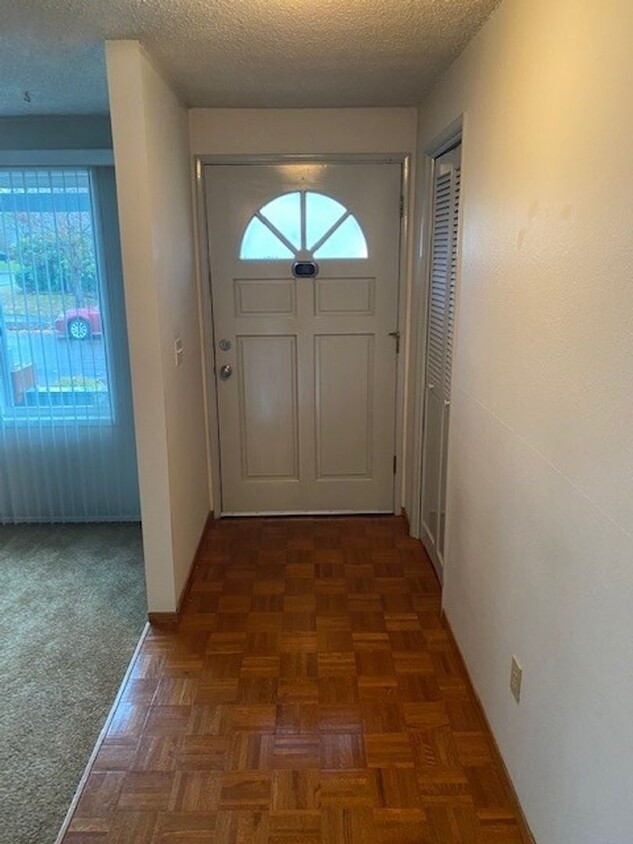
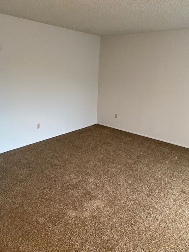
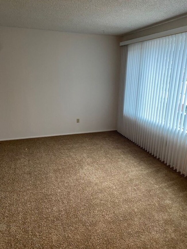
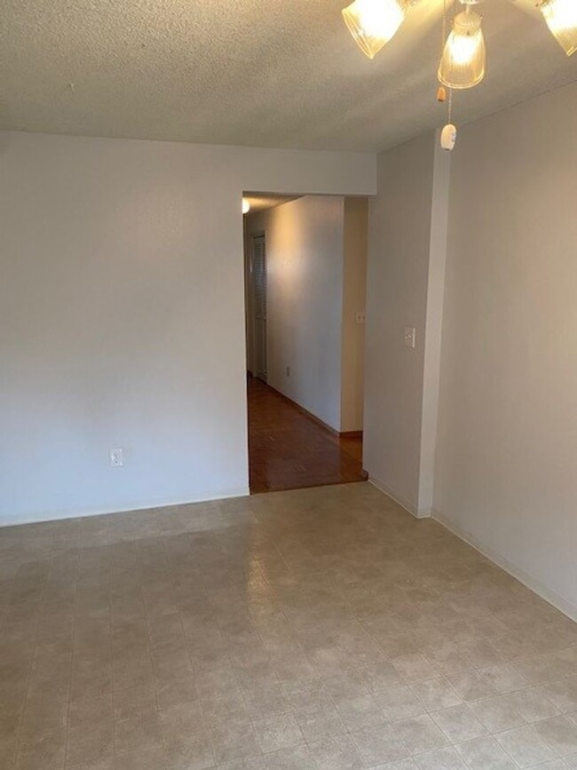
1285 Cedar Ridge Dr Unit 1285
Eugene, OR 97401
Favorites
1285 Cedar Ridge Dr Unit 1285

Favorites
Check Back Soon for Upcoming Availability
| Beds | Baths | Average SF |
|---|---|---|
| 3 Bedrooms 3 Bedrooms 3 Br | 1.5 Baths 1.5 Baths 1.5 Ba | — |
1285 Cedar Ridge Dr is an apartment community located in Lane County and the 97401 ZIP Code.
Features
- Dishwasher
1285 Cedar Ridge Dr,
Eugene,
OR
97401
The Cal Young neighborhood of Eugene, Oregon sits east of the Willamette River and occupies the northeast quarter of the city between Delta Highway and Coburg Road. As a mixed residential and commercial area, Cal Young provides low-density suburban housing options convenient to downtown Eugene, the University of Oregon campus, Autzen Stadium and local shopping malls. Easy access to Beltline Road and Interstate 5, many city parks and the Cuthbert Amphitheatre concert venue are just a few of the amenities that make this upscale neighborhood a favorite with Eugene families.
Learn more about living in Cal YoungBelow are rent ranges for similar nearby apartments
Amenities
- Dishwasher
Education
| Colleges & Universities | Distance | ||
|---|---|---|---|
| Colleges & Universities | Distance | ||
| Drive: | 10 min | 4.8 mi | |
| Drive: | 16 min | 8.6 mi | |
| Drive: | 59 min | 44.5 mi | |
| Drive: | 64 min | 48.3 mi |
1285 Cedar Ridge Dr Unit 1285 is within 10 minutes or 4.8 miles from University of Oregon. It is also near Lane Community College and Western Health Scis., Lebanon.
Walkability Near 1285 Cedar Ridge Dr Eugene, OR 97401
Getting Around
 What do Walkability, Transit, Drivability, and Bikeability mean?
Walkability measures the walking distance to day-to-day needs.
Transit measures access to public transportation.
Drivability measures congestion, parking availability, and access to major roads.
Bikeability measures the suitability for cycling.
How It Works
What do Walkability, Transit, Drivability, and Bikeability mean?
Walkability measures the walking distance to day-to-day needs.
Transit measures access to public transportation.
Drivability measures congestion, parking availability, and access to major roads.
Bikeability measures the suitability for cycling.
How It Works
Fairly Walkable
Walkability
50
/ 100
Minimal Public Transit
Transit
10
/ 100
Exceptionally Drivable
Drivability
90
/ 100
Fairly Bikeable
Bikeability
50
/ 100
Scores provided by
-
Soundscore™
-
/ 100
Traffic
-Airport
-Businesses
-Scores provided by
HowLoud What is a Sound Score Rating? A Sound Score Rating aggregates noise caused by vehicle traffic, airplane traffic and local sources. How It WorksYou May Also Like
Similar Rentals Nearby
-
-
-
3 Beds$2,575+Total Monthly PriceTotal Monthly Price NewPrices include all required monthly fees.Specials
Pets Allowed Fitness Center Pool In Unit Washer & Dryer Clubhouse Maintenance on site
-
3 Beds$2,485+Total Monthly PriceTotal Monthly Price NewPrices include base rent and required monthly fees of $30. Variable costs based on usage may apply.Base Rent:3 Beds$2,455+1 Month Free
Pets Allowed Fitness Center In Unit Washer & Dryer Stainless Steel Appliances Basketball Court
-
3 Beds$2,570Total Monthly PriceTotal Monthly Price NewPrices include base rent and required monthly fees. Variable costs based on usage may apply.Specials
Pets Allowed Fitness Center Pool Dishwasher Refrigerator In Unit Washer & Dryer
-
1 / 48

-
-
-
-


What Are Walk Score®, Transit Score®, and Bike Score® Ratings?
Walk Score® measures the walkability of any address. Transit Score® measures access to public transit. Bike Score® measures the bikeability of any address.
What is a Sound Score Rating?
A Sound Score Rating aggregates noise caused by vehicle traffic, airplane traffic and local sources.

1285 Cedar Ridge Dr
Eugene, OR 97401