
1233 S 56th St
1233 S 56th St,
Richmond,
CA
94804
2 Weeks Ago
Favorites
1233 S 56th St
Favorites
Check Back Soon for Upcoming Availability
| Beds | Baths | Average SF | Availability |
|---|---|---|---|
| Studio Studio 0 Br | 1 Bath 1 Bath 1 Ba | — | Not Available |
| 2 Bedrooms 2 Bedrooms 2 Br | 1 Bath 1 Bath 1 Ba | — | Not Available |
Fees and Policies
Details
Property Information
-
Built in 1989
-
11 units/2 stories
About 1233 S 56th St Richmond, CA 94804
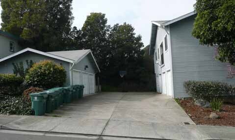
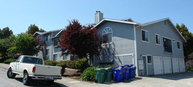
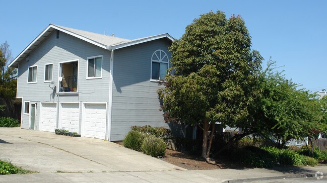
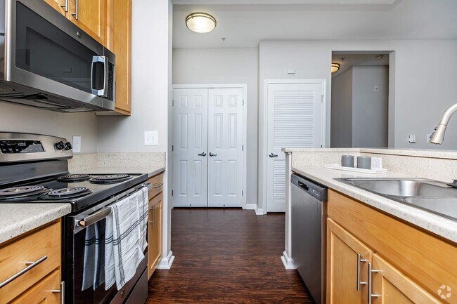
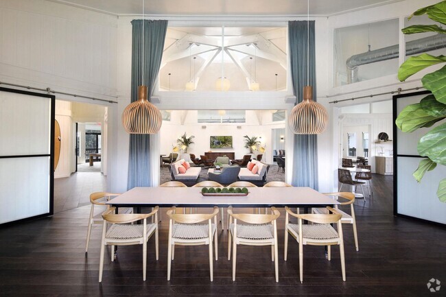
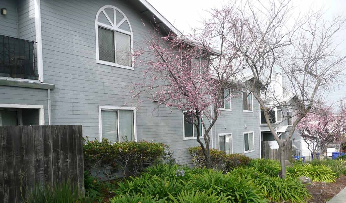
Experience Richmond living at 1233 S 56th St. The address for this community is at 1233 S. 56th St. in Richmond. This community offers a variety of amenities and features. These include: balconies, smoke free options, and high-speed internet access. The leasing staff is waiting to show you all that this community has in store. Stop by 1233 S 56th St today.
1233 S 56th St is an apartment community located in Contra Costa County and the 94804 ZIP Code. This area is served by the West Contra Costa Unified attendance zone.
Apartment Features
Air Conditioning
High Speed Internet Access
Fireplace
Smoke Free
- High Speed Internet Access
- Air Conditioning
- Smoke Free
- Fireplace
- Balcony
Location
Get Directions
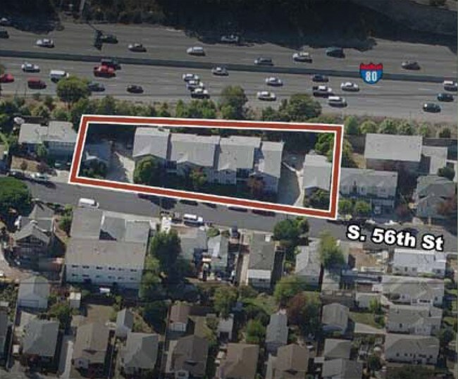
Rent an apartment in the Richmond Annex and enjoy easy access to I-80, which takes you into San Francisco. Central Avenue leads to Point Isabel, a small peninsula in San Francisco Bay.
Just across the Richmond Annex's southern border sits Albany Hill Park. Hike to the top of Albany Hill, and take in a panoramic view of the Bay Area. More trails await at the Albany Mudflats State Marine Park, just west of I-580.
Explore Playland-Not-at-the-Beach at the northern end of the neighborhood. This local hangout, with a museum and community center, features games and events for all ages. San Pablo Avenue, the hotspot for local restaurants, features international cuisine for a wide range taste buds.
Learn more about living in Richmond AnnexBelow are rent ranges for similar nearby apartments
Amenities
- High Speed Internet Access
- Air Conditioning
- Smoke Free
- Fireplace
- Balcony
Education
| Colleges & Universities | Distance | ||
|---|---|---|---|
| Colleges & Universities | Distance | ||
| Drive: | 10 min | 5.7 mi | |
| Drive: | 13 min | 6.0 mi | |
| Drive: | 16 min | 7.0 mi | |
| Drive: | 13 min | 8.6 mi |
1233 S 56th St is within 10 minutes or 5.7 miles from Contra Costa College. It is also near Berkeley City College and UC Berkeley.
Schools


Public Elementary School
Grades K-5
270 Students
Nearby
Public Elementary School
Grades K-6
503 Students
Attendance Zone
Public Middle School
Grades 7-8
681 Students
Attendance Zone
Public High School
Grades 9-12
1,522 Students
Attendance Zone
Private Elementary, Middle & High School
Grades PK-12
Nearby
Private Elementary, Middle & High School
Grades K-11
31 Students
Nearby
Private Elementary, Middle & High School
Grades K-11
Nearby
Private Elementary & Middle School
Grades K-8
189 Students
Nearby
School data provided by
 The GreatSchools Rating helps parents compare schools within a state based on a variety of school quality indicators and provides a helpful picture of how effectively each school serves all of its students. Ratings are on a scale of 1 (below average) to 10 (above average) and can include test scores, college readiness, academic progress, advanced courses, equity, discipline and attendance data. We also advise parents to visit schools, consider other information on school performance and programs, and consider family needs as part of the school selection process.
View GreatSchools Rating Methodology
View GreatSchools Rating Methodology
Transportation options available in Richmond include El Cerrito Del Norte Station, located 1.1 miles from 1233 S 56th St. 1233 S 56th St is near Metro Oakland International, located 19.0 miles or 27 minutes away, and San Francisco International, located 26.6 miles or 40 minutes away.
| Transit / Subway | Distance | ||
|---|---|---|---|
| Transit / Subway | Distance | ||
|
|
Drive: | 4 min | 1.1 mi |
|
|
Drive: | 4 min | 1.8 mi |
|
|
Drive: | 7 min | 3.5 mi |
|
|
Drive: | 10 min | 4.1 mi |
|
|
Drive: | 13 min | 6.1 mi |
| Commuter Rail | Distance | ||
|---|---|---|---|
| Commuter Rail | Distance | ||
|
|
Drive: | 8 min | 4.6 mi |
|
|
Drive: | 10 min | 6.4 mi |
|
|
Drive: | 16 min | 10.5 mi |
| Drive: | 20 min | 12.3 mi | |
| Drive: | 21 min | 14.2 mi |
| Airports | Distance | ||
|---|---|---|---|
| Airports | Distance | ||
|
Metro Oakland International
|
Drive: | 27 min | 19.0 mi |
|
San Francisco International
|
Drive: | 40 min | 26.6 mi |
Time and distance from 1233 S 56th St.
| Shopping Centers | Distance | ||
|---|---|---|---|
| Shopping Centers | Distance | ||
| Walk: | 12 min | 0.6 mi | |
| Walk: | 14 min | 0.7 mi | |
| Walk: | 14 min | 0.7 mi |
1233 S 56th St has 3 shopping centers within 0.7 mile, which is about a 14-minute walk. The miles and minutes will be for the farthest away property.
| Parks and Recreation | Distance | ||
|---|---|---|---|
| Parks and Recreation | Distance | ||
|
Point Isabel Regional Shoreline
|
Drive: | 8 min | 2.3 mi |
|
Eddy Arboretum
|
Drive: | 5 min | 2.5 mi |
|
Blake Garden
|
Drive: | 7 min | 2.9 mi |
|
Marina Park & Green
|
Drive: | 7 min | 3.3 mi |
|
Shimada Friendship Park
|
Drive: | 9 min | 3.8 mi |
1233 S 56th St has 5 parks within 3.8 miles, including Point Isabel Regional Shoreline, Blake Garden, and Eddy Arboretum.
| Hospitals | Distance | ||
|---|---|---|---|
| Hospitals | Distance | ||
| Drive: | 15 min | 7.6 mi | |
| Drive: | 13 min | 8.5 mi | |
| Drive: | 13 min | 8.5 mi |
1233 S 56th St has 3 hospitals within 8.5 miles, the nearest is Alta Bates Summit Medical Center - Alta Bates Campus which is 7.6 miles away and a 15 minute drive.
| Military Bases | Distance | ||
|---|---|---|---|
| Military Bases | Distance | ||
| Drive: | 6 min | 2.4 mi | |
| Drive: | 9 min | 4.6 mi | |
| Drive: | 18 min | 9.6 mi |
1233 S 56th St has 3 military bases within 9.6 miles, the nearest is Military Reservation which is 2.4 miles away and a 6 minute drive.
You May Also Like
What neighborhood is the property located in?
1233 S 56th St Richmond, CA 94804 is in Richmond Annex in the city of Richmond. Here you’ll find three shopping centers within 0.7 mile of the property. Five parks are within 3.8 miles, including Point Isabel Regional Shoreline, Blake Garden, and Eddy Arboretum.
Similar Rentals Nearby


What Are Walk Score®, Transit Score®, and Bike Score® Ratings?
Walk Score® measures the walkability of any address. Transit Score® measures access to public transit. Bike Score® measures the bikeability of any address.
What is a Sound Score Rating?
A Sound Score Rating aggregates noise caused by vehicle traffic, airplane traffic and local sources
1233 S 56th St
Richmond, CA 94804
Responded To This Review