
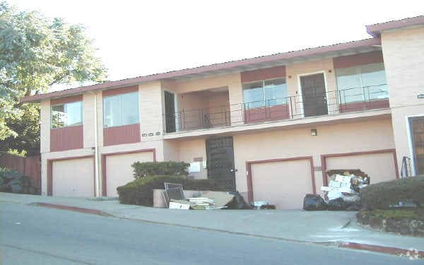
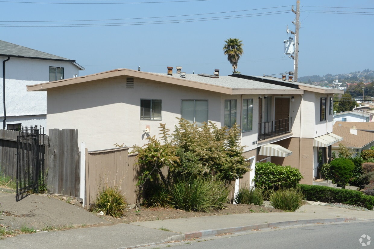
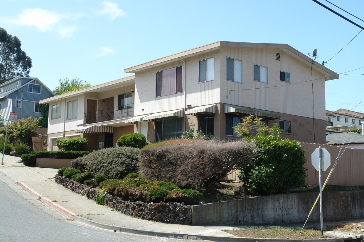
1233 S 55th St
1233 S 55th St,
Richmond,
CA
94804
2 Weeks Ago
Favorites
1233 S 55th St
Favorites
Check Back Soon for Upcoming Availability
| Beds | Baths | Average SF | Availability |
|---|---|---|---|
| 1 Bedroom 1 Bedroom 1 Br | 1 Bath 1 Bath 1 Ba | 450 SF | Not Available |
| 2 Bedrooms 2 Bedrooms 2 Br | 1 Bath 1 Bath 1 Ba | 650 SF | Not Available |
Fees and Policies
Details
Property Information
-
Built in 1960
-
4 units/2 stories
About 1233 S 55th St Richmond, CA 94804
Come home to 1233 S 55th St. The 1233 S. 55th St. location in the 94804 neighborhood of Richmond has much to offer its residents. The leasing team is available to help you find your new home. Contact us today to schedule a tour and find your new home at 1233 S 55th St.
1233 S 55th St is an apartment community located in Contra Costa County and the 94804 ZIP Code. This area is served by the West Contra Costa Unified attendance zone.
Community Amenities
- Laundry Facilities
Apartment Features
- High Speed Internet Access
- Smoke Free
Location
Get Directions
Richmond is a fairly large East Bay community on the north side of Berkeley, about thirty minutes from San Francisco. Compared to other Bay Area cities, rent tends to be relatively affordable, making it an appealing location for commuters.
Wildcat Canyon Regional Park and several large coastal parks give outdoorsy resident numerous options for enjoying the mild climate and natural beauty of the area without going far from home. Easy access to the water also makes boating and fishing popular activities for residents.
The Richmond Auditorium is a popular venue for concerts, and the Point Richmond area is a popular walking district full of unique shops and restaurants. Of course, residents also enjoy having the freedom to easily reach The City, wine country, and northern California’s other resources and attractions quickly and easily.
Learn more about living in RichmondBelow are rent ranges for similar nearby apartments
Amenities
- Laundry Facilities
- High Speed Internet Access
- Smoke Free
Education
| Colleges & Universities | Distance | ||
|---|---|---|---|
| Colleges & Universities | Distance | ||
| Drive: | 9 min | 5.4 mi | |
| Drive: | 11 min | 5.8 mi | |
| Drive: | 15 min | 6.8 mi | |
| Drive: | 12 min | 8.4 mi |
1233 S 55th St is within 9 minutes or 5.4 miles from Contra Costa College. It is also near Berkeley City College and UC Berkeley.
Schools


Public Elementary School
Grades K-5
270 Students
Nearby
Public Elementary School
Grades K-6
253 Students
Attendance Zone
Public Middle School
Grades 7-8
681 Students
Attendance Zone
Public High School
Grades 9-12
1,522 Students
Attendance Zone
Private Elementary, Middle & High School
Grades PK-12
Nearby
Private Elementary, Middle & High School
Grades K-11
31 Students
Nearby
Private Elementary, Middle & High School
Grades K-11
Nearby
Private Elementary & Middle School
Grades K-8
189 Students
Nearby
School data provided by
 The GreatSchools Rating helps parents compare schools within a state based on a variety of school quality indicators and provides a helpful picture of how effectively each school serves all of its students. Ratings are on a scale of 1 (below average) to 10 (above average) and can include test scores, college readiness, academic progress, advanced courses, equity, discipline and attendance data. We also advise parents to visit schools, consider other information on school performance and programs, and consider family needs as part of the school selection process.
View GreatSchools Rating Methodology
Data provided by GreatSchools.org © 2025. All rights reserved.
View GreatSchools Rating Methodology
Data provided by GreatSchools.org © 2025. All rights reserved.
Transportation options available in Richmond include El Cerrito Del Norte, located 0.8 mile from 1233 S 55th St. 1233 S 55th St is near Metro Oakland International, located 18.8 miles or 26 minutes away, and San Francisco International, located 26.4 miles or 38 minutes away.
| Transit / Subway | Distance | ||
|---|---|---|---|
| Transit / Subway | Distance | ||
|
|
Walk: | 15 min | 0.8 mi |
|
|
Walk: | 15 min | 0.8 mi |
|
|
Drive: | 4 min | 1.8 mi |
|
|
Drive: | 6 min | 3.3 mi |
|
|
Drive: | 10 min | 5.2 mi |
| Commuter Rail | Distance | ||
|---|---|---|---|
| Commuter Rail | Distance | ||
| Drive: | 7 min | 3.4 mi | |
|
|
Drive: | 7 min | 4.4 mi |
|
|
Drive: | 9 min | 6.2 mi |
|
|
Drive: | 15 min | 10.4 mi |
| Drive: | 20 min | 14.0 mi |
| Airports | Distance | ||
|---|---|---|---|
| Airports | Distance | ||
|
Metro Oakland International
|
Drive: | 26 min | 18.8 mi |
|
San Francisco International
|
Drive: | 38 min | 26.4 mi |
Time and distance from 1233 S 55th St.
| Shopping Centers | Distance | ||
|---|---|---|---|
| Shopping Centers | Distance | ||
| Walk: | 13 min | 0.7 mi | |
| Walk: | 19 min | 1.0 mi | |
| Drive: | 3 min | 1.3 mi |
1233 S 55th St has 3 shopping centers within 1.3 miles, which is about a 3-minute walk. The miles and minutes will be for the farthest away property.
| Parks and Recreation | Distance | ||
|---|---|---|---|
| Parks and Recreation | Distance | ||
|
Point Isabel Regional Shoreline
|
Drive: | 7 min | 2.2 mi |
|
Marina Park & Green
|
Drive: | 6 min | 2.8 mi |
|
Shimada Friendship Park
|
Drive: | 7 min | 3.3 mi |
|
Blake Garden
|
Drive: | 8 min | 3.5 mi |
|
Rosie the Riveter WWII Home Front National Historical Park
|
Drive: | 7 min | 3.6 mi |
1233 S 55th St has 5 parks within 3.6 miles, including Point Isabel Regional Shoreline, Marina Park & Green, and Blake Garden.
| Hospitals | Distance | ||
|---|---|---|---|
| Hospitals | Distance | ||
| Drive: | 14 min | 7.4 mi | |
| Drive: | 12 min | 8.3 mi | |
| Drive: | 11 min | 8.3 mi |
1233 S 55th St has 3 hospitals within 8.3 miles, the nearest is Alta Bates Summit Medical Center - Alta Bates Campus which is 7.4 miles away and a 14 minute drive.
| Military Bases | Distance | ||
|---|---|---|---|
| Military Bases | Distance | ||
| Drive: | 7 min | 3.1 mi | |
| Drive: | 9 min | 4.3 mi | |
| Drive: | 17 min | 9.4 mi |
1233 S 55th St has 3 military bases within 9.4 miles, the nearest is Military Reservation which is 3.1 miles away and a 7 minute drive.
You May Also Like
What neighborhood is the property located in?
1233 S 55th St Richmond, CA 94804 is in Panhandle Annex in the city of Richmond. Here you’ll find three shopping centers within 1.3 miles of the property. Five parks are within 3.6 miles, including Point Isabel Regional Shoreline, Marina Park & Green, and Blake Garden.
Similar Rentals Nearby


What Are Walk Score®, Transit Score®, and Bike Score® Ratings?
Walk Score® measures the walkability of any address. Transit Score® measures access to public transit. Bike Score® measures the bikeability of any address.
What is a Sound Score Rating?
A Sound Score Rating aggregates noise caused by vehicle traffic, airplane traffic and local sources
1233 S 55th St
Richmond, CA 94804
Responded To This Review