$1,725
/ Month
1232 N Hancock St
Philadelphia, PA 19122
Today
|
Edit
Favorites
267-259-7863
-
Bedrooms
3
-
Bathrooms
1
-
Square Feet
--
-
Available
Available Now
Highlights
- Traditional Architecture
- Central Air
- Hot Water Heating System
1232 N Hancock St

Favorites
About This Home
Available Now
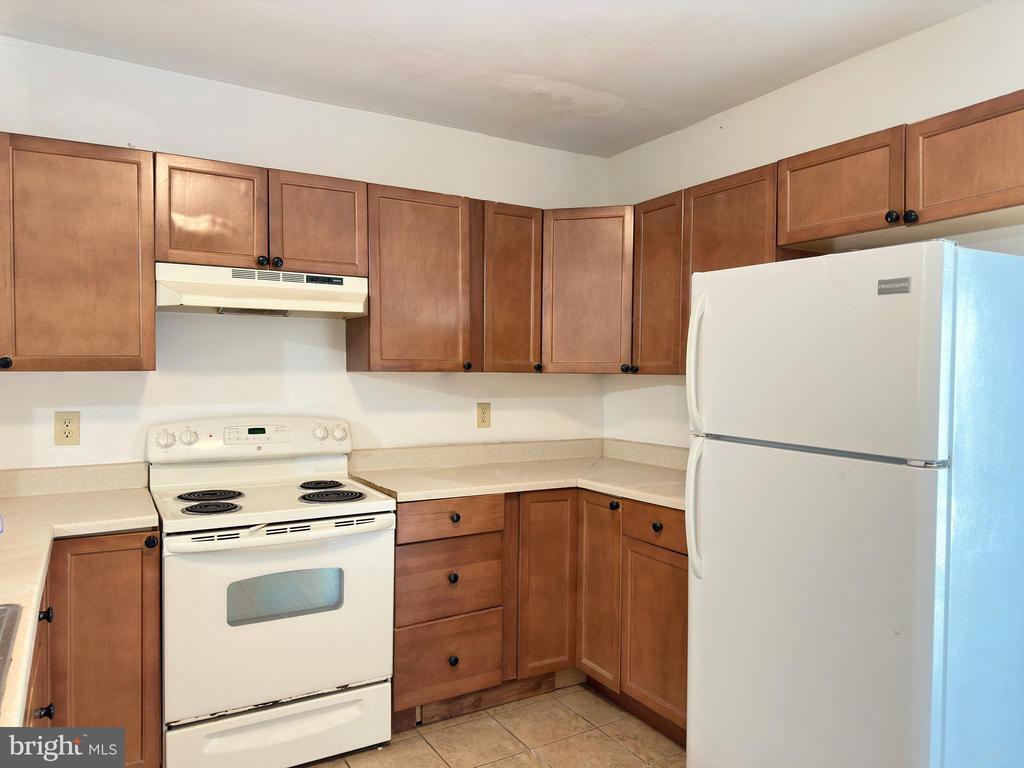
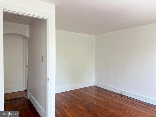
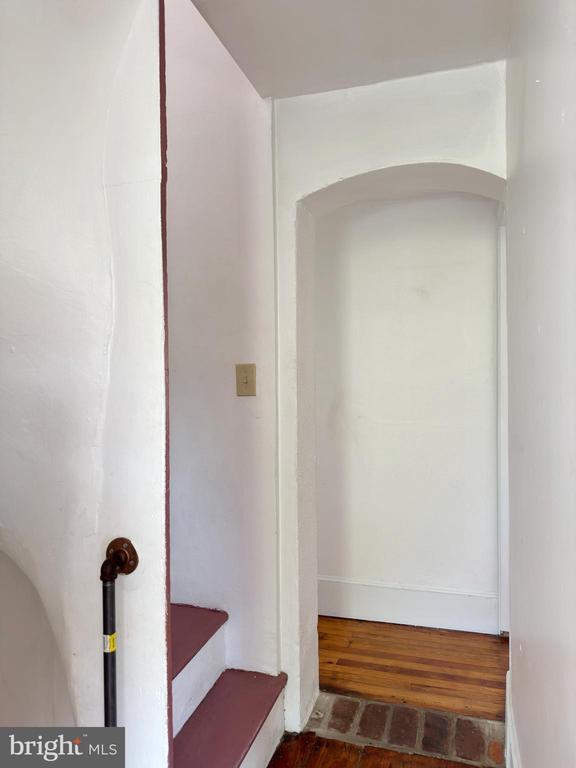
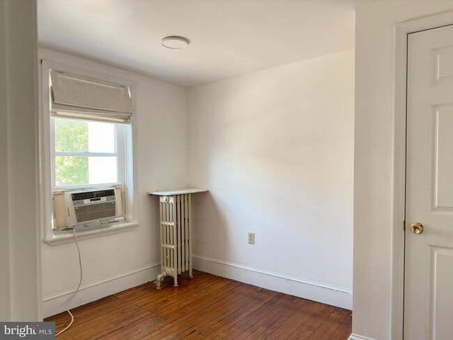
Urban Charm Meets Outdoor Living – 1232 N Hancock St, Philadelphia, PA Live in the heart of one of Philly’s most vibrant neighborhoods! This stylish 3-bedroom, 1-bath home at 1232 N Hancock St offers the perfect mix of historic character, modern comfort, and unbeatable outdoor space. Step inside to a light-filled living area with warm hardwood floors and a layout that flows effortlessly. The updated kitchen features sleek appliances and plenty of cabinet space—ideal for home chefs and takeout lovers alike. Three spacious bedrooms offer flexibility for roommates, remote work, or creative space. The full bathroom is modern and clean, with stylish fixtures and plenty of natural light. But the real magic? Step outside to your private deck—perfect for morning coffee, sunset dinners, or weekend lounging. Down below, enjoy a rare fenced backyard—your own little green escape in the middle of the city. Located on a quiet block in red-hot Fishtown/Northern Liberties, you’re just steps from popular cafés, restaurants, shops, breweries, and easy public transit. - 3 Bedrooms - 1 Full Bath - Private Deck + Fenced Backyard - Hardwood Floors & Natural Light - Walkable to Fishtown Hotspots & El Station Don’t miss this rare rental gem with outdoor space in one of Philly’s most sought-after neighborhoods. Schedule your tour today—this one won’t last!
1232 N Hancock St is a townhome located in Philadelphia County and the 19122 ZIP Code. This area is served by the The School District of Philadelphia attendance zone.
* Price shown is base rent. Excludes user-selected optional fees and variable or usage-based fees and required charges due at or prior to move-in or at move-out. Price, availability, fees, and any applicable rent special are subject to change without notice.
* Square footage definitions vary. Displayed square footage is approximate.
Home Details
Home Type
Interior Unit Townhome
Year Built
Built in 1915
Bedrooms and Bathrooms
3 Main Level Bedrooms
1 Full Bathroom
Home Design
Traditional Architecture
Masonry
Interior Spaces
1,424 Sq Ft Home
Property has 3 Levels
Listing and Financial Details
Security Deposit $1,725
12-Month Lease Term
Available 8/8/25
$60 Application Fee
Assessor Parcel Number 182081100
Residential Lease
Lot Details
836 Sq Ft Lot
Lot Dimensions are 16.00 x 52.00
Parking
Off-Street Parking
Utilities
Central Air
Hot Water Heating System
Public Septic
Community Details
Overview
Fishtown Subdivision
Pet Policy
Pets Allowed
Pet Size Limit
Pet Deposit $200
Contact
- Listed by Melissa A Impagliazzo | Mercury Real Estate Group
- Phone Number
- Contact
-
Source
 Bright MLS, Inc.
Copyright © 2026 Bright MLS, Inc.
Location
Get Directions
Amenities
- Basement
Not to be confused with Northeast Philadelphia, North Philadelphia East encompasses the smaller subsets of Ludlow, Yorktown, West Kensington, Poplar, and Callowhill. This composite area runs from the Vine Street Expressway, stretching north to Erie Avenue. Broad Street acts as its eastern border, and the western edge runs a jagged line separating North Philadelphia East from the nearby Kensington, Port Richmond, and Fishtown neighborhoods. With such a long stretch of city, the neighborhood offers a diverse blend of important city landmarks, such as renowned musical venues the Electric Factory and Union Transfer, and Temple University, North Philadelphia's premiere site of higher learning.
Learn more about living in North Philadelphia East
Education
| Colleges & Universities | Distance | ||
|---|---|---|---|
| Colleges & Universities | Distance | ||
| Drive: | 4 min | 1.6 mi | |
| Drive: | 5 min | 2.4 mi | |
| Drive: | 7 min | 2.4 mi | |
| Drive: | 8 min | 4.0 mi |
1232 N Hancock St is within 4 minutes or 1.6 miles from Temple University, Main Campus. It is also near C.C. of Philadelphia and Drexel Univ., Hahnemann.
Schools


Public Elementary & Middle School
Grades PK-8
202 Students
Nearby
Public Elementary School
Grades K-5
250 Students
Attendance Zone
Public Middle & High School
Grades 6-12
468 Students
Attendance Zone
Private Elementary, Middle & High School
Grades PK-12
272 Students
Nearby
Private Elementary & Middle School
Grades 3-8
94 Students
Nearby
School data provided by
 The GreatSchools Rating helps parents compare schools within a state based on a variety of school quality indicators and provides a helpful picture of how effectively each school serves all of its students. Ratings are on a scale of 1 (below average) to 10 (above average) and can include test scores, college readiness, academic progress, advanced courses, equity, discipline and attendance data. We also advise parents to visit schools, consider other information on school performance and programs, and consider family needs as part of the school selection process.
View GreatSchools Rating Methodology
Data provided by GreatSchools.org © 2026. All rights reserved.
View GreatSchools Rating Methodology
Data provided by GreatSchools.org © 2026. All rights reserved.
Transportation options available in Philadelphia include Girard Av & 2Nd St, located 0.1 mile from 1232 N Hancock St. 1232 N Hancock St is near Philadelphia International, located 12.8 miles or 23 minutes away, and Trenton Mercer, located 31.8 miles or 47 minutes away.
| Transit / Subway | Distance | ||
|---|---|---|---|
| Transit / Subway | Distance | ||
| Walk: | 2 min | 0.1 mi | |
|
|
Walk: | 3 min | 0.2 mi |
|
|
Walk: | 4 min | 0.2 mi |
| Walk: | 4 min | 0.2 mi | |
| Walk: | 5 min | 0.3 mi |
| Commuter Rail | Distance | ||
|---|---|---|---|
| Commuter Rail | Distance | ||
|
|
Drive: | 4 min | 1.4 mi |
|
|
Drive: | 6 min | 2.3 mi |
|
|
Drive: | 6 min | 2.3 mi |
|
|
Drive: | 6 min | 2.7 mi |
|
|
Drive: | 7 min | 2.9 mi |
| Airports | Distance | ||
|---|---|---|---|
| Airports | Distance | ||
|
Philadelphia International
|
Drive: | 23 min | 12.8 mi |
|
Trenton Mercer
|
Drive: | 47 min | 31.8 mi |
Time and distance from 1232 N Hancock St.
| Shopping Centers | Distance | ||
|---|---|---|---|
| Shopping Centers | Distance | ||
| Walk: | 5 min | 0.3 mi | |
| Walk: | 15 min | 0.8 mi | |
| Drive: | 4 min | 1.2 mi |
1232 N Hancock St has 3 shopping centers within 1.2 miles, which is about a 4-minute drive. The miles and minutes will be for the farthest away property.
| Parks and Recreation | Distance | ||
|---|---|---|---|
| Parks and Recreation | Distance | ||
|
Edgar Allan Poe Nat'l Historic Site
|
Drive: | 4 min | 1.5 mi |
|
Lower Delaware National Wild and Scenic River
|
Drive: | 5 min | 1.8 mi |
|
Great Egg Harbor River
|
Drive: | 5 min | 1.8 mi |
|
Wagner Free Institute of Science
|
Drive: | 5 min | 2.0 mi |
|
Independence National Historical Park
|
Drive: | 5 min | 2.0 mi |
1232 N Hancock St has 5 parks within 2.0 miles, including Edgar Allan Poe Nat'l Historic Site, Lower Delaware National Wild and Scenic River, and Great Egg Harbor River.
| Hospitals | Distance | ||
|---|---|---|---|
| Hospitals | Distance | ||
| Drive: | 5 min | 2.3 mi | |
| Drive: | 6 min | 2.5 mi | |
| Drive: | 7 min | 2.6 mi |
1232 N Hancock St has 3 hospitals within 2.6 miles, the nearest is Hahnemann University Hospital which is 2.3 miles away and a 5 minute drive.
| Military Bases | Distance | ||
|---|---|---|---|
| Military Bases | Distance | ||
| Drive: | 14 min | 7.2 mi |
1232 N Hancock St is 7.2 miles and a 14 minute drive from Philadelphia Naval Busi Center.
You May Also Like
Similar Rentals Nearby
-
-
-
-
-
-
-
-
1 / 24

-
-


What Are Walk Score®, Transit Score®, and Bike Score® Ratings?
Walk Score® measures the walkability of any address. Transit Score® measures access to public transit. Bike Score® measures the bikeability of any address.
What is a Sound Score Rating?
A Sound Score Rating aggregates noise caused by vehicle traffic, airplane traffic and local sources

1232 N Hancock St
Philadelphia, PA 19122