$2,100
/ Month
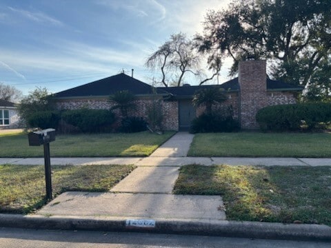
12302 Wrenthorpe Dr
Houston, TX 77031
Favorites
334-377-0890
12302 Wrenthorpe Dr

Favorites
About This Home
Available May 1
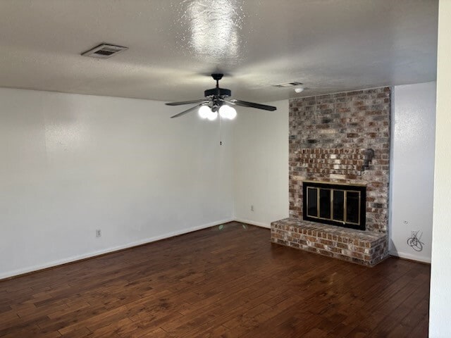
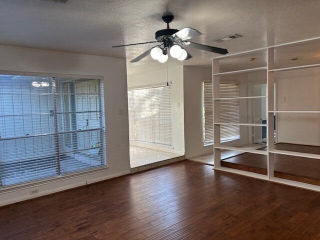
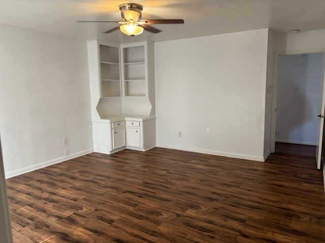
This beautiful home is move-in ready. The spacious layout is perfect for comfortable living that you can enjoy with your family. New floors throughout. Traditional wood burning brick fireplace. Roomy primary bedroom with built in shelving unit. Large backyard with swing set. Detached garage. MLS# 50110132
12302 Wrenthorpe Dr is a house located in Harris County and the 77031 ZIP Code.
* Price shown is base rent. Excludes user-selected optional fees and variable or usage-based fees and required charges due at or prior to move-in or at move-out. Price, availability, fees, and any applicable rent special are subject to change without notice.
* Square footage definitions vary. Displayed square footage is approximate.
Home Details
Home Type
Single Family Detached Home
Year Built
Built in 1975
Bedrooms and Bathrooms
2.5 Bathrooms
4 Bedrooms
Flooring
Wood
Tile
Interior Spaces
1 Fireplace
Dining Room
Family Room
2,051 Sq Ft Home
1-Story Property
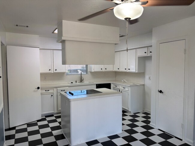
Kitchen
Double Oven
Electric Cooktop
Kitchen Island
Laundry
Washer and Electric Dryer Hookup
Listing and Financial Details
Property Available on 5/1/26
12 Month Lease Term
Lot Details
10,374 Sq Ft Lot
Corner Lot
Parking
2 Car Detached Garage
Schools
Bell Elementary School
Welch Middle School
Westbury High School
Utilities
Cooling System Powered By Gas
Central Heating and Cooling System
Heating System Uses Gas
Community Details
Overview
Glenshire Sec 06 Subdivision
Pet Policy
The building has rules on how big a pet can be within a unit
Pet Deposit Required
Contact
- Listed by Eron Wahid | NW Realty
- Phone Number
- Contact
-
Source
 Houston Association of REALTORS®
Copyright © 2026 Houston Association of Realtors. All rights reserved. All information provided by the listing agent/broker is deemed reliable but is not guaranteed and should be independently verified.
Location
Get Directions
Greater Fondren Southwest is part of the Brays Oaks District of Houston, Texas. This large neighborhood stretches from Brays Bayou Park to the north and US Route 90 to the south. The Sam Houston Tollway forms the western border of the neighborhood.
Named for oilman Walter Fondren, this historic neighborhood contains some hidden gems and is rapidly gaining in popularity due in part to its proximity to Downtown Houston, which is just 15 miles northeast. Houston Baptist University is just outside the neighborhood and is easily reached by heading north on Fondren Road. Greater Fondren Southwest is considered one of Houston's Super Neighborhoods. There’s an amazing mix of low-lying apartments and single-family homes for rent, meaning every renter will find their perfect fit.
Learn more about living in Greater Fondren Southwest
Education
| Colleges & Universities | Distance | ||
|---|---|---|---|
| Colleges & Universities | Distance | ||
| Drive: | 11 min | 5.5 mi | |
| Drive: | 11 min | 6.0 mi | |
| Drive: | 16 min | 11.2 mi | |
| Drive: | 20 min | 12.0 mi |
12302 Wrenthorpe Dr is within 11 minutes or 5.5 miles from Houston Baptist University. It is also near Houston Christian University and The Art Institute of Houston.
Transportation options available in Houston include Reliant Park, located 10.1 miles from 12302 Wrenthorpe Dr. 12302 Wrenthorpe Dr is near William P Hobby, located 20.7 miles or 33 minutes away, and George Bush Intcntl/Houston, located 37.5 miles or 45 minutes away.
| Transit / Subway | Distance | ||
|---|---|---|---|
| Transit / Subway | Distance | ||
|
|
Drive: | 18 min | 10.1 mi |
| Drive: | 18 min | 10.9 mi | |
| Drive: | 19 min | 11.7 mi | |
| Drive: | 20 min | 12.2 mi | |
| Drive: | 21 min | 12.5 mi |
| Commuter Rail | Distance | ||
|---|---|---|---|
| Commuter Rail | Distance | ||
|
|
Drive: | 26 min | 17.2 mi |
| Airports | Distance | ||
|---|---|---|---|
| Airports | Distance | ||
|
William P Hobby
|
Drive: | 33 min | 20.7 mi |
|
George Bush Intcntl/Houston
|
Drive: | 45 min | 37.5 mi |
Getting Around
 What do Walkability, Transit, Drivability, and Bikeability mean?
Walkability measures the walking distance to day-to-day needs.
Transit measures access to public transportation.
Drivability measures congestion, parking availability, and access to major roads.
Bikeability measures the suitability for cycling.
How It Works
What do Walkability, Transit, Drivability, and Bikeability mean?
Walkability measures the walking distance to day-to-day needs.
Transit measures access to public transportation.
Drivability measures congestion, parking availability, and access to major roads.
Bikeability measures the suitability for cycling.
How It Works
Fairly Walkable
Walkability
50
/ 100
Limited Public Transit
Transit
20
/ 100
Exceptionally Drivable
Drivability
90
/ 100
Fairly Bikeable
Bikeability
40
/ 100
Scores provided by
-
Soundscore™
-
/ 100
Traffic
-Airport
-Businesses
-Scores provided by
HowLoud What is a Sound Score Rating? A Sound Score Rating aggregates noise caused by vehicle traffic, airplane traffic and local sources. How It WorksTime and distance from 12302 Wrenthorpe Dr.
| Shopping Centers | Distance | ||
|---|---|---|---|
| Shopping Centers | Distance | ||
| Walk: | 15 min | 0.8 mi | |
| Walk: | 21 min | 1.1 mi | |
| Drive: | 3 min | 1.4 mi |
12302 Wrenthorpe Dr has 3 shopping centers within 1.4 miles, which is about a 3-minute drive. The miles and minutes will be for the farthest away property.
| Parks and Recreation | Distance | ||
|---|---|---|---|
| Parks and Recreation | Distance | ||
|
Club Creek Park and Vietnam Veterans Memorial
|
Drive: | 8 min | 4.4 mi |
|
Arthur Storey Park
|
Drive: | 9 min | 5.5 mi |
|
Nature Discovery Center
|
Drive: | 16 min | 8.2 mi |
|
Buffalo Bayou Paddling Trail
|
Drive: | 16 min | 9.5 mi |
|
Edith L. Moore Nature Sanctuary
|
Drive: | 14 min | 10.4 mi |
12302 Wrenthorpe Dr has 5 parks within 10.4 miles, including Club Creek Park and Vietnam Veterans Memorial, Arthur Storey Park, and Nature Discovery Center.
| Hospitals | Distance | ||
|---|---|---|---|
| Hospitals | Distance | ||
| Drive: | 16 min | 6.9 mi | |
| Drive: | 11 min | 7.1 mi | |
| Drive: | 12 min | 7.7 mi |
12302 Wrenthorpe Dr has 3 hospitals within 7.7 miles, the nearest is Behavioral Hospital of Bellaire which is 6.9 miles away and a 16 minute drive.
| Military Bases | Distance | ||
|---|---|---|---|
| Military Bases | Distance | ||
| Drive: | 45 min | 32.8 mi | |
| Drive: | 74 min | 58.4 mi |
12302 Wrenthorpe Dr is 32.8 miles from Lyndon B Johnson Space Center, and is convenient to other military bases, including Pelican Spit Military Reservation.
You May Also Like
Similar Rentals Nearby
-
-
-
1 / 31

-
4 Beds$2,882+Total Monthly PriceTotal Monthly Price NewPrices include base rent and required monthly fees of $131. Variable costs based on usage may apply.Base Rent:4 Beds$2,725+2 Months Free
-
1 / 48
 4 Beds$2,819Total Monthly PriceTotal Monthly Price NewPrices include base rent and required monthly fees of $224. Variable costs based on usage may apply.Base Rent:4 Beds$2,5952 Months Free
 -
 Total Monthly Price New4 Beds$2,238Total Monthly Price18 Month LeasePrices include base rent and required monthly fees of $37. Variable costs based on usage may apply.Base Rent:4 Beds$2,200
 -
-

-
-
 4 Beds$1,990Total Monthly PriceTotal Monthly Price NewPrices include all required monthly fees.House for Rent


What Are Walk Score®, Transit Score®, and Bike Score® Ratings?
Walk Score® measures the walkability of any address. Transit Score® measures access to public transit. Bike Score® measures the bikeability of any address.
What is a Sound Score Rating?
A Sound Score Rating aggregates noise caused by vehicle traffic, airplane traffic and local sources.

12302 Wrenthorpe Dr
Houston, TX 77031