123 Sewall Ave
123 Sewall Ave,
Brookline,
MA
02446
2 Weeks Ago
Favorites
123 Sewall Ave

Favorites
Check Back Soon for Upcoming Availability
About 123 Sewall Ave Brookline, MA 02446
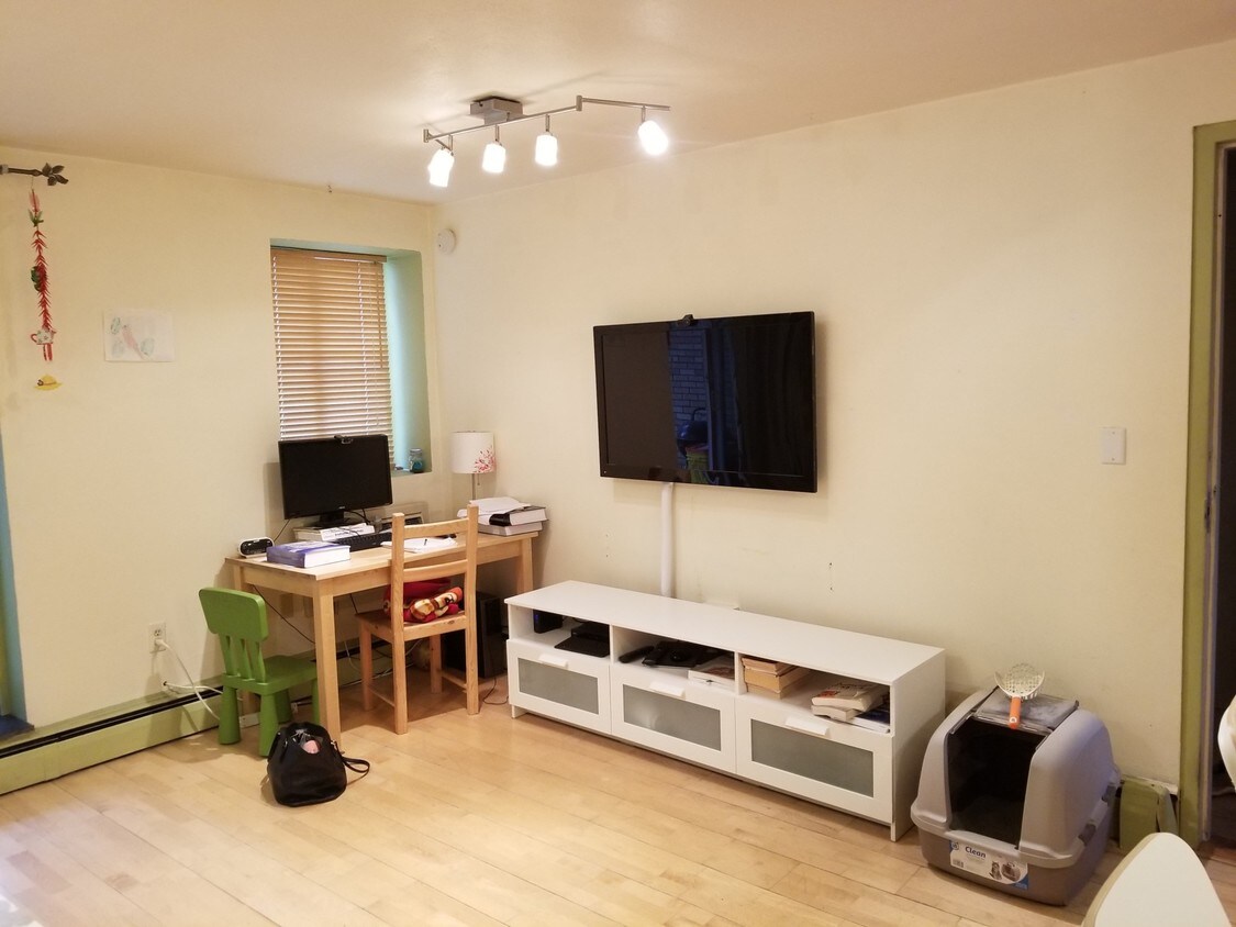
Beautiful One Bed in an Incredible Location. July 1st move in. Reach out before its too late!
123 Sewall Ave is an apartment community located in Norfolk County and the 02446 ZIP Code.
Location
Get Directions
Located just four miles west of Downtown Boston, Coolidge Corner is a vibrant commercial hub brimming with activity and gorgeous historical buildings. Residents enjoy a large selection of shops, bookstores, restaurants, and coffee houses in Coolidge Corner as well as access to the landmark Coolidge Theatre, an Art Deco-inspired venue showcasing the best of contemporary art house and independent film.
Coolidge Corner exudes a nostalgic charm, and has attracted shoppers for more than 150 years. There’s a healthy mix of local businesses and familiar chains in Coolidge Corner, offering residents the best of both worlds. Home to its own T stop, Coolidge Corner is an ideal spot for commuters and college students alike.
Learn more about living in Coolidge CornerBelow are rent ranges for similar nearby apartments
| Beds | Average Size | Lowest | Typical | Premium |
|---|---|---|---|---|
| Studio Studio Studio | 2981-2983 Sq Ft | $900 | $2,415 | $9,910 |
| 1 Bed 1 Bed 1 Bed | 2939-2941 Sq Ft | $1,200 | $3,031 | $13,221 |
| 2 Beds 2 Beds 2 Beds | 3734-3735 Sq Ft | $2,300 | $3,579 | $17,300 |
| 3 Beds 3 Beds 3 Beds | 3952-3954 Sq Ft | $1,395 | $4,624 | $11,000 |
| 4 Beds 4 Beds 4 Beds | 4052-4053 Sq Ft | $1,199 | $6,101 | $16,300 |
Education
| Colleges & Universities | Distance | ||
|---|---|---|---|
| Colleges & Universities | Distance | ||
| Walk: | 17 min | 0.9 mi | |
| Walk: | 17 min | 0.9 mi | |
| Walk: | 17 min | 0.9 mi | |
| Walk: | 18 min | 1.0 mi |
123 Sewall Ave is within 17 minutes or 0.9 mile from MCPHS University, Boston. It is also near Simmons College and Boston University.
Transportation options available in Brookline include St Paul Street Station (Green Line C), located 0.2 mile from 123 Sewall Ave. 123 Sewall Ave is near General Edward Lawrence Logan International, located 7.8 miles or 16 minutes away.
| Transit / Subway | Distance | ||
|---|---|---|---|
| Transit / Subway | Distance | ||
|
|
Walk: | 4 min | 0.2 mi |
|
|
Walk: | 5 min | 0.3 mi |
|
|
Walk: | 7 min | 0.4 mi |
|
|
Walk: | 7 min | 0.4 mi |
|
|
Walk: | 8 min | 0.4 mi |
| Commuter Rail | Distance | ||
|---|---|---|---|
| Commuter Rail | Distance | ||
|
|
Drive: | 4 min | 1.9 mi |
|
|
Drive: | 9 min | 2.8 mi |
| Drive: | 7 min | 3.3 mi | |
|
|
Drive: | 8 min | 3.6 mi |
| Drive: | 13 min | 6.2 mi |
| Airports | Distance | ||
|---|---|---|---|
| Airports | Distance | ||
|
General Edward Lawrence Logan International
|
Drive: | 16 min | 7.8 mi |
Time and distance from 123 Sewall Ave.
| Shopping Centers | Distance | ||
|---|---|---|---|
| Shopping Centers | Distance | ||
| Walk: | 10 min | 0.6 mi | |
| Drive: | 3 min | 1.1 mi | |
| Drive: | 3 min | 1.4 mi |
123 Sewall Ave has 3 shopping centers within 1.4 miles, which is about a 3-minute walk. The miles and minutes will be for the farthest away property.
| Parks and Recreation | Distance | ||
|---|---|---|---|
| Parks and Recreation | Distance | ||
|
John Fitzgerald Kennedy National Historic Site
|
Walk: | 15 min | 0.8 mi |
|
Coit Observatory
|
Drive: | 4 min | 1.4 mi |
|
Frederick Law Olmsted National Historic Site
|
Drive: | 4 min | 1.7 mi |
|
Roxbury Heritage State Park
|
Drive: | 5 min | 2.0 mi |
|
Charles River Reservation
|
Drive: | 5 min | 2.1 mi |
123 Sewall Ave has 5 parks within 2.1 miles, including John Fitzgerald Kennedy National Historic Site, Coit Observatory, and Charles River Reservation.
| Hospitals | Distance | ||
|---|---|---|---|
| Hospitals | Distance | ||
| Walk: | 12 min | 0.6 mi | |
| Walk: | 13 min | 0.7 mi | |
| Walk: | 14 min | 0.8 mi |
123 Sewall Ave has 3 hospitals within 0.8 mile, the nearest is Beth Israel Deaconess Medical Center which is 0.6 mile away and a 12 minute walk.
| Military Bases | Distance | ||
|---|---|---|---|
| Military Bases | Distance | ||
| Drive: | 26 min | 14.6 mi | |
| Drive: | 29 min | 14.7 mi |
123 Sewall Ave is 14.6 miles from US Military Reservation, and is convenient to other military bases, including Hanscom Air Force Base.
You May Also Like
-
The 305, A Broadstone Community
305 Winter St
Waltham, MA 02451
$2,722 - $5,533 Plus Fees
Studio-3 Br 8.2 mi
-
Elevation Apartments at Crown Colony
7 Crown Dr
Quincy, MA 02169
$2,200 - $3,300 Plus Fees
Studio-2 Br 12 Month Lease 9.3 mi
-
NOBO
860 Broadway
Saugus, MA 01906
$2,323 - $3,413 Plus Fees
1-2 Br 10.0 mi
Similar Rentals Nearby


What Are Walk Score®, Transit Score®, and Bike Score® Ratings?
Walk Score® measures the walkability of any address. Transit Score® measures access to public transit. Bike Score® measures the bikeability of any address.
What is a Sound Score Rating?
A Sound Score Rating aggregates noise caused by vehicle traffic, airplane traffic and local sources

123 Sewall Ave
Brookline, MA 02446