
Williamsburg
200 W Galbraith Rd,
Cincinnati, OH 45215
$843 - $2,791
Studio - 3 Beds

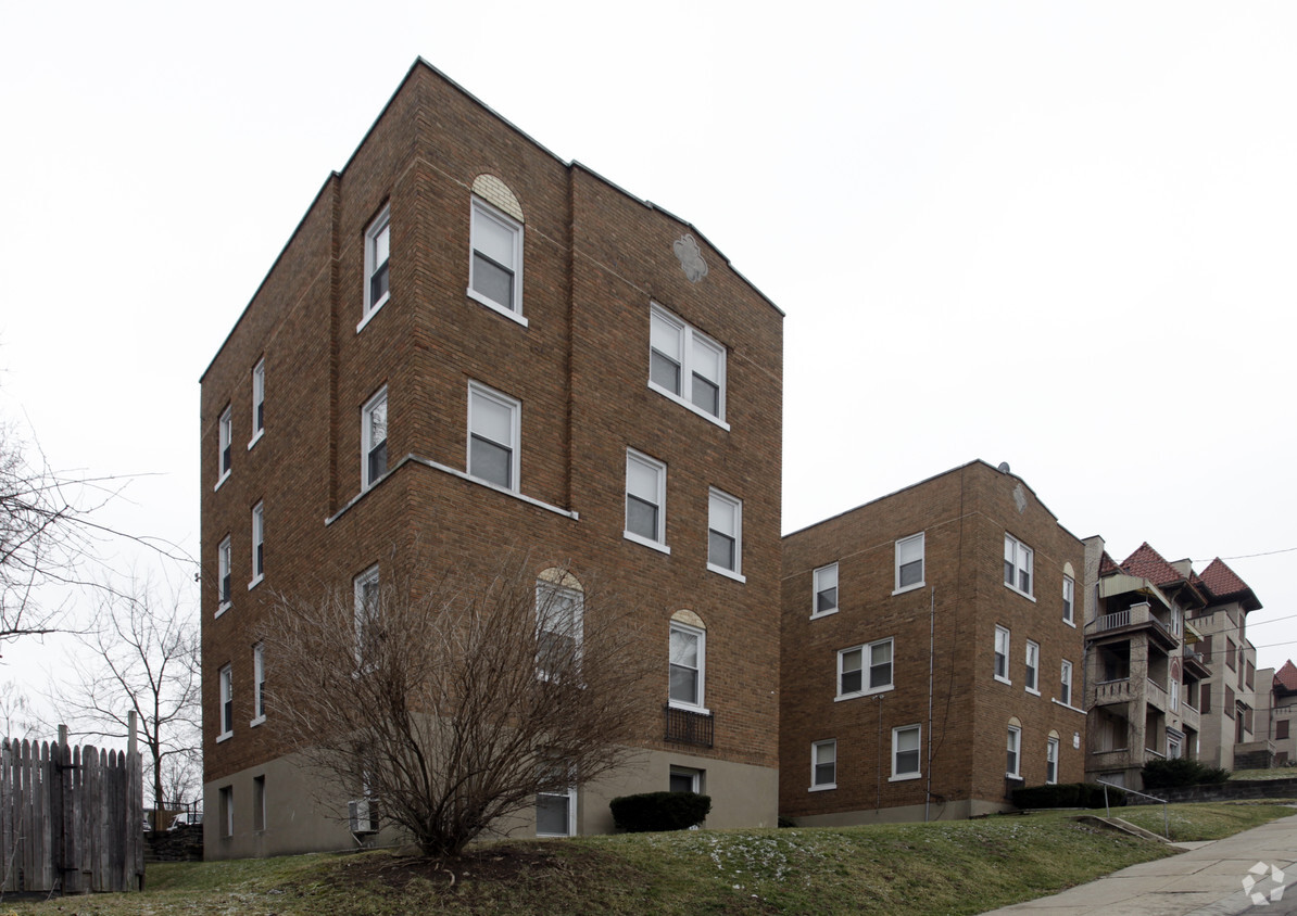

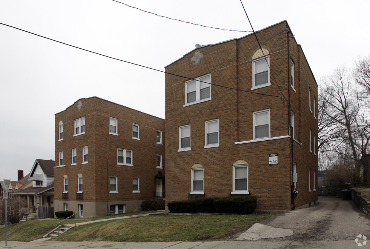
Explore Cincinnati living at 1226-1230 Rutledge Ave. The location of this community is in Cincinnati on Rutledge Ave in the 45205 area. From availability to location, the leasing team is ready and waiting to help you find the perfect fit. Be sure to see the current floorplan options. Drop by to find out the current floorplan availability.
1226-1230 Rutledge Ave is an apartment community located in Hamilton County and the 45205 ZIP Code. This area is served by the Cincinnati Public Schools attendance zone.
Located about four miles away from Downtown Cincinnati, West Price Hill is known for its affordability and wide range of rental options. Along with having condos and apartments available for rent at various price points, West Price Hill has single-family homes in a variety of architectural styles including Queen Anne, Greek Revival, Second Empire, and Italianate. The neighborhood has several restaurants and stores, but is also just a few miles from commercial hubs like Glenway Crossing, so necessities aren’t far from home. West Price Hill has multiple parks like Rapid Run Park for residents to enjoy. Parks along the Ohio River like Mount Echo Park await just a few minutes south of the neighborhood as well. If you’re looking for a central location with affordable options, West Price Hill is a great choice.
Learn more about living in West Price HillCompare neighborhood and city base rent averages by bedroom.
| West Price Hill | Cincinnati, OH | |
|---|---|---|
| Studio | $695 | $1,073 |
| 1 Bedroom | $736 | $1,135 |
| 2 Bedrooms | $1,006 | $1,424 |
| 3 Bedrooms | $1,579 | $1,731 |
| Colleges & Universities | Distance | ||
|---|---|---|---|
| Colleges & Universities | Distance | ||
| Drive: | 9 min | 3.8 mi | |
| Drive: | 14 min | 5.7 mi | |
| Drive: | 15 min | 5.9 mi | |
| Drive: | 15 min | 6.1 mi |


Transportation options available in Cincinnati include Elm & Liberty Station, located 4.6 miles from 1226-1230 Rutledge Ave. 1226-1230 Rutledge Ave is near Cincinnati/Northern Kentucky International, located 17.8 miles or 34 minutes away.
| Transit / Subway | Distance | ||
|---|---|---|---|
| Transit / Subway | Distance | ||
| Drive: | 12 min | 4.6 mi | |
| Drive: | 11 min | 4.6 mi | |
| Drive: | 12 min | 4.6 mi | |
| Drive: | 11 min | 4.8 mi | |
| Drive: | 12 min | 4.8 mi |
| Commuter Rail | Distance | ||
|---|---|---|---|
| Commuter Rail | Distance | ||
|
|
Drive: | 11 min | 4.0 mi |
| Airports | Distance | ||
|---|---|---|---|
| Airports | Distance | ||
|
Cincinnati/Northern Kentucky International
|
Drive: | 34 min | 17.8 mi |
Scores provided by
Traffic
-Airport
-Businesses
-Scores provided by
HowLoud What is a Sound Score Rating? A Sound Score Rating aggregates noise caused by vehicle traffic, airplane traffic and local sources. How It WorksTime and distance from 1226-1230 Rutledge Ave.
| Shopping Centers | Distance | ||
|---|---|---|---|
| Shopping Centers | Distance | ||
| Drive: | 4 min | 1.3 mi | |
| Drive: | 4 min | 1.4 mi | |
| Drive: | 3 min | 1.4 mi |
| Parks and Recreation | Distance | ||
|---|---|---|---|
| Parks and Recreation | Distance | ||
|
Imago Earth Center
|
Drive: | 4 min | 1.6 mi |
|
Wilson Commons
|
Drive: | 7 min | 2.3 mi |
|
Embshoff Woods
|
Drive: | 8 min | 2.8 mi |
|
Museum of Natural History and Science
|
Drive: | 11 min | 4.0 mi |
|
Cincinnati History Museum
|
Drive: | 11 min | 4.0 mi |
| Hospitals | Distance | ||
|---|---|---|---|
| Hospitals | Distance | ||
| Drive: | 14 min | 5.7 mi | |
| Drive: | 13 min | 5.7 mi | |
| Drive: | 15 min | 6.1 mi |
| Military Bases | Distance | ||
|---|---|---|---|
| Military Bases | Distance | ||
| Drive: | 77 min | 56.8 mi | |
| Drive: | 83 min | 61.9 mi | |
| Drive: | 85 min | 65.2 mi |
What Are Walk Score®, Transit Score®, and Bike Score® Ratings?
Walk Score® measures the walkability of any address. Transit Score® measures access to public transit. Bike Score® measures the bikeability of any address.
What is a Sound Score Rating?
A Sound Score Rating aggregates noise caused by vehicle traffic, airplane traffic and local sources.
1226-1230 Rutledge Ave
Cincinnati, OH 45205


