
$1,400
/ Month
1213 W William St
Philadelphia, PA 19133
Today
|
Edit
Favorites
267-710-1457
-
Bedrooms
3
-
Bathrooms
1
-
Square Feet
904 sq ft
-
Available
Available Now
Highlights
- Traditional Architecture
- Forced Air Heating System
- Dogs and Cats Allowed
1213 W William St

Favorites
About This Home
Available Now
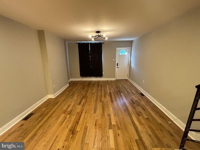
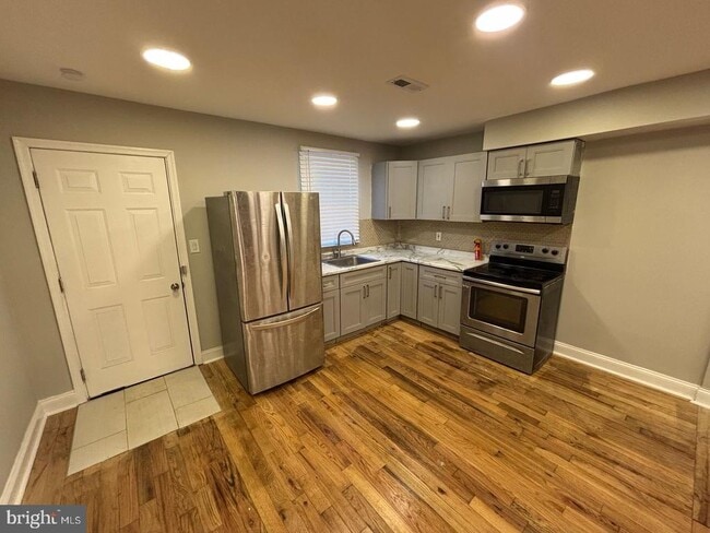
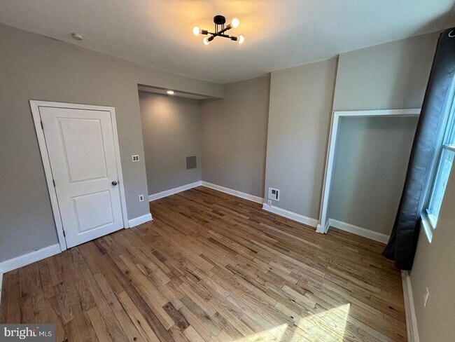
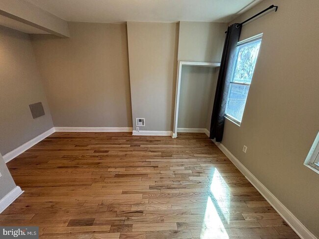
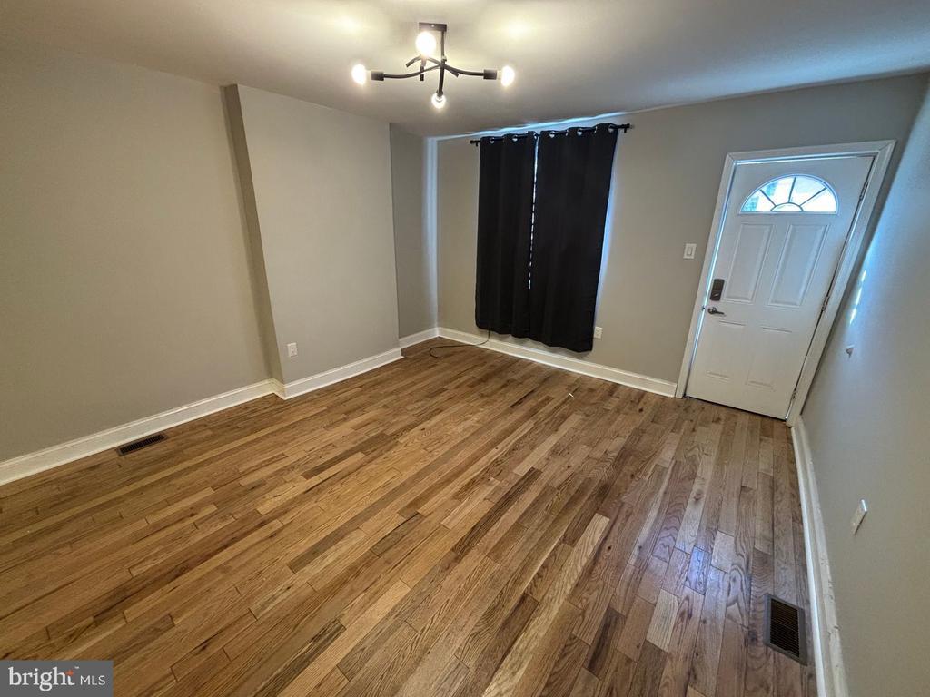
Welcome to this beautifully updated home in North Philadelphia! Upon entry, you are greeted with a spacious living/dining area with hardwood throughout. As you make your way to the kitchen, you will find that it is well updated. On the second floor, you will find 3 generously sized bedrooms and a full bathroom. Schedule your tour to see this North Philly gem today!
1213 W William St is a townhome located in Philadelphia County and the 19133 ZIP Code. This area is served by the The School District of Philadelphia attendance zone.
* Price shown is base rent. Excludes user-selected optional fees and variable or usage-based fees and required charges due at or prior to move-in or at move-out. Price, availability, fees, and any applicable rent special are subject to change without notice.
* Square footage definitions vary. Displayed square footage is approximate.
Home Details
Home Type
Interior Unit Townhome
Year Built
Built in 1920
Bedrooms and Bathrooms
3 Main Level Bedrooms
1 Full Bathroom
Home Design
Traditional Architecture
Masonry
Interior Spaces
904 Sq Ft Home
Property has 2 Levels
Listing and Financial Details
Security Deposit $1,400
12-Month Lease Term
Available 9/23/25
$65 Application Fee
Assessor Parcel Number 372368300
Tenant pays for all utilities
No Smoking Allowed
Residential Lease
Lot Details
924 Sq Ft Lot
Lot Dimensions are 14.00 x 66.00
Parking
On-Street Parking
Utilities
Forced Air Heating System
Natural Gas Water Heater
Public Septic
Community Details
Overview
No Home Owners Association
Pet Policy
Dogs and Cats Allowed
Contact
- Listed by Mark Alexander Khavinson | Skyline Realty & Property Managment LLC
- Phone Number
- Contact
-
Source
 Bright MLS, Inc.
Copyright © 2025 Bright MLS, Inc.
Location
Get Directions
Amenities
- Basement
Not to be confused with Northeast Philadelphia, North Philadelphia East encompasses the smaller subsets of Ludlow, Yorktown, West Kensington, Poplar, and Callowhill. This composite area runs from the Vine Street Expressway, stretching north to Erie Avenue. Broad Street acts as its eastern border, and the western edge runs a jagged line separating North Philadelphia East from the nearby Kensington, Port Richmond, and Fishtown neighborhoods. With such a long stretch of city, the neighborhood offers a diverse blend of important city landmarks, such as renowned musical venues the Electric Factory and Union Transfer, and Temple University, North Philadelphia's premiere site of higher learning.
Learn more about living in North Philadelphia East
Education
| Colleges & Universities | Distance | ||
|---|---|---|---|
| Colleges & Universities | Distance | ||
| Walk: | 14 min | 0.7 mi | |
| Drive: | 5 min | 1.7 mi | |
| Drive: | 8 min | 3.1 mi | |
| Drive: | 9 min | 3.2 mi |
1213 W William St is within 14 minutes or 0.7 mile from Temple Univ., Health Center. It is also near Temple University, Main Campus and C.C. of Philadelphia.
Schools


Public Elementary & Middle School
Grades PK-8
478 Students
Nearby
Charter Elementary School
Grades K-6
448 Students
Attendance Zone
Charter Middle & High School
Grades 7-12
1,160 Students
Attendance Zone
Private Elementary, Middle & High School
Grades K-10
Nearby
Private Elementary School
Grades PK-4
Nearby
Private Elementary & Middle School
Grades 5-8
52 Students
Nearby
Private High School
Grades 9-12
Nearby
School data provided by
 The GreatSchools Rating helps parents compare schools within a state based on a variety of school quality indicators and provides a helpful picture of how effectively each school serves all of its students. Ratings are on a scale of 1 (below average) to 10 (above average) and can include test scores, college readiness, academic progress, advanced courses, equity, discipline and attendance data. We also advise parents to visit schools, consider other information on school performance and programs, and consider family needs as part of the school selection process.
View GreatSchools Rating Methodology
Data provided by GreatSchools.org © 2025. All rights reserved.
View GreatSchools Rating Methodology
Data provided by GreatSchools.org © 2025. All rights reserved.
Transportation options available in Philadelphia include Allegheny (Bss), located 0.5 mile from 1213 W William St. 1213 W William St is near Philadelphia International, located 16.3 miles or 28 minutes away, and Trenton Mercer, located 31.8 miles or 50 minutes away.
| Transit / Subway | Distance | ||
|---|---|---|---|
| Transit / Subway | Distance | ||
|
|
Walk: | 10 min | 0.5 mi |
|
|
Walk: | 15 min | 0.8 mi |
|
|
Drive: | 3 min | 1.1 mi |
|
|
Drive: | 4 min | 1.7 mi |
|
|
Drive: | 5 min | 1.9 mi |
| Commuter Rail | Distance | ||
|---|---|---|---|
| Commuter Rail | Distance | ||
|
|
Walk: | 4 min | 0.2 mi |
|
|
Walk: | 6 min | 0.3 mi |
|
|
Walk: | 9 min | 0.5 mi |
|
|
Drive: | 4 min | 1.4 mi |
|
|
Drive: | 4 min | 1.4 mi |
| Airports | Distance | ||
|---|---|---|---|
| Airports | Distance | ||
|
Philadelphia International
|
Drive: | 28 min | 16.3 mi |
|
Trenton Mercer
|
Drive: | 50 min | 31.8 mi |
Time and distance from 1213 W William St.
| Shopping Centers | Distance | ||
|---|---|---|---|
| Shopping Centers | Distance | ||
| Walk: | 9 min | 0.5 mi | |
| Walk: | 9 min | 0.5 mi | |
| Walk: | 18 min | 0.9 mi |
1213 W William St has 3 shopping centers within 0.9 mile, which is about a 18-minute walk. The miles and minutes will be for the farthest away property.
| Parks and Recreation | Distance | ||
|---|---|---|---|
| Parks and Recreation | Distance | ||
|
Wagner Free Institute of Science
|
Drive: | 5 min | 1.6 mi |
|
Edgar Allan Poe Nat'l Historic Site
|
Drive: | 8 min | 3.0 mi |
|
The Academy of Natural Sciences
|
Drive: | 9 min | 3.7 mi |
|
Franklin Institute
|
Drive: | 10 min | 3.9 mi |
|
Fels Planetarium
|
Drive: | 10 min | 4.0 mi |
1213 W William St has 5 parks within 4.0 miles, including Wagner Free Institute of Science, Edgar Allan Poe Nat'l Historic Site, and The Academy of Natural Sciences.
| Hospitals | Distance | ||
|---|---|---|---|
| Hospitals | Distance | ||
| Walk: | 14 min | 0.8 mi | |
| Walk: | 17 min | 0.9 mi | |
| Drive: | 4 min | 1.8 mi |
1213 W William St has 3 hospitals within 1.8 miles, the nearest is Temple University Hospital which is 0.8 mile away and a 14 minute walk.
| Military Bases | Distance | ||
|---|---|---|---|
| Military Bases | Distance | ||
| Drive: | 19 min | 10.7 mi |
1213 W William St is 10.7 miles and a 19 minute drive from Philadelphia Naval Busi Center.
You May Also Like
Similar Rentals Nearby
-
-
-
-
-
-
-
-
1 / 24

-
-


What Are Walk Score®, Transit Score®, and Bike Score® Ratings?
Walk Score® measures the walkability of any address. Transit Score® measures access to public transit. Bike Score® measures the bikeability of any address.
What is a Sound Score Rating?
A Sound Score Rating aggregates noise caused by vehicle traffic, airplane traffic and local sources
1213 W William St
Philadelphia, PA 19133