
1201 Canal Apartments
1201 Canal St,
New Orleans, LA 70112
$1,427 - $3,250
1-3 Beds

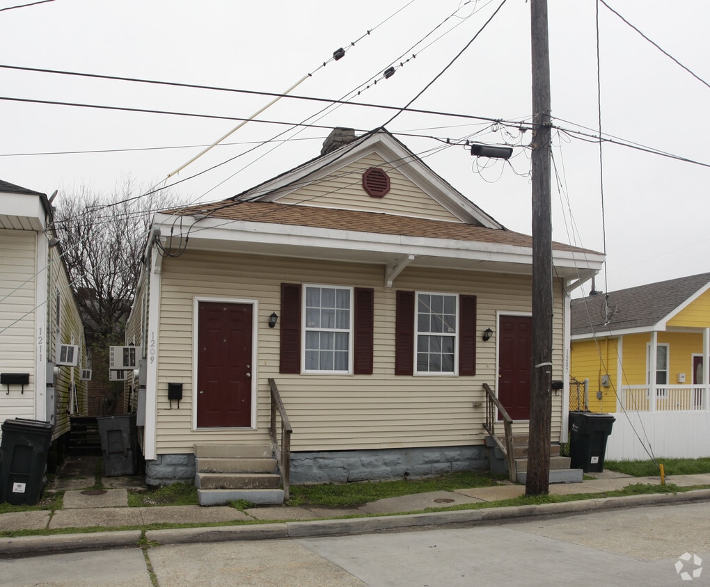

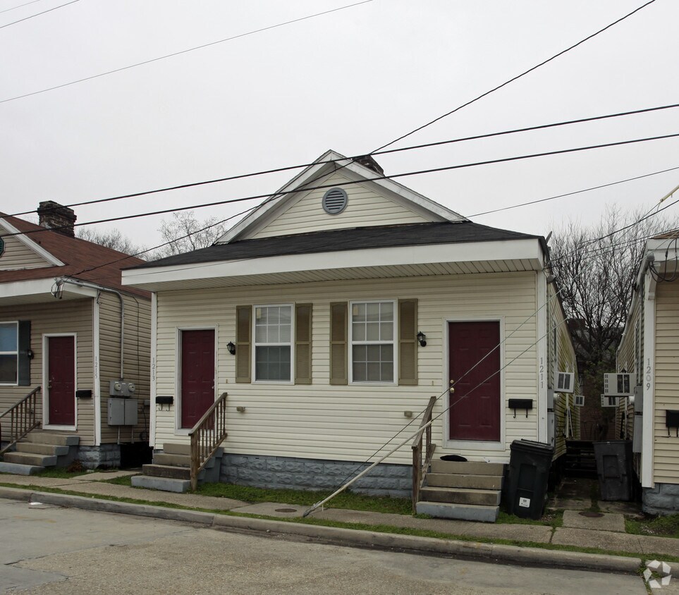
1207-1241 S Clark St offers a blend of style, comfort, and livability. This community is located at 1207-1241 S. Clark St. in New Orleans. The leasing team is ready to show off our wonderful community. Make your move to 1207-1241 S Clark St. Contact us or stop by the leasing office to schedule a tour.
1207-1241 S Clark St is an apartment community located in Orleans County and the 70125 ZIP Code. This area is served by the Orleans Parish School District attendance zone.
High Speed Internet Access
Smoke Free
Heating
Oven
Part of New Orleans' 16th Ward, Gert Town is more of a "college town." This is the location of Xavier University, a private liberal arts college opened by the Catholic Church in 1915. This prestigious, historically black university ranks as one of the nation's best.
Gert Town extends west of I-10 between B.W. Cooper to the south and Holly Grove to the north. It loosely follows Earhart Boulevard on the west end. The neighborhood has a unique street pattern, with the streets crossing and curving like the currents of the river. Since this was the swampy "back end" of New Orleans, most streets stopped before reaching Gert Town, which was uninhabited. Later, when canals helped to drain this low-lying area, Gert Town became a railroad hub. The roads were extended into Gert Town from other areas, often running into each other and creating the odd flow.
Today, Gert Town is a dynamic community located about four miles northwest of the French Quarter.
Learn more about living in Gert TownCompare neighborhood and city base rent averages by bedroom.
| Gert Town | New Orleans, LA | |
|---|---|---|
| Studio | $466 | $1,110 |
| 1 Bedroom | $1,412 | $1,273 |
| 2 Bedrooms | $1,259 | $1,487 |
| 3 Bedrooms | $1,408 | $1,551 |
| Colleges & Universities | Distance | ||
|---|---|---|---|
| Colleges & Universities | Distance | ||
| Walk: | 8 min | 0.4 mi | |
| Drive: | 4 min | 2.0 mi | |
| Drive: | 6 min | 2.2 mi | |
| Drive: | 5 min | 2.3 mi |
Transportation options available in New Orleans include Canal And Jefferson Davis Pkwy, located 1.3 miles from 1207-1241 S Clark St. 1207-1241 S Clark St is near Louis Armstrong New Orleans International, located 13.1 miles or 20 minutes away.
| Transit / Subway | Distance | ||
|---|---|---|---|
| Transit / Subway | Distance | ||
|
|
Drive: | 3 min | 1.3 mi |
|
|
Drive: | 3 min | 1.4 mi |
|
|
Drive: | 3 min | 1.5 mi |
|
|
Drive: | 4 min | 1.6 mi |
|
|
Drive: | 4 min | 1.6 mi |
| Commuter Rail | Distance | ||
|---|---|---|---|
| Commuter Rail | Distance | ||
|
|
Drive: | 5 min | 2.3 mi |
|
|
Drive: | 42 min | 34.3 mi |
| Airports | Distance | ||
|---|---|---|---|
| Airports | Distance | ||
|
Louis Armstrong New Orleans International
|
Drive: | 20 min | 13.1 mi |
Scores provided by
Traffic
-Airport
-Businesses
-Scores provided by
HowLoud What is a Sound Score Rating? A Sound Score Rating aggregates noise caused by vehicle traffic, airplane traffic and local sources. How It WorksTime and distance from 1207-1241 S Clark St.
| Shopping Centers | Distance | ||
|---|---|---|---|
| Shopping Centers | Distance | ||
| Walk: | 13 min | 0.7 mi | |
| Drive: | 3 min | 1.1 mi | |
| Drive: | 3 min | 1.4 mi |
| Parks and Recreation | Distance | ||
|---|---|---|---|
| Parks and Recreation | Distance | ||
|
Longue Vue House and Gardens
|
Drive: | 5 min | 2.3 mi |
|
New Orleans Botanical Garden
|
Drive: | 7 min | 2.8 mi |
|
Louisiana Children's Museum
|
Drive: | 7 min | 3.0 mi |
|
New Orleans City Park
|
Drive: | 8 min | 3.3 mi |
|
New Orleans Jazz National Historical Park
|
Drive: | 9 min | 3.5 mi |
| Hospitals | Distance | ||
|---|---|---|---|
| Hospitals | Distance | ||
| Drive: | 5 min | 2.1 mi | |
| Drive: | 6 min | 2.5 mi | |
| Drive: | 5 min | 2.7 mi |
| Military Bases | Distance | ||
|---|---|---|---|
| Military Bases | Distance | ||
| Drive: | 13 min | 6.9 mi | |
| Drive: | 28 min | 16.1 mi | |
| Drive: | 75 min | 57.7 mi |
Fitness Center Pool In Unit Washer & Dryer Stainless Steel Appliances Controlled Access Hardwood Floors Elevator
What Are Walk Score®, Transit Score®, and Bike Score® Ratings?
Walk Score® measures the walkability of any address. Transit Score® measures access to public transit. Bike Score® measures the bikeability of any address.
What is a Sound Score Rating?
A Sound Score Rating aggregates noise caused by vehicle traffic, airplane traffic and local sources.
1207-1241 S Clark St
New Orleans, LA 70125


