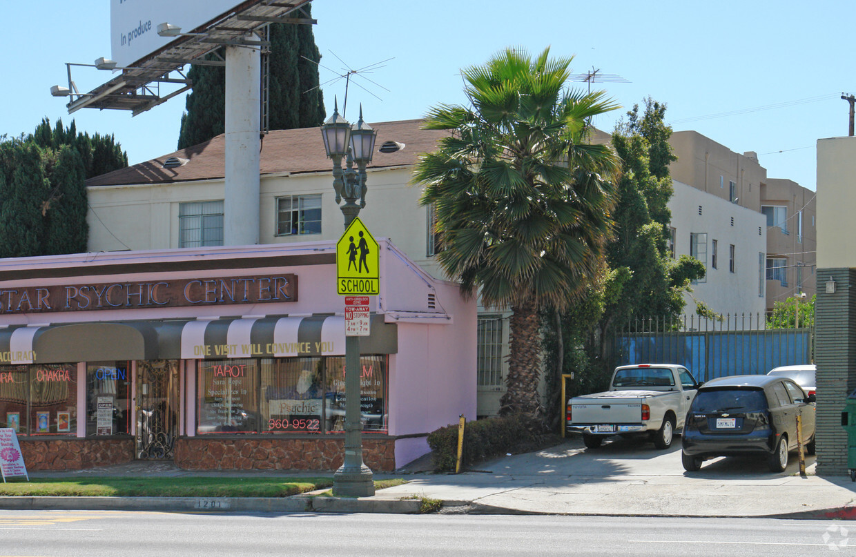
1203 S. La Cienega Blvd
1201-1203 S La Cienega Blvd,
Los Angeles,
CA
90035
2 Weeks Ago
Favorites
1203 S. La Cienega Blvd

Favorites
Pricing & Floor Plans
Check Back Soon for Upcoming Availability
| Beds | Baths | Average SF | Availability |
|---|---|---|---|
| 1 Bedroom 1 Bedroom 1 Br | 1 Bath 1 Bath 1 Ba | 670 SF | Not Available |
Fees and Policies
The fees listed below are community-provided and may exclude utilities or add-ons. All payments are made directly to the property and are non-refundable unless otherwise specified.
-
Street Parking
Property Fee Disclaimer: Based on community-supplied data and independent market research. Subject to change without notice. May exclude fees for mandatory or optional services and usage-based utilities.
Details
Lease Options
-
12 mo
Property Information
-
Built in 1939
-
4 units/2 stories
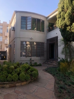
About 1203 S. La Cienega Blvd
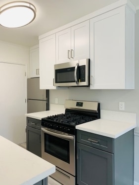
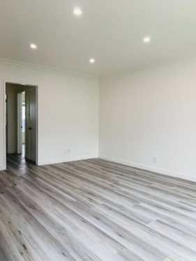
Close to Beverly Hills border, West Hollywood, Cedar Sinai, Robertson Boulevard, Perfect location to call home! +Quartz Countertops +New Kitchen w/all stainless appliances included +1 parking space + New Laminate floors +Compete Renovation! +Tenant to pay Gas and Electricity +Garage Parking Included Easy to show. Call or text Eddie @ ?(310) 752-3583 **Move In Special: Advertised rent included 1 free month which averages the monthly rent down from $1,841 over a 1 year time period. 13 month lease agreement price of $1,995** MANAGED BY: Power Property Management Find us on Google. IT490521 - IT49PP1203slacienegablvd
1203 S. La Cienega Blvd is an apartment community located in Los Angeles County and the 90035 ZIP Code. This area is served by the Los Angeles Unified Rocp School District attendance zone.
Unique Features
- Cats not allowed
- Dogs not allowed
- Parking
Apartment Features
- Kitchen
1201-1203 S La Cienega Blvd,
Los Angeles,
CA
90035
|
Edit
Pico-Robertson is a popular Los Angeles neighborhood situated directly south of Beverly Hills and east of Century City. Despite its location in the heart of glittery West Los Angeles near the Miracle Mile, Beverlywood, Carthay, and Cheviot Hills, Pico-Robertson is much more low-key. You won't find trendy hotspots and wild nightlife in Pico-Robertson, but you will find a strong sense of community and a quiet setting.
Pico-Robertson offers a unique collection of delis, bakeries, and more. It is named for the intersection of Pico Boulevard and Robertson Boulevard, and that's where you'll find the majority of the neighborhood's shops, restaurants, and cafes.
Learn more about living in Pico-Robertson
Average Prices by Area
Compare neighborhood and city base rent averages by bedroom.
| Pico-Robertson | Los Angeles, CA | |
|---|---|---|
| Studio | $1,631 | $1,708 |
| 1 Bedroom | $2,037 | $2,181 |
| 2 Bedrooms | $2,852 | $3,008 |
| 3 Bedrooms | $4,063 | $4,290 |
Below are rent ranges for similar nearby apartments
Amenities
- Cats not allowed
- Dogs not allowed
- Parking
- Kitchen
Office Hours
| Monday | 9am - 5pm |
|---|---|
| Tuesday | 9am - 5pm |
| Wednesday | 9am - 5pm |
| Thursday | 9am - 5pm |
| Friday | 9am - 5pm |
| Saturday | Closed |
| Sunday | Closed |
Education
| Colleges & Universities | Distance | ||
|---|---|---|---|
| Colleges & Universities | Distance | ||
| Drive: | 12 min | 4.6 mi | |
| Drive: | 12 min | 5.5 mi | |
| Drive: | 10 min | 5.5 mi | |
| Drive: | 11 min | 5.9 mi |
1203 S. La Cienega Blvd is within 12 minutes or 4.6 miles from West Los Angeles College. It is also near UCLA and Musicians Institute.
Schools


Public Elementary School
Grades K-5
578 Students
Nearby
Public Elementary School
Grades K-5
380 Students
Nearby
Public Elementary School
Grades PK-5
218 Students
Nearby
Public Elementary School
Grades K-5
327 Students
Attendance Zone
Public Elementary School
Grades K-5
562 Students
Nearby
Public Middle School
Grades 6-8
454 Students
Attendance Zone
Public High School
Grades 9-12
1,495 Students
Attendance Zone
Private Elementary & Middle School
Grades PK-8
282 Students
Nearby
Private High School
Grades 9-12
Nearby
School data provided by
 The GreatSchools Rating helps parents compare schools within a state based on a variety of school quality indicators and provides a helpful picture of how effectively each school serves all of its students. Ratings are on a scale of 1 (below average) to 10 (above average) and can include test scores, college readiness, academic progress, advanced courses, equity, discipline and attendance data. We also advise parents to visit schools, consider other information on school performance and programs, and consider family needs as part of the school selection process.
View GreatSchools Rating Methodology
Data provided by GreatSchools.org © 2026. All rights reserved.
View GreatSchools Rating Methodology
Data provided by GreatSchools.org © 2026. All rights reserved.
Transportation options available in Los Angeles include La Cienega/Jefferson, located 2.2 miles from 1203 S. La Cienega Blvd. 1203 S. La Cienega Blvd is near Los Angeles International, located 9.3 miles or 18 minutes away, and Bob Hope, located 13.9 miles or 26 minutes away.
| Transit / Subway | Distance | ||
|---|---|---|---|
| Transit / Subway | Distance | ||
|
|
Drive: | 5 min | 2.2 mi |
|
|
Drive: | 5 min | 2.3 mi |
|
|
Drive: | 5 min | 3.0 mi |
|
|
Drive: | 7 min | 3.8 mi |
|
|
Drive: | 8 min | 3.8 mi |
| Commuter Rail | Distance | ||
|---|---|---|---|
| Commuter Rail | Distance | ||
|
|
Drive: | 17 min | 10.8 mi |
|
|
Drive: | 19 min | 10.9 mi |
|
|
Drive: | 20 min | 11.5 mi |
|
|
Drive: | 23 min | 11.8 mi |
|
|
Drive: | 24 min | 12.7 mi |
| Airports | Distance | ||
|---|---|---|---|
| Airports | Distance | ||
|
Los Angeles International
|
Drive: | 18 min | 9.3 mi |
|
Bob Hope
|
Drive: | 26 min | 13.9 mi |
Walkability Near 1203 S. La Cienega Blvd
Getting Around
 What do Walkability, Transit, Drivability, and Bikeability mean?
Walkability measures the walking distance to day-to-day needs.
Transit measures access to public transportation.
Drivability measures congestion, parking availability, and access to major roads.
Bikeability measures the suitability for cycling.
How It Works
What do Walkability, Transit, Drivability, and Bikeability mean?
Walkability measures the walking distance to day-to-day needs.
Transit measures access to public transportation.
Drivability measures congestion, parking availability, and access to major roads.
Bikeability measures the suitability for cycling.
How It Works
Very Walkable
Walkability
80
/ 100
Good Public Transit
Transit
60
/ 100
Moderately Drivable
Drivability
70
/ 100
Moderately Bikeable
Bikeability
60
/ 100
Scores provided by
-
Soundscore™
-
/ 100
Traffic
-Airport
-Businesses
-Scores provided by
HowLoud What is a Sound Score Rating? A Sound Score Rating aggregates noise caused by vehicle traffic, airplane traffic and local sources. How It WorksTime and distance from 1203 S. La Cienega Blvd.
| Shopping Centers | Distance | ||
|---|---|---|---|
| Shopping Centers | Distance | ||
| Walk: | 4 min | 0.2 mi | |
| Walk: | 5 min | 0.3 mi | |
| Walk: | 11 min | 0.6 mi |
1203 S. La Cienega Blvd has 3 shopping centers within 0.6 mile, which is about a 11-minute walk. The miles and minutes will be for the farthest away property.
| Parks and Recreation | Distance | ||
|---|---|---|---|
| Parks and Recreation | Distance | ||
|
Zimmer Children's Museum
|
Drive: | 3 min | 1.2 mi |
|
La Brea Tar Pits
|
Drive: | 3 min | 1.7 mi |
|
Virginia Robinson Gardens
|
Drive: | 9 min | 3.8 mi |
|
Kenneth Hahn State Recreation Area
|
Drive: | 11 min | 4.3 mi |
|
Mathias Botanical Garden
|
Drive: | 11 min | 5.0 mi |
1203 S. La Cienega Blvd has 5 parks within 5.0 miles, including Zimmer Children's Museum, La Brea Tar Pits, and Virginia Robinson Gardens.
| Hospitals | Distance | ||
|---|---|---|---|
| Hospitals | Distance | ||
| Drive: | 2 min | 1.1 mi | |
| Drive: | 2 min | 1.2 mi | |
| Drive: | 2 min | 1.3 mi |
1203 S. La Cienega Blvd has 3 hospitals within 1.3 miles, the nearest is Docs Surgical Hospital which is 1.1 miles away and a 2 minute drive.
| Military Bases | Distance | ||
|---|---|---|---|
| Military Bases | Distance | ||
| Drive: | 18 min | 10.9 mi | |
| Drive: | 40 min | 27.6 mi | |
| Drive: | 43 min | 29.9 mi |
1203 S. La Cienega Blvd has 3 military bases within 29.9 miles, the nearest is Los Angeles Air Force Base which is 10.9 miles away and a 18 minute drive.
You May Also Like
Does 1203 S. La Cienega Blvd have in-unit laundry?
1203 S. La Cienega Blvd does not offer in-unit laundry or shared facilities. Please contact the property to learn about nearby laundry options.
What utilities are included in rent at 1203 S. La Cienega Blvd?
Utilities are not included in rent. Residents should plan to set up and pay for all services separately.
Is parking available at 1203 S. La Cienega Blvd?
Parking is available at 1203 S. La Cienega Blvd. Contact this property for details.
Is 1203 S. La Cienega Blvd pet-friendly?
1203 S. La Cienega Blvd does not allow pets, though service animals are always welcome in accordance with applicable laws.
How much income do I need to rent at 1203 S. La Cienega Blvd?
A good rule of thumb is to spend no more than 30% of your gross income on rent. Based on the lowest available rent of $1,841 for a one-bedroom, you would need to earn about $73,640 per year to qualify. Want to double-check your budget? Calculate how much rent you can afford with our Rent Affordability Calculator.
Does 1203 S. La Cienega Blvd have move-in specials?
1203 S. La Cienega Blvd is not currently offering any rent specials. Check back soon, as promotions change frequently.
Does 1203 S. La Cienega Blvd offer Matterport 3D tours?
While 1203 S. La Cienega Blvd does not offer Matterport 3D tours, renters can request a tour directly through our online platform.
Similar Rentals Nearby
-
-
-
-
-
-
-
-
1 Bed$2,852+2 Beds$3,469+Total Monthly PriceTotal Monthly Price NewPrices include base rent and required monthly fees of $15. Variable costs based on usage may apply.Base Rent:1 Bed$2,836+2 Beds$3,453+2 Months Free
Pets Allowed In Unit Washer & Dryer Maintenance on site Heat Controlled Access Elevator
-
-


What Are Walk Score®, Transit Score®, and Bike Score® Ratings?
Walk Score® measures the walkability of any address. Transit Score® measures access to public transit. Bike Score® measures the bikeability of any address.
What is a Sound Score Rating?
A Sound Score Rating aggregates noise caused by vehicle traffic, airplane traffic and local sources.

1201-1203 S La Cienega Blvd
Los Angeles, CA 90035
Property Manager Responded