
$2,000
/ Month
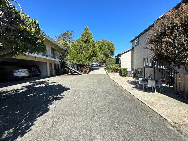
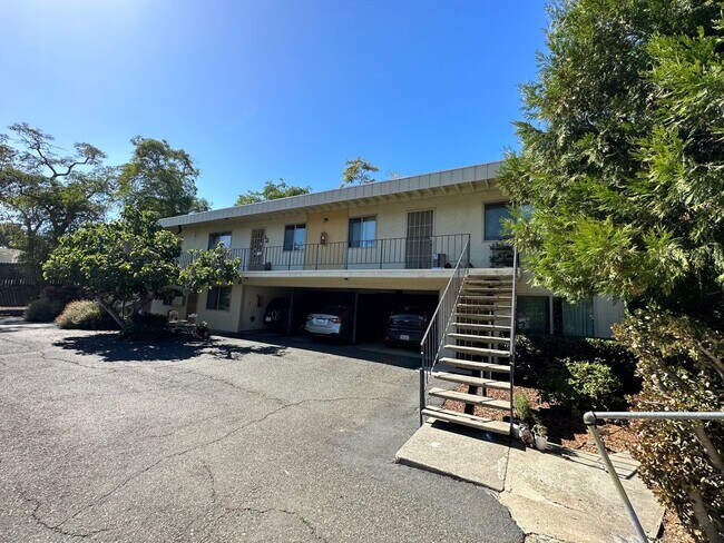
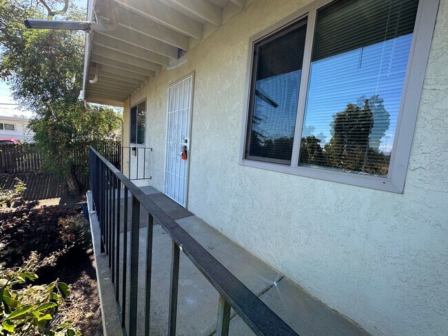
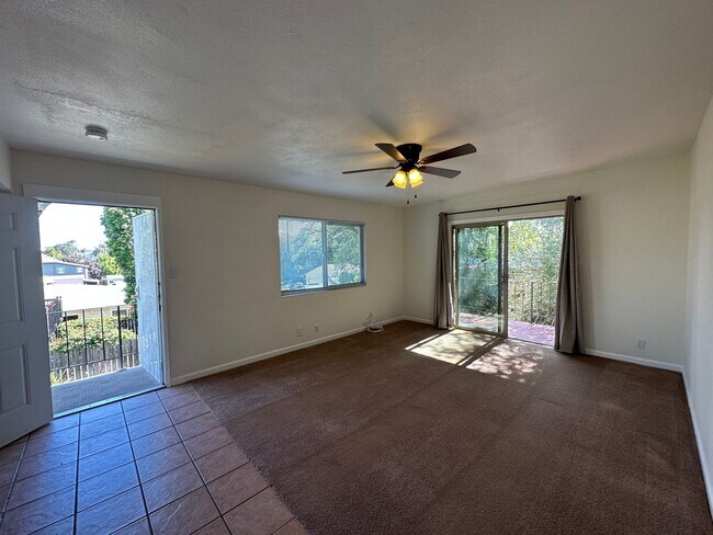
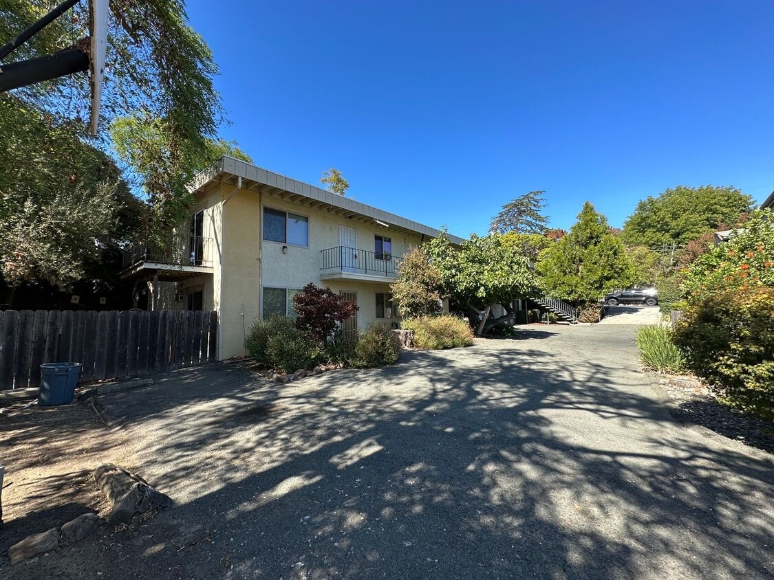
120 E I St Unit 128 East I St
Benicia, CA 94510
2 Weeks Ago
|
Edit
Favorites
120 E I St Unit 128 East I St

Favorites
Check Back Soon for Upcoming Availability
| Beds | Baths | Average SF |
|---|---|---|
| 2 Bedrooms 2 Bedrooms 2 Br | 1 Bath 1 Bath 1 Ba | — |
About This Property
Check out this great property in Benicia, CA. This apartment unit for rent can be found at 120 E I St in the 94510 area of Benicia. End your search and get to moving. Let us assist you! Contact us now to discuss the next steps!
120 E I St is an apartment community located in Solano County and the 94510 ZIP Code.
120 E I St,
Benicia,
CA
94510
Benicia sits on the north bank of the Carquinez Strait, quietly holding onto a history that most California cities can only read about — it served as the state capital for thirteen months between 1853 and 1854, and the original Capitol building still stands downtown. That sense of history gives the city a grounded, unhurried character that sets it apart from busier Bay Area neighbors. Situated in Solano County, Benicia connects easily to Vallejo to the west and Martinez across the strait, while Interstate 680 and 780 put Sacramento, Oakland, and San Francisco within reasonable driving distance.
Daily life here moves at a pace that encourages actually noticing your surroundings. The downtown area anchors the city with waterfront views, local shops, and a working arts district that grew out of the converted Benicia Arsenal — once the largest weapons storehouse on the West Coast.
Learn more about living in Benicia
Education
| Colleges & Universities | Distance | ||
|---|---|---|---|
| Colleges & Universities | Distance | ||
| Drive: | 15 min | 9.8 mi | |
| Drive: | 20 min | 10.9 mi | |
| Drive: | 23 min | 16.5 mi | |
| Drive: | 24 min | 17.2 mi |
120 E I St Unit 128 East I St is within 20 minutes or 10.9 miles from Touro University California. It is also near Diablo Valley, Pleasant Hill and Solano Community College.
Transportation options available in Benicia include North Concord / Martinez, located 10.9 miles from 120 E I St Unit 128 East I St. 120 E I St Unit 128 East I St is near Metro Oakland International, located 37.3 miles or 49 minutes away, and San Francisco International, located 47.0 miles or 64 minutes away.
| Transit / Subway | Distance | ||
|---|---|---|---|
| Transit / Subway | Distance | ||
|
|
Drive: | 16 min | 10.9 mi |
|
|
Drive: | 17 min | 11.4 mi |
| Commuter Rail | Distance | ||
|---|---|---|---|
| Commuter Rail | Distance | ||
|
|
Drive: | 9 min | 5.9 mi |
|
|
Drive: | 27 min | 20.6 mi |
| Drive: | 29 min | 20.8 mi | |
|
|
Drive: | 31 min | 24.5 mi |
| Drive: | 35 min | 26.8 mi |
| Airports | Distance | ||
|---|---|---|---|
| Airports | Distance | ||
|
Metro Oakland International
|
Drive: | 49 min | 37.3 mi |
|
San Francisco International
|
Drive: | 64 min | 47.0 mi |
Walkability Near 120 E I St Benicia, CA 94510
Getting Around
 What do Walkability, Transit, Drivability, and Bikeability mean?
Walkability measures the walking distance to day-to-day needs.
Transit measures access to public transportation.
Drivability measures congestion, parking availability, and access to major roads.
Bikeability measures the suitability for cycling.
How It Works
What do Walkability, Transit, Drivability, and Bikeability mean?
Walkability measures the walking distance to day-to-day needs.
Transit measures access to public transportation.
Drivability measures congestion, parking availability, and access to major roads.
Bikeability measures the suitability for cycling.
How It Works
Moderately Walkable
Walkability
60
/ 100
Limited Public Transit
Transit
30
/ 100
Exceptionally Drivable
Drivability
90
/ 100
Fairly Bikeable
Bikeability
50
/ 100
Scores provided by
Active
Soundscore™
77
/ 100
Traffic
ActiveAirport
CalmBusinesses
ActiveScores provided by
HowLoud What is a Sound Score Rating? A Sound Score Rating aggregates noise caused by vehicle traffic, airplane traffic and local sources. How It WorksTime and distance from 120 E I St Unit 128 East I St.
| Shopping Centers | Distance | ||
|---|---|---|---|
| Shopping Centers | Distance | ||
| Walk: | 6 min | 0.3 mi | |
| Walk: | 8 min | 0.4 mi | |
| Walk: | 12 min | 0.6 mi |
120 E I St Unit 128 East I St has 3 shopping centers within 0.6 mile, which is about a 12-minute walk. The miles and minutes will be for the farthest away property.
| Parks and Recreation | Distance | ||
|---|---|---|---|
| Parks and Recreation | Distance | ||
|
Benicia Capitol State Historic Park
|
Walk: | 2 min | 0.1 mi |
|
Benicia State Recreation Area
|
Drive: | 9 min | 4.2 mi |
|
Martinez Regional Shoreline
|
Drive: | 11 min | 5.3 mi |
|
Alhambra Creek Watershed
|
Drive: | 9 min | 5.9 mi |
|
Carquinez Strait Regional Shoreline
|
Drive: | 19 min | 11.3 mi |
120 E I St Unit 128 East I St has 5 parks within 11.3 miles, including Benicia Capitol State Historic Park, Benicia State Recreation Area, and Martinez Regional Shoreline.
| Hospitals | Distance | ||
|---|---|---|---|
| Hospitals | Distance | ||
| Drive: | 11 min | 6.5 mi | |
| Drive: | 13 min | 7.9 mi | |
| Drive: | 14 min | 9.0 mi |
120 E I St Unit 128 East I St has 3 hospitals within 9.0 miles, the nearest is Contra Costa Regional Medical Center which is 6.5 miles away and a 11 minute drive.
| Military Bases | Distance | ||
|---|---|---|---|
| Military Bases | Distance | ||
| Drive: | 4 min | 2.1 mi | |
| Drive: | 19 min | 10.3 mi |
120 E I St Unit 128 East I St is 2.1 miles from Armory Vallejo, and is convenient to other military bases, including Mare Island Naval Reserve.
You May Also Like
Similar Rentals Nearby


What Are Walk Score®, Transit Score®, and Bike Score® Ratings?
Walk Score® measures the walkability of any address. Transit Score® measures access to public transit. Bike Score® measures the bikeability of any address.
What is a Sound Score Rating?
A Sound Score Rating aggregates noise caused by vehicle traffic, airplane traffic and local sources.
120 E I St
Benicia, CA 94510