
$6,500
Total Monthly Price
12 Month Lease
12 Adella Pl
Boston, MA 02134
Today
|
Edit
Favorites
857-425-8978
-
Bedrooms
5
-
Bathrooms
2.5
-
Square Feet
1,778 sq ft
-
Available
Available Dec 1
Highlight
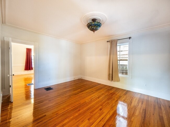
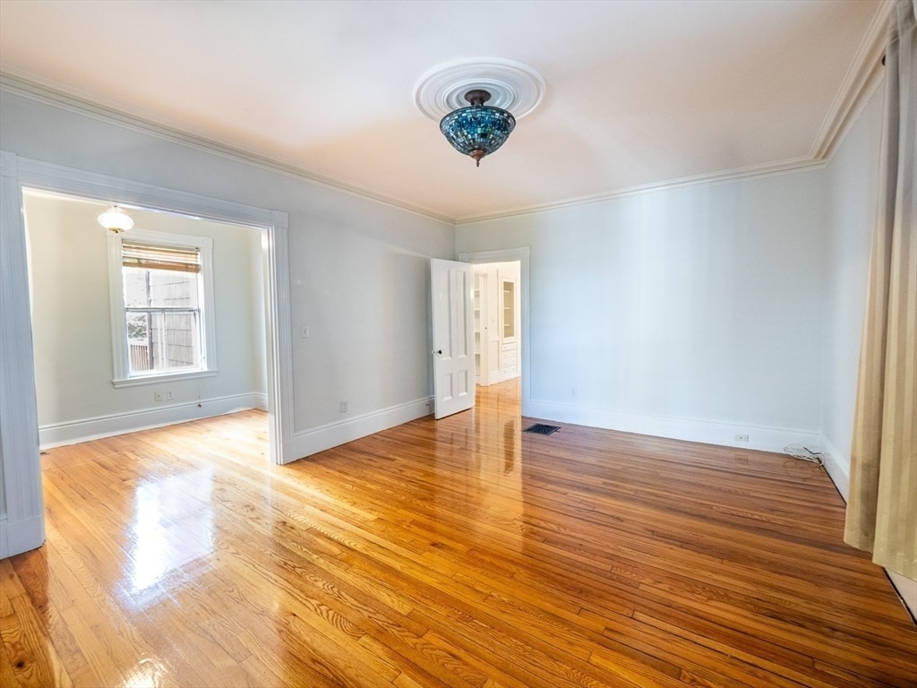
- Hardwood Floors
12 Adella Pl

Favorites
About This Home
12 Month Lease,
$6,500 deposit,
Available Dec 1
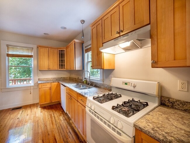
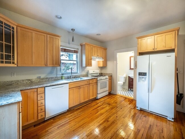
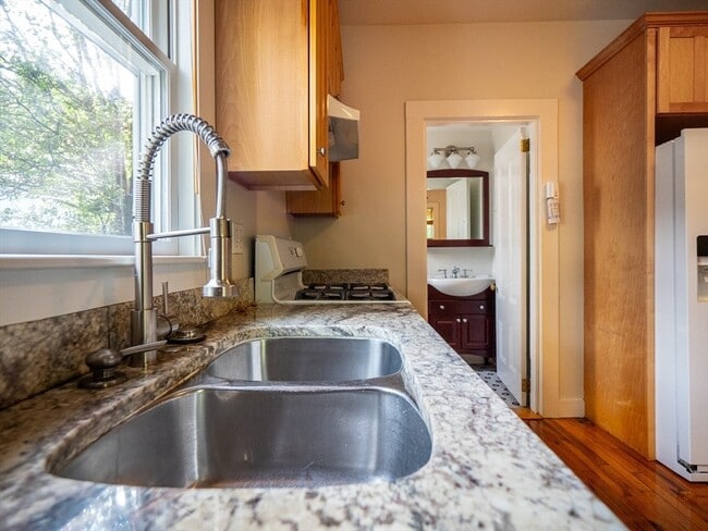
Available Now! Ready for immediate move-in! You’ll love this updated single-family home in the heart of Allston. Freshly painted and filled with natural light, it offers spacious rooms, gleaming hardwood floors, and modern updates throughout. The kitchen and bathrooms are fully renovated, and you’ll have the convenience of in-unit laundry. Located on a quiet street, you get privacy while staying close to restaurants, shops, and public transit. Commuting is easy with quick access to the Mass Pike. Off-street parking adds even more convenience to this move-in-ready home.
12 Adella Pl is a house located in Suffolk County and the 02134 ZIP Code. This area is served by the Boston Public Schools attendance zone.
* Price shown is total price based on community-supplied monthly required fees. Excludes user-selected optional fees and variable or usage-based fees and required charges due at or prior to move-in or at move-out. Price, availability, fees, and any applicable rent special are subject to change without notice.
* Square footage definitions vary. Displayed square footage is approximate.
House Features
- Washer/Dryer
- Kitchen
- Hardwood Floors
Fees and Policies
The fees below are based on community-supplied data and may exclude additional fees and utilities.
- Parking
-
Surface Lot--
Contact
- Phone Number
- Contact
Location
Get Directions
Saint Elizabeth’s is a Brighton neighborhood situated about 10 miles away from Boston. Thanks to Saint Elizabeth’s top border sitting on Highway 20, commuting in and out of Brighton is easy. Some residents travel by car, but buses and railways make commuting via public transportation a breeze.
The neighborhood’s best amenities are two world-renowned hospitals, Saint Elizabeth’s Medical Center and Franciscan Children’s, that sit on the edge of town. Other great amenities of Saint Elizabeth’s include many local parks like Ringer Playground and Chestnut Hill Reservoir, which has great trails and greenspace. This neighborhood is also equipped with cozy coffee shops, restaurants serving international and American classics, and shopping plazas with grocers and convenience stores.
Saint Elizabeth’s has several rental options ranging from apartments to single-family homes.
Learn more about living in St Elizabeth's
Education
| Colleges & Universities | Distance | ||
|---|---|---|---|
| Colleges & Universities | Distance | ||
| Drive: | 3 min | 1.5 mi | |
| Drive: | 5 min | 2.2 mi | |
| Drive: | 6 min | 2.4 mi | |
| Drive: | 6 min | 2.5 mi |
12 Adella Pl is within 3 minutes or 1.5 miles from Boston University. It is also near Boston College, Brighton and Harvard University.
Schools


Public Elementary & Middle School
Grades PK-8
352 Students
Attendance Zone
Charter Middle & High School
Grades 6-12
476 Students
Attendance Zone
Public Middle & High School
Grades 7-12
2,423 Students
Attendance Zone
Public Middle & High School
Grades 7-12
532 Students
Attendance Zone
Public High School
Grades 9-12
116 Students
Attendance Zone
Private Elementary & Middle School
Grades K-8
30 Students
Nearby
Private Elementary & Middle School
Grades PK-8
Nearby
Private High School
Grades 9-12
270 Students
Nearby
School data provided by
 The GreatSchools Rating helps parents compare schools within a state based on a variety of school quality indicators and provides a helpful picture of how effectively each school serves all of its students. Ratings are on a scale of 1 (below average) to 10 (above average) and can include test scores, college readiness, academic progress, advanced courses, equity, discipline and attendance data. We also advise parents to visit schools, consider other information on school performance and programs, and consider family needs as part of the school selection process.
View GreatSchools Rating Methodology
Data provided by GreatSchools.org © 2025. All rights reserved.
View GreatSchools Rating Methodology
Data provided by GreatSchools.org © 2025. All rights reserved.
Transportation options available in Boston include Allston Street Station, located 0.4 mile from 12 Adella Pl. 12 Adella Pl is near General Edward Lawrence Logan International, located 8.4 miles or 15 minutes away.
| Transit / Subway | Distance | ||
|---|---|---|---|
| Transit / Subway | Distance | ||
|
|
Walk: | 7 min | 0.4 mi |
|
|
Walk: | 7 min | 0.4 mi |
|
|
Walk: | 8 min | 0.4 mi |
|
|
Walk: | 9 min | 0.5 mi |
|
|
Walk: | 12 min | 0.6 mi |
| Commuter Rail | Distance | ||
|---|---|---|---|
| Commuter Rail | Distance | ||
|
|
Drive: | 4 min | 2.5 mi |
|
|
Drive: | 7 min | 3.1 mi |
|
|
Drive: | 7 min | 3.4 mi |
|
|
Drive: | 10 min | 4.3 mi |
| Drive: | 10 min | 5.1 mi |
| Airports | Distance | ||
|---|---|---|---|
| Airports | Distance | ||
|
General Edward Lawrence Logan International
|
Drive: | 15 min | 8.4 mi |
Time and distance from 12 Adella Pl.
| Shopping Centers | Distance | ||
|---|---|---|---|
| Shopping Centers | Distance | ||
| Walk: | 9 min | 0.5 mi | |
| Walk: | 13 min | 0.7 mi | |
| Drive: | 3 min | 1.2 mi |
12 Adella Pl has 3 shopping centers within 1.2 miles, which is about a 3-minute walk. The miles and minutes will be for the farthest away property.
| Parks and Recreation | Distance | ||
|---|---|---|---|
| Parks and Recreation | Distance | ||
|
John Fitzgerald Kennedy National Historic Site
|
Walk: | 19 min | 1.0 mi |
|
Chestnut Hill Reservation
|
Drive: | 4 min | 1.8 mi |
|
Coit Observatory
|
Drive: | 4 min | 1.9 mi |
|
Longfellow National Historic Site
|
Drive: | 7 min | 2.9 mi |
|
Charles River Reservation
|
Drive: | 7 min | 3.0 mi |
12 Adella Pl has 5 parks within 3.0 miles, including John Fitzgerald Kennedy National Historic Site, Coit Observatory, and Chestnut Hill Reservation.
| Hospitals | Distance | ||
|---|---|---|---|
| Hospitals | Distance | ||
| Walk: | 13 min | 0.7 mi | |
| Walk: | 14 min | 0.8 mi | |
| Walk: | 16 min | 0.9 mi |
12 Adella Pl has 3 hospitals within 0.9 mile, the nearest is Franciscan Children's Hospital & Rehab Center which is 0.7 mile away and a 13 minute walk.
| Military Bases | Distance | ||
|---|---|---|---|
| Military Bases | Distance | ||
| Drive: | 26 min | 13.4 mi | |
| Drive: | 24 min | 14.4 mi |
12 Adella Pl is 13.4 miles from Hanscom Air Force Base, and is convenient to other military bases, including US Military Reservation.
Amenities
- Washer/Dryer
- Kitchen
- Hardwood Floors
12 Adella Pl Photos
What Are Walk Score®, Transit Score®, and Bike Score® Ratings?
Walk Score® measures the walkability of any address. Transit Score® measures access to public transit. Bike Score® measures the bikeability of any address.
What is a Sound Score Rating?
A Sound Score Rating aggregates noise caused by vehicle traffic, airplane traffic and local sources
12 Adella Pl
Boston, MA 02134