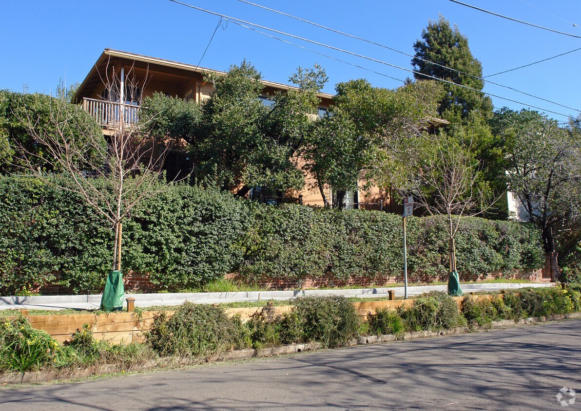
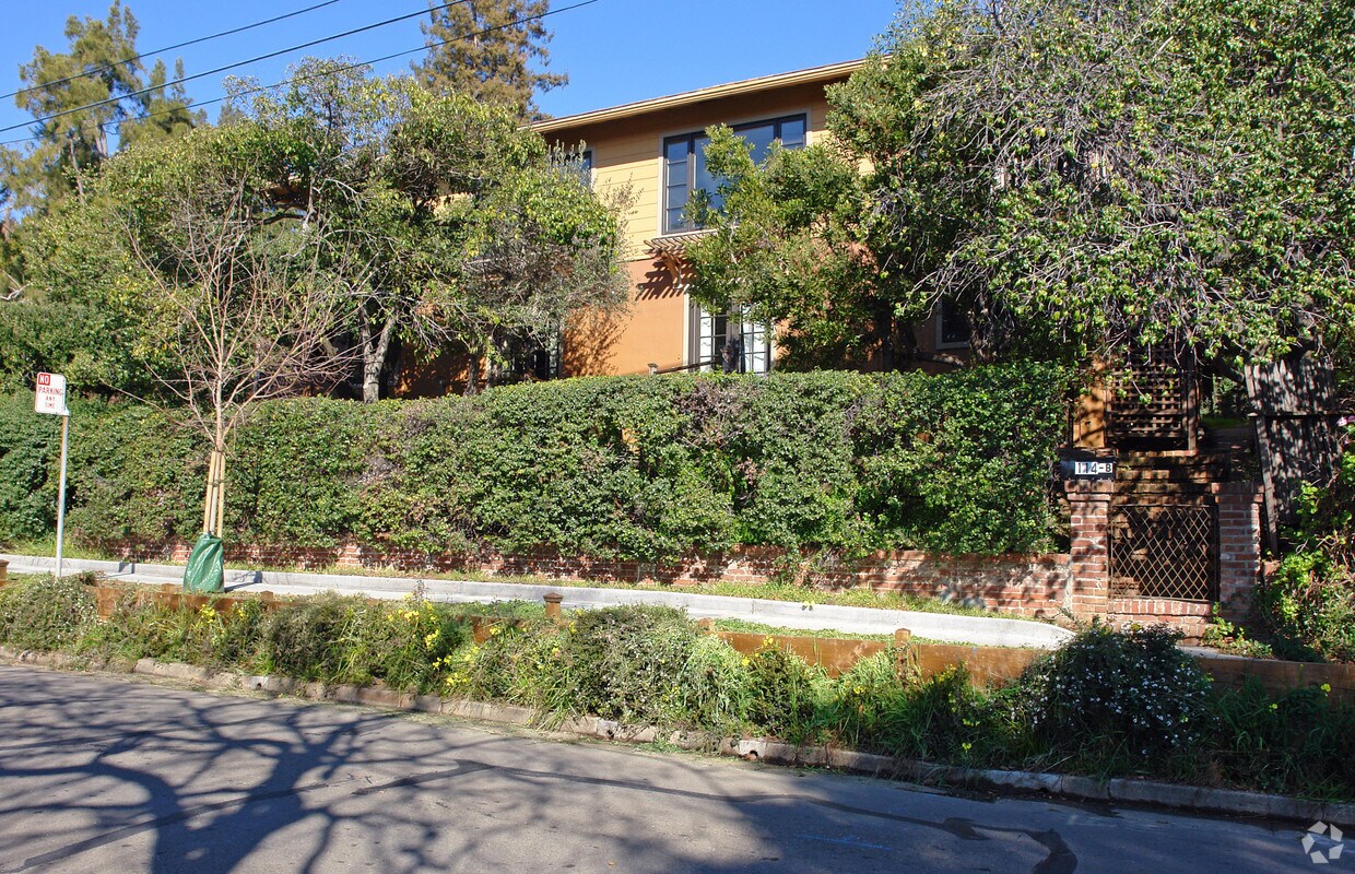
114 Laurel Pl
114 Laurel Pl,
San Rafael,
CA
94901
2 Weeks Ago
Favorites
114 Laurel Pl
Favorites
Check Back Soon for Upcoming Availability
| Beds | Baths | Average SF | Availability |
|---|---|---|---|
| Studio Studio 0 Br | 1 Bath 1 Bath 1 Ba | 550 SF | Not Available |
| 2 Bedrooms 2 Bedrooms 2 Br | 1 Bath 1 Bath 1 Ba | 850 SF | Not Available |
Fees and Policies
The fees below are based on community-supplied data and may exclude additional fees and utilities.
- Parking
-
Surface Lot--1 Max
Details
Property Information
-
Built in 1954
-
4 units/2 stories
About 114 Laurel Pl San Rafael, CA 94901
Find your new place at 114 Laurel Pl. Based in the 94901 Zip code of San Rafael on Laurel Pl, residents have easy connection to enjoyable points of interest. Here at this community, the professional leasing team is ready to help you find your perfect apartment. Make a visit to view the available floorplans. Stop by 114 Laurel Pl today.
114 Laurel Pl is an apartment community located in Marin County and the 94901 ZIP Code. This area is served by the San Rafael City Elementary attendance zone.
Location
Get Directions
Located along Highway 101, Lincoln-San Rafael Hill is a major artery leading to Downtown San Rafael. Given the close proximity to downtown, the large population of residential communities, and nearby wineries, Lincoln-San Rafael Hill can feel partially urban, rural, and suburban all at once.
Since the re-opening of Boyd Park, numerous ongoing activities are held including a variety of exercise classes as well as storytelling and sing-a-longs for kids of all ages. Lincoln-San Rafael Hill residents enjoy access to many nearby parks such as the San Pedro Mountain Open Space Preserve. Cultural amenities abound in the neighboring downtown area and the Dominican University of California.
Travel plans from Lincoln-San Rafael Hill are made easy with San Francisco International and Oakland International Airports both being less than an hour’s drive away.
Learn more about living in Lincoln-San Rafael HillBelow are rent ranges for similar nearby apartments
Education
| Colleges & Universities | Distance | ||
|---|---|---|---|
| Colleges & Universities | Distance | ||
| Walk: | 20 min | 1.0 mi | |
| Drive: | 23 min | 14.3 mi | |
| Drive: | 26 min | 16.3 mi | |
| Drive: | 27 min | 16.6 mi |
114 Laurel Pl is within 20 minutes or 1.0 miles from Dominican Univ. of Ca. It is also near Contra Costa College and UC San Francisco, Mount Zion.
Schools


Public Elementary School
Grades K-5
367 Students
Attendance Zone
Public Elementary School
Grades K-5
99 Students
Nearby
Public Middle School
Grades 6-8
1,063 Students
Attendance Zone
Public High School
Grades 9-12
1,265 Students
Attendance Zone
Public High School
Grades 9-12
1,189 Students
Attendance Zone
Private Elementary & Middle School
Grades PK-8
233 Students
Nearby
Private Elementary School
Grades PK-6
156 Students
Nearby
Private High School
Grades 9-12
438 Students
Nearby
School data provided by
 The GreatSchools Rating helps parents compare schools within a state based on a variety of school quality indicators and provides a helpful picture of how effectively each school serves all of its students. Ratings are on a scale of 1 (below average) to 10 (above average) and can include test scores, college readiness, academic progress, advanced courses, equity, discipline and attendance data. We also advise parents to visit schools, consider other information on school performance and programs, and consider family needs as part of the school selection process.
View GreatSchools Rating Methodology
Data provided by GreatSchools.org © 2025. All rights reserved.
View GreatSchools Rating Methodology
Data provided by GreatSchools.org © 2025. All rights reserved.
Transportation options available in San Rafael include Richmond Station, located 11.5 miles from 114 Laurel Pl. 114 Laurel Pl is near San Francisco International, located 31.1 miles or 50 minutes away, and Metro Oakland International, located 31.3 miles or 43 minutes away.
| Transit / Subway | Distance | ||
|---|---|---|---|
| Transit / Subway | Distance | ||
|
|
Drive: | 18 min | 11.5 mi |
| Commuter Rail | Distance | ||
|---|---|---|---|
| Commuter Rail | Distance | ||
| Walk: | 6 min | 0.3 mi | |
| Drive: | 7 min | 3.2 mi | |
| Drive: | 6 min | 3.6 mi | |
| Drive: | 11 min | 7.0 mi | |
| Drive: | 15 min | 10.8 mi |
| Airports | Distance | ||
|---|---|---|---|
| Airports | Distance | ||
|
San Francisco International
|
Drive: | 50 min | 31.1 mi |
|
Metro Oakland International
|
Drive: | 43 min | 31.3 mi |
Time and distance from 114 Laurel Pl.
| Shopping Centers | Distance | ||
|---|---|---|---|
| Shopping Centers | Distance | ||
| Walk: | 5 min | 0.3 mi | |
| Walk: | 11 min | 0.6 mi | |
| Walk: | 14 min | 0.7 mi |
114 Laurel Pl has 3 shopping centers within 0.7 mile, which is about a 14-minute walk. The miles and minutes will be for the farthest away property.
| Parks and Recreation | Distance | ||
|---|---|---|---|
| Parks and Recreation | Distance | ||
|
WildCare
|
Walk: | 13 min | 0.7 mi |
|
Hal Brown Park at Creekside
|
Drive: | 9 min | 4.1 mi |
|
John F. McInnis County Park
|
Drive: | 10 min | 5.4 mi |
|
China Camp State Park
|
Drive: | 13 min | 5.5 mi |
|
Baltimore Canyon Open Space
|
Drive: | 15 min | 6.0 mi |
114 Laurel Pl has 5 parks within 6.0 miles, including WildCare, Hal Brown Park at Creekside, and Baltimore Canyon Open Space.
| Hospitals | Distance | ||
|---|---|---|---|
| Hospitals | Distance | ||
| Drive: | 8 min | 3.9 mi | |
| Drive: | 9 min | 4.4 mi | |
| Drive: | 14 min | 9.9 mi |
114 Laurel Pl has 3 hospitals within 9.9 miles, the nearest is Kaiser Foundation Hospital which is 3.9 miles away and a 8 minute drive.
| Military Bases | Distance | ||
|---|---|---|---|
| Military Bases | Distance | ||
| Drive: | 23 min | 14.5 mi | |
| Drive: | 28 min | 16.1 mi | |
| Drive: | 29 min | 16.5 mi |
114 Laurel Pl has 3 military bases within 16.5 miles, the nearest is Armory West Contra Costa which is 14.5 miles away and a 23 minute drive.
You May Also Like
What neighborhood is the property located in?
114 Laurel Pl San Rafael, CA 94901 is in Lincoln-San Rafael Hill in the city of San Rafael. Here you’ll find three shopping centers within 0.7 mile of the property. Five parks are within 6.0 miles, including WildCare, Hal Brown Park at Creekside, and Baltimore Canyon Open Space.
Similar Rentals Nearby


What Are Walk Score®, Transit Score®, and Bike Score® Ratings?
Walk Score® measures the walkability of any address. Transit Score® measures access to public transit. Bike Score® measures the bikeability of any address.
What is a Sound Score Rating?
A Sound Score Rating aggregates noise caused by vehicle traffic, airplane traffic and local sources

114 Laurel Pl
San Rafael, CA 94901
Responded To This Review