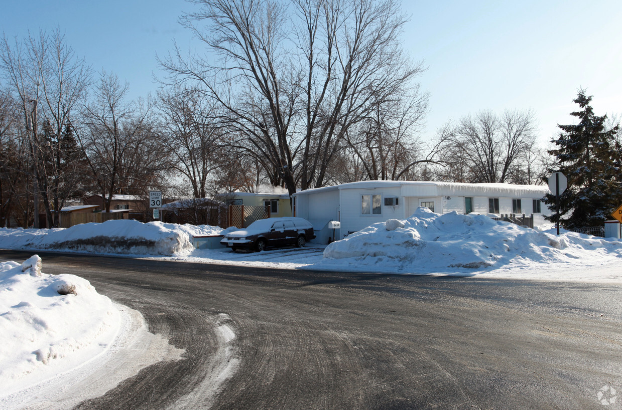
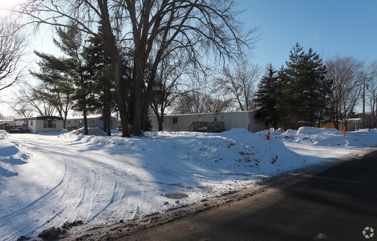
1130 Onondaga Way
1130 Onondaga Way,
Fridley,
MN
55432
2 Weeks Ago
Favorites
1130 Onondaga Way
Favorites
Check Back Soon for Upcoming Availability
About 1130 Onondaga Way Fridley, MN 55432
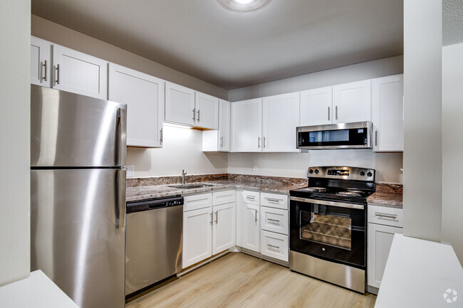
Experience a new place to live at 1130 Onondaga Way. These apartments are located in Fridley on Onondaga Way. The professional leasing staff is waiting to show you all that this community has to offer. Be sure to see the current floorplan options. Start living the good life at 1130 Onondaga Way. Contact or drop by to find out the availability today.
1130 Onondaga Way is an apartment community located in Anoka County and the 55432 ZIP Code. This area is served by the Spring Lake Park Public Schools attendance zone.
Fees and Policies
Details
Property Information
-
Built in 1974
-
40 units/1 story
Location
Get Directions
Nestled along the scenic banks of the Mississippi River, Fridley beckons to prospective renters seeking a dynamic and welcoming community to call home. Affectionately known as the "Friendly City," Fridley lives up to its nickname, offering a delightful blend of suburban charm and city convenience. As you consider the prospect of settling here, you'll discover a tapestry of engaging experiences and amenities that make life in Fridley truly exceptional.
One of the city's standout features is its extensive park system, with over 38 parks, offering an abundance of green spaces for outdoor enthusiasts. Whether it's a leisurely stroll along the Mississippi Regional Trail or a family picnic in Commons Park, nature's beauty is always within reach. For cultural enrichment, Fridley boasts the Banfill-Locke Center for the Arts, showcasing local talent and fostering creativity.
Learn more about living in Fridley
Education
| Colleges & Universities | Distance | ||
|---|---|---|---|
| Colleges & Universities | Distance | ||
| Drive: | 13 min | 6.4 mi | |
| Drive: | 14 min | 8.1 mi | |
| Drive: | 15 min | 8.6 mi | |
| Drive: | 17 min | 12.0 mi |
1130 Onondaga Way is within 13 minutes or 6.4 miles from Bethel University, Saint Paul. It is also near Northwestern College and Anoka-Ramsey C.C., Coon Rapids.
Schools


Public Elementary School
Grades PK-4
552 Students
Attendance Zone
Public Elementary & Middle School
Grades 5-8
1,691 Students
Attendance Zone
Public Elementary, Middle & High School
Grades PK-12
Nearby
Public High School
Grades 9-12
1,947 Students
Attendance Zone
Private Elementary, Middle & High School
Grades PK-12
159 Students
Nearby
Private Elementary & Middle School
Grades K-7
17 Students
Nearby
Private High School
Grades 9-12
239 Students
Nearby
School data provided by
 The GreatSchools Rating helps parents compare schools within a state based on a variety of school quality indicators and provides a helpful picture of how effectively each school serves all of its students. Ratings are on a scale of 1 (below average) to 10 (above average) and can include test scores, college readiness, academic progress, advanced courses, equity, discipline and attendance data. We also advise parents to visit schools, consider other information on school performance and programs, and consider family needs as part of the school selection process.
View GreatSchools Rating Methodology
View GreatSchools Rating Methodology
Transportation options available in Fridley include Target Field Station Platform 2, located 11.7 miles from 1130 Onondaga Way. 1130 Onondaga Way is near Minneapolis-St Paul International/Wold-Chamberlain, located 23.6 miles or 37 minutes away.
| Transit / Subway | Distance | ||
|---|---|---|---|
| Transit / Subway | Distance | ||
| Drive: | 18 min | 11.7 mi | |
|
|
Drive: | 18 min | 11.9 mi |
|
|
Drive: | 18 min | 12.0 mi |
|
|
Drive: | 19 min | 12.0 mi |
|
|
Drive: | 19 min | 12.2 mi |
| Commuter Rail | Distance | ||
|---|---|---|---|
| Commuter Rail | Distance | ||
|
|
Drive: | 8 min | 4.0 mi |
|
|
Drive: | 15 min | 10.3 mi |
|
|
Drive: | 19 min | 11.8 mi |
|
|
Drive: | 16 min | 11.9 mi |
|
|
Drive: | 23 min | 15.7 mi |
| Airports | Distance | ||
|---|---|---|---|
| Airports | Distance | ||
|
Minneapolis-St Paul International/Wold-Chamberlain
|
Drive: | 37 min | 23.6 mi |
Time and distance from 1130 Onondaga Way.
| Shopping Centers | Distance | ||
|---|---|---|---|
| Shopping Centers | Distance | ||
| Drive: | 3 min | 1.3 mi | |
| Drive: | 5 min | 2.0 mi | |
| Drive: | 5 min | 2.7 mi |
1130 Onondaga Way has 3 shopping centers within 2.7 miles, which is about a 5-minute drive. The miles and minutes will be for the farthest away property.
| Parks and Recreation | Distance | ||
|---|---|---|---|
| Parks and Recreation | Distance | ||
|
Creekview Park
|
Drive: | 5 min | 2.2 mi |
|
Locke County Park
|
Drive: | 8 min | 2.9 mi |
|
Springbrook Nature Center
|
Drive: | 6 min | 3.2 mi |
|
Silverwood Park
|
Drive: | 11 min | 6.4 mi |
|
West Coon Rapids Dam Visitor Center
|
Drive: | 17 min | 10.5 mi |
1130 Onondaga Way has 5 parks within 10.5 miles, including Locke County Park, Creekview Park, and Springbrook Nature Center.
| Hospitals | Distance | ||
|---|---|---|---|
| Hospitals | Distance | ||
| Drive: | 17 min | 9.8 mi | |
| Drive: | 16 min | 10.9 mi | |
| Drive: | 21 min | 12.8 mi |
1130 Onondaga Way has 3 hospitals within 12.8 miles, the nearest is Mercy Hospital which is 9.8 miles away and a 17 minute drive.
| Military Bases | Distance | ||
|---|---|---|---|
| Military Bases | Distance | ||
| Drive: | 32 min | 20.5 mi |
1130 Onondaga Way is 20.5 miles and a 32 minute drive from Fort Snelling Military Reservation.
You May Also Like
Similar Rentals Nearby


What Are Walk Score®, Transit Score®, and Bike Score® Ratings?
Walk Score® measures the walkability of any address. Transit Score® measures access to public transit. Bike Score® measures the bikeability of any address.
What is a Sound Score Rating?
A Sound Score Rating aggregates noise caused by vehicle traffic, airplane traffic and local sources
Responded To This Review