
$2,050 / Month
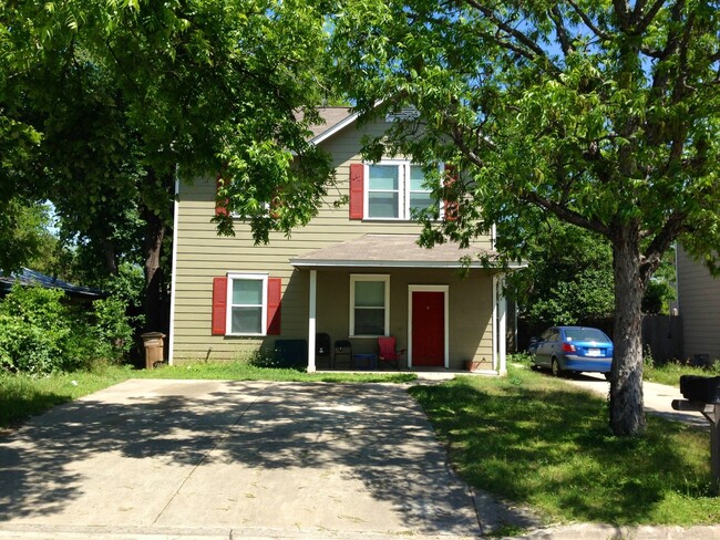
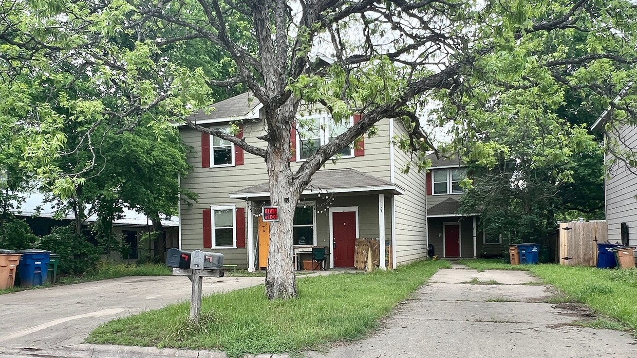
1127 Map St Unit A
Austin, TX 78721
2 Weeks Ago
Favorites
1127 Map St Unit A

Favorites
Check Back Soon for Upcoming Availability
| Beds | Baths | Average SF |
|---|---|---|
| 4 Bedrooms 4 Bedrooms 4 Br | 2.5 Baths 2.5 Baths 2.5 Ba | 1,453 SF |
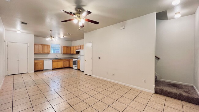
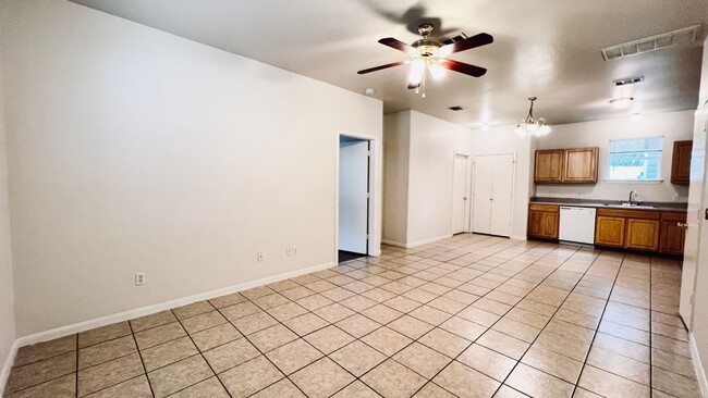
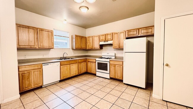
About This Property
Check out your new address in Austin, TX. This well-maintained apartment unit for rent is located in Austin, TX at 1127 Map St, where you'll have access to a variety of attractions. Stop looking and get to moving. Reach out to see everything this home offers.
1127 Map St is an apartment community located in Travis County and the 78721 ZIP Code.
Location
Get Directions
East MLK is a quaint, historic neighborhood just four miles east of downtown Austin and eight miles north of the Austin-Bergstrom International Airport. With such luxuries in close proximity, East MLK residents have easy access to lively downtown streets and international travel.
The Austin Independent School District offers public schools like Norman Elementary School, along with community parks and open green space. On its way to becoming a wonderful recreational space for Austin residents with a master plan in progress, Little Walnut Creek Greenbelt covers 200 acres of undeveloped space in this residential neighborhood.
Residents appreciate the abundance of local restaurants in and around East MLK. Be sure to try Contigo, modeled after the owners’ family’s Texas ranch. This incredible restaurant has a covered patio and full bar that flows into outdoor ranch-style seating.
Learn more about living in East MLKBelow are rent ranges for similar nearby apartments
| Beds | Average Size | Lowest | Typical | Premium |
|---|---|---|---|---|
| Studio Studio Studio | 492-494 Sq Ft | $799 | $1,650 | $3,649 |
| 1 Bed 1 Bed 1 Bed | 744-745 Sq Ft | $624 | $2,060 | $3,660 |
| 2 Beds 2 Beds 2 Beds | 1163-1164 Sq Ft | $741 | $2,835 | $6,766 |
| 3 Beds 3 Beds 3 Beds | 1579 Sq Ft | $1,284 | $3,317 | $6,799 |
| 4 Beds 4 Beds 4 Beds | 1886 Sq Ft | $1,800 | $3,606 | $5,145 |
Education
| Colleges & Universities | Distance | ||
|---|---|---|---|
| Colleges & Universities | Distance | ||
| Drive: | 3 min | 1.4 mi | |
| Drive: | 7 min | 3.3 mi | |
| Drive: | 6 min | 3.5 mi | |
| Drive: | 8 min | 4.2 mi |
1127 Map St Unit A is within 3 minutes or 1.4 miles from Austin C.C., Eastview Campus. It is also near University of Texas at Austin and Austin C.C., Riverside Campus.
Transportation options available in Austin include M L King Jr Station, located 1.8 miles from 1127 Map St Unit A. 1127 Map St Unit A is near Austin-Bergstrom International, located 9.7 miles or 19 minutes away.
| Transit / Subway | Distance | ||
|---|---|---|---|
| Transit / Subway | Distance | ||
| Drive: | 4 min | 1.8 mi | |
| Drive: | 5 min | 3.1 mi | |
| Drive: | 7 min | 3.8 mi | |
| Drive: | 8 min | 4.8 mi | |
| Drive: | 11 min | 5.8 mi |
| Commuter Rail | Distance | ||
|---|---|---|---|
| Commuter Rail | Distance | ||
|
|
Drive: | 11 min | 5.2 mi |
|
|
Drive: | 43 min | 33.0 mi |
|
|
Drive: | 42 min | 34.3 mi |
| Airports | Distance | ||
|---|---|---|---|
| Airports | Distance | ||
|
Austin-Bergstrom International
|
Drive: | 19 min | 9.7 mi |
Time and distance from 1127 Map St Unit A.
| Shopping Centers | Distance | ||
|---|---|---|---|
| Shopping Centers | Distance | ||
| Walk: | 13 min | 0.7 mi | |
| Walk: | 15 min | 0.8 mi | |
| Drive: | 3 min | 1.4 mi |
1127 Map St Unit A has 3 shopping centers within 1.4 miles, which is about a 3-minute walk. The miles and minutes will be for the farthest away property.
| Parks and Recreation | Distance | ||
|---|---|---|---|
| Parks and Recreation | Distance | ||
|
Boggy Creek Greenbelt
|
Drive: | 4 min | 1.6 mi |
|
Thinkery
|
Drive: | 5 min | 2.7 mi |
|
Texas Memorial Museum
|
Drive: | 7 min | 3.3 mi |
|
Lady Bird Lake
|
Drive: | 6 min | 3.3 mi |
|
Elisabet Ney Museum
|
Drive: | 8 min | 3.9 mi |
1127 Map St Unit A has 5 parks within 3.9 miles, including Boggy Creek Greenbelt, Thinkery, and Texas Memorial Museum.
| Hospitals | Distance | ||
|---|---|---|---|
| Hospitals | Distance | ||
| Drive: | 5 min | 2.9 mi | |
| Drive: | 6 min | 2.9 mi | |
| Drive: | 7 min | 3.2 mi |
1127 Map St Unit A has 3 hospitals within 3.2 miles, the nearest is Dell Children's Medical Center of Central Texas which is 2.9 miles away and a 5 minute drive.
| Military Bases | Distance | ||
|---|---|---|---|
| Military Bases | Distance | ||
| Drive: | 85 min | 69.3 mi | |
| Drive: | 91 min | 73.7 mi |
1127 Map St Unit A is 69.3 miles from Randolph Air Force Base, and is convenient to other military bases, including Fort Cavazos.
You May Also Like
Similar Rentals Nearby
-
-
-
-
-
-
1 / 16

-
-
-
-


What Are Walk Score®, Transit Score®, and Bike Score® Ratings?
Walk Score® measures the walkability of any address. Transit Score® measures access to public transit. Bike Score® measures the bikeability of any address.
What is a Sound Score Rating?
A Sound Score Rating aggregates noise caused by vehicle traffic, airplane traffic and local sources
1127 Map St
Austin, TX 78721