
$2,200 / Month
11 Parsons St Unit 2
Quincy, MA 02169
Today
Favorites
617-820-3505
-
Bedrooms
2
-
Bathrooms
1
-
Square Feet
9,999 sq ft
-
Available
Available Aug 1
11 Parsons St Unit 2

Favorites
About This Home
Available Aug 1
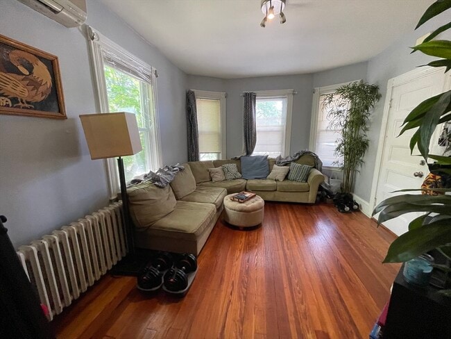
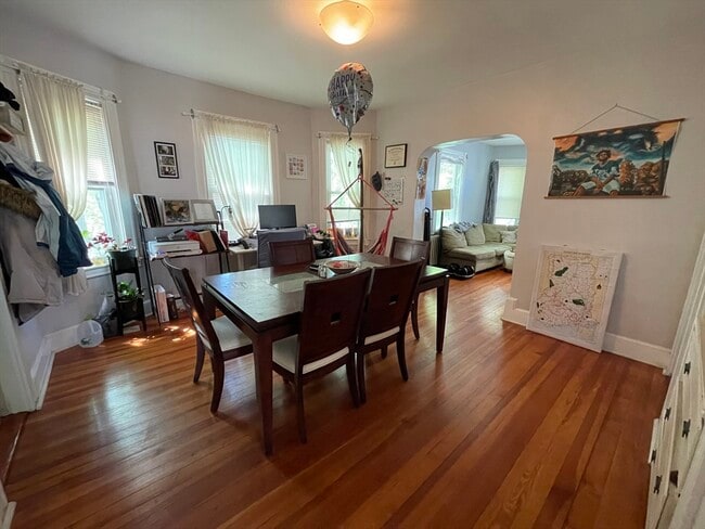
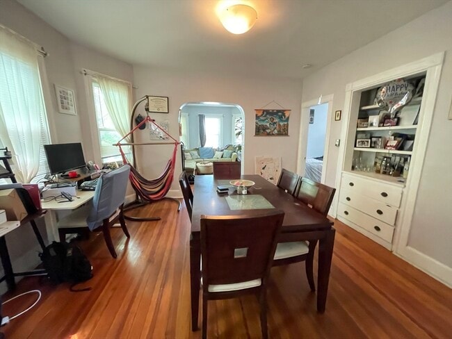
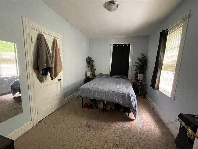
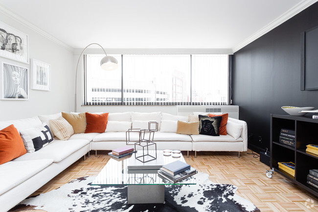
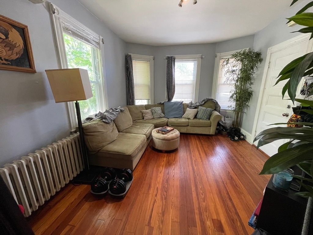
Beautiful apartment in Quincy available 08/01- Second floor apartment with ample off street and on street parking :- Great size 2 bed with great closet space - Carpeted bedroom floors - Hardwood floors - Living and dining room- Free washer and dryer in the basement - Eat-in kitchen,no dishwasher - Great size pantry - 1 full bathroom - shared backyard - Tenants pay for gas Heat,cooking gas,hot water and electric .- Close to the red line,Dunkin Donut,93 and many restaurants - Tenants pay one month's rent of brokers' fee MLS# 73374266
11 Parsons St is an apartment community located in Norfolk County and the 02169 ZIP Code.
* Price shown is base rent and may not include non-optional fees and utilities.
Price, availability, fees, and any applicable rent special are subject to change without notice.
* Square footage definitions vary. Displayed square footage is approximate.
Contact
- Listed by Nadgla Anilus | Concept Properties
- Phone Number
-
Source
 MLS Property Information Network
The property listing data and information set forth herein were provided to MLS Property Information Network, Inc. from third party sources, including sellers, lessors and public records, and were compiled by MLS Property Information Network, Inc. The property listing data and information are for the personal, non-commercial use of consumers having a good faith interest in purchasing or leasing listed properties of the type displayed to them and may not be used for any purpose other than to identify prospective properties which such consumers may have a good faith interest in purchasing or leasing. MLS Property Information Network, Inc. and its subscribers disclaim any and all representations and warranties as to the accuracy of the property listing data and information set forth herein. All properties are subject to prior sale, change or withdrawal. Copyright © 2025 MLS Property Information Network, Inc. All rights reserved.
Location
Get Directions
Situated in the south central portion of Quincy, South Quincy is a predominantly residential neighborhood teeming with historic homes and luxury apartments available for rent. South Quincy residents enjoy a peaceful atmosphere along with convenience to abundant shopping and dining options at Quincy Center, South Shore Plaza, and Marketplace at Braintree.
South Quincy is popular among commuters for its quick access to I-93, Route 3, MBTA buses, and the Red T Line. Downtown Boston sits just 12 miles north of South Quincy, brimming with metropolitan amenities and attractions. Several beaches are also proximate to South Quincy, including Mound Street Beach and Wollaston Beach.
Learn more about living in South Quincy
Education
| Colleges & Universities | Distance | ||
|---|---|---|---|
| Colleges & Universities | Distance | ||
| Drive: | 18 min | 7.9 mi | |
| Drive: | 14 min | 8.0 mi | |
| Drive: | 16 min | 8.2 mi | |
| Drive: | 18 min | 10.5 mi |
11 Parsons St Unit 2 is within 16 minutes or 8.2 miles from Massasoit C.C., Canton Campus. It is also near Curry College and UMass Boston.
Transportation options available in Quincy include Quincy Adams Station, located 1.5 miles from 11 Parsons St Unit 2. 11 Parsons St Unit 2 is near General Edward Lawrence Logan International, located 13.4 miles or 22 minutes away.
| Transit / Subway | Distance | ||
|---|---|---|---|
| Transit / Subway | Distance | ||
|
|
Drive: | 4 min | 1.5 mi |
|
|
Drive: | 5 min | 2.5 mi |
|
|
Drive: | 7 min | 2.7 mi |
|
|
Drive: | 8 min | 3.6 mi |
|
|
Drive: | 11 min | 5.4 mi |
| Commuter Rail | Distance | ||
|---|---|---|---|
| Commuter Rail | Distance | ||
|
|
Drive: | 4 min | 1.5 mi |
|
|
Drive: | 5 min | 2.4 mi |
| Drive: | 6 min | 2.8 mi | |
|
|
Drive: | 11 min | 5.5 mi |
|
|
Drive: | 12 min | 6.2 mi |
| Airports | Distance | ||
|---|---|---|---|
| Airports | Distance | ||
|
General Edward Lawrence Logan International
|
Drive: | 22 min | 13.4 mi |
Time and distance from 11 Parsons St Unit 2.
| Shopping Centers | Distance | ||
|---|---|---|---|
| Shopping Centers | Distance | ||
| Walk: | 16 min | 0.9 mi | |
| Walk: | 17 min | 0.9 mi | |
| Walk: | 18 min | 0.9 mi |
11 Parsons St Unit 2 has 3 shopping centers within 0.9 mile, which is about a 18-minute walk. The miles and minutes will be for the farthest away property.
| Parks and Recreation | Distance | ||
|---|---|---|---|
| Parks and Recreation | Distance | ||
|
Adams National Historical Park
|
Drive: | 4 min | 1.9 mi |
|
Squantum Point Park
|
Drive: | 13 min | 5.3 mi |
|
Webb Memorial State Park
|
Drive: | 13 min | 5.8 mi |
|
Blue Hills Reservation
|
Drive: | 12 min | 7.0 mi |
|
Houghton's Pond Recreation Area
|
Drive: | 12 min | 7.0 mi |
11 Parsons St Unit 2 has 5 parks within 7.0 miles, including Adams National Historical Park, Squantum Point Park, and Webb Memorial State Park.
| Hospitals | Distance | ||
|---|---|---|---|
| Hospitals | Distance | ||
| Drive: | 11 min | 5.3 mi | |
| Drive: | 10 min | 5.5 mi | |
| Drive: | 11 min | 6.1 mi |
11 Parsons St Unit 2 has 3 hospitals within 6.1 miles, the nearest is Beth Israel Deaconess Hospital - Milton which is 5.3 miles away and a 11 minute drive.
You May Also Like
Similar Rentals Nearby


What Are Walk Score®, Transit Score®, and Bike Score® Ratings?
Walk Score® measures the walkability of any address. Transit Score® measures access to public transit. Bike Score® measures the bikeability of any address.
What is a Sound Score Rating?
A Sound Score Rating aggregates noise caused by vehicle traffic, airplane traffic and local sources
11 Parsons St
Quincy, MA 02169