$3,300 - $3,400
Total Monthly Price
12 Month Lease
11 Aberdeen St
Boston, MA 02215
Favorites
-
Bedrooms
2
-
Bathrooms
1
-
Square Feet
680 sq ft
Highlight
- Smoke Free
11 Aberdeen St

Favorites
2 Available Units
3A
$3,300
Total Monthly Price
2 beds,
1 bath,
680 sq ft
12 Month Lease, $3,300 deposit,
Available Now
2A
$3,400
Total Monthly Price
2 beds,
1 bath,
680 sq ft
12 Month Lease, $3,400 deposit,
Available Now
* Price shown is base rent. Excludes user-selected optional fees and variable or usage-based fees and required charges due at or prior to move-in or at move-out.
Price, availability, fees, and any applicable rent special are subject to change without notice.
* Square footage definitions vary. Displayed square footage is approximate.
About 11 Aberdeen St Boston, MA 02215
12 Month Lease,
$3,300 deposit
Right in the middle of highly desirable Audubon Circle area of the Fenway, close to everything Boston has to offer! Green Line trains are close by at Kenmore & Fenway Stations, as well as multiple major MBTA bus routes! Close to top schools, hospitals, and attractions - minutes to BU South Campus! Near Landmark Center, Berklee College, MCPHS, Boston University, Mass Art, Boston University, Simmons, Wentworth, Symphony Hall, Beth Israel, Wheelock, Harvard School of Medicine, Longwood Medical Area, Emmanuel, Brigham & Women’s, Children’s Hospital, Back Bay, Newbury Street, Copley, Fenway Park, and Kenmore Square!
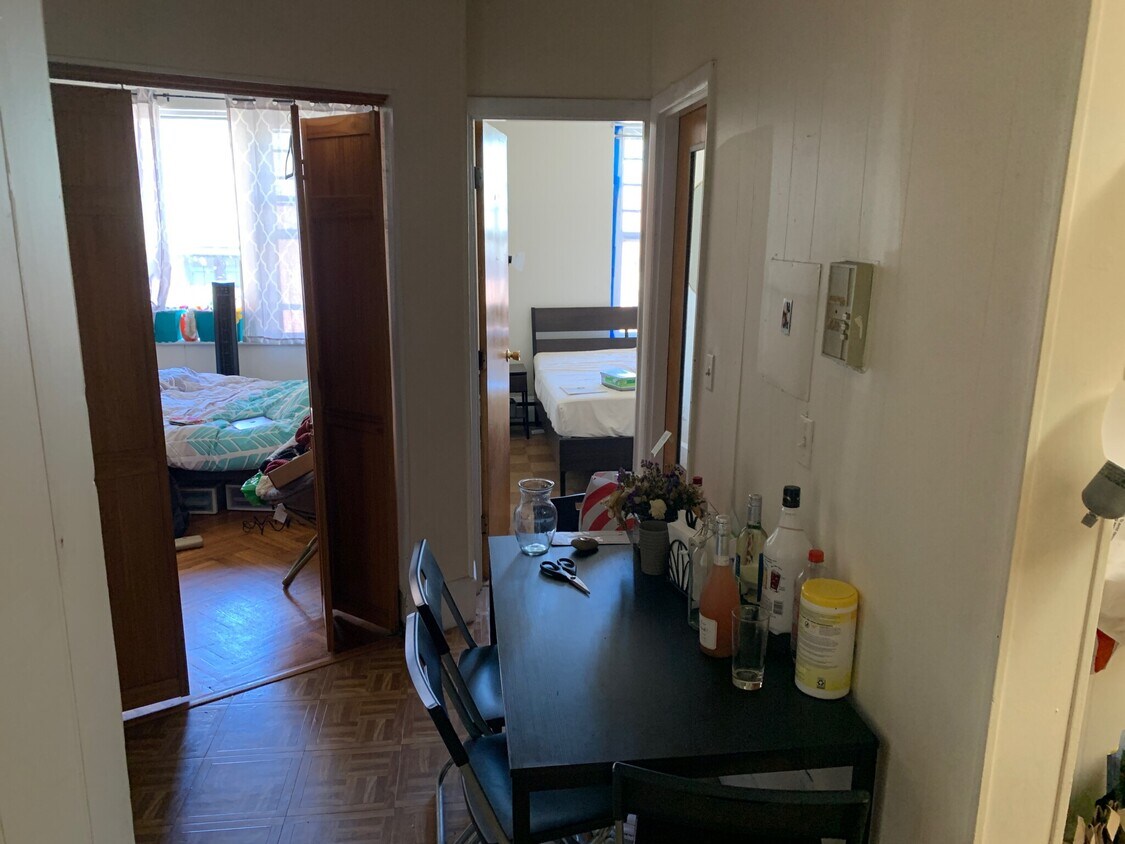
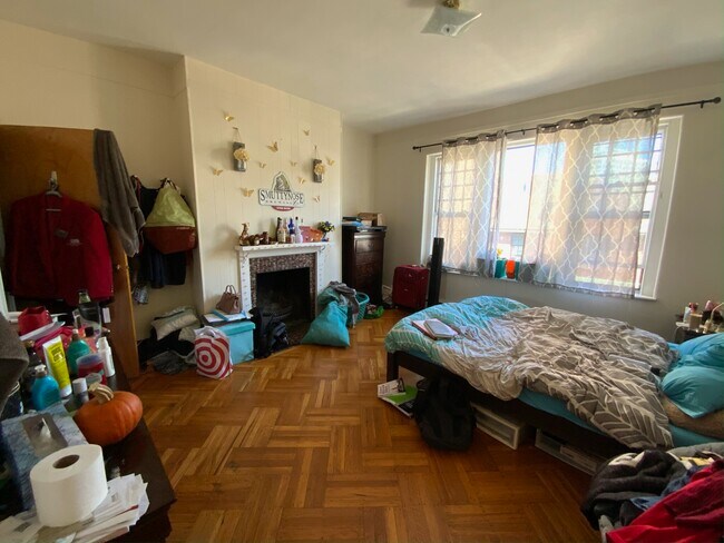
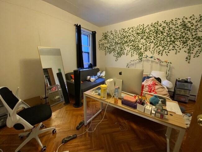
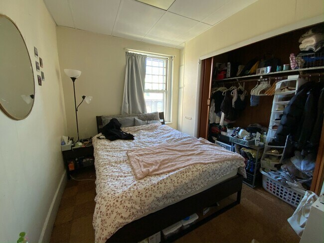
Fantastic 2 bed split right near BUGreat unit with hardwood floors, eat-in kitchen, modern bath, decorative fireplace, and laundry in basement. Great location for BU students with easy access to public transportation. Available for September 1st
11 Aberdeen St is an apartment community located in Suffolk County and the 02215 ZIP Code.
* Price shown is total price based on community-supplied monthly required fees. Excludes user-selected optional fees and variable or usage-based fees and required charges due at or prior to move-in or at move-out. Price, availability, fees, and any applicable rent special are subject to change without notice.
* Square footage definitions vary. Displayed square footage is approximate.
Apartment Features
- Smoke Free
- Laundry Facilities
Fees and Policies
The fees listed below are community-provided and may exclude utilities or add-ons. All payments are made directly to the property and are non-refundable unless otherwise specified.
- Parking
-
Street--
Details
Utilities Included
-
Water
-
Heat
-
Sewer
Property Information
-
8 units
Contact
Location
Get Directions
In a city so rich with history and culture, Fenway Park is arguably Boston’s most beloved attraction, and Audubon Circle is the perfect neighborhood for experiencing the electric energy surrounding “The Cathedral.” Although Fenway is only seven blocks from even the farthest point in Audubon Circle, it is far from the only noteworthy landmark within walking distance: amenities as diverse as Boston Beer Works, the Emerald Necklace park system, and a multiplex movie theater are all easily accessible on foot.
Most of the local apartments—which range from highly affordable to upscale-- are situated above ground-floor businesses in gorgeous historic brick buildings. Just across Saint Marys Street to the west, locals can reach a row of diverse restaurants, bakeries, and grocery stores. The Charles River and Boston University’s campus sit just a few blocks to the north; Amory Park and the New England Hebrew Academy are just minutes to the west.
Learn more about living in Audubon Circle
Education
| Colleges & Universities | Distance | ||
|---|---|---|---|
| Colleges & Universities | Distance | ||
| Walk: | 6 min | 0.3 mi | |
| Walk: | 9 min | 0.5 mi | |
| Walk: | 11 min | 0.6 mi | |
| Walk: | 12 min | 0.6 mi |
11 Aberdeen St is within 6 minutes or 0.3 mile from Lesley Univ., Art Institute. It is also near Boston University and Emmanuel College.
Transportation options available in Boston include Fenway Station, located 0.2 mile from 11 Aberdeen St. 11 Aberdeen St is near General Edward Lawrence Logan International, located 6.3 miles or 14 minutes away.
| Transit / Subway | Distance | ||
|---|---|---|---|
| Transit / Subway | Distance | ||
|
|
Walk: | 4 min | 0.2 mi |
|
|
Walk: | 4 min | 0.3 mi |
|
|
Walk: | 7 min | 0.4 mi |
|
|
Walk: | 8 min | 0.4 mi |
|
|
Walk: | 9 min | 0.5 mi |
| Commuter Rail | Distance | ||
|---|---|---|---|
| Commuter Rail | Distance | ||
|
|
Drive: | 4 min | 1.5 mi |
|
|
Drive: | 8 min | 2.0 mi |
| Drive: | 7 min | 2.9 mi | |
|
|
Drive: | 7 min | 3.7 mi |
| Drive: | 14 min | 6.8 mi |
| Airports | Distance | ||
|---|---|---|---|
| Airports | Distance | ||
|
General Edward Lawrence Logan International
|
Drive: | 14 min | 6.3 mi |
Getting Around
 What do Walkability, Transit, Drivability, and Bikeability mean?
Walkability measures the walking distance to day-to-day needs.
Transit measures access to public transportation.
Drivability measures congestion, parking availability, and access to major roads.
Bikeability measures the suitability for cycling.
How It Works
What do Walkability, Transit, Drivability, and Bikeability mean?
Walkability measures the walking distance to day-to-day needs.
Transit measures access to public transportation.
Drivability measures congestion, parking availability, and access to major roads.
Bikeability measures the suitability for cycling.
How It Works
Exceptionally Walkable
Walkability
100
/ 100
Exceptional Public Transit
Transit
90
/ 100
Somewhat Drivable
Drivability
30
/ 100
Moderately Bikeable
Bikeability
70
/ 100
Scores provided by
Busy
Soundscore™
67
/ 100
Traffic
BusyAirport
CalmBusinesses
BusyScores provided by
HowLoud What is a Sound Score Rating? A Sound Score Rating aggregates noise caused by vehicle traffic, airplane traffic and local sources. How It WorksTime and distance from 11 Aberdeen St.
| Shopping Centers | Distance | ||
|---|---|---|---|
| Shopping Centers | Distance | ||
| Walk: | 14 min | 0.8 mi | |
| Drive: | 3 min | 1.2 mi | |
| Drive: | 3 min | 1.3 mi |
11 Aberdeen St has 3 shopping centers within 1.3 miles, which is about a 3-minute drive. The miles and minutes will be for the farthest away property.
| Parks and Recreation | Distance | ||
|---|---|---|---|
| Parks and Recreation | Distance | ||
|
Coit Observatory
|
Walk: | 10 min | 0.5 mi |
|
Charles River Reservation
|
Drive: | 3 min | 1.4 mi |
|
John Fitzgerald Kennedy National Historic Site
|
Drive: | 3 min | 1.4 mi |
|
Roxbury Heritage State Park
|
Drive: | 5 min | 2.1 mi |
|
Boston Public Garden
|
Drive: | 7 min | 2.3 mi |
11 Aberdeen St has 5 parks within 2.3 miles, including Coit Observatory, Charles River Reservation, and John Fitzgerald Kennedy National Historic Site.
| Hospitals | Distance | ||
|---|---|---|---|
| Hospitals | Distance | ||
| Walk: | 11 min | 0.6 mi | |
| Walk: | 16 min | 0.9 mi | |
| Drive: | 2 min | 1.1 mi |
11 Aberdeen St has 3 hospitals within 1.1 miles, the nearest is Beth Israel Deaconess Medical Center which is 0.6 mile away and a 11 minute walk.
| Military Bases | Distance | ||
|---|---|---|---|
| Military Bases | Distance | ||
| Drive: | 28 min | 14.3 mi | |
| Drive: | 27 min | 15.3 mi | |
| Drive: | 37 min | 20.9 mi |
11 Aberdeen St has 3 military bases within 20.9 miles, the nearest is Hanscom Air Force Base which is 14.3 miles away and a 28 minute drive.
Amenities
- Smoke Free
- Laundry Facilities
11 Aberdeen St Photos
What Are Walk Score®, Transit Score®, and Bike Score® Ratings?
Walk Score® measures the walkability of any address. Transit Score® measures access to public transit. Bike Score® measures the bikeability of any address.
What is a Sound Score Rating?
A Sound Score Rating aggregates noise caused by vehicle traffic, airplane traffic and local sources.

11 Aberdeen St
Boston, MA 02215