$2,200 / Month
1080 Aileen St Unit G. Beans
Oakland, CA 94608
2 Weeks Ago
Favorites
1080 Aileen St Unit G. Beans

Favorites
Check Back Soon for Upcoming Availability
| Beds | Baths | Average SF |
|---|---|---|
| 2 Bedrooms 2 Bedrooms 2 Br | 1 Bath 1 Bath 1 Ba | 756 SF |
Fees and Policies
The fees below are based on community-supplied data and may exclude additional fees and utilities.
- Cats Allowed
-
Fees not specified
-
Weight limit--
-
Pet Limit--
- Parking
-
Surface Lot--
Details
Utilities Included
-
Trash Removal
-
Sewer
Property Information
-
3 units
About This Property
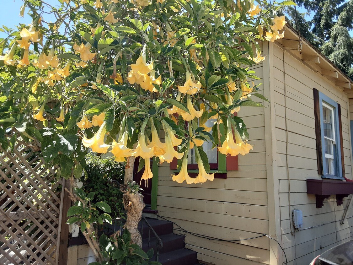
Secluded Cottage in desirable Gaskil Street neighborhood on Emeryville/Oakland border. 2bdrms, 1 bath, yard, off street parking. Close to colleges, shopping and transportation: UC Berkeley, Lincoln University, JFK University, walk to Ashby BART, Emeryville Marina, Trader Joe's, Ike's, Safeway, Gazalli's, Target, Pizza, Arizmendi Bakery, Stanford Health.
1080 Aileen St is an apartment community located in Alameda County and the 94608 ZIP Code.
Apartment Features
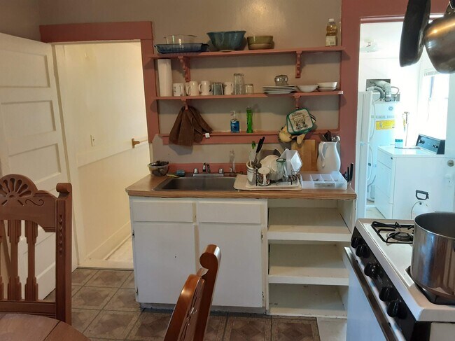
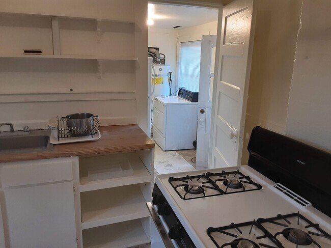
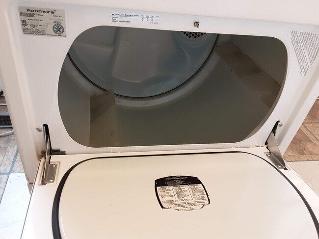
Washer/Dryer
Refrigerator
Tub/Shower
Tile Floors
- Washer/Dryer
- Heating
- Smoke Free
- Cable Ready
- Tub/Shower
- Eat-in Kitchen
- Kitchen
- Oven
- Range
- Refrigerator
- Tile Floors
- Dining Room
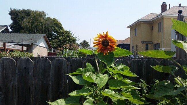
- Yard
- Garden
Location
Get Directions
Sitting directly across the I-80 from San Francisco, Oakland is a thriving city in its own right, and in recent years has become a popular home for folks seeking more affordable (and available) living arrangements than what is available across the bay without sacrificing the distinctive atmosphere.
While shipping is still a major part of the local economy, Oakland is home to the corporate headquarters for everything from established consumer brands to younger tech businesses. The cultural diversity of the city is vast, meaning that it’s easy to find art, food, and people from every corner of the world by just walking down the street.
California College of the Arts brings a creative streak to the community, which is reflected in the eclectic shops and cafes along College Avenue; In the Mosswood area, an eclectic mix of coffee houses, taverns, arts centers, and international restaurants line Telegraph Avenue, which runs all the way up to the UC Berkeley campus.
Learn more about living in OaklandBelow are rent ranges for similar nearby apartments
Amenities
- Washer/Dryer
- Heating
- Smoke Free
- Cable Ready
- Tub/Shower
- Eat-in Kitchen
- Kitchen
- Oven
- Range
- Refrigerator
- Tile Floors
- Dining Room
- Yard
- Garden
Expenses
Utilities Included
Trash Removal, Sewer
Included
Education
| Colleges & Universities | Distance | ||
|---|---|---|---|
| Colleges & Universities | Distance | ||
| Drive: | 6 min | 2.1 mi | |
| Drive: | 8 min | 2.6 mi | |
| Drive: | 7 min | 2.8 mi | |
| Drive: | 12 min | 3.8 mi |
1080 Aileen St Unit G. Beans is within 6 minutes or 2.1 miles from Samuel Merritt University. It is also near Berkeley City College and Lincoln University, Oakland.
Transportation options available in Oakland include Ashby Station, located 1.4 miles from 1080 Aileen St Unit G. Beans. 1080 Aileen St Unit G. Beans is near Metro Oakland International, located 12.1 miles or 20 minutes away, and San Francisco International, located 22.1 miles or 34 minutes away.
| Transit / Subway | Distance | ||
|---|---|---|---|
| Transit / Subway | Distance | ||
|
|
Drive: | 4 min | 1.4 mi |
|
|
Drive: | 8 min | 2.8 mi |
|
|
Drive: | 6 min | 2.8 mi |
|
|
Drive: | 7 min | 3.0 mi |
|
|
Drive: | 7 min | 3.1 mi |
| Commuter Rail | Distance | ||
|---|---|---|---|
| Commuter Rail | Distance | ||
|
|
Walk: | 14 min | 0.7 mi |
|
|
Drive: | 7 min | 3.5 mi |
|
|
Drive: | 8 min | 3.6 mi |
| Drive: | 16 min | 9.6 mi | |
| Drive: | 16 min | 9.7 mi |
| Airports | Distance | ||
|---|---|---|---|
| Airports | Distance | ||
|
Metro Oakland International
|
Drive: | 20 min | 12.1 mi |
|
San Francisco International
|
Drive: | 34 min | 22.1 mi |
Time and distance from 1080 Aileen St Unit G. Beans.
| Shopping Centers | Distance | ||
|---|---|---|---|
| Shopping Centers | Distance | ||
| Walk: | 10 min | 0.5 mi | |
| Walk: | 17 min | 0.9 mi | |
| Drive: | 6 min | 1.9 mi |
1080 Aileen St Unit G. Beans has 3 shopping centers within 1.9 miles, which is about a 6-minute walk. The miles and minutes will be for the farthest away property.
| Parks and Recreation | Distance | ||
|---|---|---|---|
| Parks and Recreation | Distance | ||
|
San Francisco Bay Trail (at Emeryville)
|
Drive: | 4 min | 1.6 mi |
|
Strawberry Creek Park
|
Drive: | 6 min | 2.2 mi |
|
Willard Park
|
Drive: | 7 min | 2.4 mi |
|
Habitot Children's Museum
|
Drive: | 8 min | 2.5 mi |
|
People's Park
|
Drive: | 9 min | 2.8 mi |
1080 Aileen St Unit G. Beans has 5 parks within 2.8 miles, including San Francisco Bay Trail (at Emeryville), Strawberry Creek Park, and Willard Park.
| Hospitals | Distance | ||
|---|---|---|---|
| Hospitals | Distance | ||
| Walk: | 19 min | 1.0 mi | |
| Drive: | 6 min | 2.1 mi | |
| Drive: | 6 min | 2.1 mi |
1080 Aileen St Unit G. Beans has 3 hospitals within 2.1 miles, the nearest is Children's Hospital & Research Center Oakland which is 1.0 mile away and a 19 minute walk.
| Military Bases | Distance | ||
|---|---|---|---|
| Military Bases | Distance | ||
| Drive: | 13 min | 5.1 mi | |
| Drive: | 15 min | 6.3 mi |
1080 Aileen St Unit G. Beans is 5.1 miles from Oakland Army Base, and is convenient to other military bases, including Alameda/US Naval Air Station Alameda.
You May Also Like
Similar Rentals Nearby


What Are Walk Score®, Transit Score®, and Bike Score® Ratings?
Walk Score® measures the walkability of any address. Transit Score® measures access to public transit. Bike Score® measures the bikeability of any address.
What is a Sound Score Rating?
A Sound Score Rating aggregates noise caused by vehicle traffic, airplane traffic and local sources

1080 Aileen St
Oakland, CA 94608