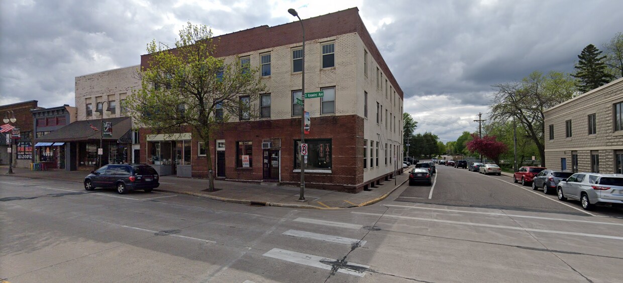
107 S Knowles Ave
107 S Knowles Ave
New Richmond, WI 54017
Favorites
107 S Knowles Ave

Favorites
Check Back Soon for Upcoming Availability
| Beds | Baths | Average SF |
|---|---|---|
| 1 Bedroom 1 Bedroom 1 Br | 1 Bath 1 Bath 1 Ba | 1,000 SF |
Fees and Policies
Details
Property Information
-
19 units
107 S Knowles Ave,
New Richmond,
WI
54017
Saint Croix Far Eastern Suburbs is an area encompassing the dynamic city of Hudson and stretches west to the more residential areas of the Greater Hudson Area. Its western border is situated off the banks of the Saint Croix River, and a 30-mile drive west on Interstate 94 will take you into the heart of Minneapolis. Stay within Saint Croix Hudson Far Eastern Suburbs to find a historic downtown area located near the river, home to local eateries and boutiques. Head outside of downtown to find nationally recognized stores and restaurants at Plaza 94 Shopping Center. Several parks, some offering riverfront views, dot the area and provide a plethora of outdoor activities as well.
The rental market in Saint Croix Far Eastern Suburbs consists of a variety of apartments and condos situated in clustered spots around the region.
Learn more about living in St Croix Far Eastern SuburbsBelow are rent ranges for similar nearby apartments
| Beds | Average Size | Lowest | Typical | Premium |
|---|---|---|---|---|
| Studio Studio Studio | 522 Sq Ft | $1,026 | $1,252 | $1,515 |
| 1 Bed 1 Bed 1 Bed | 786-796 Sq Ft | $475 | $1,423 | $1,899 |
| 2 Beds 2 Beds 2 Beds | 1091-1094 Sq Ft | $1,000 | $1,678 | $2,500 |
| 3 Beds 3 Beds 3 Beds | 1617-1622 Sq Ft | $1,252 | $2,173 | $2,850 |
| 4 Beds 4 Beds 4 Beds | 1560 Sq Ft | $1,750 | $2,040 | $2,450 |
Education
| Colleges & Universities | Distance | ||
|---|---|---|---|
| Colleges & Universities | Distance | ||
| Drive: | 37 min | 23.3 mi | |
| Drive: | 33 min | 27.3 mi | |
| Drive: | 44 min | 34.9 mi | |
| Drive: | 46 min | 37.8 mi |
107 S Knowles Ave is within 37 minutes or 23.3 miles from Univ of Wisc., River Falls. It is also near Century College and Metropolitan State University.
Walkability Near 107 S Knowles Ave New Richmond, WI 54017
Getting Around
 What do Walkability, Transit, Drivability, and Bikeability mean?
Walkability measures the walking distance to day-to-day needs.
Transit measures access to public transportation.
Drivability measures congestion, parking availability, and access to major roads.
Bikeability measures the suitability for cycling.
How It Works
What do Walkability, Transit, Drivability, and Bikeability mean?
Walkability measures the walking distance to day-to-day needs.
Transit measures access to public transportation.
Drivability measures congestion, parking availability, and access to major roads.
Bikeability measures the suitability for cycling.
How It Works
Fairly Walkable
Walkability
40
/ 100
Exceptionally Drivable
Drivability
100
/ 100
Somewhat Bikeable
Bikeability
30
/ 100
Scores provided by
-
Soundscore™
-
/ 100
Traffic
-Airport
-Businesses
-Scores provided by
HowLoud What is a Sound Score Rating? A Sound Score Rating aggregates noise caused by vehicle traffic, airplane traffic and local sources. How It WorksYou May Also Like
Similar Rentals Nearby
-
-
-
-
-
-
-
1 Bed$1,581+2 Beds$2,008+Total Monthly Price12 Month LeaseTotal Monthly Price NewPrices include base rent and required monthly fees of $6. Variable costs based on usage may apply.Base Rent:1 Bed$1,575+2 Beds$2,002+
Pets Allowed Fitness Center Pool Dishwasher Refrigerator Kitchen
-
-
1 Bed$1,596+2 Beds$2,187+3 Beds+$2,457+Total Monthly PriceTotal Monthly Price NewPrices include base rent and required monthly fees of $5. Variable costs based on usage may apply.Base Rent:1 Bed$1,590+2 Beds$2,181+3 Beds+$2,451+
Pets Allowed Fitness Center Pool Dishwasher In Unit Washer & Dryer Walk-In Closets
-
1 Bed$1,770+2 Beds$2,649+3 Beds$3,327+Total Monthly Price12 Month LeaseTotal Monthly Price NewPrices include base rent and required monthly fees of $64. Variable costs based on usage may apply.Base Rent:1 Bed$1,705+2 Beds$2,584+3 Beds$3,262+Discounts
Pets Allowed Fitness Center Pool Package Service Controlled Access EV Charging Smoke Free


What Are Walk Score®, Transit Score®, and Bike Score® Ratings?
Walk Score® measures the walkability of any address. Transit Score® measures access to public transit. Bike Score® measures the bikeability of any address.
What is a Sound Score Rating?
A Sound Score Rating aggregates noise caused by vehicle traffic, airplane traffic and local sources.

107 S Knowles Ave
New Richmond, WI 54017