
Baxter on Broadway
4901 Broadway,
Oakland, CA 94611
$2,208 - $3,319 Total Monthly Price
Studio - 3 Beds
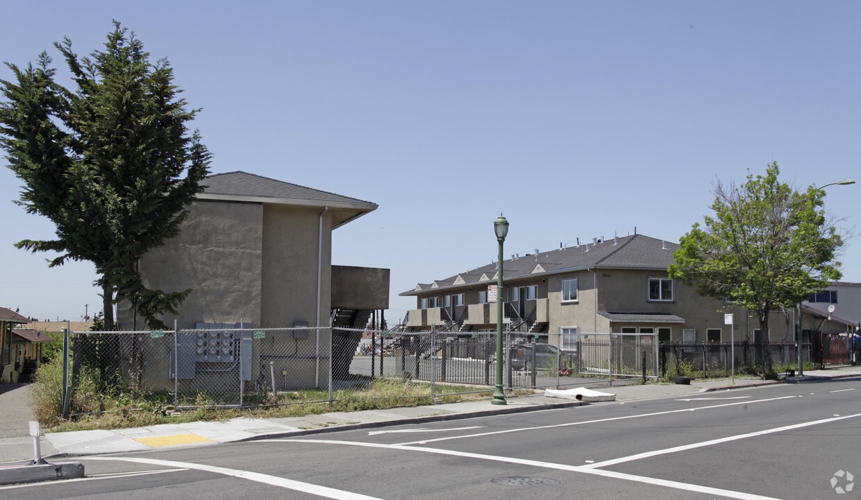
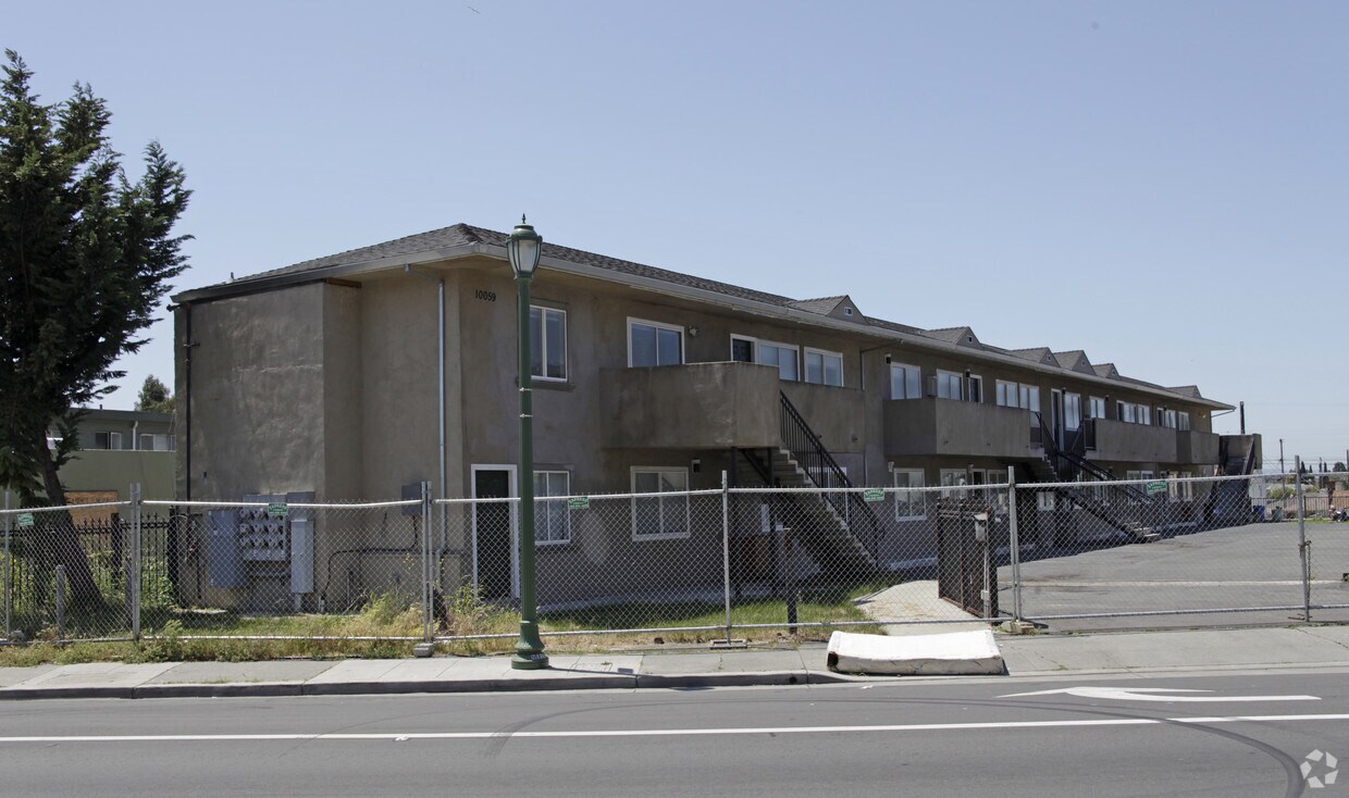
Experience Oakland living at 10031-10059 MacArthur Blvd. These apartments are located on 10031-10059 Macarthur Blvd in the 94605 area of Oakland. Here at this community, the leasing staff is ready to match you with your perfect floorplan option. Schedule a time to see the available floorplan options. Come see 10031-10059 MacArthur Blvd today.
10031-10059 MacArthur Blvd is an apartment community located in Alameda County and the 94605 ZIP Code. This area is served by the Oakland Unified School District attendance zone.
Oakland sits on the eastern shore of San Francisco Bay, anchored by Lake Merritt—the nation's first official wildlife refuge—and backed by redwood-covered hills that stretch toward the horizon. As the county seat of Alameda County and a major port city, Oakland carries real economic weight in the Bay Area, drawing employers in technology, healthcare, logistics, and the arts. California College of the Arts and Mills College contribute to a strong creative and academic presence that shapes the city's character.
Neighborhoods here cover a wide range of personalities. Rockridge offers tree-lined streets and walkable retail along College Avenue, while Temescal draws those who want a lively, arts-forward atmosphere. Uptown sits close to the historic Fox Theater and Paramount Theatre, and Jack London Square puts residents at the waterfront with ferry access to San Francisco. The Oakland Hills neighborhoods like Montclair offer sweeping Bay views and proximity to regional parks.
Learn more about living in OaklandCompare neighborhood and city base rent averages by bedroom.
| Foothill Square | Oakland, CA | |
|---|---|---|
| Studio | - | $1,734 |
| 1 Bedroom | $1,400 | $2,140 |
| 2 Bedrooms | $1,304 | $2,723 |
| 3 Bedrooms | - | $3,290 |
| Colleges & Universities | Distance | ||
|---|---|---|---|
| Colleges & Universities | Distance | ||
| Drive: | 10 min | 3.9 mi | |
| Drive: | 13 min | 8.8 mi | |
| Drive: | 18 min | 10.9 mi | |
| Drive: | 31 min | 14.4 mi |


Transportation options available in Oakland include San Leandro, located 2.6 miles from 10031-10059 MacArthur Blvd. 10031-10059 MacArthur Blvd is near Metro Oakland International, located 4.9 miles or 9 minutes away, and San Francisco International, located 29.5 miles or 39 minutes away.
| Transit / Subway | Distance | ||
|---|---|---|---|
| Transit / Subway | Distance | ||
|
|
Drive: | 6 min | 2.6 mi |
|
|
Drive: | 6 min | 3.1 mi |
|
|
Drive: | 8 min | 4.5 mi |
|
|
Drive: | 9 min | 4.6 mi |
|
|
Drive: | 9 min | 5.0 mi |
| Commuter Rail | Distance | ||
|---|---|---|---|
| Commuter Rail | Distance | ||
|
|
Drive: | 13 min | 7.8 mi |
| Drive: | 13 min | 7.8 mi | |
|
|
Drive: | 13 min | 9.1 mi |
| Drive: | 17 min | 12.6 mi | |
|
|
Drive: | 18 min | 14.2 mi |
| Airports | Distance | ||
|---|---|---|---|
| Airports | Distance | ||
|
Metro Oakland International
|
Drive: | 9 min | 4.9 mi |
|
San Francisco International
|
Drive: | 39 min | 29.5 mi |
Scores provided by
Traffic
-Airport
-Businesses
-Scores provided by
HowLoud What is a Sound Score Rating? A Sound Score Rating aggregates noise caused by vehicle traffic, airplane traffic and local sources. How It WorksTime and distance from 10031-10059 MacArthur Blvd.
| Shopping Centers | Distance | ||
|---|---|---|---|
| Shopping Centers | Distance | ||
| Walk: | 10 min | 0.6 mi | |
| Drive: | 4 min | 1.3 mi | |
| Drive: | 4 min | 1.7 mi |
| Parks and Recreation | Distance | ||
|---|---|---|---|
| Parks and Recreation | Distance | ||
|
Dunsmuir Hellman Historic Estate
|
Walk: | 15 min | 0.8 mi |
|
Arroyo Viejo Creek at the Oakland Zoo
|
Drive: | 4 min | 1.4 mi |
|
Oakland Zoo
|
Drive: | 5 min | 1.6 mi |
|
Martin Luther King Jr. Regional Shoreline
|
Drive: | 10 min | 4.3 mi |
|
Leona Canyon Regional Open Space Preserve
|
Drive: | 9 min | 4.6 mi |
| Hospitals | Distance | ||
|---|---|---|---|
| Hospitals | Distance | ||
| Drive: | 5 min | 3.6 mi | |
| Drive: | 9 min | 5.0 mi | |
| Drive: | 11 min | 5.7 mi |
| Military Bases | Distance | ||
|---|---|---|---|
| Military Bases | Distance | ||
| Drive: | 22 min | 12.4 mi |
What Are Walk Score®, Transit Score®, and Bike Score® Ratings?
Walk Score® measures the walkability of any address. Transit Score® measures access to public transit. Bike Score® measures the bikeability of any address.
What is a Sound Score Rating?
A Sound Score Rating aggregates noise caused by vehicle traffic, airplane traffic and local sources.

10031-10059 MacArthur Blvd
Oakland, CA 94605


