
$2,300
Total Monthly Price
10 Scottfield Rd Unit B33
Boston, MA 02134
2 Weeks Ago
|
Edit
Favorites
10 Scottfield Rd Unit B33

Favorites
Check Back Soon for Upcoming Availability
| Beds | Baths | Average SF |
|---|---|---|
| 2 Bedrooms 2 Bedrooms 2 Br | 1 Bath 1 Bath 1 Ba | 9,999 SF |
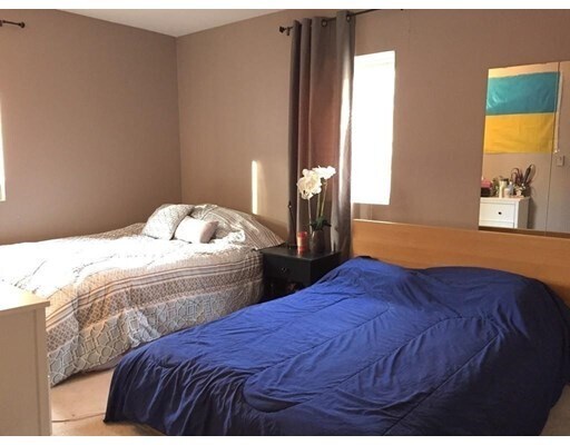
About This Property
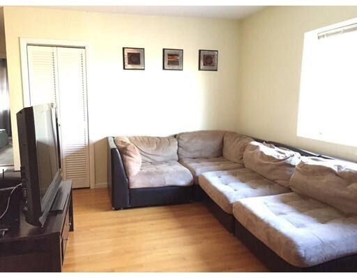
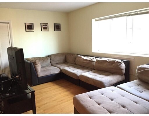
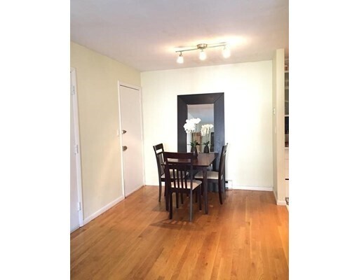
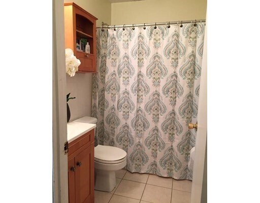
This spacious TOP floor unit is conveniently located between BU and BC with easy access to highway and public transportation. Features hardwood floors, great kitchen off dining area with complete appliances, large two bedrooms, laundry in basement, and in a professionally-managed building. Steps to restaurants, supermarkets, Gym, and T stops (B-Green Line). Small Pet negotiable
10 Scottfield Rd is a condo located in Suffolk County and the 02134 ZIP Code. This area is served by the Boston Public Schools attendance zone.
10 Scottfield Rd,
Boston,
MA
02134
Situated about five miles west of Downtown Boston, Commonwealth boasts a vibrant atmosphere with charming brick buildings, local shops, delectable restaurants, numerous entertainment options, lush parks and playgrounds, and a diverse population. Commonwealth is convenient to several renowned attractions, including the John Fitzgerald Kennedy National Historic Site, Coolidge Corner Theatre, Brookline Booksmith, and Brighton Music Hall.
Commonwealth residents also enjoy quick access to Boston College, making the area especially popular among the institution’s students, faculty, and staff. A host of T stops strewn along Commonwealth Avenue provide easy commutes and travels to Greater Boston as well as convenience to an array of metropolitan amenities.
Learn more about living in CommonwealthBelow are rent ranges for similar nearby apartments
| Beds | Average Size | Lowest | Typical | Premium |
|---|---|---|---|---|
| Studio Studio Studio | 2860-2861 Sq Ft | $1,225 | $2,268 | $8,643 |
| 1 Bed 1 Bed 1 Bed | 3097-3098 Sq Ft | $1,025 | $2,614 | $11,229 |
| 2 Beds 2 Beds 2 Beds | 3313-3315 Sq Ft | $1,174 | $3,280 | $22,315 |
| 3 Beds 3 Beds 3 Beds | 3705-3707 Sq Ft | $1,410 | $4,115 | $11,513 |
| 4 Beds 4 Beds 4 Beds | 3492-3493 Sq Ft | $900 | $5,420 | $38,000 |
Expenses
Utilities Included
Water, Trash Removal, Sewer
Included
Education
| Colleges & Universities | Distance | ||
|---|---|---|---|
| Colleges & Universities | Distance | ||
| Drive: | 3 min | 1.6 mi | |
| Drive: | 5 min | 2.2 mi | |
| Drive: | 6 min | 2.4 mi | |
| Drive: | 6 min | 2.4 mi |
10 Scottfield Rd Unit B33 is within 3 minutes or 1.6 miles from Boston University. It is also near Boston College, Brighton and Simmons College.
Schools

Public Elementary & Middle School
Grades PK-8
656 Students
Nearby
Public Middle & High School
Grades 6-12
609 Students
Nearby
Private Elementary & Middle School
Grades PK-8
263 Students
Nearby
Private Middle & High School
Grades 6-12
9 Students
Nearby
Private High School
Grades 9-12
210 Students
Nearby
School data provided by
 The GreatSchools Rating helps parents compare schools within a state based on a variety of school quality indicators and provides a helpful picture of how effectively each school serves all of its students. Ratings are on a scale of 1 (below average) to 10 (above average) and can include test scores, college readiness, academic progress, advanced courses, equity, discipline and attendance data. We also advise parents to visit schools, consider other information on school performance and programs, and consider family needs as part of the school selection process.
View GreatSchools Rating Methodology
Data provided by GreatSchools.org © 2026. All rights reserved.
View GreatSchools Rating Methodology
Data provided by GreatSchools.org © 2026. All rights reserved.
Transportation options available in Boston include Allston Street Station, located 0.2 mile from 10 Scottfield Rd Unit B33. 10 Scottfield Rd Unit B33 is near General Edward Lawrence Logan International, located 8.7 miles or 16 minutes away.
| Transit / Subway | Distance | ||
|---|---|---|---|
| Transit / Subway | Distance | ||
|
|
Walk: | 3 min | 0.2 mi |
|
|
Walk: | 3 min | 0.2 mi |
|
|
Walk: | 4 min | 0.2 mi |
|
|
Walk: | 7 min | 0.4 mi |
|
|
Walk: | 10 min | 0.5 mi |
| Commuter Rail | Distance | ||
|---|---|---|---|
| Commuter Rail | Distance | ||
|
|
Drive: | 5 min | 2.8 mi |
|
|
Drive: | 7 min | 3.2 mi |
|
|
Drive: | 8 min | 3.7 mi |
|
|
Drive: | 11 min | 4.6 mi |
| Drive: | 9 min | 4.8 mi |
| Airports | Distance | ||
|---|---|---|---|
| Airports | Distance | ||
|
General Edward Lawrence Logan International
|
Drive: | 16 min | 8.7 mi |
Walkability Near 10 Scottfield Rd Boston, MA 02134
Getting Around
 What do Walkability, Transit, Drivability, and Bikeability mean?
Walkability measures the walking distance to day-to-day needs.
Transit measures access to public transportation.
Drivability measures congestion, parking availability, and access to major roads.
Bikeability measures the suitability for cycling.
How It Works
What do Walkability, Transit, Drivability, and Bikeability mean?
Walkability measures the walking distance to day-to-day needs.
Transit measures access to public transportation.
Drivability measures congestion, parking availability, and access to major roads.
Bikeability measures the suitability for cycling.
How It Works
Very Walkable
Walkability
80
/ 100
Good Public Transit
Transit
70
/ 100
Fairly Drivable
Drivability
40
/ 100
Moderately Bikeable
Bikeability
60
/ 100
Scores provided by
Active
Soundscore™
70
/ 100
Traffic
ActiveAirport
CalmBusinesses
BusyScores provided by
HowLoud What is a Sound Score Rating? A Sound Score Rating aggregates noise caused by vehicle traffic, airplane traffic and local sources. How It WorksTime and distance from 10 Scottfield Rd Unit B33.
| Shopping Centers | Distance | ||
|---|---|---|---|
| Shopping Centers | Distance | ||
| Walk: | 8 min | 0.4 mi | |
| Walk: | 15 min | 0.8 mi | |
| Drive: | 3 min | 1.2 mi |
10 Scottfield Rd Unit B33 has 3 shopping centers within 1.2 miles, which is about a 3-minute drive. The miles and minutes will be for the farthest away property.
| Parks and Recreation | Distance | ||
|---|---|---|---|
| Parks and Recreation | Distance | ||
|
John Fitzgerald Kennedy National Historic Site
|
Walk: | 16 min | 0.8 mi |
|
Chestnut Hill Reservation
|
Drive: | 3 min | 1.6 mi |
|
Coit Observatory
|
Drive: | 4 min | 2.0 mi |
|
Frederick Law Olmsted National Historic Site
|
Drive: | 6 min | 2.1 mi |
|
Charles River Reservation
|
Drive: | 7 min | 3.1 mi |
10 Scottfield Rd Unit B33 has 5 parks within 3.1 miles, including John Fitzgerald Kennedy National Historic Site, Chestnut Hill Reservation, and Coit Observatory.
| Hospitals | Distance | ||
|---|---|---|---|
| Hospitals | Distance | ||
| Walk: | 8 min | 0.4 mi | |
| Walk: | 12 min | 0.6 mi | |
| Walk: | 19 min | 1.0 mi |
10 Scottfield Rd Unit B33 has 3 hospitals within 1.0 mile, the nearest is Franciscan Children's Hospital & Rehab Center which is 0.4 mile away and a 8 minute walk.
| Military Bases | Distance | ||
|---|---|---|---|
| Military Bases | Distance | ||
| Drive: | 27 min | 13.8 mi | |
| Drive: | 24 min | 14.1 mi |
10 Scottfield Rd Unit B33 is 13.8 miles from Hanscom Air Force Base, and is convenient to other military bases, including US Military Reservation.
You May Also Like
Similar Rentals Nearby


What Are Walk Score®, Transit Score®, and Bike Score® Ratings?
Walk Score® measures the walkability of any address. Transit Score® measures access to public transit. Bike Score® measures the bikeability of any address.
What is a Sound Score Rating?
A Sound Score Rating aggregates noise caused by vehicle traffic, airplane traffic and local sources.

10 Scottfield Rd
Boston, MA 02134