
$2,600
Total Monthly Price
12 Month Lease
10 High St Unit 2
Natick, MA 01760
1 Day Ago
|
Edit
Favorites
-
Bedrooms
2
-
Bathrooms
2
-
Square Feet
1,300 sq ft
-
Available
Available Dec 15
Highlights
- Pets Allowed
- Basement
- Deck
10 High St Unit 2

Favorites
About This Home
12 Month Lease,
$2,600 deposit,
Available Dec 15
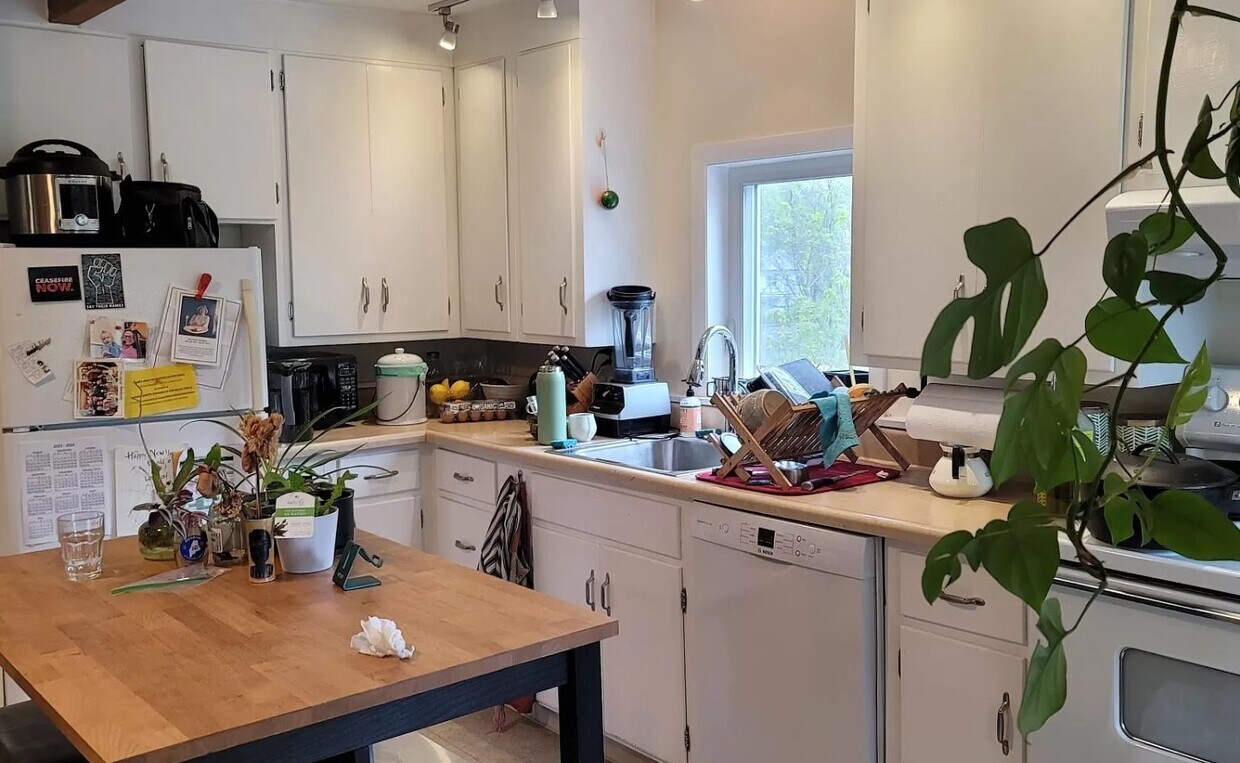
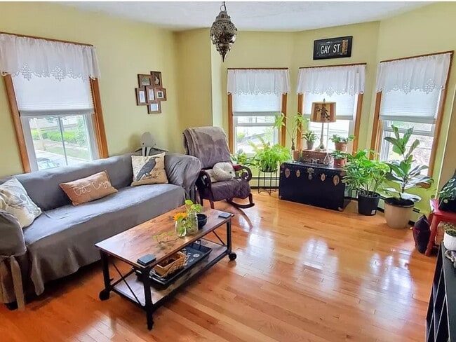
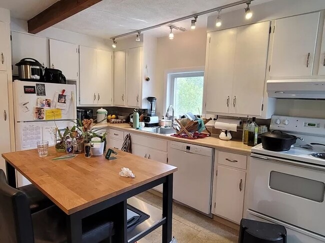
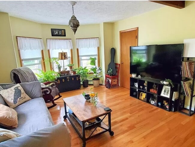
Available December 15th. Two floor, two bedroom, 2 full bathrooms, plus a bonus room office! Located on the 2nd and 3rd floor (top floors) of three unit building. Large living room and eat in kitchen w/ dishwasher. Office room had sliding doors with private deck. 2 off street parking included, laundry in basement First and 1 month security due at signing. Video tour available
10 High St is an apartment community located in Middlesex County and the 01760 ZIP Code.
* Price shown is total price based on community-supplied monthly required fees. Excludes user-selected optional fees and variable or usage-based fees and required charges due at or prior to move-in or at move-out. Price, availability, fees, and any applicable rent special are subject to change without notice.
* Square footage definitions vary. Displayed square footage is approximate.
Apartment Features
Dishwasher
Office
Basement
Eat-in Kitchen
- Dishwasher
- Eat-in Kitchen
- Basement
- Office
- Laundry Facilities
- Deck
Fees and Policies
The fees below are based on community-supplied data and may exclude additional fees and utilities.
- One-Time Move-In Fees
-
Broker Fee$0
- Dogs Allowed
-
Fees not specified
- Cats Allowed
-
Fees not specified
Details
Utilities Included
-
Water
-
Trash Removal
-
Sewer
Property Information
-
3 units
Contact
- Listed by Tom Giblin
- Contact
Location
Get Directions
Just west of Boston and East of Worcester sits Metro West, a region that houses a group of towns and cities with significant historical backgrounds. A total of 19 municipalities make up the core of this community, but other municipalities are considered to be a part of the Interstate 495/Metro West Corridor.
Learn more about living in Metro West
Education
| Colleges & Universities | Distance | ||
|---|---|---|---|
| Colleges & Universities | Distance | ||
| Drive: | 8 min | 3.2 mi | |
| Drive: | 10 min | 5.2 mi | |
| Drive: | 11 min | 5.8 mi | |
| Drive: | 20 min | 9.8 mi |
10 High St Unit 2 is within 8 minutes or 3.2 miles from Wellesley College. It is also near Babson College and Framingham State College.
Transportation options available in Natick include Woodland Station, located 7.3 miles from 10 High St Unit 2. 10 High St Unit 2 is near General Edward Lawrence Logan International, located 21.3 miles or 35 minutes away, and Worcester Regional, located 29.8 miles or 51 minutes away.
| Transit / Subway | Distance | ||
|---|---|---|---|
| Transit / Subway | Distance | ||
|
|
Drive: | 13 min | 7.3 mi |
|
|
Drive: | 15 min | 7.4 mi |
|
|
Drive: | 15 min | 8.0 mi |
|
|
Drive: | 16 min | 8.6 mi |
|
|
Drive: | 17 min | 8.8 mi |
| Commuter Rail | Distance | ||
|---|---|---|---|
| Commuter Rail | Distance | ||
|
|
Walk: | 14 min | 0.8 mi |
|
|
Drive: | 4 min | 2.0 mi |
|
|
Drive: | 7 min | 3.4 mi |
|
|
Drive: | 8 min | 3.5 mi |
|
|
Drive: | 7 min | 3.5 mi |
| Airports | Distance | ||
|---|---|---|---|
| Airports | Distance | ||
|
General Edward Lawrence Logan International
|
Drive: | 35 min | 21.3 mi |
|
Worcester Regional
|
Drive: | 51 min | 29.8 mi |
Time and distance from 10 High St Unit 2.
| Shopping Centers | Distance | ||
|---|---|---|---|
| Shopping Centers | Distance | ||
| Drive: | 2 min | 1.4 mi | |
| Drive: | 4 min | 1.8 mi | |
| Drive: | 5 min | 1.9 mi |
10 High St Unit 2 has 3 shopping centers within 1.9 miles, which is about a 5-minute drive. The miles and minutes will be for the farthest away property.
| Parks and Recreation | Distance | ||
|---|---|---|---|
| Parks and Recreation | Distance | ||
|
Wellesley College Botanic Gardens
|
Drive: | 4 min | 2.6 mi |
|
Mass Audubon's Broadmoor Wildlife Sanctuary
|
Drive: | 6 min | 2.8 mi |
|
Natick Community Organic Farm
|
Drive: | 6 min | 2.9 mi |
|
Lookout Farm
|
Drive: | 7 min | 3.1 mi |
|
Cochituate State Park
|
Drive: | 19 min | 11.5 mi |
10 High St Unit 2 has 5 parks within 11.5 miles, including Natick Community Organic Farm, Mass Audubon's Broadmoor Wildlife Sanctuary, and Wellesley College Botanic Gardens.
| Hospitals | Distance | ||
|---|---|---|---|
| Hospitals | Distance | ||
| Drive: | 8 min | 3.8 mi | |
| Drive: | 13 min | 7.0 mi | |
| Drive: | 13 min | 7.1 mi |
10 High St Unit 2 has 3 hospitals within 7.1 miles, the nearest is MetroWest Medical Center which is 3.8 miles away and a 8 minute drive.
| Military Bases | Distance | ||
|---|---|---|---|
| Military Bases | Distance | ||
| Walk: | 16 min | 0.9 mi | |
| Drive: | 30 min | 16.2 mi |
10 High St Unit 2 is 0.9 mile from US Military Reservation, and is convenient to other military bases, including Hanscom Air Force Base.
Amenities
- Dishwasher
- Eat-in Kitchen
- Basement
- Office
- Laundry Facilities
- Deck
10 High St Unit 2 Photos
What Are Walk Score®, Transit Score®, and Bike Score® Ratings?
Walk Score® measures the walkability of any address. Transit Score® measures access to public transit. Bike Score® measures the bikeability of any address.
What is a Sound Score Rating?
A Sound Score Rating aggregates noise caused by vehicle traffic, airplane traffic and local sources

10 High St
Natick, MA 01760