$2,800
/ Month
111 Wolcott St
Brooklyn, NY 11231
2 Weeks Ago
|
Edit
Favorites
WOLCOTT STREET

Favorites
Check Back Soon for Upcoming Availability
| Beds | Baths | Average SF |
|---|---|---|
| 2 Bedrooms 2 Bedrooms 2 Br | 1 Bath 1 Bath 1 Ba | — |
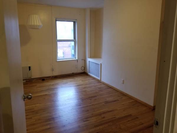
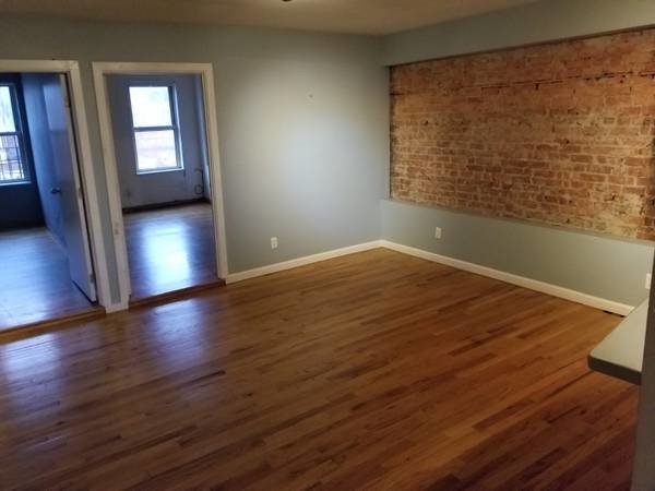
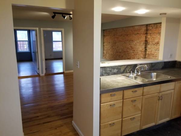
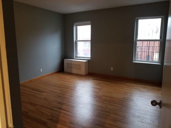
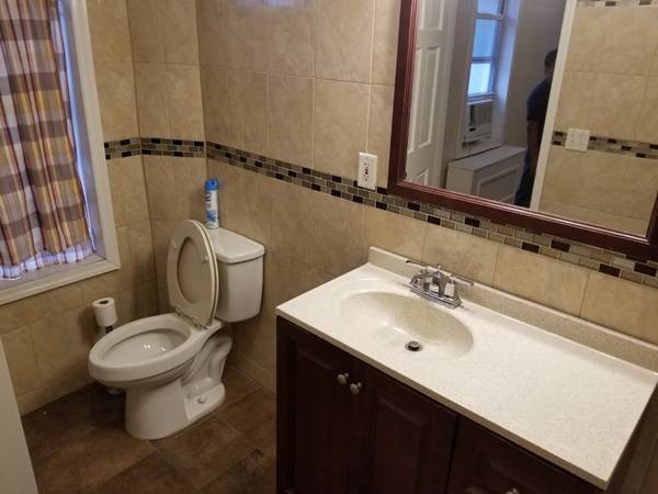
About This Property
Description coming soon, please contact your Highline Residential agent for more information===Ref:613843===
WOLCOTT STREET is an apartment community located in Kings County and the 11231 ZIP Code.
111 Wolcott St,
Brooklyn,
NY
11231
Once a thriving shipping and port area, Red Hook has transformed into an eclectic seaside neighborhood possessing a close-knit community. Located on a peninsula in Brooklyn overlooking the Upper New York Bay and smaller waterways like Gowanus Bay, Red Hook houses many brick buildings, charming storefronts, and longstanding homes, townhomes, and apartment buildings.
The local businesses in Red Hook are what you would expect from a seaside village – charming, unique, and welcoming. From restaurants and bars to breweries and markets, you’ll find plenty of local charm in this neighborhood – not to mention the artistic vibe that exudes from local art galleries and museums.
Learn more about living in Red HookBelow are rent ranges for similar nearby apartments
Education
| Colleges & Universities | Distance | ||
|---|---|---|---|
| Colleges & Universities | Distance | ||
| Drive: | 7 min | 2.3 mi | |
| Drive: | 6 min | 2.3 mi | |
| Drive: | 6 min | 2.5 mi | |
| Drive: | 7 min | 3.3 mi |
WOLCOTT STREET is within 6 minutes or 2.3 miles from St. Francis College. It is also near Brooklyn Law School and ASA College Brooklyn.
Transportation options available in Brooklyn include Smith-9 Streets, located 1.5 miles from WOLCOTT STREET. WOLCOTT STREET is near LaGuardia, located 12.6 miles or 23 minutes away, and Newark Liberty International, located 16.2 miles or 28 minutes away.
| Transit / Subway | Distance | ||
|---|---|---|---|
| Transit / Subway | Distance | ||
|
|
Drive: | 4 min | 1.5 mi |
|
|
Drive: | 4 min | 1.6 mi |
|
|
Drive: | 5 min | 1.8 mi |
|
|
Drive: | 5 min | 2.0 mi |
|
|
Drive: | 5 min | 2.1 mi |
| Commuter Rail | Distance | ||
|---|---|---|---|
| Commuter Rail | Distance | ||
|
|
Drive: | 9 min | 3.0 mi |
|
|
Drive: | 13 min | 4.5 mi |
|
|
Drive: | 18 min | 7.4 mi |
|
|
Drive: | 19 min | 7.5 mi |
|
|
Drive: | 20 min | 7.9 mi |
| Airports | Distance | ||
|---|---|---|---|
| Airports | Distance | ||
|
LaGuardia
|
Drive: | 23 min | 12.6 mi |
|
Newark Liberty International
|
Drive: | 28 min | 16.2 mi |
Walkability Near WOLCOTT STREET
Getting Around
 What do Walkability, Transit, Drivability, and Bikeability mean?
Walkability measures the walking distance to day-to-day needs.
Transit measures access to public transportation.
Drivability measures congestion, parking availability, and access to major roads.
Bikeability measures the suitability for cycling.
How It Works
What do Walkability, Transit, Drivability, and Bikeability mean?
Walkability measures the walking distance to day-to-day needs.
Transit measures access to public transportation.
Drivability measures congestion, parking availability, and access to major roads.
Bikeability measures the suitability for cycling.
How It Works
Exceptionally Walkable
Walkability
100
/ 100
Exceptional Public Transit
Transit
90
/ 100
Moderately Drivable
Drivability
60
/ 100
Very Bikeable
Bikeability
80
/ 100
Scores provided by
-
Soundscore™
-
/ 100
Traffic
-Airport
-Businesses
-Scores provided by
HowLoud What is a Sound Score Rating? A Sound Score Rating aggregates noise caused by vehicle traffic, airplane traffic and local sources. How It WorksTime and distance from WOLCOTT STREET.
| Shopping Centers | Distance | ||
|---|---|---|---|
| Shopping Centers | Distance | ||
| Drive: | 9 min | 3.0 mi | |
| Drive: | 7 min | 3.5 mi | |
| Drive: | 10 min | 4.0 mi |
WOLCOTT STREET has 3 shopping centers within 4.0 miles, which is about a 10-minute drive. The miles and minutes will be for the farthest away property.
| Parks and Recreation | Distance | ||
|---|---|---|---|
| Parks and Recreation | Distance | ||
|
Waterfront Museum & Showboat Barge
|
Walk: | 5 min | 0.3 mi |
|
Valentino Pier
|
Walk: | 6 min | 0.3 mi |
|
Coffey Park
|
Walk: | 6 min | 0.3 mi |
|
Red Hook Park
|
Drive: | 2 min | 1.1 mi |
|
Cobble Hill Park
|
Drive: | 5 min | 1.6 mi |
WOLCOTT STREET has 5 parks within 1.6 miles, including Waterfront Museum & Showboat Barge, Valentino Pier, and Coffey Park.
| Hospitals | Distance | ||
|---|---|---|---|
| Hospitals | Distance | ||
| Drive: | 8 min | 2.8 mi | |
| Drive: | 9 min | 3.0 mi | |
| Drive: | 12 min | 5.5 mi |
WOLCOTT STREET has 3 hospitals within 5.5 miles, the nearest is New York-Presbyterian Brooklyn Methodist Hospital which is 2.8 miles away and a 8 minute drive.
| Military Bases | Distance | ||
|---|---|---|---|
| Military Bases | Distance | ||
| Drive: | 10 min | 4.7 mi | |
| Drive: | 26 min | 13.5 mi |
WOLCOTT STREET is 4.7 miles from Governors Island Support Center, and is convenient to other military bases, including Military Ocean Terminal.
You May Also Like
Similar Rentals Nearby


What Are Walk Score®, Transit Score®, and Bike Score® Ratings?
Walk Score® measures the walkability of any address. Transit Score® measures access to public transit. Bike Score® measures the bikeability of any address.
What is a Sound Score Rating?
A Sound Score Rating aggregates noise caused by vehicle traffic, airplane traffic and local sources.

111 Wolcott St
Brooklyn, NY 11231