Westerville Commons

601 W Main St, Westerville, OH 43081

Share Listing
Favorites
Westerville Commons
Share Listing
Favorites

About Westerville Commons

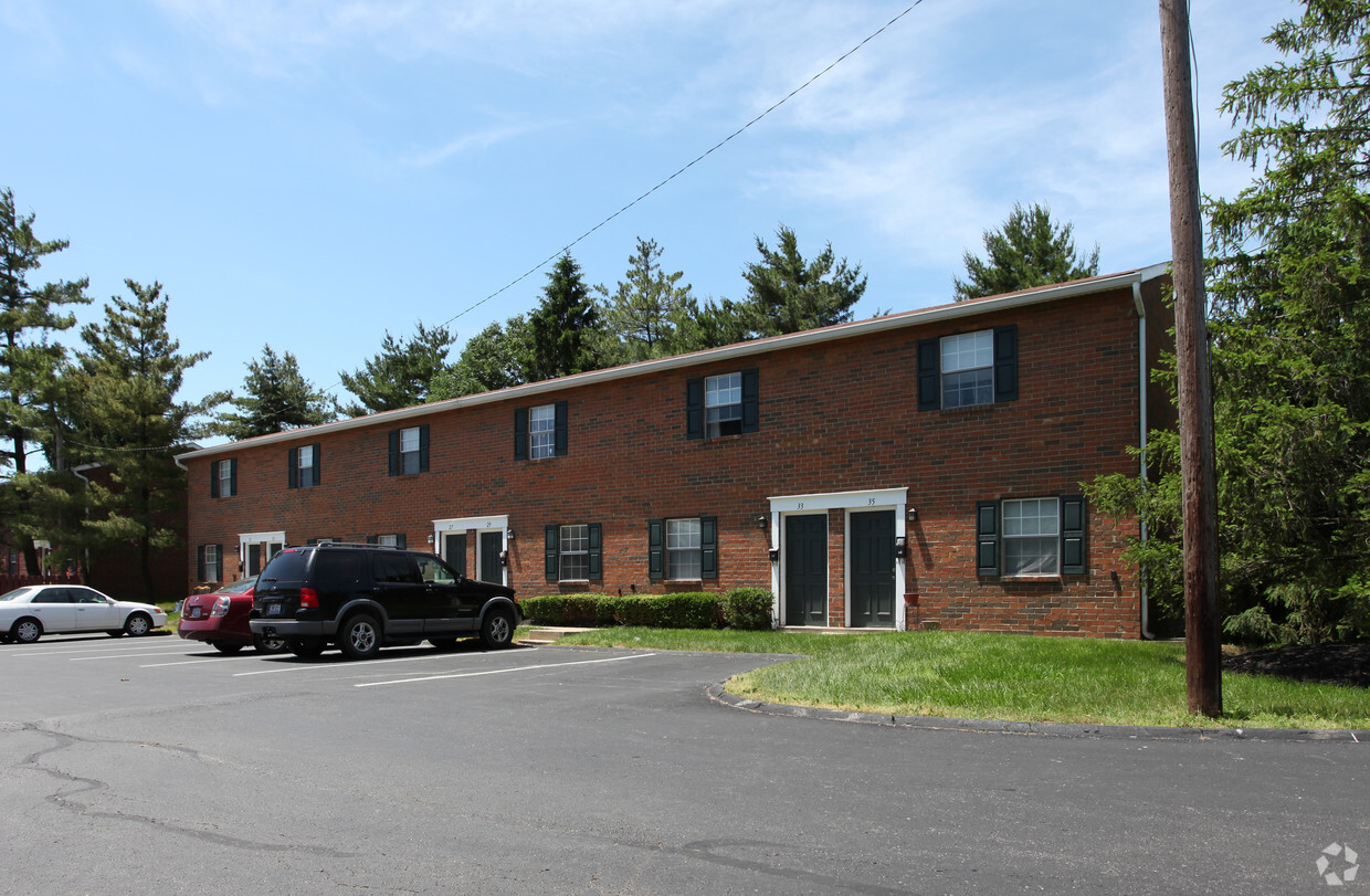
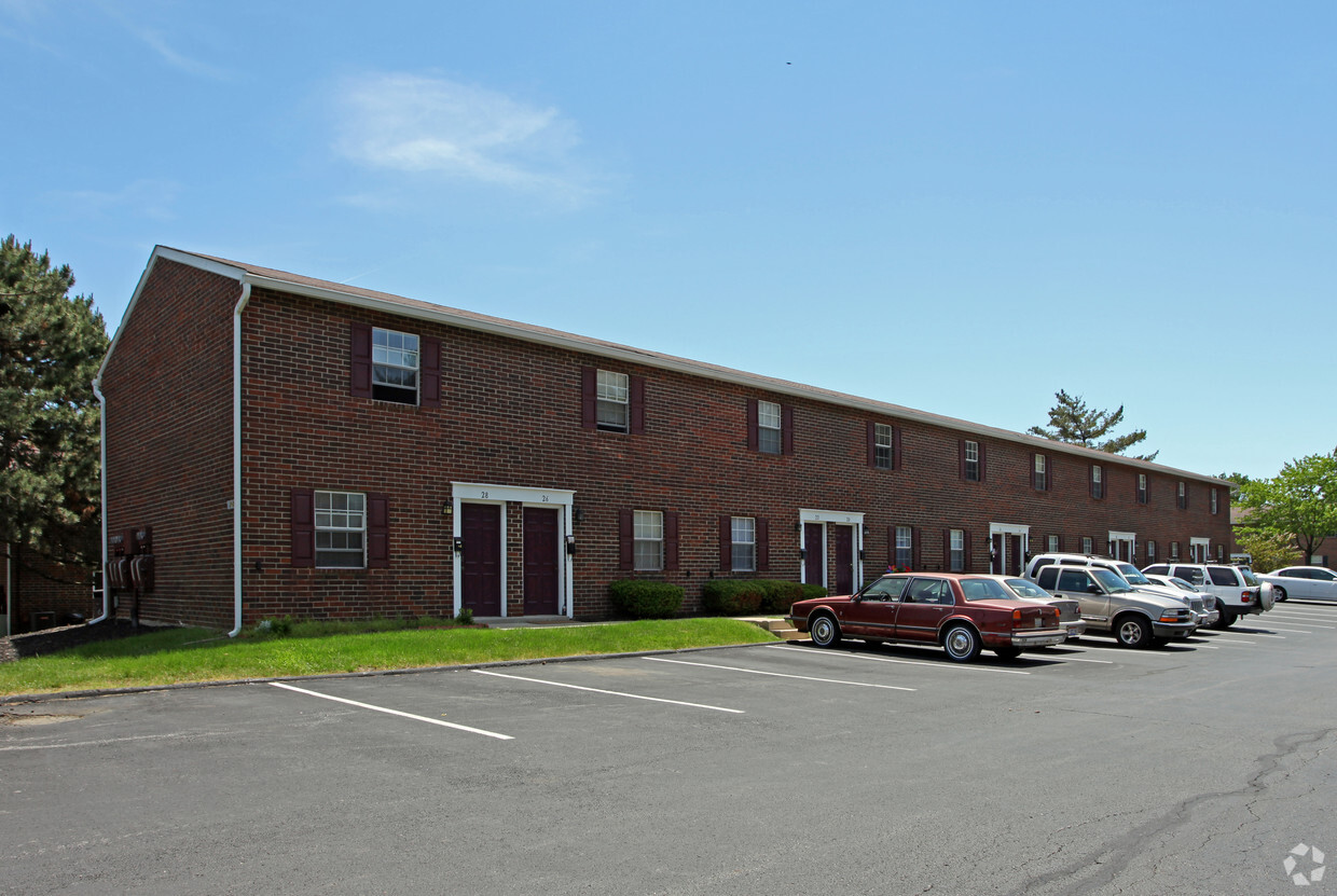
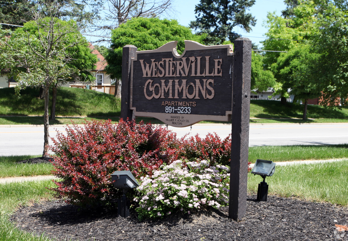
Explore a new place to live at Westerville Commons in Westerville. These apartments are located in Westerville on W. Main St.. Come by to check out the current floorplan options. From pricing to features, the leasing team is excited to help you find your perfect place. It's time to find your next place. Contact or stop by Westerville Commons to schedule a tour!

Westerville Commons is an apartment community located in Franklin County and the 43081 ZIP Code. This area is served by the Westerville City School District attendance zone.

Community Amenities

  • Walk-Up

Apartment Features

Air Conditioning

Washer/Dryer Hookup

High Speed Internet Access

Refrigerator

  • High Speed Internet Access
  • Washer/Dryer Hookup
  • Air Conditioning
  • Heating
  • Smoke Free
  • Tub/Shower
  • Kitchen
  • Oven
  • Range
  • Refrigerator
  • Window Coverings
Location
601 W Main St, Westerville,
OH 43081
Get Directions
Neighborhood

Around 15 miles outside of the center of Columbus, Ohio, Outer Northeast Columbus includes the neighborhoods of Westerville and Huber Ridge. The area has an abundant selection of parks, lakes and golf courses, attracting people who seek outdoor recreation. Both Interstate 71 and Highway 270 border Outer Northeast Columbus, making travel to downtown and other areas of the city simple and convenient.

Many families flock to outer northeast Columbus for its recreation and amenities. Westerville includes plenty of dining and shopping options, along with excellent residential neighborhoods and schools. Residents find refuge from busier areas of the city while enjoying the benefits of easy commutes, along with plenty of opportunities for fun and entertainment.

Learn more about living in Northeast Columbus 
Education
Colleges & Universities Distance
Walk: 17 min 0.9 mi
Drive: 20 min 10.7 mi
Drive: 18 min 11.3 mi
Drive: 20 min 12.4 mi
Westerville Commons is within 17 minutes or 0.9 mile from Otterbein College. It is also near Ohio Dominican University and Columbus State C.C., Delaware.
Schools
Public Elementary School
Grades K-5
361 Students
Nearby
Public Elementary School
Grades PK-5
311 Students
Nearby
Public Elementary School
Grades K-5
405 Students
Attendance Zone
Public Middle School
Grades 6-8
594 Students
Attendance Zone
Public High School
Grades 9-12
1,429 Students
Attendance Zone
Private Elementary & Middle School
Grades PK-8
831 Students
Nearby
Private Elementary School
Grades PK-5
243 Students
Nearby
Private Elementary, Middle & High School
Grades K-12
350 Students
Nearby
Transportation

Westerville Commons is near John Glenn Columbus International, located 13.0 miles or 19 minutes away, and Rickenbacker International, located 27.4 miles or 37 minutes away.

Airports Distance
Airports Distance
John Glenn Columbus International
Drive: 19 min 13.0 mi
Rickenbacker International
Drive: 37 min 27.4 mi

Walkability Near Westerville Commons

Getting Around
Fairly Walkable
Walkability
50 / 100
Limited Public Transit
Transit
30 / 100
Exceptionally Drivable
Drivability
100 / 100
Moderately Bikeable
Bikeability
70 / 100

Scores provided by

What do Walkability, Transit, Drivability, and Bikeability mean? Walkability measures the walking distance to day-to-day needs. Transit measures access to public transportation. Drivability measures congestion, parking availability, and access to major roads. Bikeability measures the suitability for cycling. How It Works
Active
Soundscore
71 / 100

Traffic

Busy

Airport

Calm

Businesses

Calm

Scores provided by

HowLoud What is a Sound Score Rating? A Sound Score Rating aggregates noise caused by vehicle traffic, airplane traffic and local sources. How It Works
Points of Interest

Time and distance from Westerville Commons.

Shopping Centers Distance
Walk: 5 min 0.3 mi
Drive: 3 min 1.3 mi
Drive: 3 min 1.3 mi
Westerville Commons has 3 shopping centers within 1.3 miles, which is about a 3-minute drive. The miles and minutes will be for the farthest away property.
Parks and Recreation Distance
Weitkamp Observatory
Walk: 16 min 0.9 mi
Sharon Woods Metro Park
Drive: 6 min 1.6 mi
Rocky Fork Metro Park
Drive: 6 min 3.8 mi
Inniswood Gardens
Drive: 10 min 4.3 mi
Highbanks Metro Park
Drive: 13 min 6.5 mi
Westerville Commons has 5 parks within 6.5 miles, including Weitkamp Observatory, Sharon Woods Metro Park, and Rocky Fork Metro Park.
Hospitals Distance
Hospitals Distance
Walk: 15 min 0.8 mi
Drive: 9 min 4.6 mi
Drive: 17 min 10.8 mi
Westerville Commons has 3 hospitals within 10.8 miles, the nearest is Mount Carmel St. Ann's which is 0.8 mile away and a 15 minute walk.
Military Bases Distance
Drive: 40 min 28.7 mi
Drive: 76 min 60.3 mi
Drive: 89 min 74.3 mi
Westerville Commons has 3 military bases within 74.3 miles, the nearest is Rickenbacker Air Force Base which is 28.7 miles away and a 40 minute drive.

Explore Similar Rentals Nearby