
Jersey Walk
925 E Jersey St,
Elizabeth, NJ 07201
$2,000 - $3,000
Studio - 2 Beds
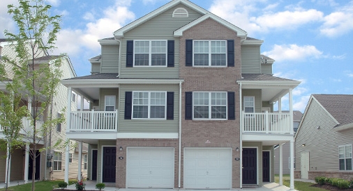

WE HAVE AN ACTIVE WAITING LIST AND ARE ALWAYS ACCEPTING APPLICATIONS - Please contact us for availability!! * The amount of time one has to wait varies, so please contact our office for more information. Our community offers 1, 2 and 3 bedroom apartment homes. Located in the Port section of Elizabeth, this community is across the street from the Elizabeth Marina and Park. Water’s Edge Crescent is an affordable rental community and income restrictions apply.
Water's Edge Crescent is a townhouse community located in Union County and the 07206 ZIP Code. This area is served by the Elizabeth Public School District attendance zone.
Unique Features
Aire acondicionado
Lavavajillas
Acceso a Internet de alta velocidad
Microondas
Living in Elizabeth, New Jersey combines metropolitan accessibility with historical significance, just 20 miles from Manhattan. The city offers various housing options, from historic single-family homes to apartments, with average rents ranging from $1,371 for studios to $2,013 for three-bedroom units. Elizabeth's neighborhoods each showcase distinct characteristics - the Midtown district features Art Deco architecture, while the Elizabethport area near the waterfront has experienced recent development. The Elmora and Peterstown areas maintain their established cultural heritage through local markets and architecture.
Elizabeth's position as a transportation hub includes multiple train stations providing direct access to Newark and New York City. The Mills at Jersey Gardens outlet mall and the Port Newark-Elizabeth Marine Terminal contribute to the local economy. For outdoor recreation, Warinanco Park offers boating facilities and seasonal activities.
Learn more about living in Elizabeth| Colleges & Universities | Distance | ||
|---|---|---|---|
| Colleges & Universities | Distance | ||
| Drive: | 7 min | 2.3 mi | |
| Drive: | 11 min | 4.0 mi | |
| Drive: | 15 min | 6.7 mi | |
| Drive: | 19 min | 9.7 mi |


Transportation options available in Elizabeth include 8Th Street Light Rail Station, located 8.3 miles from Water's Edge Crescent. Water's Edge Crescent is near Newark Liberty International, located 8.1 miles or 15 minutes away, and LaGuardia, located 25.9 miles or 49 minutes away.
| Transit / Subway | Distance | ||
|---|---|---|---|
| Transit / Subway | Distance | ||
| Drive: | 16 min | 8.3 mi | |
|
|
Drive: | 18 min | 9.6 mi |
|
|
Drive: | 18 min | 10.4 mi |
|
|
Drive: | 19 min | 10.4 mi |
|
|
Drive: | 19 min | 10.5 mi |
| Commuter Rail | Distance | ||
|---|---|---|---|
| Commuter Rail | Distance | ||
|
|
Drive: | 7 min | 2.6 mi |
|
|
Drive: | 9 min | 3.7 mi |
|
|
Drive: | 11 min | 4.4 mi |
|
|
Drive: | 13 min | 4.9 mi |
|
|
Drive: | 14 min | 5.9 mi |
| Airports | Distance | ||
|---|---|---|---|
| Airports | Distance | ||
|
Newark Liberty International
|
Drive: | 15 min | 8.1 mi |
|
LaGuardia
|
Drive: | 49 min | 25.9 mi |
Scores provided by
Traffic
-Airport
-Businesses
-Scores provided by
HowLoud What is a Sound Score Rating? A Sound Score Rating aggregates noise caused by vehicle traffic, airplane traffic and local sources. How It WorksTime and distance from Water's Edge Crescent.
| Shopping Centers | Distance | ||
|---|---|---|---|
| Shopping Centers | Distance | ||
| Drive: | 5 min | 1.5 mi | |
| Drive: | 6 min | 2.0 mi | |
| Drive: | 6 min | 2.4 mi |
| Parks and Recreation | Distance | ||
|---|---|---|---|
| Parks and Recreation | Distance | ||
|
Staten Island Industrial Park
|
Drive: | 12 min | 5.8 mi |
|
Willowbrook Park
|
Drive: | 14 min | 6.6 mi |
|
Westerleigh Park
|
Drive: | 14 min | 6.7 mi |
|
Faber Park
|
Drive: | 14 min | 7.1 mi |
|
G. Thomas DiDomenico Park
|
Drive: | 18 min | 8.7 mi |
| Hospitals | Distance | ||
|---|---|---|---|
| Hospitals | Distance | ||
| Drive: | 7 min | 2.4 mi | |
| Drive: | 13 min | 6.5 mi | |
| Drive: | 16 min | 7.7 mi |
| Military Bases | Distance | ||
|---|---|---|---|
| Military Bases | Distance | ||
| Drive: | 20 min | 11.0 mi | |
| Drive: | 23 min | 11.3 mi |
What Are Walk Score®, Transit Score®, and Bike Score® Ratings?
Walk Score® measures the walkability of any address. Transit Score® measures access to public transit. Bike Score® measures the bikeability of any address.
What is a Sound Score Rating?
A Sound Score Rating aggregates noise caused by vehicle traffic, airplane traffic and local sources.

80 Magnolia Ave
Elizabeth, NJ 07206


