
Lux: Wonderland in Crossroads / Katz on Main
1923 Broadway Blvd,
Kansas City, MO 64108
$1,157 - $2,925
Studio - 2 Beds
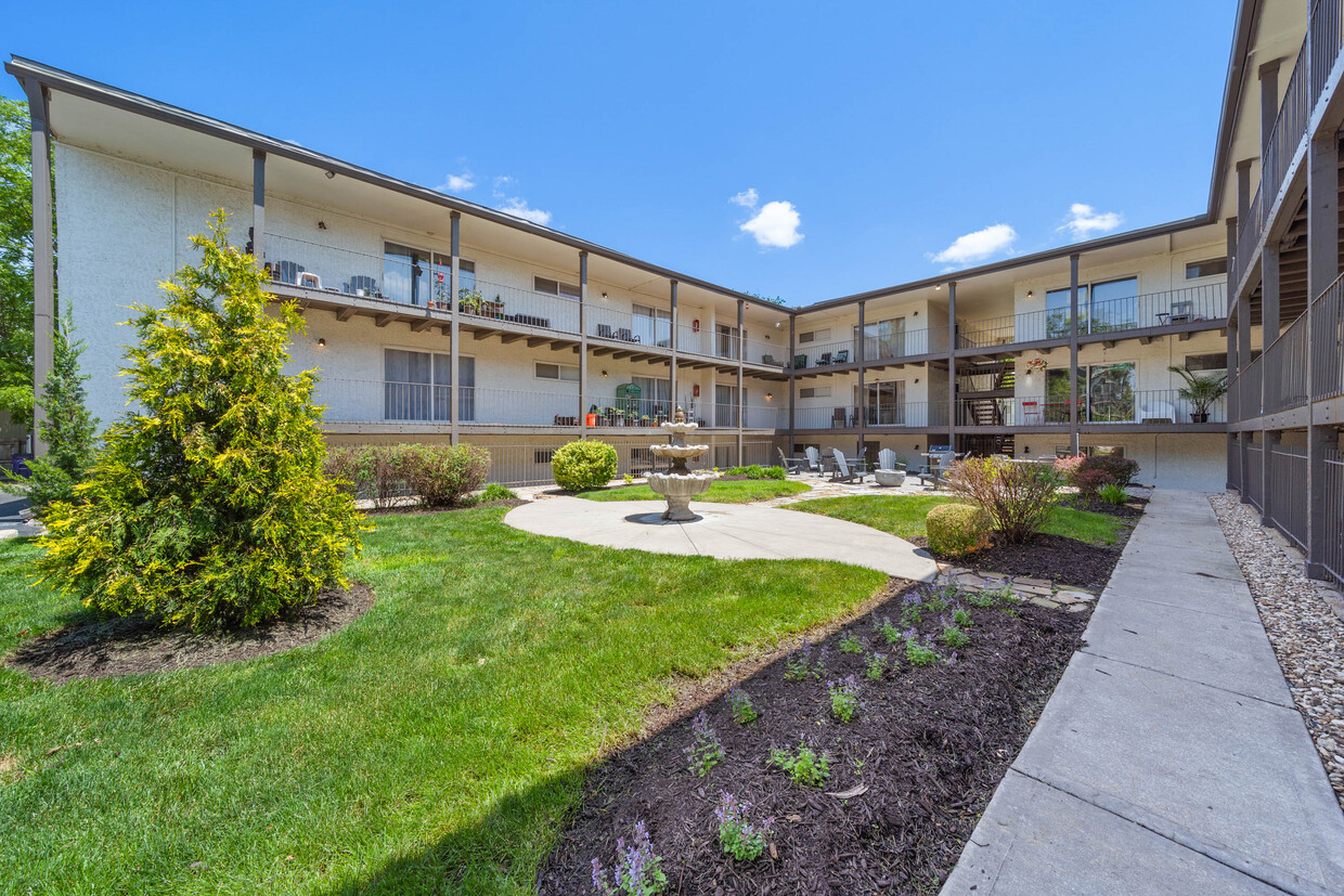
Welcome to our vibrant Hyde Park community, nestled in a neighborhood renowned for its lush surroundings and walkability. Step into spacious interiors that accommodate your lifestyle and budget-friendly options, equipped with stainless steel appliances, in-unit laundry and carpet free floor plans. Connect with neighbors in our outdoor community space or relax on your balcony/patio. Either way, you'll experience the best of city living.
Warwick Gardens - 3926-3934 Warwick Blvd is an apartment community located in Jackson County and the 64111 ZIP Code. This area is served by the Kansas City 33 attendance zone.
Washer/Dryer
Air Conditioning
Dishwasher
Hardwood Floors
Southmoreland is a historic neighborhood known for its vibrant arts scene. This charming locale blends the old and new with a multitude of rental options available including luxury condos, brick high-rise apartments, and 20th century single-family houses. Southmoreland is anchored by its renowned art centers: Kemper Museum of Contemporary Art, Kansas City Art Institute, Donald J. Hall Sculpture Park, and the Nelson-Atkins Museum of Art. Southmoreland Park is home to various cultural events year-round, including Shakespeare in the Park. Hotels, business parks, cafes, coffee shops, and parks are interspersed between these art institutions, but residents also enjoy proximity to Country Club Plaza, one of the most popular commercial hubs in the city. Southmoreland also neighbors other trendy neighborhoods including Old Westport, Valentine, and Hanover, all known for incredible dining and nightlife.
Learn more about living in Southmoreland| Colleges & Universities | Distance | ||
|---|---|---|---|
| Colleges & Universities | Distance | ||
| Walk: | 12 min | 0.6 mi | |
| Drive: | 4 min | 2.1 mi | |
| Drive: | 6 min | 2.4 mi | |
| Drive: | 21 min | 10.8 mi |


Transportation options available in Kansas City include Union Station On Main At Pershing Sb, located 2.2 miles from Warwick Gardens - 3926-3934 Warwick Blvd. Warwick Gardens - 3926-3934 Warwick Blvd is near Kansas City International, located 22.8 miles or 34 minutes away.
| Transit / Subway | Distance | ||
|---|---|---|---|
| Transit / Subway | Distance | ||
| Drive: | 5 min | 2.2 mi | |
| Drive: | 6 min | 2.2 mi | |
| Drive: | 6 min | 2.6 mi | |
| Drive: | 7 min | 2.9 mi | |
| Drive: | 7 min | 3.3 mi |
| Commuter Rail | Distance | ||
|---|---|---|---|
| Commuter Rail | Distance | ||
|
|
Drive: | 7 min | 2.4 mi |
|
|
Drive: | 21 min | 10.6 mi |
|
|
Drive: | 29 min | 17.1 mi |
| Airports | Distance | ||
|---|---|---|---|
| Airports | Distance | ||
|
Kansas City International
|
Drive: | 34 min | 22.8 mi |
Time and distance from Warwick Gardens - 3926-3934 Warwick Blvd.
| Shopping Centers | Distance | ||
|---|---|---|---|
| Shopping Centers | Distance | ||
| Walk: | 8 min | 0.4 mi | |
| Walk: | 11 min | 0.6 mi | |
| Walk: | 11 min | 0.6 mi |
| Parks and Recreation | Distance | ||
|---|---|---|---|
| Parks and Recreation | Distance | ||
|
Mill Creek Park
|
Walk: | 11 min | 0.6 mi |
|
Donald J. Hall Sculpture Park
|
Walk: | 19 min | 1.0 mi |
|
Theis Park
|
Drive: | 3 min | 1.6 mi |
|
Anita B. Gorman Conservation Discovery Center
|
Drive: | 4 min | 1.6 mi |
|
Kauffman Memorial Garden
|
Drive: | 3 min | 1.6 mi |
| Hospitals | Distance | ||
|---|---|---|---|
| Hospitals | Distance | ||
| Drive: | 4 min | 1.3 mi | |
| Drive: | 5 min | 1.6 mi | |
| Drive: | 4 min | 2.1 mi |
| Military Bases | Distance | ||
|---|---|---|---|
| Military Bases | Distance | ||
| Drive: | 57 min | 39.7 mi |
What Are Walk Score®, Transit Score®, and Bike Score® Ratings?
Walk Score® measures the walkability of any address. Transit Score® measures access to public transit. Bike Score® measures the bikeability of any address.
What is a Sound Score Rating?
A Sound Score Rating aggregates noise caused by vehicle traffic, airplane traffic and local sources

3926 Warwick Blvd
Kansas City, MO 64111


