
Vaya
1800 Lacassie Ave,
Walnut Creek, CA 94596
$2,261 - $4,521 Total Monthly Price
Studio - 2 Beds
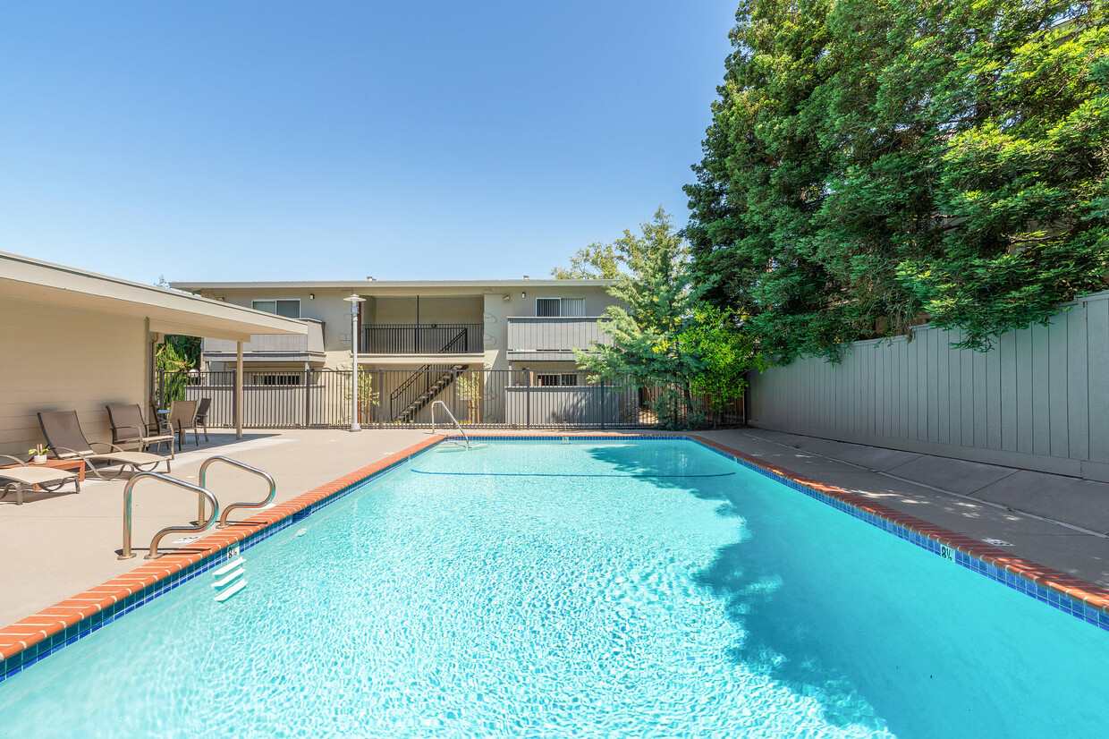

A great location… BART on one side and the new trail system on the other… At the top of Main Street just a block away from Highway 680 on ramp… Large two bedrooms with great floor plans… Easy freeway access to Berkeley, San Francisco… You get a lot for your money at Walnut Creek! Two bedrooms with walk-in closets. New landscaping. Freshly painted exterior. We have large two bedrooms with walk-in closets, mirrored closet doors, fresh carpet, blinds, and paint. Granite counter-tops. A wonderful neighborhood with lovely homes just down the street from us. Contact our manager Katerina, or stop by the Walnut Creek Apartments leasing office to learn more about our community. ** Rents and terms may change. Promotional offers may not now be available and may be withdrawn at any time. This is not an offer to rent.
Walnut Creek Apartments is an apartment community located in Contra Costa County and the 94597 ZIP Code. This area is served by the Mt. Diablo Unified attendance zone.
Air Conditioning
Dishwasher
High Speed Internet Access
Walk-In Closets
Nestled in the East Bay region of the San Francisco Bay Area, Walnut Creek combines suburban comfort with city amenities. The city encompasses 1,800 acres of open space, featuring Shell Ridge and Lime Ridge trails for hiking and outdoor recreation. Downtown Walnut Creek features Broadway Plaza shopping district, while the Lesher Center for the Arts hosts performances and cultural events. The rental market shows a 1.7% annual increase, with one-bedroom units averaging $2,476 and two-bedroom homes typically renting for $2,953. Notable areas include Parkmead, Walnut Heights, and the Northgate district.
Established in 1849 along what early settlers called "Nuts Creek," Walnut Creek has grown into a community of over 70,000 residents. The Mediterranean climate makes it ideal for exploring outdoor spaces like Heather Farm Park and the Ruth Bancroft Garden.
Learn more about living in Walnut Creek| Colleges & Universities | Distance | ||
|---|---|---|---|
| Colleges & Universities | Distance | ||
| Drive: | 9 min | 3.5 mi | |
| Drive: | 18 min | 8.5 mi | |
| Drive: | 25 min | 15.6 mi | |
| Drive: | 26 min | 16.0 mi |


Transportation options available in Walnut Creek include Pleasant Hill / Contra Costa Centre, located 0.7 mile from Walnut Creek Apartments. Walnut Creek Apartments is near Metro Oakland International, located 25.4 miles or 35 minutes away, and San Francisco International, located 37.4 miles or 53 minutes away.
| Transit / Subway | Distance | ||
|---|---|---|---|
| Transit / Subway | Distance | ||
|
|
Walk: | 14 min | 0.7 mi |
|
|
Drive: | 4 min | 2.1 mi |
|
|
Drive: | 9 min | 5.0 mi |
|
|
Drive: | 7 min | 5.4 mi |
|
|
Drive: | 10 min | 6.6 mi |
| Commuter Rail | Distance | ||
|---|---|---|---|
| Commuter Rail | Distance | ||
|
|
Drive: | 15 min | 10.4 mi |
| Drive: | 25 min | 16.8 mi | |
|
|
Drive: | 24 min | 18.6 mi |
|
|
Drive: | 26 min | 20.0 mi |
| Drive: | 36 min | 26.2 mi |
| Airports | Distance | ||
|---|---|---|---|
| Airports | Distance | ||
|
Metro Oakland International
|
Drive: | 35 min | 25.4 mi |
|
San Francisco International
|
Drive: | 53 min | 37.4 mi |
Time and distance from Walnut Creek Apartments.
| Shopping Centers | Distance | ||
|---|---|---|---|
| Shopping Centers | Distance | ||
| Walk: | 1 min | 0.1 mi | |
| Walk: | 3 min | 0.2 mi | |
| Walk: | 6 min | 0.3 mi |
| Parks and Recreation | Distance | ||
|---|---|---|---|
| Parks and Recreation | Distance | ||
|
Lindsay Wildlife Museum
|
Walk: | 16 min | 0.9 mi |
|
Larkey Park
|
Walk: | 16 min | 0.9 mi |
|
The Ruth Bancroft Garden
|
Drive: | 5 min | 2.1 mi |
|
Heather Farm Park
|
Drive: | 7 min | 2.8 mi |
|
Gardens at Heather Farm
|
Drive: | 7 min | 3.0 mi |
| Hospitals | Distance | ||
|---|---|---|---|
| Hospitals | Distance | ||
| Drive: | 6 min | 3.1 mi | |
| Drive: | 6 min | 3.7 mi | |
| Drive: | 8 min | 5.5 mi |
Pets Allowed Fitness Center In Unit Washer & Dryer Stainless Steel Appliances Business Center Package Service Elevator
Pets Allowed Fitness Center In Unit Washer & Dryer High-Speed Internet Controlled Access EV Charging Rooftop Deck
Pets Allowed Fitness Center In Unit Washer & Dryer High-Speed Internet Controlled Access Concierge Rooftop Deck
What Are Walk Score®, Transit Score®, and Bike Score® Ratings?
Walk Score® measures the walkability of any address. Transit Score® measures access to public transit. Bike Score® measures the bikeability of any address.
What is a Sound Score Rating?
A Sound Score Rating aggregates noise caused by vehicle traffic, airplane traffic and local sources

1595 Sunnyvale Ave
Walnut Creek, CA 94597


