
Williamsburg
200 W Galbraith Rd,
Cincinnati, OH 45215
$843 - $2,791
Studio - 3 Beds
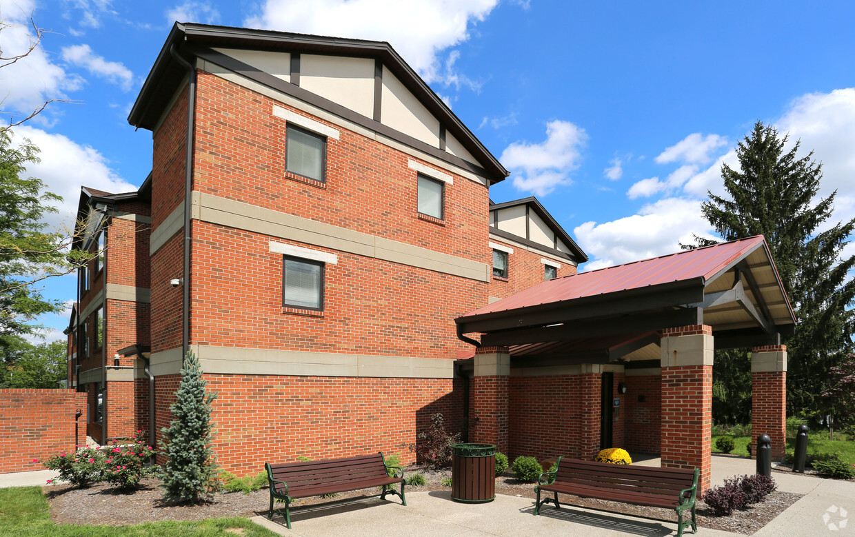


Come home to Walnut Court in Cincinnati, OH. The location in Cincinnati's 45206 area has much to offer its residents. Here at this community, the team of leasing professionals is available to assist you in finding your perfect home. Make a visit to check out the current floorplan options. Get a head start on your move right now. Contact or stop by the Walnut Court leasing office to check the availability and set up a tour today.
Walnut Court is an apartment community located in Hamilton County and the 45206 ZIP Code. This area is served by the Cincinnati Public Schools attendance zone.
Walnut Hills, located in the heart of Cincinnati, combines rich history with rapid growth. As one of the oldest neighborhoods in the city, its architecture, traditions and long time residents reflect a vision of Cincinnati from years gone by. Its up-and-coming districts like East Walnut Hills, with new restaurants and businesses opening each year, make Walnut Hills a neighborhood constantly evolving.
With its proximity to both downtown Cincinnati and more northern suburbs, Walnut Hills nestles in the convenient center of the city. Its superb parks and nearby public school – one of the best in the Cincinnati Public School system – make Walnut Hills a desirable neighborhood for families. Young people also flock to Walnut Hills for its wide variety of dining options and reasonably-priced apartments, many in historic Victorian homes.
Learn more about living in Walnut HillsCompare neighborhood and city base rent averages by bedroom.
| Walnut Hills | Cincinnati, OH | |
|---|---|---|
| Studio | $695 | $1,073 |
| 1 Bedroom | $877 | $1,135 |
| 2 Bedrooms | $968 | $1,424 |
| 3 Bedrooms | $1,560 | $1,731 |
| Colleges & Universities | Distance | ||
|---|---|---|---|
| Colleges & Universities | Distance | ||
| Drive: | 4 min | 1.6 mi | |
| Drive: | 4 min | 1.7 mi | |
| Drive: | 6 min | 2.1 mi | |
| Drive: | 12 min | 4.4 mi |


Transportation options available in Cincinnati include Findlay Market-Race Station - Race & Elder, located 2.7 miles from Walnut Court. Walnut Court is near Cincinnati/Northern Kentucky International, located 17.5 miles or 32 minutes away.
| Transit / Subway | Distance | ||
|---|---|---|---|
| Transit / Subway | Distance | ||
| Drive: | 7 min | 2.7 mi | |
| Drive: | 8 min | 2.8 mi | |
| Drive: | 6 min | 3.0 mi | |
| Drive: | 7 min | 3.2 mi | |
| Drive: | 8 min | 3.4 mi |
| Commuter Rail | Distance | ||
|---|---|---|---|
| Commuter Rail | Distance | ||
|
|
Drive: | 11 min | 5.5 mi |
| Airports | Distance | ||
|---|---|---|---|
| Airports | Distance | ||
|
Cincinnati/Northern Kentucky International
|
Drive: | 32 min | 17.5 mi |
Scores provided by
Traffic
ActiveAirport
CalmBusinesses
ActiveScores provided by
HowLoud What is a Sound Score Rating? A Sound Score Rating aggregates noise caused by vehicle traffic, airplane traffic and local sources. How It WorksTime and distance from Walnut Court.
| Shopping Centers | Distance | ||
|---|---|---|---|
| Shopping Centers | Distance | ||
| Drive: | 6 min | 2.1 mi | |
| Drive: | 7 min | 3.0 mi | |
| Drive: | 6 min | 3.6 mi |
| Parks and Recreation | Distance | ||
|---|---|---|---|
| Parks and Recreation | Distance | ||
|
Eden Park
|
Drive: | 3 min | 1.1 mi |
|
Krohn Conservatory
|
Drive: | 3 min | 1.3 mi |
|
Cincinnati Zoo and Botanical Garden
|
Drive: | 5 min | 2.0 mi |
|
William H. Taft National Historic Site
|
Drive: | 6 min | 2.0 mi |
|
Theodore M. Berry Friendship Park
|
Drive: | 6 min | 2.3 mi |
| Hospitals | Distance | ||
|---|---|---|---|
| Hospitals | Distance | ||
| Drive: | 3 min | 1.3 mi | |
| Drive: | 3 min | 1.3 mi | |
| Drive: | 4 min | 1.5 mi |
| Military Bases | Distance | ||
|---|---|---|---|
| Military Bases | Distance | ||
| Drive: | 70 min | 51.8 mi | |
| Drive: | 76 min | 56.9 mi | |
| Drive: | 78 min | 60.2 mi |
What Are Walk Score®, Transit Score®, and Bike Score® Ratings?
Walk Score® measures the walkability of any address. Transit Score® measures access to public transit. Bike Score® measures the bikeability of any address.
What is a Sound Score Rating?
A Sound Score Rating aggregates noise caused by vehicle traffic, airplane traffic and local sources.


