
$2,398 / Month
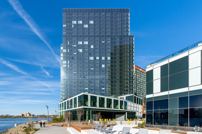
518 Wales Ave Unit 1
The Bronx, NY 10455
2 Weeks Ago
Favorites
WALES AVENUE

Favorites
Check Back Soon for Upcoming Availability
| Beds | Baths | Average SF |
|---|---|---|
| 2 Bedrooms 2 Bedrooms 2 Br | 1 Bath 1 Bath 1 Ba | — |
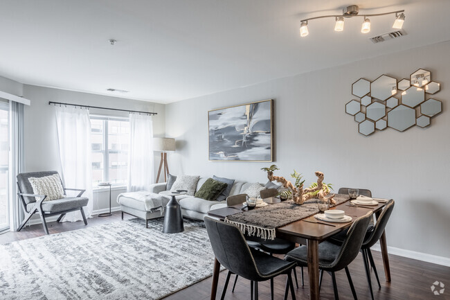
About This Property
Description coming soon, please contact your Highline Residential agent for more information ===Ref:1894137===
WALES AVENUE is an apartment community located in Bronx County and the 10455 ZIP Code.
Location
Get Directions
North New York is cradled by I-87 and I-278, just across the Harlem River from northeast Manhattan. With apartments just a fraction of the cost, this slice of the Big Apple offers an affordable location with terrific proximity to everything New York City has to offer. Also called Mott Haven, North New York is a mixed-use neighborhood wrapped around a large park, Saint Mary's Park.
Typical of many New York neighborhoods, North New York contains apartment buildings, brownstones, and multi-family row houses. The neighborhood is densely populated and is home to three historic districts.
Learn more about living in North New YorkBelow are rent ranges for similar nearby apartments
Education
| Colleges & Universities | Distance | ||
|---|---|---|---|
| Colleges & Universities | Distance | ||
| Drive: | 4 min | 1.4 mi | |
| Drive: | 9 min | 3.6 mi | |
| Drive: | 9 min | 4.4 mi | |
| Drive: | 10 min | 4.4 mi |
WALES AVENUE is within 4 minutes or 1.4 miles from Hostos Community College. It is also near The City College of New York and Manhattan School Of Music.
Transportation options available in The Bronx include East 149 Street, located 0.2 mile from WALES AVENUE. WALES AVENUE is near Laguardia, located 6.5 miles or 14 minutes away, and John F Kennedy International, located 17.8 miles or 27 minutes away.
| Transit / Subway | Distance | ||
|---|---|---|---|
| Transit / Subway | Distance | ||
|
|
Walk: | 4 min | 0.2 mi |
|
|
Walk: | 5 min | 0.3 mi |
|
|
Walk: | 7 min | 0.4 mi |
|
|
Walk: | 13 min | 0.7 mi |
|
|
Walk: | 13 min | 0.7 mi |
| Commuter Rail | Distance | ||
|---|---|---|---|
| Commuter Rail | Distance | ||
|
|
Drive: | 6 min | 1.9 mi |
|
|
Drive: | 6 min | 2.7 mi |
|
|
Drive: | 4 min | 2.9 mi |
|
|
Drive: | 9 min | 3.1 mi |
| Drive: | 9 min | 4.4 mi |
| Airports | Distance | ||
|---|---|---|---|
| Airports | Distance | ||
|
Laguardia
|
Drive: | 14 min | 6.5 mi |
|
John F Kennedy International
|
Drive: | 27 min | 17.8 mi |
Time and distance from WALES AVENUE.
| Shopping Centers | Distance | ||
|---|---|---|---|
| Shopping Centers | Distance | ||
| Walk: | 10 min | 0.5 mi | |
| Walk: | 15 min | 0.8 mi | |
| Walk: | 17 min | 0.9 mi |
WALES AVENUE has 3 shopping centers within 0.9 mile, which is about a 17-minute walk. The miles and minutes will be for the farthest away property.
| Parks and Recreation | Distance | ||
|---|---|---|---|
| Parks and Recreation | Distance | ||
|
St. Mary's Park
|
Walk: | 6 min | 0.3 mi |
|
Captain Rivera Playground
|
Walk: | 11 min | 0.6 mi |
|
Barretto Point Park
|
Drive: | 4 min | 1.6 mi |
|
Randall's Island Park
|
Drive: | 3 min | 1.7 mi |
|
Joyce Kilmer Park
|
Drive: | 8 min | 2.4 mi |
WALES AVENUE has 5 parks within 2.4 miles, including St. Mary's Park, Captain Rivera Playground, and Barretto Point Park.
| Hospitals | Distance | ||
|---|---|---|---|
| Hospitals | Distance | ||
| Walk: | 19 min | 1.0 mi | |
| Drive: | 6 min | 2.0 mi | |
| Drive: | 6 min | 2.7 mi |
WALES AVENUE has 3 hospitals within 2.7 miles, the nearest is Lincoln Medical & Mental Health Center which is 1.0 miles away and a 19 minute walk.
| Military Bases | Distance | ||
|---|---|---|---|
| Military Bases | Distance | ||
| Drive: | 19 min | 9.8 mi | |
| Drive: | 26 min | 13.2 mi |
WALES AVENUE is 9.8 miles from Fort Totten US Govt Reservation, and is convenient to other military bases, including Governors Island Support Center.
You May Also Like
Similar Rentals Nearby


What Are Walk Score®, Transit Score®, and Bike Score® Ratings?
Walk Score® measures the walkability of any address. Transit Score® measures access to public transit. Bike Score® measures the bikeability of any address.
What is a Sound Score Rating?
A Sound Score Rating aggregates noise caused by vehicle traffic, airplane traffic and local sources
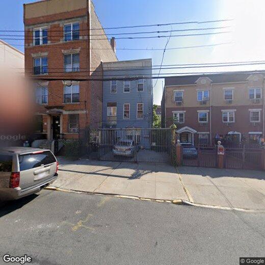
518 Wales Ave
The Bronx, NY 10455