
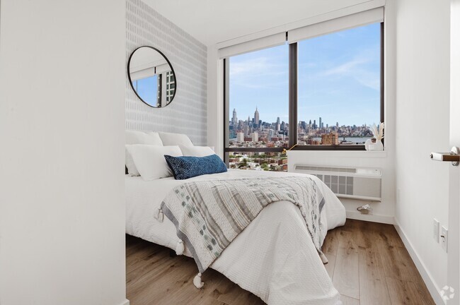
$2,500 / Month
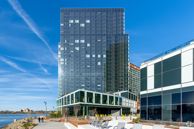
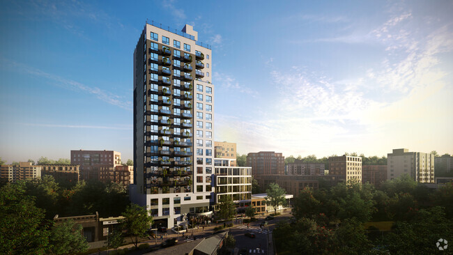
479 W 152nd St Unit 2D
New York, NY 10031
2 Weeks Ago
Favorites
W 152ND ST

Favorites
Check Back Soon for Upcoming Availability
| Beds | Baths | Average SF |
|---|---|---|
| 1 Bedroom 1 Bedroom 1 Br | 1 Bath 1 Bath 1 Ba | — |
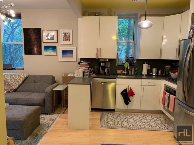
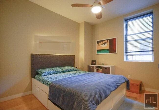
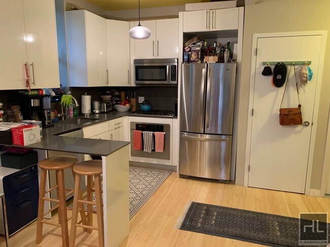
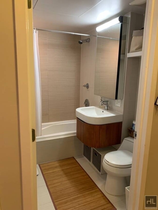
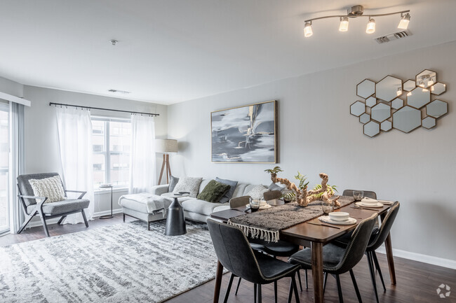
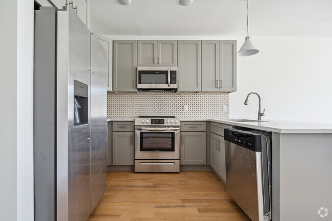
About This Property
Description coming soon, please contact your Highline Residential agent for more information===Ref:1404005===
W 152ND ST is an apartment community located in New York County and the 10031 ZIP Code.
Location
Get Directions
As a historic part of Harlem in Upper Manhattan, Sugar Hill is tied to the Harlem Renaissance, harboring the sense of community that came from the era. Almost entirely residential, in an urban sense, Sugar Hill houses a variety of prewar walk-up apartment buildings, rowhouses, and townhomes that give this neighborhood an architectural appeal. And if cost is an issue for you, Sugar Hill is known as one of the more affordable neighborhoods in the area.
Though the neighborhood offers a few pizza shops, cafes, and delis, there are many more restaurants and shops outside of Sugar Hill.
Learn more about living in Sugar HillBelow are rent ranges for similar nearby apartments
Education
| Colleges & Universities | Distance | ||
|---|---|---|---|
| Colleges & Universities | Distance | ||
| Walk: | 19 min | 1.0 mi | |
| Drive: | 5 min | 1.5 mi | |
| Drive: | 5 min | 1.9 mi | |
| Drive: | 4 min | 1.9 mi |
W 152ND ST is within 19 minutes or 1.0 mile from The City College of New York. It is also near Hostos Community College and Manhattan School Of Music.
Transportation options available in New York include 155 Street (A,C Line), located 0.3 mile from W 152ND ST. W 152ND ST is near Laguardia, located 8.3 miles or 17 minutes away, and Newark Liberty International, located 21.9 miles or 27 minutes away.
| Transit / Subway | Distance | ||
|---|---|---|---|
| Transit / Subway | Distance | ||
|
|
Walk: | 5 min | 0.3 mi |
|
|
Walk: | 8 min | 0.4 mi |
|
|
Walk: | 9 min | 0.5 mi |
|
|
Walk: | 10 min | 0.5 mi |
|
|
Walk: | 15 min | 0.8 mi |
| Commuter Rail | Distance | ||
|---|---|---|---|
| Commuter Rail | Distance | ||
|
|
Drive: | 8 min | 2.2 mi |
| Drive: | 7 min | 2.3 mi | |
|
|
Drive: | 6 min | 2.7 mi |
|
|
Drive: | 7 min | 2.7 mi |
|
|
Drive: | 9 min | 3.0 mi |
| Airports | Distance | ||
|---|---|---|---|
| Airports | Distance | ||
|
Laguardia
|
Drive: | 17 min | 8.3 mi |
|
Newark Liberty International
|
Drive: | 27 min | 21.9 mi |
Time and distance from W 152ND ST.
| Shopping Centers | Distance | ||
|---|---|---|---|
| Shopping Centers | Distance | ||
| Walk: | 24 min | 1.2 mi | |
| Drive: | 6 min | 1.5 mi | |
| Drive: | 4 min | 1.9 mi |
W 152ND ST has 3 shopping centers within 1.9 miles, which is about a 4-minute walk. The miles and minutes will be for the farthest away property.
| Parks and Recreation | Distance | ||
|---|---|---|---|
| Parks and Recreation | Distance | ||
|
Northern Manhattan Parks
|
Walk: | 5 min | 0.3 mi |
|
Jackie Robinson Park
|
Walk: | 7 min | 0.4 mi |
|
Roger Morris Park
|
Walk: | 11 min | 0.6 mi |
|
Mill Pond Park
|
Drive: | 4 min | 1.2 mi |
|
Riverbank State Park
|
Drive: | 4 min | 1.9 mi |
W 152ND ST has 5 parks within 1.9 miles, including Northern Manhattan Parks, Jackie Robinson Park, and Roger Morris Park.
| Hospitals | Distance | ||
|---|---|---|---|
| Hospitals | Distance | ||
| Drive: | 3 min | 1.2 mi | |
| Drive: | 5 min | 1.5 mi | |
| Drive: | 5 min | 1.7 mi |
W 152ND ST has 3 hospitals within 1.7 miles, the nearest is New York State Psychiatric Institute which is 1.2 miles away and a 3 minute drive.
| Military Bases | Distance | ||
|---|---|---|---|
| Military Bases | Distance | ||
| Drive: | 27 min | 11.3 mi | |
| Drive: | 23 min | 12.5 mi |
W 152ND ST is 11.3 miles from Governors Island Support Center, and is convenient to other military bases, including Fort Totten US Govt Reservation.
You May Also Like
Similar Rentals Nearby


What Are Walk Score®, Transit Score®, and Bike Score® Ratings?
Walk Score® measures the walkability of any address. Transit Score® measures access to public transit. Bike Score® measures the bikeability of any address.
What is a Sound Score Rating?
A Sound Score Rating aggregates noise caused by vehicle traffic, airplane traffic and local sources
479 W 152nd St
New York, NY 10031