
-
Monthly Rent
Call for Rent
-
Bedrooms
2 bd
-
Bathrooms
2 ba
-
Square Feet
770 sq ft

Explore Hayward living at Tyrrell Terrace. The location in Hayward's 94544 area has so much to offer its residents. Be sure to come for a visit to see the current floorplan options. You'll experience a unique selection of features and amenities at this community including convenient on-site parking options, smoke free options, and high-speed internet access. Drop by the leasing office to talk about leasing your new apartment.
Pricing & Floor Plans
Fees and Policies
Details
Property Information
-
Built in 1989
-
27 units/2 stories
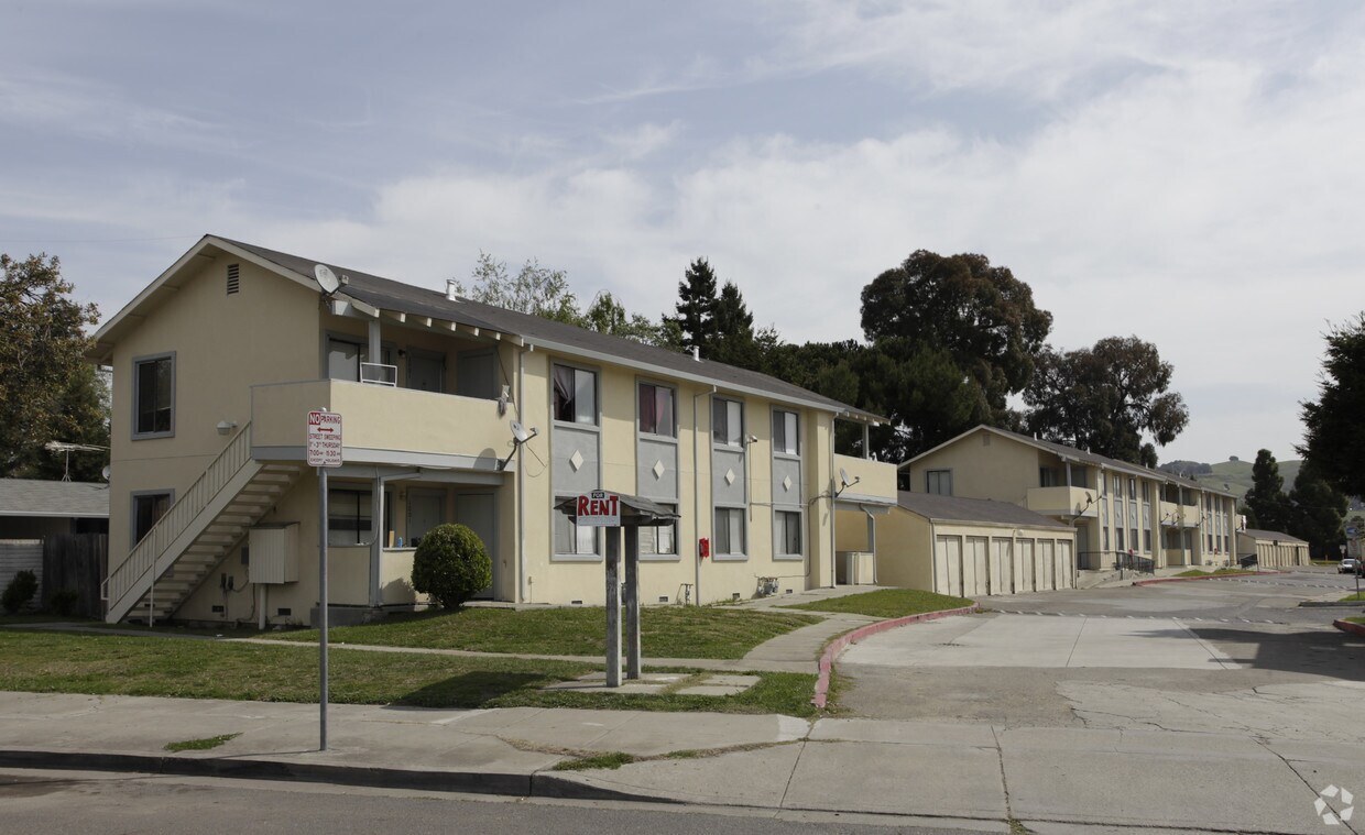
About Tyrrell Terrace
Explore Hayward living at Tyrrell Terrace. The location in Hayward's 94544 area has so much to offer its residents. Be sure to come for a visit to see the current floorplan options. You'll experience a unique selection of features and amenities at this community including convenient on-site parking options, smoke free options, and high-speed internet access. Drop by the leasing office to talk about leasing your new apartment.
Tyrrell Terrace is an apartment community located in Alameda County and the 94544 ZIP Code. This area is served by the Hayward Unified School District attendance zone.
Contact
Community Amenities
- Laundry Facilities
Apartment Features
- High Speed Internet Access
- Heating
- Smoke Free
- Balcony
Harder-Tennyson is a quaint, Bay Area neighborhood in the city of Hayward. The neighborhood is conveniently located along Interstate 880 and is about 10 minutes from the parks and beaches along the San Francisco Bay, such as the Eden Landing Ecological Reserve. Hayward Executive Airport is just a short drive away, as is Southland Mall and sprawling golf courses. Inside the neighborhood, ranch-style houses and green spaces like Weekes Community Center Park make up the area. While residents can easily travel to world-class restaurants in the Bay Area, the neighborhood has a variety of restaurants situated along Tennyson Road. Harder-Tennyson’s rental market is made up of a variety of low-rise apartments as well as a few condos situated along the eastern side of town.
Learn more about living in Harder-TennysonCompare neighborhood and city base rent averages by bedroom.
| Harder-Tennyson | Hayward, CA | |
|---|---|---|
| Studio | - | $2,054 |
| 1 Bedroom | $1,767 | $2,121 |
| 2 Bedrooms | $1,895 | $2,402 |
| 3 Bedrooms | $2,747 | $2,811 |
- Laundry Facilities
- High Speed Internet Access
- Heating
- Smoke Free
- Balcony
| Colleges & Universities | Distance | ||
|---|---|---|---|
| Colleges & Universities | Distance | ||
| Drive: | 7 min | 2.7 mi | |
| Drive: | 9 min | 3.5 mi | |
| Drive: | 16 min | 11.0 mi | |
| Drive: | 25 min | 14.6 mi |


View GreatSchools Rating Methodology
Data provided by GreatSchools.org © 2026. All rights reserved.
Transportation options available in Hayward include South Hayward Station, located 1.8 miles from Tyrrell Terrace. Tyrrell Terrace is near Metro Oakland International, located 12.3 miles or 19 minutes away, and San Francisco International, located 22.8 miles or 31 minutes away.
| Transit / Subway | Distance | ||
|---|---|---|---|
| Transit / Subway | Distance | ||
|
|
Drive: | 5 min | 1.8 mi |
|
|
Drive: | 8 min | 3.3 mi |
|
|
Drive: | 13 min | 5.7 mi |
|
|
Drive: | 12 min | 6.2 mi |
|
|
Drive: | 14 min | 6.8 mi |
| Commuter Rail | Distance | ||
|---|---|---|---|
| Commuter Rail | Distance | ||
| Drive: | 8 min | 3.2 mi | |
|
|
Drive: | 8 min | 3.2 mi |
| Drive: | 15 min | 8.3 mi | |
| Drive: | 16 min | 8.5 mi | |
| Drive: | 27 min | 17.8 mi |
| Airports | Distance | ||
|---|---|---|---|
| Airports | Distance | ||
|
Metro Oakland International
|
Drive: | 19 min | 12.3 mi |
|
San Francisco International
|
Drive: | 31 min | 22.8 mi |
Scores provided by
Traffic
ActiveAirport
CalmBusinesses
ActiveScores provided by
HowLoud What is a Sound Score Rating? A Sound Score Rating aggregates noise caused by vehicle traffic, airplane traffic and local sources. How It WorksTime and distance from Tyrrell Terrace.
| Shopping Centers | Distance | ||
|---|---|---|---|
| Shopping Centers | Distance | ||
| Walk: | 13 min | 0.7 mi | |
| Walk: | 15 min | 0.8 mi | |
| Walk: | 17 min | 0.9 mi |
| Parks and Recreation | Distance | ||
|---|---|---|---|
| Parks and Recreation | Distance | ||
|
Sulphur Creek Nature Center
|
Drive: | 11 min | 4.4 mi |
|
Garin/Dry Creek Pioneer Parks
|
Drive: | 11 min | 4.6 mi |
|
Hayward Shoreline Interpretive Center
|
Drive: | 11 min | 4.9 mi |
|
Don Castro Regional Recreation Area
|
Drive: | 11 min | 5.3 mi |
|
Hayward Regional Shoreline
|
Drive: | 18 min | 7.9 mi |
| Hospitals | Distance | ||
|---|---|---|---|
| Hospitals | Distance | ||
| Drive: | 5 min | 1.6 mi | |
| Drive: | 12 min | 7.1 mi | |
| Drive: | 14 min | 8.6 mi |
| Military Bases | Distance | ||
|---|---|---|---|
| Military Bases | Distance | ||
| Drive: | 31 min | 19.7 mi | |
| Drive: | 31 min | 19.9 mi | |
| Drive: | 37 min | 24.4 mi |
Tyrrell Terrace Photos
Nearby Apartments
Within 50 Miles of Tyrrell Terrace
While Tyrrell Terrace does not provide in‑unit laundry, on‑site laundry facilities are available for shared resident use.
Utilities are not included in rent. Residents should plan to set up and pay for all services separately.
Contact this property for parking details.
Tyrrell Terrace does not allow pets, though service animals are always welcome in accordance with applicable laws.
Tyrrell Terrace is not currently offering any rent specials. Check back soon, as promotions change frequently.
While Tyrrell Terrace does not offer Matterport 3D tours, renters can request a tour directly through our online platform.

26898 Tyrrell Ave
Hayward, CA 94544
Property Manager Responded