
Williamsburg
200 W Galbraith Rd,
Cincinnati, OH 45215
$843 - $2,765
Studio - 3 Beds

Bedrooms
1 bd
Bathrooms
1 ba
Square Feet
750 sq ft
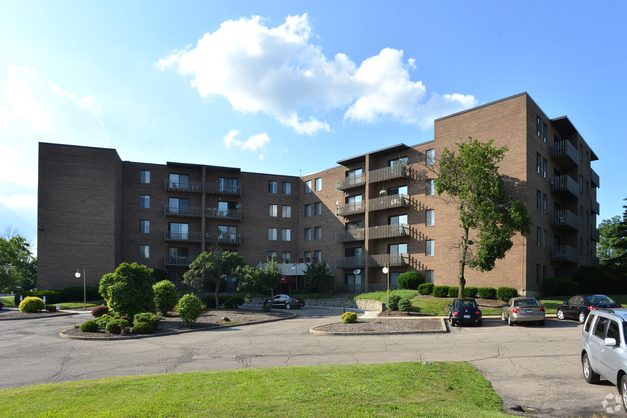
Spyglass Apartments – Scenic Hilltop Living Overlooking Northside, Cincinnati Experience a unique blend of charm and convenience at Spyglass Apartments, perched on a high hill with sweeping views of Northside and the Cincinnati skyline. This well-situated community offers a peaceful retreat while keeping you close to all the energy and eclectic character that Northside is known for. Residents enjoy easy access to major highways and nearby bus stops, making commuting simple. The neighborhood features a wide variety of restaurants, bars, coffee shops, eclectic boutiques, and a popular Farmers Market, all just minutes away. If you’re looking for apartments for rent in Northside Cincinnati with stunning views and a prime location, Spyglass Apartments offers the perfect combination of quiet hilltop living and convenient city access. Contact Gaslight Property today to schedule a tour and see your next home in Northside.
Spyglass Apartments – Scenic Hilltop Living Overlooking Northside, Cincinnati Experience a unique blend of charm and convenience at Spyglass Apartments, perched on a high hill with sweeping views of Northside and the Cincinnati skyline. This well-situated community offers a peaceful retreat while keeping you close to all the energy and eclectic character that Northside is known for. Residents enjoy easy access to major highways and nearby bus stops, making commuting simple. The neighborhood features a wide variety of restaurants, bars, coffee shops, eclectic boutiques, and a popular Farmers Market, all just minutes away. If you’re looking for apartments for rent in Northside Cincinnati with stunning views and a prime location, Spyglass Apartments offers the perfect combination of quiet hilltop living and convenient city access. Contact Gaslight Property today to schedule a tour and see your next home in Northside.
Spyglass is an apartment community located in Hamilton County and the 45223 ZIP Code. This area is served by the Cincinnati Public Schools attendance zone.
Unique Features
Laundry Facilities
24 Hour Access
Maintenance on site
Public Transportation
Air Conditioning
Dishwasher
Walk-In Closets
Refrigerator
Northside is one of Cincinnati’s trendiest neighborhoods. This diverse, eclectic neighborhood is known for its artistic feel and walkability. With murals, live music, and a bustling commercial hub, Northside combines the excitement of urban living with the charm of a small town. This vibrant locale is home to a variety of quirky shops, restaurants, breweries, coffeehouses, art galleries, and more. Annual events like the Northside 4th of July Parade and Rock ‘n’ Roll Carnival keep the neighborhood lively as well. Northside's tradition of community activism attracts renters seeking a close-knit neighborhood.
Tucked away just a short trip from downtown, Northside is also convenient to Xavier University, the University of Cincinnati, and Cincinnati State Technical and Community College. Providing something for everyone, Northside is more affordable compared to other Cincinnati neighborhoods. Rentals range from single-family houses to apartments in brick buildings.
Learn more about living in NorthsideCompare neighborhood and city base rent averages by bedroom.
| Northside | Cincinnati, OH | |
|---|---|---|
| Studio | $1,113 | $1,072 |
| 1 Bedroom | $1,004 | $1,134 |
| 2 Bedrooms | $1,471 | $1,422 |
| 3 Bedrooms | - | $1,733 |
| Colleges & Universities | Distance | ||
|---|---|---|---|
| Colleges & Universities | Distance | ||
| Drive: | 8 min | 2.4 mi | |
| Drive: | 11 min | 3.8 mi | |
| Drive: | 12 min | 3.9 mi | |
| Drive: | 16 min | 5.4 mi |


Transportation options available in Cincinnati include Brewery District Station - Elm & Henry, located 4.8 miles from Spyglass. Spyglass is near Cincinnati/Northern Kentucky International, located 19.7 miles or 37 minutes away.
| Transit / Subway | Distance | ||
|---|---|---|---|
| Transit / Subway | Distance | ||
| Drive: | 12 min | 4.8 mi | |
| Drive: | 13 min | 5.0 mi | |
| Drive: | 13 min | 5.0 mi | |
| Drive: | 13 min | 5.1 mi | |
| Drive: | 13 min | 5.3 mi |
| Commuter Rail | Distance | ||
|---|---|---|---|
| Commuter Rail | Distance | ||
|
|
Drive: | 12 min | 5.7 mi |
| Airports | Distance | ||
|---|---|---|---|
| Airports | Distance | ||
|
Cincinnati/Northern Kentucky International
|
Drive: | 37 min | 19.7 mi |
Scores provided by
Traffic
ActiveAirport
CalmBusinesses
CalmScores provided by
HowLoud What is a Sound Score Rating? A Sound Score Rating aggregates noise caused by vehicle traffic, airplane traffic and local sources. How It WorksTime and distance from Spyglass.
| Shopping Centers | Distance | ||
|---|---|---|---|
| Shopping Centers | Distance | ||
| Drive: | 7 min | 2.5 mi | |
| Drive: | 9 min | 3.4 mi | |
| Drive: | 9 min | 3.6 mi |
| Parks and Recreation | Distance | ||
|---|---|---|---|
| Parks and Recreation | Distance | ||
|
Buttercup Valley
|
Walk: | 14 min | 0.7 mi |
|
LaBoiteaux Woods
|
Drive: | 6 min | 2.1 mi |
|
Burnet Woods
|
Drive: | 9 min | 3.1 mi |
|
Mt. Airy Forest
|
Drive: | 9 min | 3.3 mi |
|
Trailside Nature Center
|
Drive: | 11 min | 3.8 mi |
| Hospitals | Distance | ||
|---|---|---|---|
| Hospitals | Distance | ||
| Drive: | 9 min | 3.0 mi | |
| Drive: | 12 min | 4.2 mi | |
| Drive: | 12 min | 4.3 mi |
| Military Bases | Distance | ||
|---|---|---|---|
| Military Bases | Distance | ||
| Drive: | 71 min | 51.9 mi | |
| Drive: | 77 min | 56.9 mi | |
| Drive: | 80 min | 60.2 mi |
What Are Walk Score®, Transit Score®, and Bike Score® Ratings?
Walk Score® measures the walkability of any address. Transit Score® measures access to public transit. Bike Score® measures the bikeability of any address.
What is a Sound Score Rating?
A Sound Score Rating aggregates noise caused by vehicle traffic, airplane traffic and local sources.
1600 Thompson Heights Ave
Cincinnati, OH 45223


