
TENTEN Campus Glendale
414 N Orange St,
Glendale, CA 91203
$3,128 - $5,277 Total Monthly Price
Studio - 2 Beds

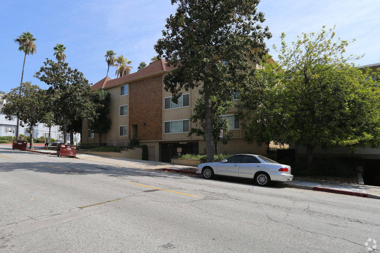
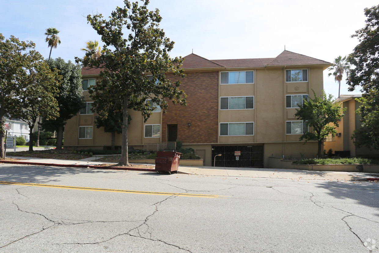
The Sherwood offers a combination of style, comfort, and livability. The 130 W Mountain St location in the Verdugo Viejo neighborhood of Glendale is convenient to everything. Select from 1 to 2 bedroom floor plans and then come by for a tour of the community. From amenities to availability, the leasing team is excited to help you find your perfect new place. Come see The Sherwood today.
The Sherwood is an apartment community located in Los Angeles County and the 91202 ZIP Code. This area is served by the Glendale Unified School District attendance zone.
Refrigerator
Heating
Oven
Range
If you’re looking for a central location in the Los Angeles area, Verdugo Viejo is an excellent choice. This small community is located between Burbank and Downtown Glendale, giving residents easy access to plenty of dining, shopping, and entertainment options. Verdugo Viejo is also convenient to popular parks and hiking areas including the iconic Griffith Park and Verdugo Mountains Open Space Preserve. Access to Highway 134 and Interstate 5 allows residents to travel across Southern California with ease. Verdugo Viejo also has great schools and several restaurants and shops. The neighborhood has a variety of rental options including modern apartments, California bungalows, modern townhomes, and luxury condos.
Learn more about living in Verdugo ViejoCompare neighborhood and city base rent averages by bedroom.
| Verdugo Viejo | Glendale, CA | |
|---|---|---|
| Studio | $2,031 | $2,003 |
| 1 Bedroom | $2,168 | $2,095 |
| 2 Bedrooms | $2,770 | $2,664 |
| 3 Bedrooms | $3,537 | $3,445 |
| Colleges & Universities | Distance | ||
|---|---|---|---|
| Colleges & Universities | Distance | ||
| Drive: | 5 min | 1.9 mi | |
| Drive: | 10 min | 4.8 mi | |
| Drive: | 8 min | 5.4 mi | |
| Drive: | 16 min | 8.8 mi |


Transportation options available in Glendale include Southwest Museum Station, located 6.8 miles from The Sherwood. The Sherwood is near Bob Hope, located 10.2 miles or 16 minutes away, and Los Angeles International, located 25.4 miles or 39 minutes away.
| Transit / Subway | Distance | ||
|---|---|---|---|
| Transit / Subway | Distance | ||
|
|
Drive: | 14 min | 6.8 mi |
|
|
Drive: | 11 min | 6.8 mi |
|
|
Drive: | 12 min | 7.4 mi |
|
|
Drive: | 12 min | 7.4 mi |
|
|
Drive: | 13 min | 7.8 mi |
| Commuter Rail | Distance | ||
|---|---|---|---|
| Commuter Rail | Distance | ||
|
|
Drive: | 7 min | 3.6 mi |
|
|
Drive: | 8 min | 4.8 mi |
|
|
Drive: | 12 min | 7.5 mi |
| Drive: | 11 min | 8.0 mi | |
|
|
Drive: | 16 min | 10.3 mi |
| Airports | Distance | ||
|---|---|---|---|
| Airports | Distance | ||
|
Bob Hope
|
Drive: | 16 min | 10.2 mi |
|
Los Angeles International
|
Drive: | 39 min | 25.4 mi |
Scores provided by
Traffic
-Airport
-Businesses
-Scores provided by
HowLoud What is a Sound Score Rating? A Sound Score Rating aggregates noise caused by vehicle traffic, airplane traffic and local sources. How It WorksTime and distance from The Sherwood.
| Shopping Centers | Distance | ||
|---|---|---|---|
| Shopping Centers | Distance | ||
| Walk: | 13 min | 0.7 mi | |
| Walk: | 14 min | 0.8 mi | |
| Walk: | 18 min | 0.9 mi |
| Parks and Recreation | Distance | ||
|---|---|---|---|
| Parks and Recreation | Distance | ||
|
Los Angeles Zoo
|
Drive: | 14 min | 5.0 mi |
|
Descanso Gardens
|
Drive: | 11 min | 5.7 mi |
|
Bird Sanctuary
|
Drive: | 12 min | 6.4 mi |
|
Griffith Observatory
|
Drive: | 16 min | 7.6 mi |
|
Griffith Park
|
Drive: | 25 min | 9.8 mi |
| Hospitals | Distance | ||
|---|---|---|---|
| Hospitals | Distance | ||
| Drive: | 6 min | 2.7 mi | |
| Drive: | 7 min | 3.0 mi | |
| Drive: | 7 min | 5.0 mi |
| Military Bases | Distance | ||
|---|---|---|---|
| Military Bases | Distance | ||
| Drive: | 36 min | 27.0 mi |
Pets Allowed Fitness Center Pool In Unit Washer & Dryer Clubhouse Balcony
What Are Walk Score®, Transit Score®, and Bike Score® Ratings?
Walk Score® measures the walkability of any address. Transit Score® measures access to public transit. Bike Score® measures the bikeability of any address.
What is a Sound Score Rating?
A Sound Score Rating aggregates noise caused by vehicle traffic, airplane traffic and local sources.
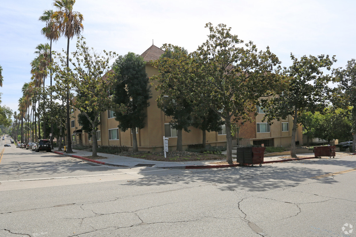
130 W Mountain St
Glendale, CA 91202


