
The Watson
11901 Burnet Rd,
Austin, TX 78758
$1,227 - $7,950
Studio - 3 Beds

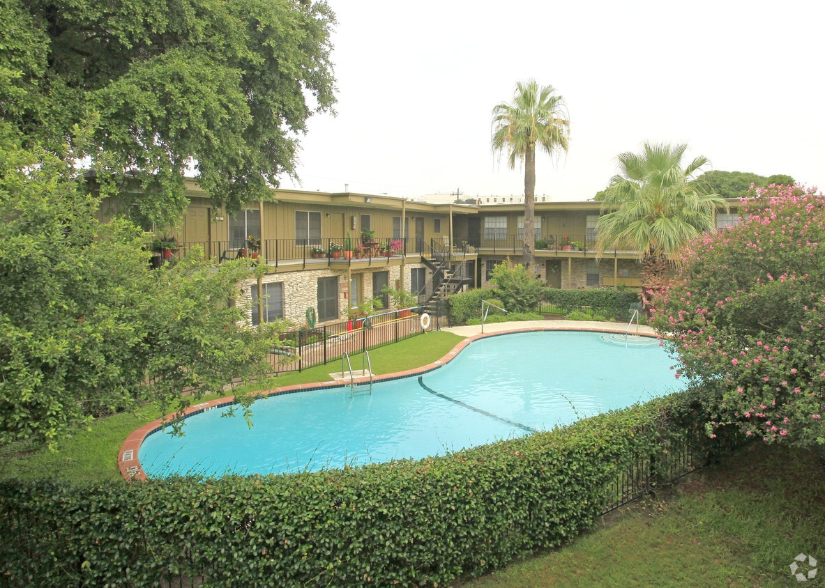
The Rosedale Apartments are located in one of Austin’s fastest-growing neighborhoods. This Allendale community is a quick walk away from an endless list of newly renovated shops, cafes, and restaurants. Only minutes away from downtown and UT campus, this is the perfect spot for every Austinite to start their day. Come relax in one of our sparkling swimming pools or in one of our three beautiful courtyards. With one and two-bedroom apartments, The Rosedale is sure to be the new home you’ve been looking for.
The Rosedale is an apartment community located in Travis County and the 78756 ZIP Code. This area is served by the Austin Independent School District attendance zone.
Unique Features
Pool
Fitness Center
Laundry Facilities
Clubhouse
Air Conditioning
Dishwasher
High Speed Internet Access
Tub/Shower
Situated in the northwestern portion of Central Austin, Rosedale is one of the city’s most desirable neighborhoods. Between the charming bungalows surrounded by mature trees and the exceptionally convenient locale, Rosedale maintains a distinctive allure.
Ramsey Park sits at the center of the neighborhood, offering ample opportunities for outdoor activities with tennis courts, picnic areas, playgrounds, and a swimming pool. While Rosedale is largely residential, it is proximate to a host of eateries, cafes, and shops strewn along Burnet Road as well as the expansive Central Market.
Most Rosedale residents enjoy an easy commute, with convenience to multiple medical centers, the Capitol, the University of Texas at Austin, and Downtown Austin. Quick access to the MoPac Expressway makes getting around from Rosedale simple.
Learn more about living in RosedaleCompare neighborhood and city base rent averages by bedroom.
| Rosedale | Austin, TX | |
|---|---|---|
| Studio | $1,283 | $1,207 |
| 1 Bedroom | $1,709 | $1,394 |
| 2 Bedrooms | $2,256 | $1,822 |
| 3 Bedrooms | $3,175 | $2,402 |
| Colleges & Universities | Distance | ||
|---|---|---|---|
| Colleges & Universities | Distance | ||
| Drive: | 9 min | 4.1 mi | |
| Drive: | 9 min | 5.3 mi | |
| Drive: | 11 min | 6.0 mi | |
| Drive: | 14 min | 6.7 mi |


Transportation options available in Austin include Highland Station, located 2.2 miles from The Rosedale. The Rosedale is near Austin-Bergstrom International, located 14.7 miles or 28 minutes away.
| Transit / Subway | Distance | ||
|---|---|---|---|
| Transit / Subway | Distance | ||
| Drive: | 5 min | 2.2 mi | |
| Drive: | 6 min | 2.4 mi | |
| Drive: | 9 min | 4.9 mi | |
| Drive: | 10 min | 5.8 mi | |
| Drive: | 11 min | 6.1 mi |
| Commuter Rail | Distance | ||
|---|---|---|---|
| Commuter Rail | Distance | ||
|
|
Drive: | 11 min | 5.8 mi |
|
|
Drive: | 42 min | 34.0 mi |
|
|
Drive: | 45 min | 36.3 mi |
| Airports | Distance | ||
|---|---|---|---|
| Airports | Distance | ||
|
Austin-Bergstrom International
|
Drive: | 28 min | 14.7 mi |
Scores provided by
Traffic
-Airport
-Businesses
-Scores provided by
HowLoud What is a Sound Score Rating? A Sound Score Rating aggregates noise caused by vehicle traffic, airplane traffic and local sources. How It WorksTime and distance from The Rosedale.
| Shopping Centers | Distance | ||
|---|---|---|---|
| Shopping Centers | Distance | ||
| Walk: | 3 min | 0.2 mi | |
| Walk: | 5 min | 0.3 mi | |
| Walk: | 12 min | 0.6 mi |
| Parks and Recreation | Distance | ||
|---|---|---|---|
| Parks and Recreation | Distance | ||
|
Elisabet Ney Museum
|
Drive: | 5 min | 2.1 mi |
|
Beverly S. Sheffield Northwest District Park
|
Drive: | 6 min | 2.1 mi |
|
Bright Leaf Preserve
|
Drive: | 7 min | 2.8 mi |
|
Shoal Creek Greenbelt Park
|
Drive: | 6 min | 2.9 mi |
|
Mayfield Park and Preserve
|
Drive: | 7 min | 3.1 mi |
| Hospitals | Distance | ||
|---|---|---|---|
| Hospitals | Distance | ||
| Drive: | 3 min | 1.7 mi | |
| Drive: | 3 min | 1.7 mi | |
| Drive: | 5 min | 2.1 mi |
| Military Bases | Distance | ||
|---|---|---|---|
| Military Bases | Distance | ||
| Drive: | 87 min | 71.2 mi | |
| Drive: | 90 min | 71.9 mi | |
| Drive: | 112 min | 87.1 mi |
What Are Walk Score®, Transit Score®, and Bike Score® Ratings?
Walk Score® measures the walkability of any address. Transit Score® measures access to public transit. Bike Score® measures the bikeability of any address.
What is a Sound Score Rating?
A Sound Score Rating aggregates noise caused by vehicle traffic, airplane traffic and local sources.
2211 North Loop W
Austin, TX 78756


