
The Bernice
1900 3rd St,
Sacramento, CA 95811
$1,630 - $2,999
Studio - 2 Beds
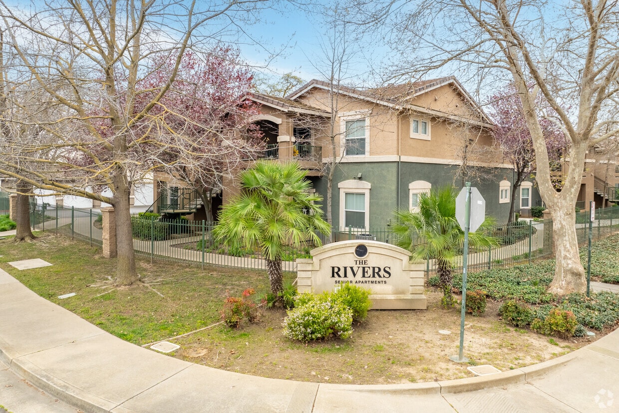
Enjoy West Sacramento living at The Rivers Senior. Located at 750 Dorothy Adamo Ln in West Sacramento, this community is convenient to everything. From amenities to availability, the professional leasing team is excited to help you find your perfect home. It's time to love where you live. Stop by for a visit today.
The Rivers is an apartment community located in Yolo County and the 95605 ZIP Code. This area is served by the Washington Unified School District attendance zone.
Pool
Laundry Facilities
Clubhouse
Business Center
Washer/Dryer
Air Conditioning
Dishwasher
Washer/Dryer Hookup
West Sacramento enjoys the unique privilege of being a fairly quiet residential community right next door to a thriving metropolis. Separated from the state capital only by the Sacramento River, West Sac (as the locals call it) shares virtually all of Sacramento’s resources, cultural and otherwise. The I Street Bridge and Tower Bridge both feed straight into Sacramento’s historic district and downtown entertainment district. On West Sacramento’s side of the river, one of the biggest attractions is the shopping, but scenic areas like River Walk Park and venues like Raley Field give folks plenty to do in their own neighborhood.
Learn more about living in West Sacramento| Colleges & Universities | Distance | ||
|---|---|---|---|
| Colleges & Universities | Distance | ||
| Drive: | 11 min | 5.8 mi | |
| Drive: | 14 min | 6.6 mi | |
| Drive: | 22 min | 12.9 mi | |
| Drive: | 21 min | 13.6 mi |


Transportation options available in West Sacramento include Sacramento Valley Station, located 1.9 miles from The Rivers. The Rivers is near Sacramento International, located 11.9 miles or 19 minutes away.
| Transit / Subway | Distance | ||
|---|---|---|---|
| Transit / Subway | Distance | ||
|
|
Drive: | 4 min | 1.9 mi |
|
|
Drive: | 4 min | 2.1 mi |
|
|
Drive: | 5 min | 2.2 mi |
| Drive: | 6 min | 2.8 mi | |
| Drive: | 6 min | 2.8 mi |
| Commuter Rail | Distance | ||
|---|---|---|---|
| Commuter Rail | Distance | ||
| Drive: | 4 min | 1.9 mi | |
| Drive: | 19 min | 14.2 mi | |
|
|
Drive: | 31 min | 21.5 mi |
|
|
Drive: | 32 min | 23.7 mi |
|
|
Drive: | 45 min | 35.9 mi |
| Airports | Distance | ||
|---|---|---|---|
| Airports | Distance | ||
|
Sacramento International
|
Drive: | 19 min | 11.9 mi |
Scores provided by
Traffic
ActiveAirport
CalmBusinesses
CalmScores provided by
HowLoud What is a Sound Score Rating? A Sound Score Rating aggregates noise caused by vehicle traffic, airplane traffic and local sources. How It WorksTime and distance from The Rivers.
| Shopping Centers | Distance | ||
|---|---|---|---|
| Shopping Centers | Distance | ||
| Walk: | 15 min | 0.8 mi | |
| Drive: | 4 min | 1.5 mi | |
| Drive: | 4 min | 1.8 mi |
| Parks and Recreation | Distance | ||
|---|---|---|---|
| Parks and Recreation | Distance | ||
|
California State Railroad Museum
|
Drive: | 4 min | 1.8 mi |
|
Old Sacramento Historic District
|
Drive: | 4 min | 1.9 mi |
|
Discovery County Park
|
Drive: | 7 min | 3.6 mi |
|
Natomas Oaks Park
|
Drive: | 8 min | 3.7 mi |
|
Bannon Creek Parkway
|
Drive: | 8 min | 3.9 mi |
| Hospitals | Distance | ||
|---|---|---|---|
| Hospitals | Distance | ||
| Drive: | 8 min | 3.8 mi | |
| Drive: | 10 min | 4.4 mi | |
| Drive: | 10 min | 6.0 mi |
| Military Bases | Distance | ||
|---|---|---|---|
| Military Bases | Distance | ||
| Drive: | 27 min | 13.3 mi |
What Are Walk Score®, Transit Score®, and Bike Score® Ratings?
Walk Score® measures the walkability of any address. Transit Score® measures access to public transit. Bike Score® measures the bikeability of any address.
What is a Sound Score Rating?
A Sound Score Rating aggregates noise caused by vehicle traffic, airplane traffic and local sources.

750 Dorothy Adamo Ln
West Sacramento, CA 95605


