
Bridgepointe
1987 Bridgepointe Pky,
San Mateo, CA 94404
1-3 Beds $3,390 - $4,928
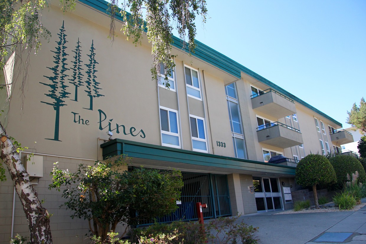
The Pines is one of five apartment buildings owned and managed by San Mateo Investment Co. Please see www.sanmateoinvestment.com for up-to-date rentals and a more detailed description of our company. You can also find us on Facebook.
The Pines is an apartment community located in San Mateo County and the 94403 ZIP Code. This area is served by the San Mateo-Foster City attendance zone.
Pool
Laundry Facilities
Elevator
Bicycle Storage
Dishwasher
Hardwood Floors
Granite Countertops
Microwave
Located about halfway between San Francisco and San Jose, Sugarloaf is a peaceful, suburban neighborhood in San Mateo. Sugarloaf is predominantly residential, touting an array of single-family houses and apartment buildings atop scenic hillsides. However, Sugarloaf also provides plenty of shopping opportunities, from the extensive retail offerings of the Hillsdale Shopping Center to the unique finds in local shops along 37th Avenue.
Sugarloaf residents enjoy ample outdoor activities at the sprawling Laurelwood Park in addition to quick commutes for those working at the San Mateo Medical Center and the College of San Mateo. Convenience to El Camino Real, J. Arthur Younger Freeway, the Hillsdale CalTrain Station, and San Francisco International Airport makes getting around from Sugarloaf a breeze.
Learn more about living in Sugarloaf| Colleges & Universities | Distance | ||
|---|---|---|---|
| Colleges & Universities | Distance | ||
| Drive: | 3 min | 1.2 mi | |
| Drive: | 15 min | 9.9 mi | |
| Drive: | 21 min | 13.6 mi | |
| Drive: | 20 min | 14.0 mi |


Transportation options available in San Mateo include Millbrae (Caltrain Transfer Platform), located 7.6 miles from The Pines. The Pines is near San Francisco International, located 11.3 miles or 17 minutes away, and Metro Oakland International, located 26.9 miles or 34 minutes away.
| Transit / Subway | Distance | ||
|---|---|---|---|
| Transit / Subway | Distance | ||
|
|
Drive: | 14 min | 7.6 mi |
|
|
Drive: | 14 min | 7.6 mi |
|
|
Drive: | 15 min | 10.8 mi |
| Drive: | 16 min | 10.9 mi | |
|
|
Drive: | 17 min | 11.1 mi |
| Commuter Rail | Distance | ||
|---|---|---|---|
| Commuter Rail | Distance | ||
| Drive: | 5 min | 1.9 mi | |
| Drive: | 5 min | 2.9 mi | |
| Drive: | 5 min | 2.9 mi | |
| Drive: | 8 min | 4.2 mi | |
| Drive: | 9 min | 5.8 mi |
| Airports | Distance | ||
|---|---|---|---|
| Airports | Distance | ||
|
San Francisco International
|
Drive: | 17 min | 11.3 mi |
|
Metro Oakland International
|
Drive: | 34 min | 26.9 mi |
Time and distance from The Pines.
| Shopping Centers | Distance | ||
|---|---|---|---|
| Shopping Centers | Distance | ||
| Walk: | 7 min | 0.4 mi | |
| Drive: | 3 min | 1.4 mi | |
| Drive: | 4 min | 2.3 mi |
| Parks and Recreation | Distance | ||
|---|---|---|---|
| Parks and Recreation | Distance | ||
|
San Mateo Arboretum
|
Drive: | 5 min | 3.2 mi |
|
Japanese Tea Garden (San Mateo)
|
Drive: | 6 min | 3.6 mi |
|
Crystal Springs Trail
|
Drive: | 7 min | 4.7 mi |
|
Shoreline Parks
|
Drive: | 9 min | 5.8 mi |
|
Coyote Point Recreational Area
|
Drive: | 12 min | 7.1 mi |
| Hospitals | Distance | ||
|---|---|---|---|
| Hospitals | Distance | ||
| Drive: | 5 min | 2.1 mi | |
| Drive: | 12 min | 7.1 mi | |
| Drive: | 15 min | 9.3 mi |
| Military Bases | Distance | ||
|---|---|---|---|
| Military Bases | Distance | ||
| Drive: | 29 min | 21.1 mi |
What Are Walk Score®, Transit Score®, and Bike Score® Ratings?
Walk Score® measures the walkability of any address. Transit Score® measures access to public transit. Bike Score® measures the bikeability of any address.
What is a Sound Score Rating?
A Sound Score Rating aggregates noise caused by vehicle traffic, airplane traffic and local sources

1333 Palos Verdes Dr
San Mateo, CA 94403


