
Citrus Commons
14150 Riverside Dr,
Sherman Oaks, CA 91423
$2,795 - $5,960
Studio - 2 Beds
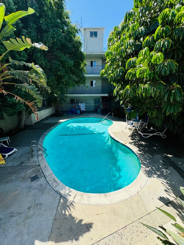

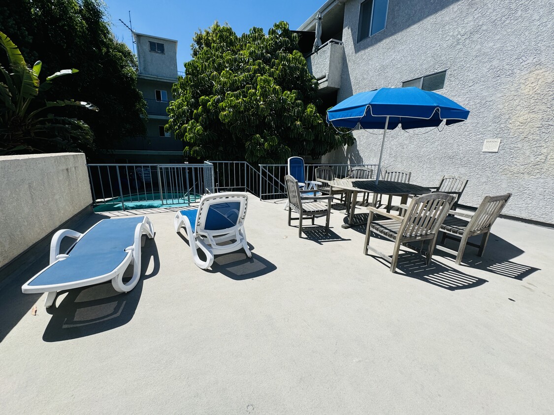
This beautifully maintained 34-unit building in the heart of Sherman Oaks has gated parking, entry, and a heated swimming pool. This location is ideally located near grocery stores, shopping, restaurants, electric car charging, and is easily accessible from the 101 and 405 freeways. **Currently offering a leasing special - 2 week rental credit on all new leases. **
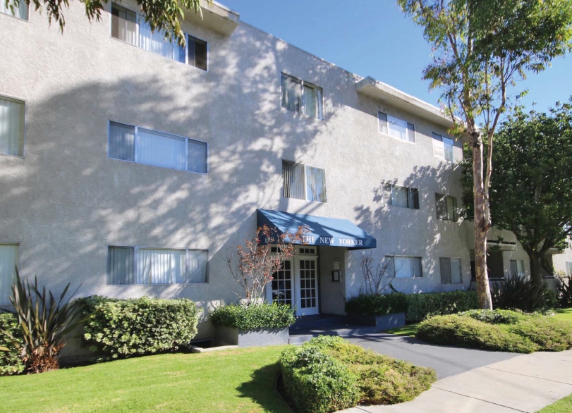
The New Yorker is an apartment community located in Los Angeles County and the 91423 ZIP Code. This area is served by the Los Angeles Unified Rocp School District attendance zone.
Pool
Laundry Facilities
Elevator
Controlled Access
Air Conditioning
Dishwasher
High Speed Internet Access
Walk-In Closets
Refrigerator
Tub/Shower
Disposal
Freezer
Sherman Oaks sits in the heart of the San Fernando Valley, offering a grounded, residential feel while staying well-connected to the rest of Los Angeles. The neighborhood traces its roots to the early 20th century, when Gen. Moses Hazeltine Sherman developed the area as part of the Los Angeles Suburban Homes Company. Today, Sherman Oaks balances its historic character with the practicalities of modern city living. Ventura Boulevard runs through its core, lined with established restaurants, coffee shops, and local businesses that have served the community for decades. The nearby 101 and 405 freeways make commuting to major employment centers across the metro relatively straightforward.
The housing mix here leans toward mid-century apartment communities, garden-style buildings, and two-story walkups tucked along tree-lined streets.
Learn more about living in Sherman Oaks| Colleges & Universities | Distance | ||
|---|---|---|---|
| Colleges & Universities | Distance | ||
| Drive: | 7 min | 3.4 mi | |
| Drive: | 9 min | 6.4 mi | |
| Drive: | 16 min | 9.8 mi | |
| Drive: | 21 min | 10.9 mi |


Transportation options available in Sherman Oaks include Universal City/Studio City, located 5.5 miles from The New Yorker. The New Yorker is near Bob Hope, located 7.9 miles or 14 minutes away, and Los Angeles International, located 19.3 miles or 27 minutes away.
| Transit / Subway | Distance | ||
|---|---|---|---|
| Transit / Subway | Distance | ||
|
|
Drive: | 8 min | 5.5 mi |
|
|
Drive: | 8 min | 5.5 mi |
|
|
Drive: | 12 min | 8.4 mi |
|
|
Drive: | 12 min | 8.7 mi |
|
|
Drive: | 18 min | 12.2 mi |
| Commuter Rail | Distance | ||
|---|---|---|---|
| Commuter Rail | Distance | ||
|
|
Drive: | 10 min | 5.1 mi |
|
|
Drive: | 14 min | 8.2 mi |
|
|
Drive: | 13 min | 8.4 mi |
|
|
Drive: | 15 min | 8.9 mi |
| Drive: | 15 min | 9.1 mi |
| Airports | Distance | ||
|---|---|---|---|
| Airports | Distance | ||
|
Bob Hope
|
Drive: | 14 min | 7.9 mi |
|
Los Angeles International
|
Drive: | 27 min | 19.3 mi |
Scores provided by
Traffic
BusyAirport
CalmBusinesses
ActiveScores provided by
HowLoud What is a Sound Score Rating? A Sound Score Rating aggregates noise caused by vehicle traffic, airplane traffic and local sources. How It WorksTime and distance from The New Yorker.
| Shopping Centers | Distance | ||
|---|---|---|---|
| Shopping Centers | Distance | ||
| Walk: | 3 min | 0.2 mi | |
| Walk: | 8 min | 0.4 mi | |
| Walk: | 10 min | 0.6 mi |
| Parks and Recreation | Distance | ||
|---|---|---|---|
| Parks and Recreation | Distance | ||
|
The Japanese Garden
|
Drive: | 7 min | 4.1 mi |
|
Franklin Canyon Park
|
Drive: | 12 min | 4.4 mi |
|
Sooky Goldman Nature Center
|
Drive: | 13 min | 4.5 mi |
|
Sepulveda Basin Wildlife Reserve
|
Drive: | 11 min | 4.5 mi |
|
Skirball Cultural Center
|
Drive: | 9 min | 5.3 mi |
| Hospitals | Distance | ||
|---|---|---|---|
| Hospitals | Distance | ||
| Drive: | 2 min | 1.2 mi | |
| Drive: | 5 min | 2.9 mi | |
| Drive: | 8 min | 4.6 mi |
| Military Bases | Distance | ||
|---|---|---|---|
| Military Bases | Distance | ||
| Drive: | 28 min | 21.8 mi |
What Are Walk Score®, Transit Score®, and Bike Score® Ratings?
Walk Score® measures the walkability of any address. Transit Score® measures access to public transit. Bike Score® measures the bikeability of any address.
What is a Sound Score Rating?
A Sound Score Rating aggregates noise caused by vehicle traffic, airplane traffic and local sources.

13951 Moorpark St
Sherman Oaks, CA 91423


