
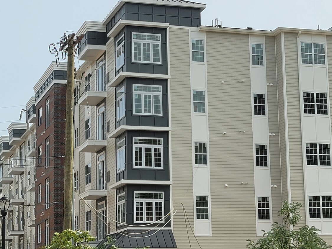
The Metropolitan
78 Murray St,
Elizabeth,
NJ
07202
-
Monthly Rent
$2,150 - $2,700
-
Bedrooms
1 - 2 bd
-
Bathrooms
1 - 2 ba
-
Square Feet
729 - 1,120 sq ft

A new modern pet-friendly five-story building that's located steps away from all public transportation, major highways and Newark international airport.
Highlights
- Den
- Walk-In Closets
- Deck
- Controlled Access
- Fireplace
- Sundeck
- Dog Park
- Elevator
- Balcony
Pricing & Floor Plans
Fees and Policies
The fees listed below are community-provided and may exclude utilities or add-ons. All payments are made directly to the property and are non-refundable unless otherwise specified.
-
One-Time Basics
-
Due at Application
-
Application Fee Per ApplicantCharged per applicant.$70
-
-
Due at Application
Pet policies are negotiable.
-
Dogs
-
One-Time Pet FeeMax of 2. Charged per pet.$450
-
Monthly Pet FeeMax of 2. Charged per pet.$45 / mo
Pet interviewRestrictions:certain breed and weight restrictions apply. Maximum of 2 pets TOTALRead More Read Less -
-
Cats
-
One-Time Pet FeeMax of 2. Charged per pet.$450
-
Monthly Pet FeeMax of 2. Charged per pet.$45 / mo
Pet interviewRestrictions: -
-
CoveredEach unit will be assigned spaces as needed and as spots are available
Property Fee Disclaimer: Based on community-supplied data and independent market research. Subject to change without notice. May exclude fees for mandatory or optional services and usage-based utilities.
Details
Utilities Included
-
Trash Removal
-
Sewer
Lease Options
-
12 mo
Property Information
-
Built in 2020
-
80 units/5 stories
About The Metropolitan
A new modern pet-friendly five-story building that's located steps away from all public transportation, major highways and Newark international airport.
The Metropolitan is an apartment community located in Union County and the 07202 ZIP Code. This area is served by the Elizabeth Public attendance zone.
Unique Features
- Dog Park
- Meeting Area
- Gym
- Business Center
- Meeting Areas
Contact
Community Amenities
Fitness Center
Elevator
Playground
Controlled Access
- Controlled Access
- Elevator
- Business Center
- Lounge
- Fitness Center
- Playground
- Sundeck
- Dog Park
Apartment Features
Washer/Dryer
Air Conditioning
Dishwasher
High Speed Internet Access
Walk-In Closets
Granite Countertops
Microwave
Refrigerator
Indoor Features
- High Speed Internet Access
- Wi-Fi
- Washer/Dryer
- Air Conditioning
- Heating
- Smoke Free
- Cable Ready
- Trash Compactor
- Tub/Shower
- Fireplace
- Intercom
- Sprinkler System
- Wheelchair Accessible (Rooms)
Kitchen Features & Appliances
- Dishwasher
- Ice Maker
- Granite Countertops
- Stainless Steel Appliances
- Pantry
- Eat-in Kitchen
- Kitchen
- Microwave
- Oven
- Range
- Refrigerator
- Freezer
- Instant Hot Water
Model Details
- Carpet
- Tile Floors
- Den
- Walk-In Closets
- Linen Closet
- Double Pane Windows
- Balcony
- Patio
- Deck
- Lawn
Living in Elizabeth, New Jersey combines metropolitan accessibility with historical significance, just 20 miles from Manhattan. The city offers various housing options, from historic single-family homes to apartments, with average rents ranging from $1,371 for studios to $2,013 for three-bedroom units. Elizabeth's neighborhoods each showcase distinct characteristics - the Midtown district features Art Deco architecture, while the Elizabethport area near the waterfront has experienced recent development. The Elmora and Peterstown areas maintain their established cultural heritage through local markets and architecture.
Elizabeth's position as a transportation hub includes multiple train stations providing direct access to Newark and New York City. The Mills at Jersey Gardens outlet mall and the Port Newark-Elizabeth Marine Terminal contribute to the local economy. For outdoor recreation, Warinanco Park offers boating facilities and seasonal activities.
Learn more about living in ElizabethCompare neighborhood and city base rent averages by bedroom.
| Downtown Elizabeth | Elizabeth, NJ | |
|---|---|---|
| Studio | $1,494 | $1,409 |
| 1 Bedroom | $1,844 | $1,581 |
| 2 Bedrooms | $2,450 | $2,023 |
| 3 Bedrooms | $1,826 | $2,075 |
- Controlled Access
- Elevator
- Business Center
- Lounge
- Sundeck
- Dog Park
- Fitness Center
- Playground
- Dog Park
- Meeting Area
- Gym
- Business Center
- Meeting Areas
- High Speed Internet Access
- Wi-Fi
- Washer/Dryer
- Air Conditioning
- Heating
- Smoke Free
- Cable Ready
- Trash Compactor
- Tub/Shower
- Fireplace
- Intercom
- Sprinkler System
- Wheelchair Accessible (Rooms)
- Dishwasher
- Ice Maker
- Granite Countertops
- Stainless Steel Appliances
- Pantry
- Eat-in Kitchen
- Kitchen
- Microwave
- Oven
- Range
- Refrigerator
- Freezer
- Instant Hot Water
- Carpet
- Tile Floors
- Den
- Walk-In Closets
- Linen Closet
- Double Pane Windows
- Balcony
- Patio
- Deck
- Lawn
| Monday | 9am - 5pm |
|---|---|
| Tuesday | 9am - 5pm |
| Wednesday | 9am - 5pm |
| Thursday | 9am - 5pm |
| Friday | 9am - 5pm |
| Saturday | 9am - 5pm |
| Sunday | 12pm - 5pm |
| Colleges & Universities | Distance | ||
|---|---|---|---|
| Colleges & Universities | Distance | ||
| Walk: | 5 min | 0.3 mi | |
| Drive: | 4 min | 1.5 mi | |
| Drive: | 17 min | 6.3 mi | |
| Drive: | 15 min | 6.8 mi |


View GreatSchools Rating Methodology
Data provided by GreatSchools.org © 2026. All rights reserved.
Transportation options available in Elizabeth include Military Park, located 6.6 miles from The Metropolitan. The Metropolitan is near Newark Liberty International, located 7.2 miles or 12 minutes away, and LaGuardia, located 24.9 miles or 46 minutes away.
| Transit / Subway | Distance | ||
|---|---|---|---|
| Transit / Subway | Distance | ||
|
|
Drive: | 10 min | 6.6 mi |
|
|
Drive: | 11 min | 7.2 mi |
|
|
Drive: | 12 min | 7.7 mi |
| Drive: | 16 min | 8.4 mi | |
|
|
Drive: | 18 min | 9.6 mi |
| Commuter Rail | Distance | ||
|---|---|---|---|
| Commuter Rail | Distance | ||
|
|
Walk: | 6 min | 0.3 mi |
|
|
Drive: | 5 min | 1.9 mi |
|
|
Drive: | 4 min | 1.9 mi |
|
|
Drive: | 7 min | 3.2 mi |
|
|
Drive: | 8 min | 4.0 mi |
| Airports | Distance | ||
|---|---|---|---|
| Airports | Distance | ||
|
Newark Liberty International
|
Drive: | 12 min | 7.2 mi |
|
LaGuardia
|
Drive: | 46 min | 24.9 mi |
Time and distance from The Metropolitan.
| Shopping Centers | Distance | ||
|---|---|---|---|
| Shopping Centers | Distance | ||
| Walk: | 10 min | 0.5 mi | |
| Walk: | 10 min | 0.6 mi | |
| Drive: | 4 min | 1.5 mi |
| Parks and Recreation | Distance | ||
|---|---|---|---|
| Parks and Recreation | Distance | ||
|
Hawk Rise Sanctuary
|
Drive: | 13 min | 5.5 mi |
|
Staten Island Industrial Park
|
Drive: | 12 min | 5.8 mi |
|
Liberty State Park
|
Drive: | 14 min | 7.1 mi |
|
Faber Park
|
Drive: | 14 min | 7.2 mi |
|
G. Thomas DiDomenico Park
|
Drive: | 17 min | 8.7 mi |
| Hospitals | Distance | ||
|---|---|---|---|
| Hospitals | Distance | ||
| Walk: | 12 min | 0.7 mi | |
| Drive: | 8 min | 4.1 mi | |
| Drive: | 14 min | 5.7 mi |
| Military Bases | Distance | ||
|---|---|---|---|
| Military Bases | Distance | ||
| Drive: | 22 min | 9.5 mi | |
| Drive: | 20 min | 9.9 mi | |
| Drive: | 17 min | 11.0 mi |
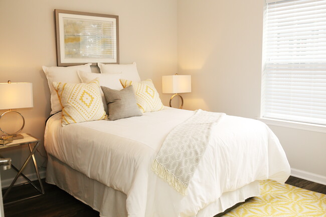
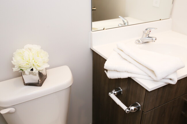
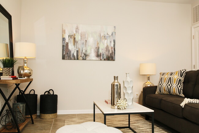
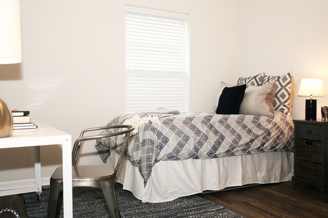
The Metropolitan Photos
-
The Metropolitan
-
-
-
-
-
-
The Metropolitan has units with in‑unit washers and dryers, making laundry day simple for residents.
Select utilities are included in rent at The Metropolitan, including trash removal and sewer. Residents are responsible for any other utilities not listed.
Parking is available at The Metropolitan. Contact this property for details.
The Metropolitan has one to two-bedrooms with rent ranges from $2,150/mo. to $2,700/mo.
Yes, The Metropolitan welcomes pets. Breed restrictions, weight limits, and additional fees may apply. View this property's pet policy.
A good rule of thumb is to spend no more than 30% of your gross income on rent. Based on the lowest available rent of $2,150 for a one-bedroom, you would need to earn about $86,000 per year to qualify. Want to double-check your budget? Calculate how much rent you can afford with our Rent Affordability Calculator.
The Metropolitan is not currently offering any rent specials. Check back soon, as promotions change frequently.
While The Metropolitan does not offer Matterport 3D tours, renters can request a tour directly through our online platform.
Statewide service is free, confidential, multilingual and always open. Three easy ways to reach Social Services in NJ: Dial 2-1-1; text your zip code to 898-211; or chat at https://www.nj211.org
What Are Walk Score®, Transit Score®, and Bike Score® Ratings?
Walk Score® measures the walkability of any address. Transit Score® measures access to public transit. Bike Score® measures the bikeability of any address.
What is a Sound Score Rating?
A Sound Score Rating aggregates noise caused by vehicle traffic, airplane traffic and local sources
78 Murray St
Elizabeth, NJ 07202