
Parker
2038 Parker St,
Berkeley, CA 94704
$2,752 - $7,064
Studio - 3 Beds
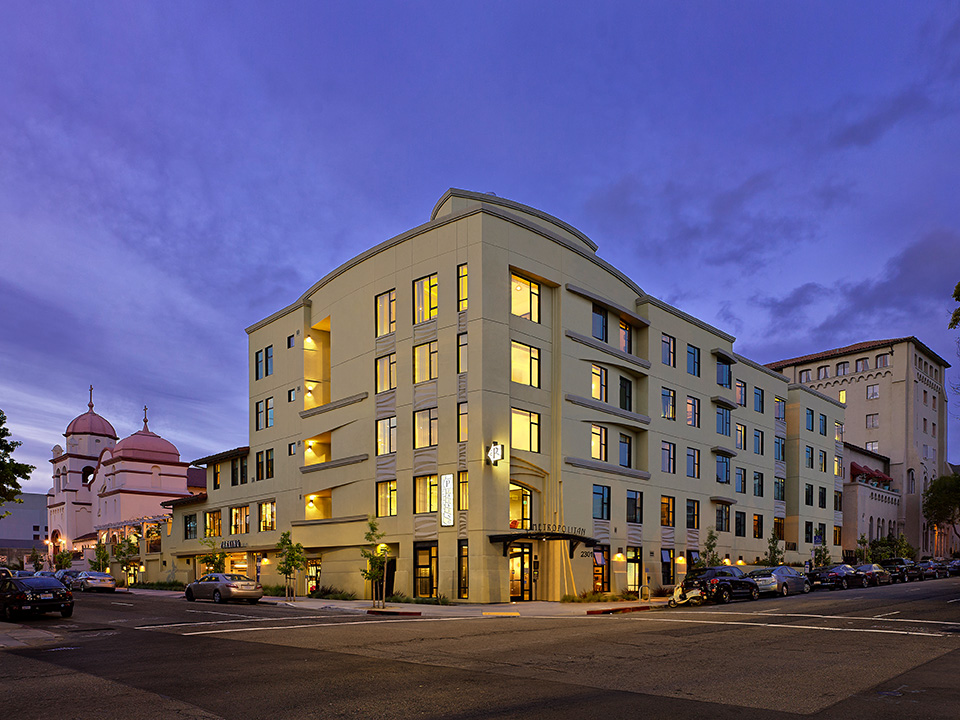

The Metropolitan in Berkeley is ready for you to move in. The location of this community is on Durant Ave in the 94704 area of Berkeley. The professional leasing staff is ready for you to come by for a tour. Schedule a time to see the available floorplan options. At The Metropolitan you're right at home. Stop by the community today.
The Metropolitan is an apartment community located in Alameda County and the 94704 ZIP Code. This area is served by the Berkeley Unified attendance zone.
Located just minutes from Downtown Berkeley, South Berkeley encompasses part of historic Rancho San Antonio. Today, it has become a mecca for sports as well as cool apartments. The Ashby Stage is a great place to see a show, and it’s down the road from the Berkeley Bowl supermarket. Adeline Street is where you’ll find most restaurants, nightlife, and Ashby BART Station.
Grove Park offers an array of outdoor amenities to locals including sports courts and a playground. When you live in South Berkeley, you’re close to the University of California, Berkeley and five miles from Oakland.
Learn more about living in South Berkeley| Colleges & Universities | Distance | ||
|---|---|---|---|
| Colleges & Universities | Distance | ||
| Walk: | 11 min | 0.6 mi | |
| Drive: | 5 min | 1.5 mi | |
| Drive: | 10 min | 3.6 mi | |
| Drive: | 13 min | 5.6 mi |


Transportation options available in Berkeley include Downtown Berkeley Station, located 0.5 mile from The Metropolitan. The Metropolitan is near Metro Oakland International, located 14.7 miles or 25 minutes away, and San Francisco International, located 25.0 miles or 41 minutes away.
| Transit / Subway | Distance | ||
|---|---|---|---|
| Transit / Subway | Distance | ||
|
|
Walk: | 8 min | 0.5 mi |
|
|
Walk: | 9 min | 0.5 mi |
|
|
Drive: | 4 min | 1.4 mi |
|
|
Drive: | 6 min | 2.1 mi |
|
|
Drive: | 7 min | 2.1 mi |
| Commuter Rail | Distance | ||
|---|---|---|---|
| Commuter Rail | Distance | ||
|
|
Drive: | 8 min | 2.7 mi |
|
|
Drive: | 9 min | 3.2 mi |
|
|
Drive: | 13 min | 6.4 mi |
| Drive: | 18 min | 9.2 mi | |
| Drive: | 23 min | 12.5 mi |
| Airports | Distance | ||
|---|---|---|---|
| Airports | Distance | ||
|
Metro Oakland International
|
Drive: | 25 min | 14.7 mi |
|
San Francisco International
|
Drive: | 41 min | 25.0 mi |
Time and distance from The Metropolitan.
| Shopping Centers | Distance | ||
|---|---|---|---|
| Shopping Centers | Distance | ||
| Walk: | 5 min | 0.3 mi | |
| Walk: | 12 min | 0.6 mi | |
| Drive: | 7 min | 2.5 mi |
| Parks and Recreation | Distance | ||
|---|---|---|---|
| Parks and Recreation | Distance | ||
|
UC Berkeley Museum of Paleontology
|
Walk: | 7 min | 0.4 mi |
|
Essig Museum of Entomology
|
Walk: | 7 min | 0.4 mi |
|
University and Jepson Herbaria
|
Walk: | 7 min | 0.4 mi |
|
Habitot Children's Museum
|
Walk: | 7 min | 0.4 mi |
|
Museum of Vertebrate Zoology
|
Walk: | 9 min | 0.5 mi |
| Hospitals | Distance | ||
|---|---|---|---|
| Hospitals | Distance | ||
| Drive: | 3 min | 1.2 mi | |
| Drive: | 7 min | 2.6 mi | |
| Drive: | 10 min | 3.6 mi |
| Military Bases | Distance | ||
|---|---|---|---|
| Military Bases | Distance | ||
| Drive: | 14 min | 4.6 mi | |
| Drive: | 20 min | 7.3 mi |
What Are Walk Score®, Transit Score®, and Bike Score® Ratings?
Walk Score® measures the walkability of any address. Transit Score® measures access to public transit. Bike Score® measures the bikeability of any address.
What is a Sound Score Rating?
A Sound Score Rating aggregates noise caused by vehicle traffic, airplane traffic and local sources

2301 Durant Ave
Berkeley, CA 94704


