
The Station Apartments
5959 Broadway,
Bronx, NY 10463
$1,750 - $2,300
Studio - 1 Bed
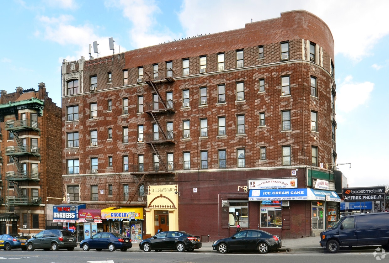
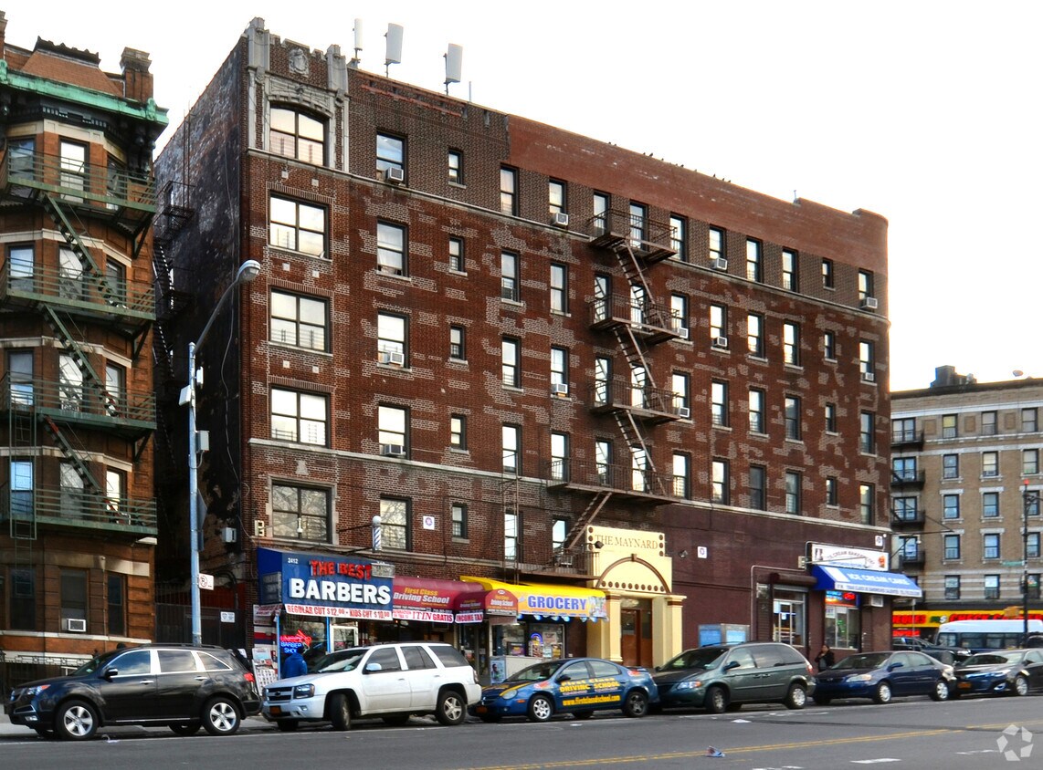
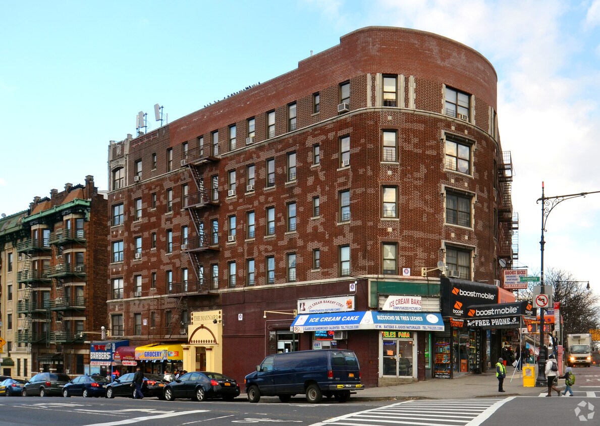

Discover The Maynard in Bronx. These apartments are located in Bronx on University Ave. The community staff is ready to help you find your perfect place. Be sure to check out the current floorplan options. Contact us or stop by today.
The Maynard is an apartment community located in Bronx County and the 10468 ZIP Code. This area is served by the New York City Geographic District #10 attendance zone.
Fordham Manor is a densely populated, buzzing neighborhood in the Bronx, home to about 43,000 residents. It includes Fordham University and stretches from Interstate 87 and the Harlem River east to the Bronx Park, home of the Bronx Zoo.
With a history dating back to Colonial times, the oldest section of the neighborhood is Old Fordham Village. Fordham is a fantastic neighborhood with a colorful history. Downtown Manhattan is just eight miles southwest; you'll be able to take the subway or train and get there in less than 30 minutes after moving to your Fordham Manor apartment. Nearby Fordham Road hosts a thriving retail marketplace with over 200 independent and chain stores, attracting plenty of foot traffic throughout the year while keeping the local economy robust.
Learn more about living in Fordham Manor| Colleges & Universities | Distance | ||
|---|---|---|---|
| Colleges & Universities | Distance | ||
| Walk: | 5 min | 0.3 mi | |
| Walk: | 12 min | 0.6 mi | |
| Walk: | 19 min | 1.0 mi | |
| Drive: | 4 min | 1.2 mi |


Transportation options available in Bronx include Fordham Road (4 Line), located 0.2 mile from The Maynard. The Maynard is near LaGuardia, located 10.6 miles or 20 minutes away, and John F Kennedy International, located 21.0 miles or 31 minutes away.
| Transit / Subway | Distance | ||
|---|---|---|---|
| Transit / Subway | Distance | ||
|
|
Walk: | 3 min | 0.2 mi |
|
|
Walk: | 8 min | 0.4 mi |
|
|
Walk: | 9 min | 0.5 mi |
|
|
Walk: | 11 min | 0.6 mi |
|
|
Walk: | 14 min | 0.8 mi |
| Commuter Rail | Distance | ||
|---|---|---|---|
| Commuter Rail | Distance | ||
|
|
Walk: | 11 min | 0.6 mi |
|
|
Walk: | 15 min | 0.8 mi |
|
|
Drive: | 4 min | 1.6 mi |
|
|
Drive: | 4 min | 1.6 mi |
|
|
Drive: | 4 min | 1.7 mi |
| Airports | Distance | ||
|---|---|---|---|
| Airports | Distance | ||
|
LaGuardia
|
Drive: | 20 min | 10.6 mi |
|
John F Kennedy International
|
Drive: | 31 min | 21.0 mi |
Time and distance from The Maynard.
| Shopping Centers | Distance | ||
|---|---|---|---|
| Shopping Centers | Distance | ||
| Walk: | 10 min | 0.5 mi | |
| Walk: | 13 min | 0.7 mi | |
| Walk: | 17 min | 0.9 mi |
| Parks and Recreation | Distance | ||
|---|---|---|---|
| Parks and Recreation | Distance | ||
|
St. James Park
|
Walk: | 9 min | 0.5 mi |
|
Poe Park
|
Walk: | 12 min | 0.6 mi |
|
Dyckman House Park
|
Drive: | 3 min | 1.2 mi |
|
Roberto Clemente State Park
|
Drive: | 5 min | 1.6 mi |
|
Sherman Creek and Swindler Cove
|
Drive: | 11 min | 5.1 mi |
| Hospitals | Distance | ||
|---|---|---|---|
| Hospitals | Distance | ||
| Drive: | 5 min | 1.3 mi | |
| Drive: | 5 min | 2.4 mi | |
| Drive: | 8 min | 3.1 mi |
| Military Bases | Distance | ||
|---|---|---|---|
| Military Bases | Distance | ||
| Drive: | 21 min | 11.4 mi |
What Are Walk Score®, Transit Score®, and Bike Score® Ratings?
Walk Score® measures the walkability of any address. Transit Score® measures access to public transit. Bike Score® measures the bikeability of any address.
What is a Sound Score Rating?
A Sound Score Rating aggregates noise caused by vehicle traffic, airplane traffic and local sources


