
Park East
200 Mesnager St,
Los Angeles, CA 90012
$2,135 - $4,284
Studio - 2 Beds
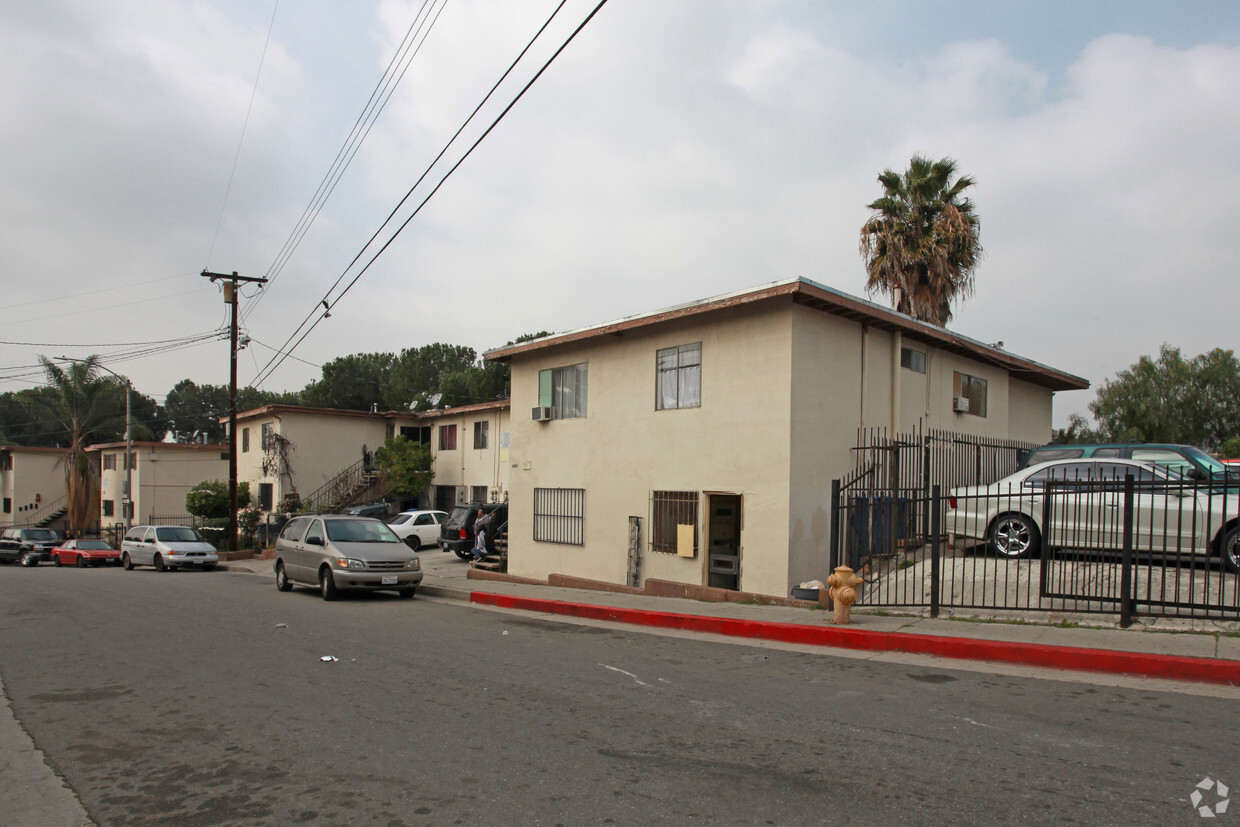
El complejo recientemente renovado de The Grey Apartment es la definición de vida de lujo. Te sorprenderás a primera vista de las impresionantes vistas del horizonte de Los Ángeles desde nuestra propiedad. Nuestra atención a los detalles estéticos y la funcionalidad es visible en cada uno de nuestros apartamentos completamente renovados y cuidadosamente diseñados. Cocina una comida suntuosa en tu cocina de lujo recientemente renovada equipada con electrodomésticos de acero inoxidable, relucientes encimeras de cuarzo y gabinetes blancos impecables. Hay pisos de madera de tablones de vinilo en todas las unidades. ¡Esperamos darle la bienvenida a usted y a su mascota, ya que nuestra propiedad admite mascotas! Su búsqueda de un nuevo hogar termina aquí en los espectaculares Grey Apartments. Esta propiedad está administrada profesionalmente por Property Management Associates en Los Ángeles. The Grey Apartments está ubicado en la hermosa ciudad de El Sereno. El hermoso El Sereno tiene una ubicación central entre los vecindarios más vibrantes de Los Ángeles. Nuestra propiedad está a minutos de la floreciente vida nocturna del centro de Los Ángeles, el Walt Disney Concert Hall, el Broad Museum, el Staples Center, Union Station y una variedad de restaurantes exquisitos. Realice un corto viaje panorámico hasta Old Town Pasadena, hogar de restaurantes, tiendas y vida nocturna de lujo. Nuestra propiedad está a menos de una milla de Rose Hill Park, El Sereno Park y Ascot Hills Park. Estamos convenientemente ubicados justo a la salida de las autopistas 110, I-5 e I-10, lo que hace que cualquier viaje sea sencillo. Los apartamentos Grey están a solo 15 minutos en auto de Pasadena y a 20 minutos en auto del centro de Los Ángeles. ¡Compruebe usted mismo por qué El Sereno es el mejor vecindario de Los Ángeles!
The Grey is an apartment community located in Los Angeles County and the 90032 ZIP Code. This area is served by the Los Angeles Unified attendance zone.
Acceso a Internet de alta velocidad
Suelos de madera maciza
Bañera/Ducha
Congelador
A quiet suburb outside of Los Angeles, Monterey Hills is known for its rolling hills, winding residential streets, and elevated city views. Check out Elephant Hill, a popular place to bike or hike that offers beautiful views of the neighborhood. Herman Park is nestled along Highway 110 in the north end of the neighborhood, offering tennis courts, playgrounds, and a dog park. And for more outdoor recreation, visit the biking paths and hiking trails at Ernest E. Debs Regional Park, bordering Monterey Hills.
Monterey Hills is a more secluded part of Northeast Los Angeles with larger lots, single-family homes, and tree-lined streets. However, if you cross over Highway 110, you’ll find theatres, restaurants, services, and more. Monterey Hills is located just seven miles northeast of Downtown Los Angeles and eight miles east of major attractions such as Griffith Park, the Los Angeles Zoo, the Greek Theatre, and Glendale Galleria.
Learn more about living in Monterey Hills| Colleges & Universities | Distance | ||
|---|---|---|---|
| Colleges & Universities | Distance | ||
| Drive: | 7 min | 3.0 mi | |
| Drive: | 8 min | 3.4 mi | |
| Drive: | 13 min | 5.0 mi | |
| Drive: | 13 min | 5.6 mi |


Transportation options available in Los Angeles include Highland Park Station, located 2.8 miles from The Grey. The Grey is near Bob Hope, located 17.8 miles or 27 minutes away, and Los Angeles International, located 20.6 miles or 35 minutes away.
| Transit / Subway | Distance | ||
|---|---|---|---|
| Transit / Subway | Distance | ||
|
|
Drive: | 8 min | 2.8 mi |
|
|
Drive: | 8 min | 3.2 mi |
|
|
Drive: | 9 min | 3.4 mi |
|
|
Drive: | 10 min | 4.0 mi |
|
|
Drive: | 9 min | 4.4 mi |
| Commuter Rail | Distance | ||
|---|---|---|---|
| Commuter Rail | Distance | ||
|
|
Drive: | 11 min | 4.5 mi |
|
|
Drive: | 10 min | 4.6 mi |
|
|
Drive: | 14 min | 7.1 mi |
| Drive: | 13 min | 8.5 mi | |
|
|
Drive: | 19 min | 9.3 mi |
| Airports | Distance | ||
|---|---|---|---|
| Airports | Distance | ||
|
Bob Hope
|
Drive: | 27 min | 17.8 mi |
|
Los Angeles International
|
Drive: | 35 min | 20.6 mi |
Time and distance from The Grey.
| Shopping Centers | Distance | ||
|---|---|---|---|
| Shopping Centers | Distance | ||
| Drive: | 5 min | 2.1 mi | |
| Drive: | 8 min | 2.9 mi | |
| Drive: | 8 min | 3.2 mi |
| Parks and Recreation | Distance | ||
|---|---|---|---|
| Parks and Recreation | Distance | ||
|
Audubon Center at Debs Park
|
Drive: | 9 min | 3.2 mi |
|
Hollenbeck Lake
|
Drive: | 9 min | 4.3 mi |
|
Chavez Ravine Arboretum
|
Drive: | 12 min | 5.2 mi |
|
Elysian Park
|
Drive: | 14 min | 5.2 mi |
|
Elyria Canyon Park
|
Drive: | 13 min | 5.8 mi |
| Hospitals | Distance | ||
|---|---|---|---|
| Hospitals | Distance | ||
| Drive: | 6 min | 2.7 mi | |
| Drive: | 7 min | 3.1 mi | |
| Drive: | 7 min | 3.5 mi |
| Military Bases | Distance | ||
|---|---|---|---|
| Military Bases | Distance | ||
| Drive: | 32 min | 22.2 mi | |
| Drive: | 40 min | 26.2 mi |
What Are Walk Score®, Transit Score®, and Bike Score® Ratings?
Walk Score® measures the walkability of any address. Transit Score® measures access to public transit. Bike Score® measures the bikeability of any address.
What is a Sound Score Rating?
A Sound Score Rating aggregates noise caused by vehicle traffic, airplane traffic and local sources

4601-4689 Grey Dr
Los Angeles, CA 90032


 - Violet on Virgil")
 - AVA Burbank")

