
The Tolman
39176 Fremont Blvd,
Fremont, CA 94538
$3,425 - $4,840 Total Monthly Price
Studio - 2 Beds


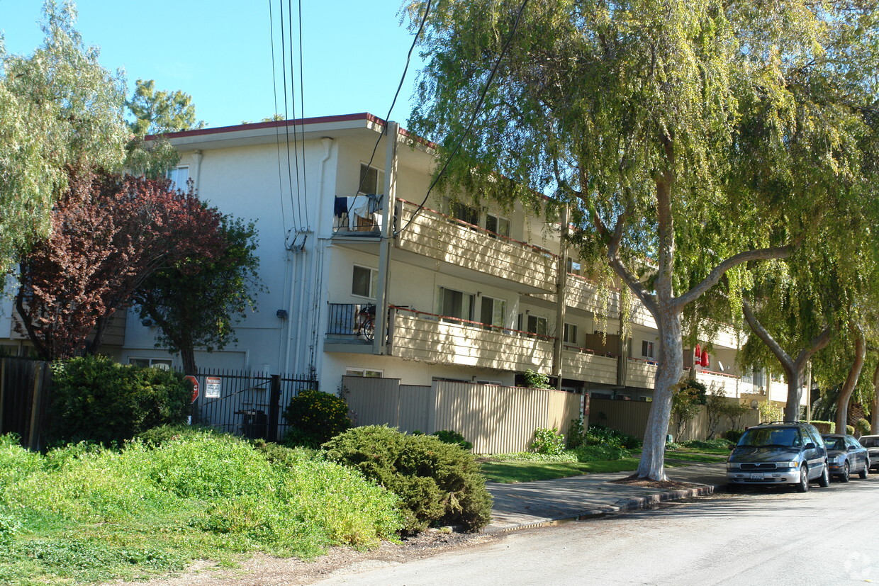
Visit The Fontana in Fremont, CA. Select from 1 to 3 bedroom apartments. Our apartment community offers you a wide selection of amenities and features. These include: convenient on-site parking options, high-speed internet access, and smoke-free options. Let the knowledgeable leasing staff show you everything this community has in store. Stop by the leasing office to check the current floor plan availability.
The Fontana is an apartment community located in Alameda County and the 94538 ZIP Code. This area is served by the Fremont Unified School District attendance zone.
High Speed Internet Access
Smoke Free
Heating
Kitchen
Irvington is a diverse, family-friendly suburb about two miles south of Downtown Fremont. Complemented by palm tree-lined streets, Irvington offers affordable to upscale rentals available in a variety of styles, including single-family homes and apartments. Great for families, Irvington is home to several excellent schools. Although residents certainly enjoy proximity to downtown’s abundant dining and shopping options, Irvington has a small commercial center in the middle of the neighborhood filled with authentic global eateries, boutiques, and grocery stores. This central area is also home to the Irvington Farmers Market and the Fremont Bay Saint Farmers Market. Irvington borders Central Park to the north, providing residents with a day of fun outdoors with its dynamic facilities that include a skate park, golf course, and water park.
Learn more about living in IrvingtonCompare neighborhood and city base rent averages by bedroom.
| Irvington | Fremont, CA | |
|---|---|---|
| Studio | $2,090 | $2,247 |
| 1 Bedroom | $2,135 | $2,595 |
| 2 Bedrooms | $2,869 | $3,229 |
| 3 Bedrooms | $3,626 | $3,943 |
| Colleges & Universities | Distance | ||
|---|---|---|---|
| Colleges & Universities | Distance | ||
| Drive: | 7 min | 3.2 mi | |
| Drive: | 8 min | 3.8 mi | |
| Drive: | 16 min | 10.8 mi | |
| Drive: | 22 min | 15.4 mi |


Transportation options available in Fremont include Warm Springs / South Fremont, located 2.7 miles from The Fontana. The Fontana is near Norman Y Mineta San Jose International, located 14.8 miles or 20 minutes away, and Metro Oakland International, located 23.3 miles or 31 minutes away.
| Transit / Subway | Distance | ||
|---|---|---|---|
| Transit / Subway | Distance | ||
|
|
Drive: | 5 min | 2.7 mi |
|
|
Drive: | 7 min | 2.9 mi |
|
|
Drive: | 15 min | 7.2 mi |
|
|
Drive: | 14 min | 9.6 mi |
|
|
Drive: | 14 min | 10.1 mi |
| Commuter Rail | Distance | ||
|---|---|---|---|
| Commuter Rail | Distance | ||
| Drive: | 8 min | 3.7 mi | |
| Drive: | 8 min | 3.7 mi | |
| Drive: | 17 min | 12.4 mi | |
| Drive: | 18 min | 13.3 mi | |
| Drive: | 23 min | 16.3 mi |
| Airports | Distance | ||
|---|---|---|---|
| Airports | Distance | ||
|
Norman Y Mineta San Jose International
|
Drive: | 20 min | 14.8 mi |
|
Metro Oakland International
|
Drive: | 31 min | 23.3 mi |
Scores provided by
Traffic
-Airport
-Businesses
-Scores provided by
HowLoud What is a Sound Score Rating? A Sound Score Rating aggregates noise caused by vehicle traffic, airplane traffic and local sources. How It WorksTime and distance from The Fontana.
| Shopping Centers | Distance | ||
|---|---|---|---|
| Shopping Centers | Distance | ||
| Walk: | 6 min | 0.3 mi | |
| Walk: | 7 min | 0.4 mi | |
| Walk: | 10 min | 0.5 mi |
| Parks and Recreation | Distance | ||
|---|---|---|---|
| Parks and Recreation | Distance | ||
|
Central Park (Lake Elizabeth)
|
Drive: | 7 min | 2.9 mi |
|
Quarry Lakes Regional Recreation Area
|
Drive: | 10 min | 5.1 mi |
|
Niles Canyon Railway
|
Drive: | 10 min | 5.3 mi |
|
Niles Community Park
|
Drive: | 12 min | 5.8 mi |
|
Mission Peak Regional Preserve
|
Drive: | 20 min | 6.6 mi |
| Hospitals | Distance | ||
|---|---|---|---|
| Hospitals | Distance | ||
| Drive: | 5 min | 2.2 mi | |
| Drive: | 7 min | 3.1 mi |
| Military Bases | Distance | ||
|---|---|---|---|
| Military Bases | Distance | ||
| Drive: | 26 min | 17.6 mi | |
| Drive: | 43 min | 30.8 mi | |
| Drive: | 44 min | 31.0 mi |
Fitness Center Pool In Unit Washer & Dryer High-Speed Internet Stainless Steel Appliances Package Service
What Are Walk Score®, Transit Score®, and Bike Score® Ratings?
Walk Score® measures the walkability of any address. Transit Score® measures access to public transit. Bike Score® measures the bikeability of any address.
What is a Sound Score Rating?
A Sound Score Rating aggregates noise caused by vehicle traffic, airplane traffic and local sources.
3843 Carol Ave
Fremont, CA 94538


