
Revery
1766 El Camino Real,
Burlingame, CA 94010
$3,421 - $7,311
1-3 Beds
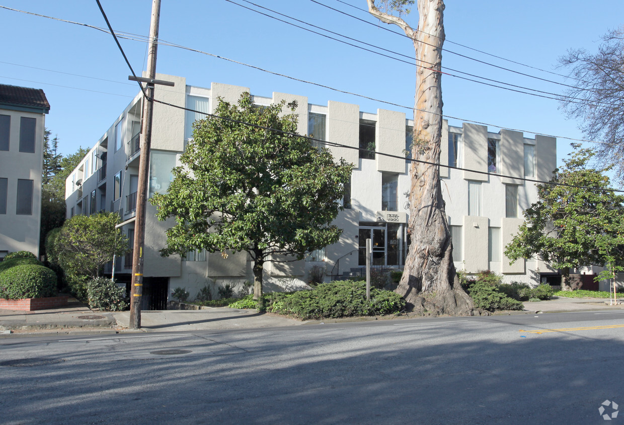
The Charmaine Apartments is ready for you to move in. The community staff is ready for you to visit. Be sure to see the available floorplan options. At this community, you'll experience a wide variety in options of amenities and features. Some of these include: security systems, convenient on-site parking options, and smoke free options. Experience a new standard at The Charmaine Apartments.
The Charmaine Apartments is an apartment community located in San Mateo County and the 94010 ZIP Code. This area is served by the Burlingame Elementary attendance zone.
Burlingame’s Easton Addition is home to a mix of older and newer properties of varying styles along quiet, tree-covered streets. Easton Addition’s notable amenities include the Kohl Mansion, Mercy Center Burlingame, and a Burlingame Public Library branch.
Primarily a residential community, Easton Addition borders a thriving retail district on Broadway. Some of the local favorites in the district include Taste in Mediterranean Food, Royal Donut Café, Mokutanya, and Il Piccolo Caffe. Easton Addition is also located near numerous parks such as Mills Canyon Park, Cuernavaca Park, Bayside Park, and Hillsborough Recreation, which all offer plenty of options for outdoor activities.
Stretched along El Camino Real on the easternmost border with convenience to U.S. 101 as well as I-280, Easton Addition provides ample opportunities for taking public transportation with access to Caltrain and BART stations.
Learn more about living in Easton Addition| Colleges & Universities | Distance | ||
|---|---|---|---|
| Colleges & Universities | Distance | ||
| Drive: | 11 min | 6.6 mi | |
| Drive: | 13 min | 7.6 mi | |
| Drive: | 20 min | 13.6 mi | |
| Drive: | 22 min | 15.2 mi |


Transportation options available in Burlingame include Millbrae (Caltrain Transfer Platform), located 1.4 miles from The Charmaine Apartments. The Charmaine Apartments is near San Francisco International, located 3.8 miles or 8 minutes away, and Metro Oakland International, located 29.3 miles or 37 minutes away.
| Transit / Subway | Distance | ||
|---|---|---|---|
| Transit / Subway | Distance | ||
|
|
Drive: | 3 min | 1.4 mi |
|
|
Drive: | 3 min | 1.4 mi |
|
|
Drive: | 6 min | 3.3 mi |
| Drive: | 7 min | 3.4 mi | |
|
|
Drive: | 8 min | 3.6 mi |
| Commuter Rail | Distance | ||
|---|---|---|---|
| Commuter Rail | Distance | ||
| Walk: | 15 min | 0.8 mi | |
| Drive: | 3 min | 1.4 mi | |
| Drive: | 3 min | 1.8 mi | |
| Drive: | 3 min | 1.9 mi | |
| Drive: | 6 min | 3.6 mi |
| Airports | Distance | ||
|---|---|---|---|
| Airports | Distance | ||
|
San Francisco International
|
Drive: | 8 min | 3.8 mi |
|
Metro Oakland International
|
Drive: | 37 min | 29.3 mi |
Time and distance from The Charmaine Apartments.
| Shopping Centers | Distance | ||
|---|---|---|---|
| Shopping Centers | Distance | ||
| Walk: | 19 min | 1.0 mi | |
| Drive: | 2 min | 1.2 mi | |
| Drive: | 3 min | 1.6 mi |
| Parks and Recreation | Distance | ||
|---|---|---|---|
| Parks and Recreation | Distance | ||
|
Bayside Park
|
Drive: | 2 min | 1.3 mi |
|
Japanese Tea Garden (San Mateo)
|
Drive: | 5 min | 3.2 mi |
|
San Mateo Arboretum
|
Drive: | 6 min | 3.5 mi |
|
Coyote Point Recreational Area
|
Drive: | 8 min | 3.6 mi |
|
CuriOdyssey
|
Drive: | 8 min | 3.6 mi |
| Hospitals | Distance | ||
|---|---|---|---|
| Hospitals | Distance | ||
| Walk: | 17 min | 0.9 mi | |
| Drive: | 11 min | 6.3 mi | |
| Drive: | 12 min | 7.6 mi |
| Military Bases | Distance | ||
|---|---|---|---|
| Military Bases | Distance | ||
| Drive: | 44 min | 28.9 mi | |
| Drive: | 45 min | 29.1 mi |
What Are Walk Score®, Transit Score®, and Bike Score® Ratings?
Walk Score® measures the walkability of any address. Transit Score® measures access to public transit. Bike Score® measures the bikeability of any address.
What is a Sound Score Rating?
A Sound Score Rating aggregates noise caused by vehicle traffic, airplane traffic and local sources

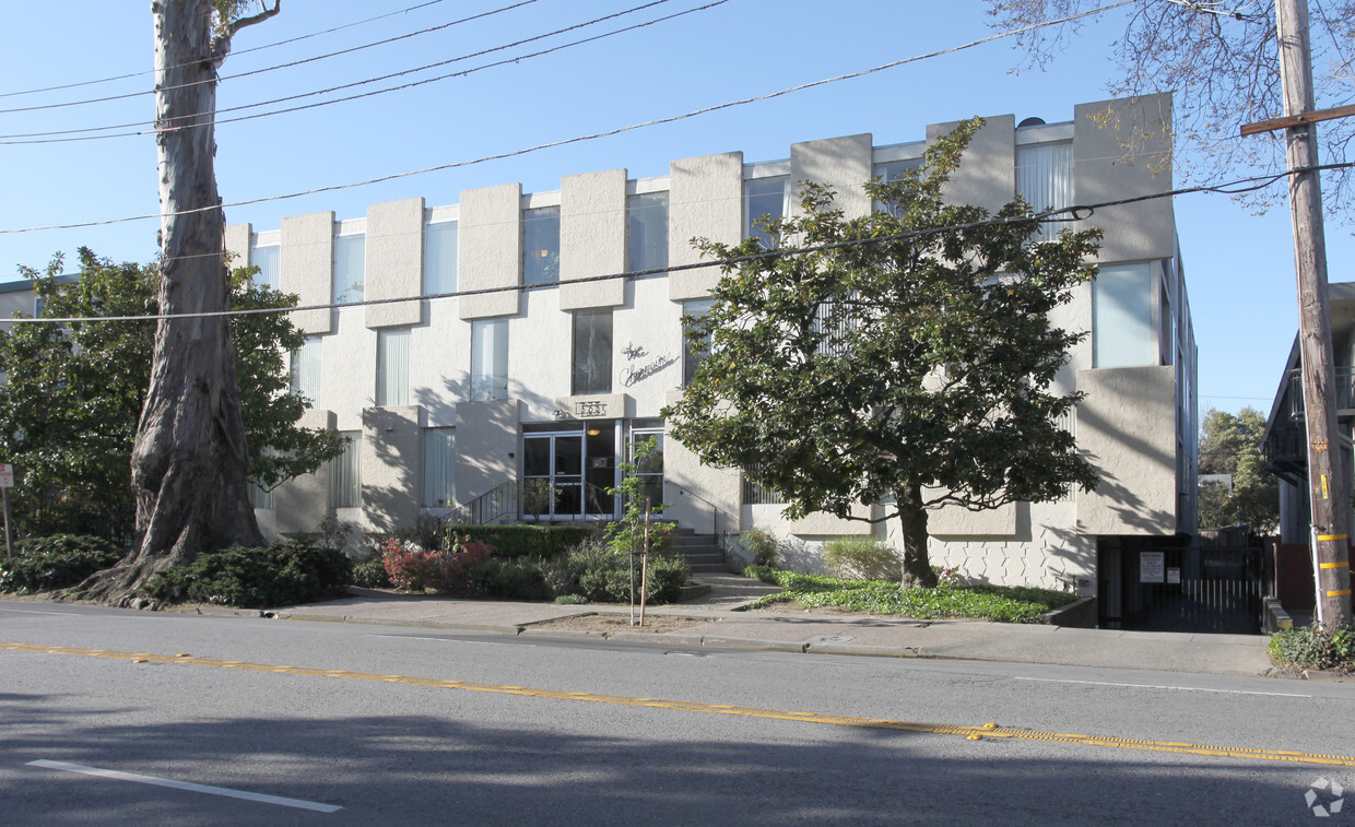
1335 El Camino Real
Burlingame, CA 94010


