
Fayette Arms Apartments
2680 Fayette Dr,
Mountain View, CA 94040
$2,754 - $3,676
1-2 Beds
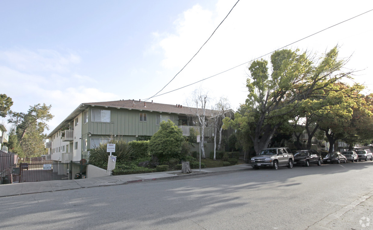
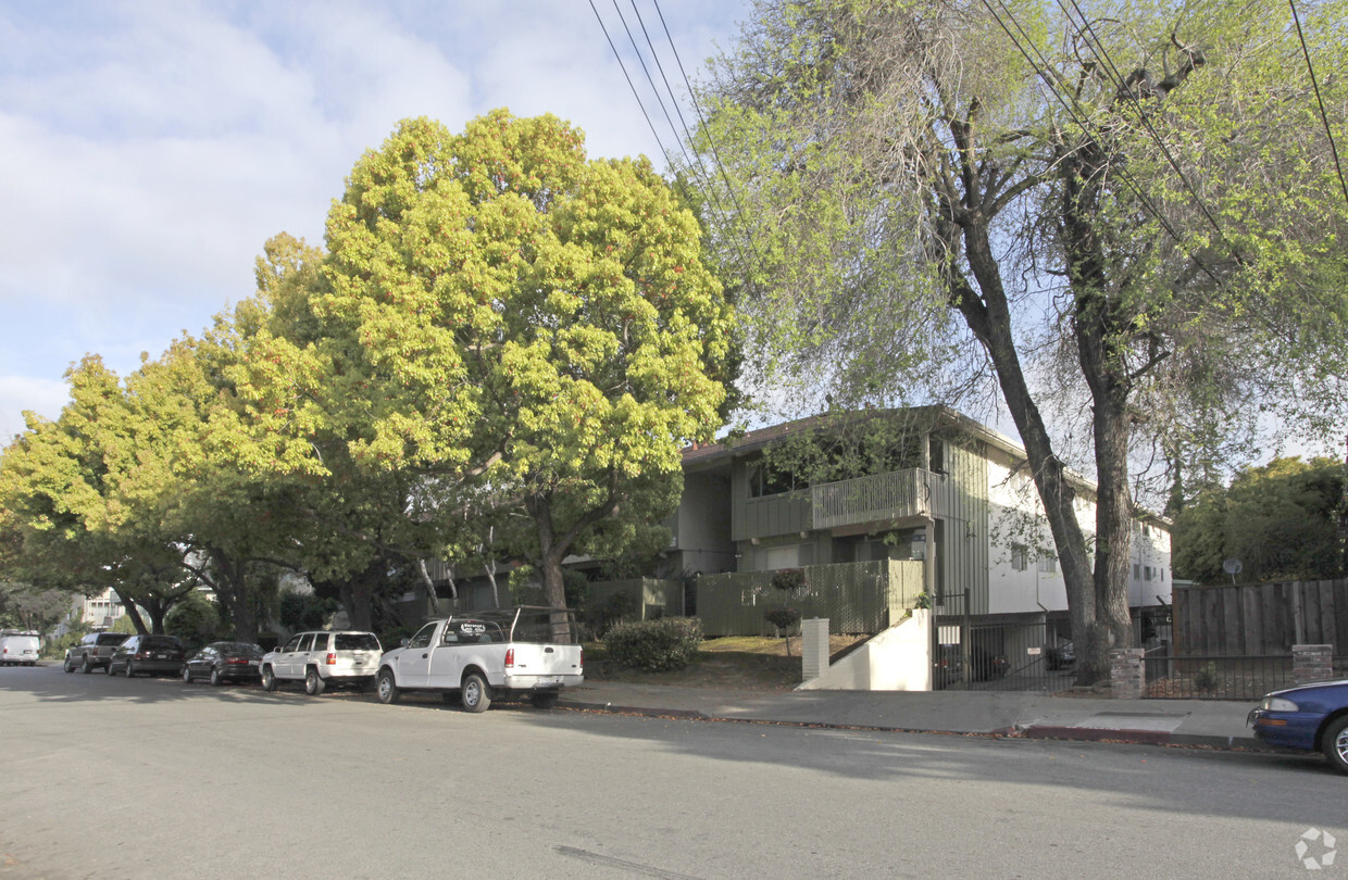

Consider making a move to The Ardmore. Be sure to see the available floorplan options. From amenities to floorplan options, the professional leasing team will assist you in finding the perfect apartment. At this community, you'll have a wide selection of features and amenities. These include: convenient on-site parking options, high-speed internet access, and smoke free options. Stop by to talk about leasing your new apartment.
The Ardmore is an apartment community located in San Mateo County and the 94303 ZIP Code. This area is served by the Ravenswood City Elementary attendance zone.
High Speed Internet Access
Smoke Free
Heating
Kitchen
Living in Palo Alto places you in Silicon Valley, where historic neighborhoods complement the city's technological presence. Tree-lined streets wind through the community, which is anchored by Stanford University. University Avenue features local boutiques and restaurants housed in preserved historic buildings, while the Stanford Shopping Center offers high-end retail destinations. The city maintains 36 parks and preserves, including the Baylands Nature Preserve and Foothills Park, where residents enjoy hiking trails and outdoor activities. Palo Alto's infrastructure supports alternative transportation, with dedicated bike lanes throughout the city.
The rental market in Palo Alto reflects the area's popularity, with current average rents ranging from $2,634 for studios to $6,139 for four-bedroom homes. Recent trends show steady growth, with rent increases varying from 1.8% to 17% across different unit sizes over the past year.
Learn more about living in Palo Alto| Colleges & Universities | Distance | ||
|---|---|---|---|
| Colleges & Universities | Distance | ||
| Drive: | 11 min | 3.8 mi | |
| Drive: | 13 min | 3.9 mi | |
| Drive: | 10 min | 5.0 mi | |
| Drive: | 21 min | 9.4 mi |


Transportation options available in Palo Alto include Bayshore Nasa Station, located 7.3 miles from The Ardmore. The Ardmore is near Norman Y Mineta San Jose International, located 14.9 miles or 21 minutes away, and San Francisco International, located 19.0 miles or 26 minutes away.
| Transit / Subway | Distance | ||
|---|---|---|---|
| Transit / Subway | Distance | ||
| Drive: | 11 min | 7.3 mi | |
|
|
Drive: | 12 min | 7.4 mi |
| Drive: | 12 min | 7.7 mi | |
|
|
Drive: | 12 min | 7.7 mi |
|
|
Drive: | 13 min | 7.9 mi |
| Commuter Rail | Distance | ||
|---|---|---|---|
| Commuter Rail | Distance | ||
| Drive: | 7 min | 2.1 mi | |
| Drive: | 8 min | 2.9 mi | |
| Drive: | 9 min | 3.9 mi | |
| Drive: | 10 min | 4.3 mi | |
| Drive: | 11 min | 5.8 mi |
| Airports | Distance | ||
|---|---|---|---|
| Airports | Distance | ||
|
Norman Y Mineta San Jose International
|
Drive: | 21 min | 14.9 mi |
|
San Francisco International
|
Drive: | 26 min | 19.0 mi |
Time and distance from The Ardmore.
| Shopping Centers | Distance | ||
|---|---|---|---|
| Shopping Centers | Distance | ||
| Drive: | 6 min | 1.5 mi | |
| Drive: | 5 min | 1.8 mi | |
| Drive: | 5 min | 2.1 mi |
| Parks and Recreation | Distance | ||
|---|---|---|---|
| Parks and Recreation | Distance | ||
|
Seminary Oaks Park
|
Drive: | 4 min | 1.3 mi |
|
Hopkins Creekside Park
|
Drive: | 5 min | 1.6 mi |
|
Rinconada Park
|
Drive: | 6 min | 1.7 mi |
|
Junior Museum and Zoo
|
Drive: | 6 min | 1.9 mi |
|
Gamble Garden
|
Drive: | 7 min | 2.2 mi |
| Hospitals | Distance | ||
|---|---|---|---|
| Hospitals | Distance | ||
| Drive: | 10 min | 3.0 mi | |
| Drive: | 12 min | 3.6 mi | |
| Drive: | 10 min | 5.4 mi |
| Military Bases | Distance | ||
|---|---|---|---|
| Military Bases | Distance | ||
| Drive: | 14 min | 7.8 mi |
What Are Walk Score®, Transit Score®, and Bike Score® Ratings?
Walk Score® measures the walkability of any address. Transit Score® measures access to public transit. Bike Score® measures the bikeability of any address.
What is a Sound Score Rating?
A Sound Score Rating aggregates noise caused by vehicle traffic, airplane traffic and local sources

315 E Okeefe St
Palo Alto, CA 94303


