
$3,500
/ Month
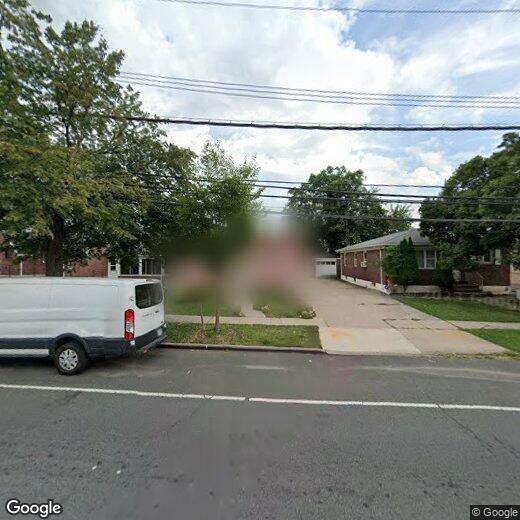
875 Targee St Unit 1
Staten Island, NY 10304
2 Weeks Ago
|
Edit
Favorites
TARGEE STREET

Favorites
Check Back Soon for Upcoming Availability
| Beds | Baths | Average SF |
|---|---|---|
| 3 Bedrooms 3 Bedrooms 3 Br | 2 Baths 2 Baths 2 Ba | — |
About This Property
Description coming soon, please contact your Highline Residential agent for more information===Ref:1770717===
TARGEE STREET is an apartment community located in Richmond County and the 10304 ZIP Code.
Location
Get Directions
Staten Island combines suburban comfort with convenient Manhattan access, making it ideal for renters who appreciate a slower pace while staying connected to city life. As the "Borough of Parks," Staten Island features over 12,300 acres of protected parkland and more than 170 parks, offering residents plenty of outdoor recreation opportunities. Housing options span from historic Victorian homes in St. George and Stapleton to contemporary apartment communities in Great Kills and New Dorp. Average rents range from $1,563 for studios to $2,335 for two-bedroom units, with moderate year-over-year increases between 1.8% to 3.2% for most unit types.
Each neighborhood brings its own character to the borough. The North Shore, especially St. George, serves as Staten Island's cultural center with landmarks like the beautifully restored St. George Theatre, Empire Outlets shopping complex, and the Staten Island Ferry terminal, offering free 24/7 service to Manhattan.
Learn more about living in Staten Island
Education
| Colleges & Universities | Distance | ||
|---|---|---|---|
| Colleges & Universities | Distance | ||
| Drive: | 5 min | 1.2 mi | |
| Drive: | 10 min | 4.5 mi | |
| Drive: | 20 min | 9.3 mi | |
| Drive: | 23 min | 12.9 mi |
TARGEE STREET is within 5 minutes or 1.2 miles from Wagner College. It is also near Coll. of Staten Island, CUNY and Brooklyn College.
Transportation options available in Staten Island include Bay Ridge-95 Street, located 4.2 miles from TARGEE STREET. TARGEE STREET is near Newark Liberty International, located 15.5 miles or 24 minutes away, and LaGuardia, located 20.6 miles or 34 minutes away.
| Transit / Subway | Distance | ||
|---|---|---|---|
| Transit / Subway | Distance | ||
|
|
Drive: | 7 min | 4.2 mi |
|
|
Drive: | 7 min | 4.5 mi |
|
|
Drive: | 8 min | 5.0 mi |
|
|
Drive: | 9 min | 5.3 mi |
| Drive: | 12 min | 7.2 mi |
| Commuter Rail | Distance | ||
|---|---|---|---|
| Commuter Rail | Distance | ||
|
|
Walk: | 10 min | 0.5 mi |
|
|
Drive: | 3 min | 1.3 mi |
|
|
Drive: | 4 min | 1.6 mi |
|
|
Drive: | 6 min | 2.0 mi |
|
|
Drive: | 5 min | 2.1 mi |
| Airports | Distance | ||
|---|---|---|---|
| Airports | Distance | ||
|
Newark Liberty International
|
Drive: | 24 min | 15.5 mi |
|
LaGuardia
|
Drive: | 34 min | 20.6 mi |
Time and distance from TARGEE STREET.
| Shopping Centers | Distance | ||
|---|---|---|---|
| Shopping Centers | Distance | ||
| Walk: | 11 min | 0.6 mi | |
| Drive: | 3 min | 1.7 mi | |
| Drive: | 6 min | 2.1 mi |
TARGEE STREET has 3 shopping centers within 2.1 miles, which is about a 6-minute drive. The miles and minutes will be for the farthest away property.
| Parks and Recreation | Distance | ||
|---|---|---|---|
| Parks and Recreation | Distance | ||
|
Clove Lakes Park
|
Drive: | 3 min | 1.5 mi |
|
Alice Austen Park
|
Drive: | 4 min | 1.8 mi |
|
Silver Lake Park
|
Drive: | 5 min | 1.9 mi |
|
Ocean Breeze Park
|
Drive: | 5 min | 2.0 mi |
|
Gateway NRA - Staten Island Unit -Fort Wadsworth
|
Drive: | 5 min | 2.2 mi |
TARGEE STREET has 5 parks within 2.2 miles, including Clove Lakes Park, Silver Lake Park, and Alice Austen Park.
| Hospitals | Distance | ||
|---|---|---|---|
| Hospitals | Distance | ||
| Drive: | 5 min | 2.3 mi | |
| Drive: | 7 min | 2.8 mi | |
| Drive: | 7 min | 2.9 mi |
TARGEE STREET has 3 hospitals within 2.9 miles, the nearest is Staten Island University Hospital which is 2.3 miles away and a 5 minute drive.
| Military Bases | Distance | ||
|---|---|---|---|
| Military Bases | Distance | ||
| Drive: | 7 min | 2.2 mi | |
| Drive: | 9 min | 4.6 mi |
TARGEE STREET is 2.2 miles from Naval Station NY Stapleton Site, and is convenient to other military bases, including Fort Hamilton.
You May Also Like
Similar Rentals Nearby
-
-
-
1 / 22

-
-
-
-
-
-
-


What Are Walk Score®, Transit Score®, and Bike Score® Ratings?
Walk Score® measures the walkability of any address. Transit Score® measures access to public transit. Bike Score® measures the bikeability of any address.
What is a Sound Score Rating?
A Sound Score Rating aggregates noise caused by vehicle traffic, airplane traffic and local sources
875 Targee St
Staten Island, NY 10304